
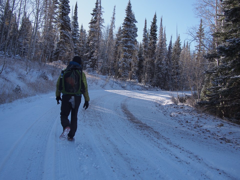
11/2/19…..Hayduke Day 37…..14 miles
I think someone camping nearby in Mather Campground was having night terrors last night or they were screaming at the top of their lungs at 4:30 in the morning for a legitimate reason. Either way I didn’t check it out or get back to sleep.
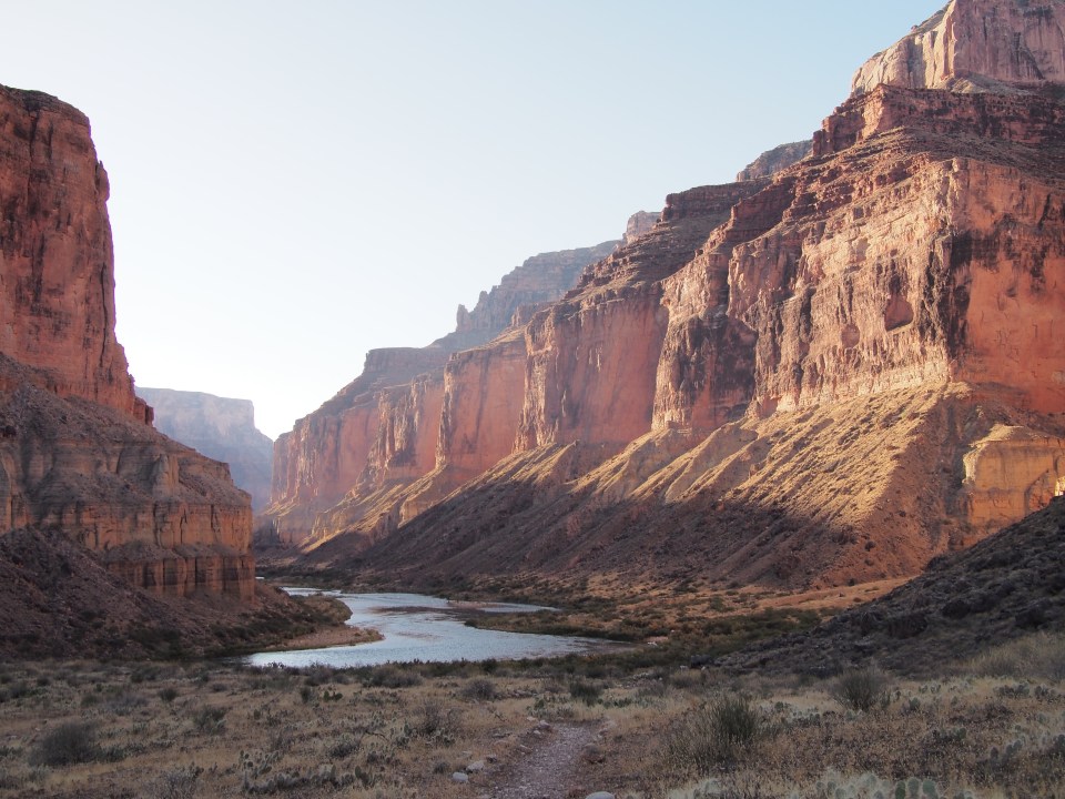
From the South Rim the Hayduke follows the South and North Kaibab Trails through the main corridor of the canyon back up onto the Kaibab Plateau on the North Rim. Normally the Hayduke goes along the Plateau then drops back into Saddle Canyon on Northwestern part of the GC. Because of an active fire closure near Swamp Point there’s a reroute that requires almost an extra day of walking roads on the Plateau before dropping back into the Canyon.
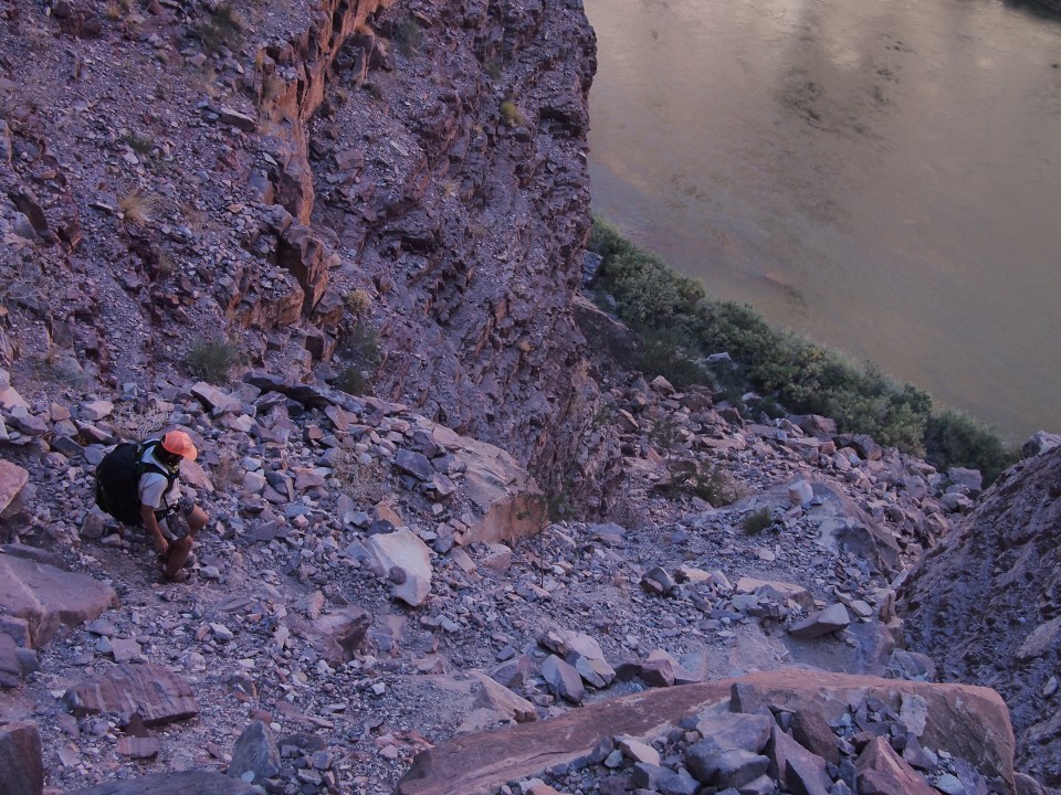
Last year while on the Arizona Trail, QB and I went Rim to Rim of the Canyon but this time decided to get a later start and eat a full breakfast before leaving. We started downhill with heavy packs around 10 am with hordes of other people. After a few miles it thinned out and soon we were nearing the river. From about a mile away and a ton of switchbacks up we could see 4 blue boats beached near the bridge we’d soon cross and wondered if it was our friends who gave us a ride the other day. Of course it was. We’re all on much different schedules and hiking along the river and floating it are far different lengths so the chances are low that we’d be crossing back over during the hour that they’d stop for lunch. Everybody else was surprised, I wasn’t.
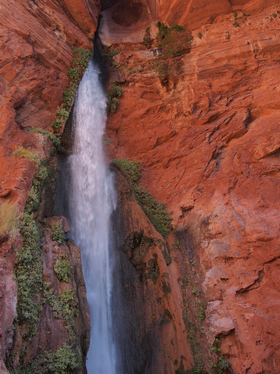
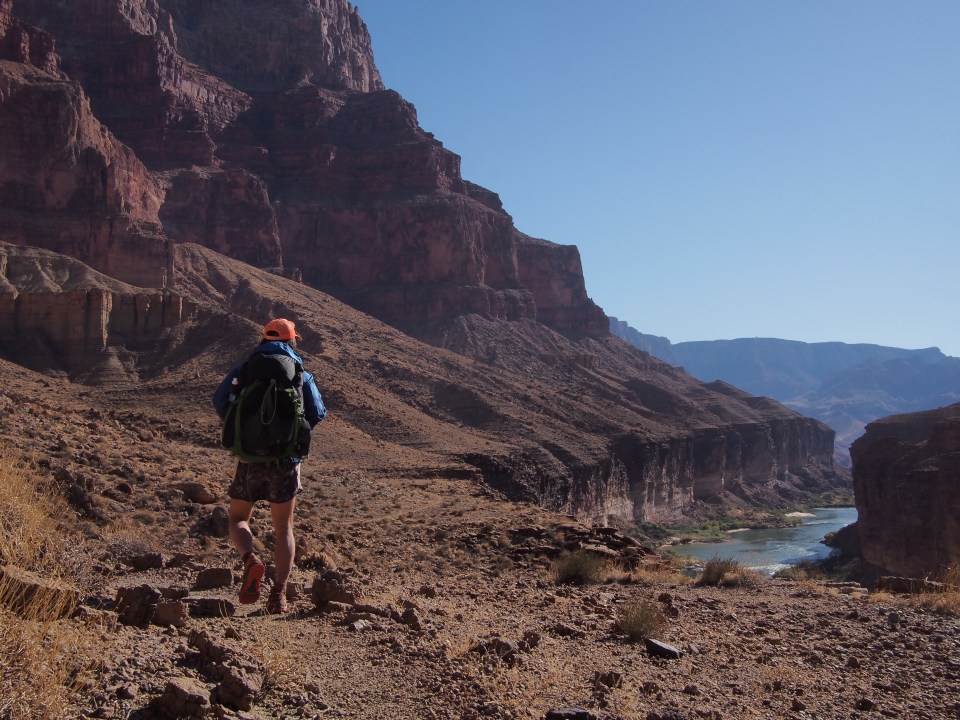
We carried on up the North Kaibab Trail and stopped shortly at Phantom Ranch. The next half dozen miles are pretty cruiser and have just a slight elevation gain so we whipped through those then took a side trail over to Ribbon Falls for a quick swim. After that little field trip we were within a mile of Cottonwood CG where we had a permit to camp for the night. 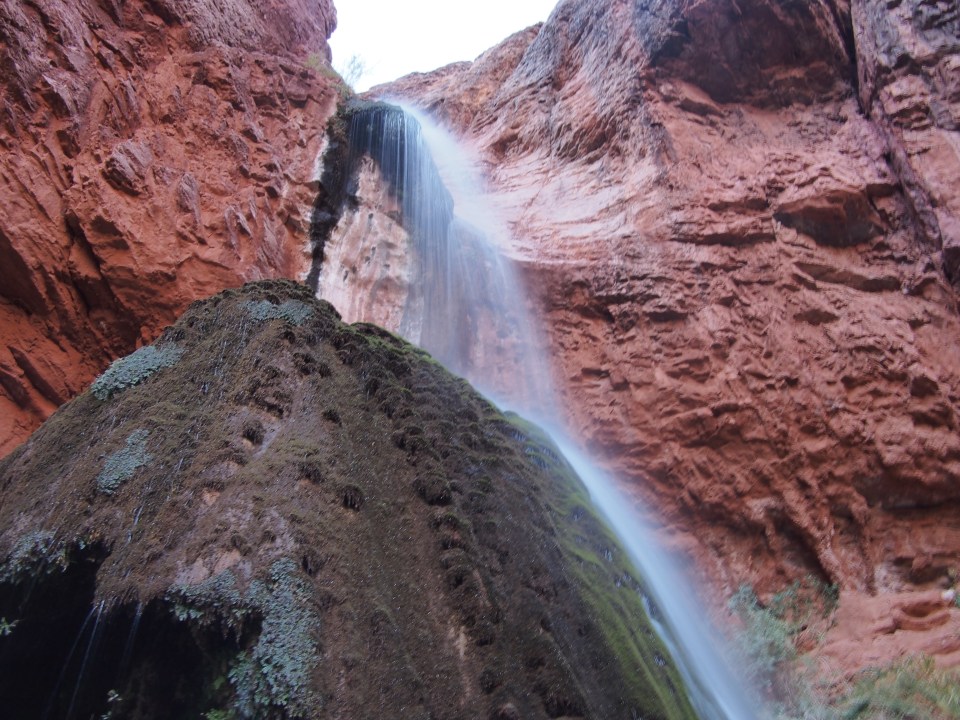
11/3/19…..Hayduke Day 38…..26 miles
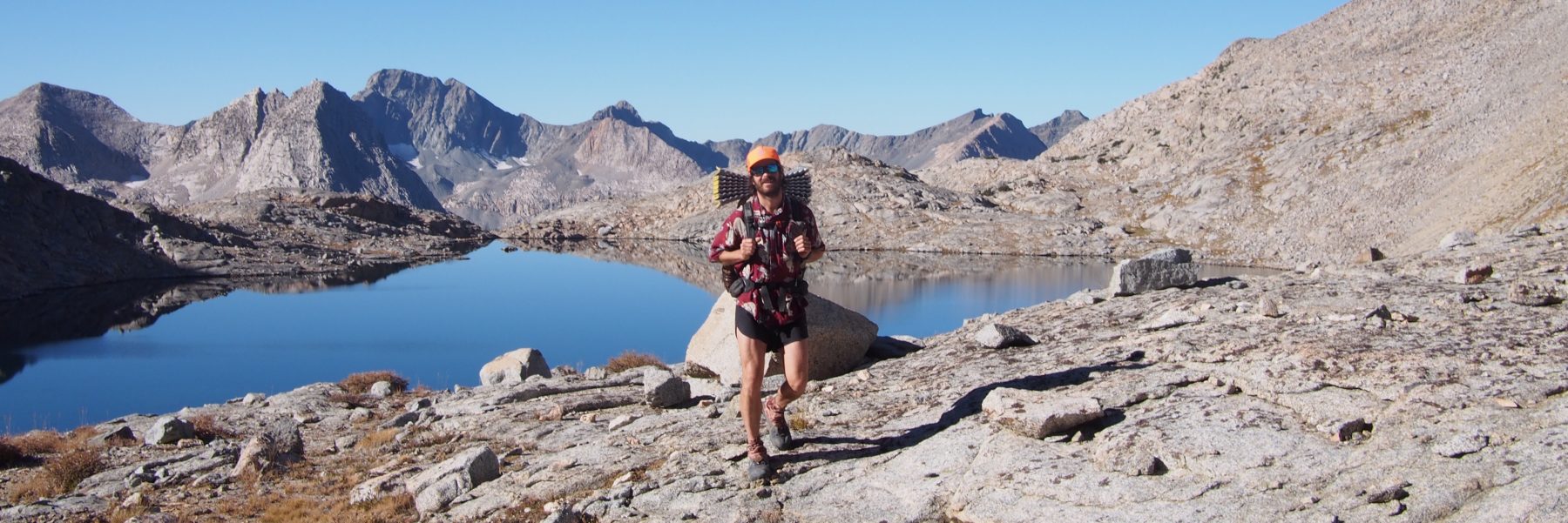
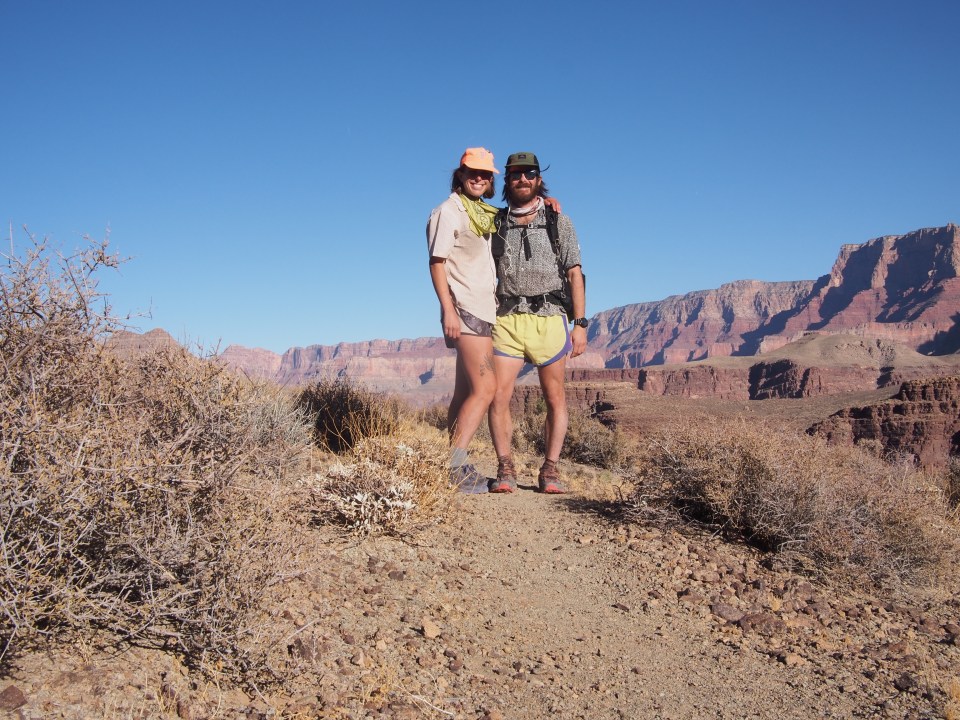
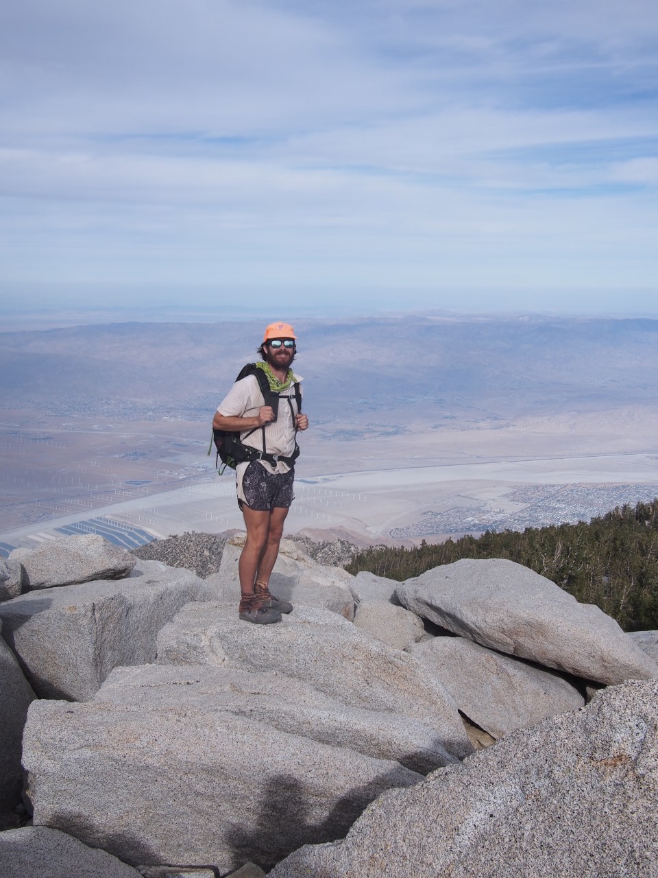
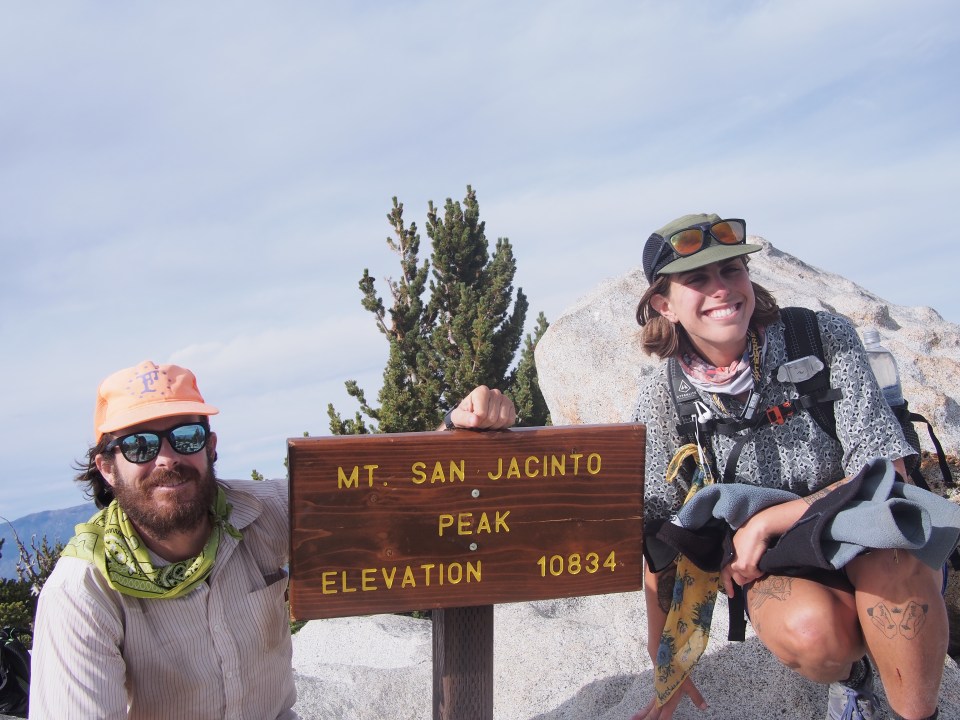
We broke camp and walked a mile up canyon to Manzanita Rest which is our last reliable water source for potentially 50+ miles. I left there with almost 9 liters of water and 6 days of food. It felt like I was carrying a Volkswagen. From Manzanita the North Kaibab Trail climbs nearly 4000 feet in 5 miles on nice wide groomed trail. It was a stiff climb but QB and I kind of crushed it. The views were spectacular, walking up the North Rim you can see all the colors of the canyon and look back and see across to the South Rim and even Humphrey’s Peak way in the distance. In the trailhead parking lot we met Karla working for Wildland Adventure Trekking company and she hooked us up with some apple juice, chips, and another liter of water each that we guzzled on the spot.
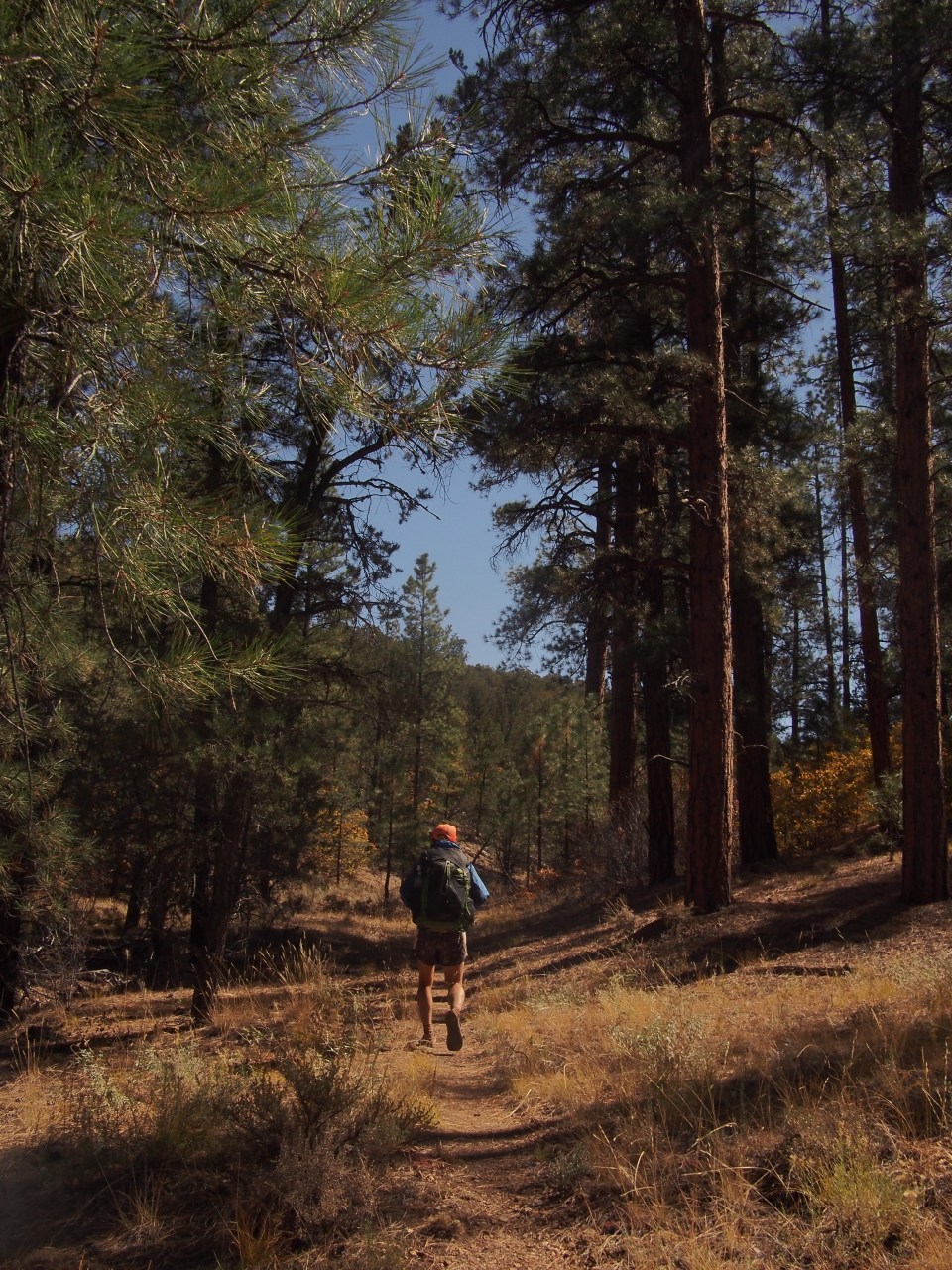
For the next 20 miles we walked dirt roads across the Kaibab Plateau within GCNP. It was a peaceful 20 miles through a pretty forest full of ponderosas and aspens but with the wicked heavy packs it was a bit of a slog. Tonight we’re camped on the border of National Park and National Forest land, never even saw a car out there today on these roads. 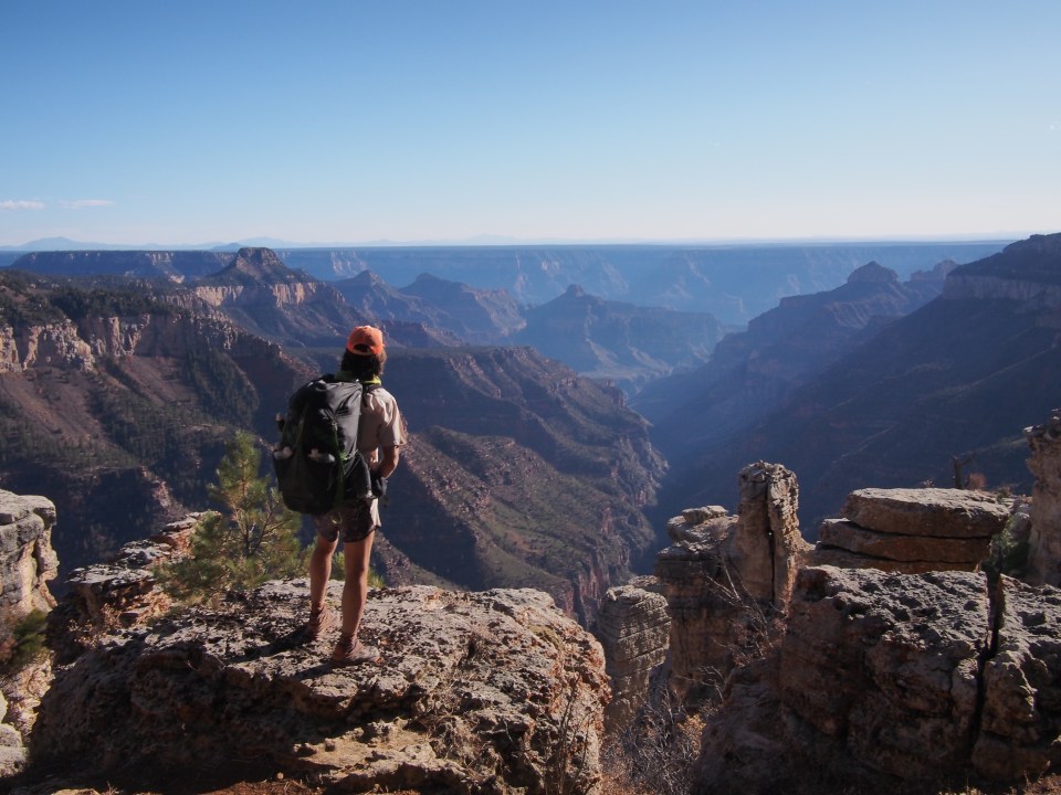
11/4/19…..Hayduke Day 39…..27 miles
“Here’s the great thing about the Southwest, there’s so much more than desert. Along the North Rim of the Grand Canyon is a forest as lush as you’ve ever seen.”
-Deangelo Vickers
Not exactly, but still it’s a big forest.
It was so cold this morning! Overnight it was chilly and as we got going the temperatures seemed to plummet for the next couple hours. The road kept bringing us through gullies and the sun took forever to get above the trees. Our water bottles froze and my coffee drink turned to slush. And then it warmed up and just like that we were super comfortable.
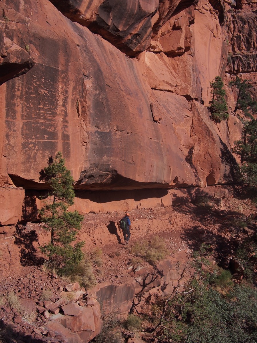
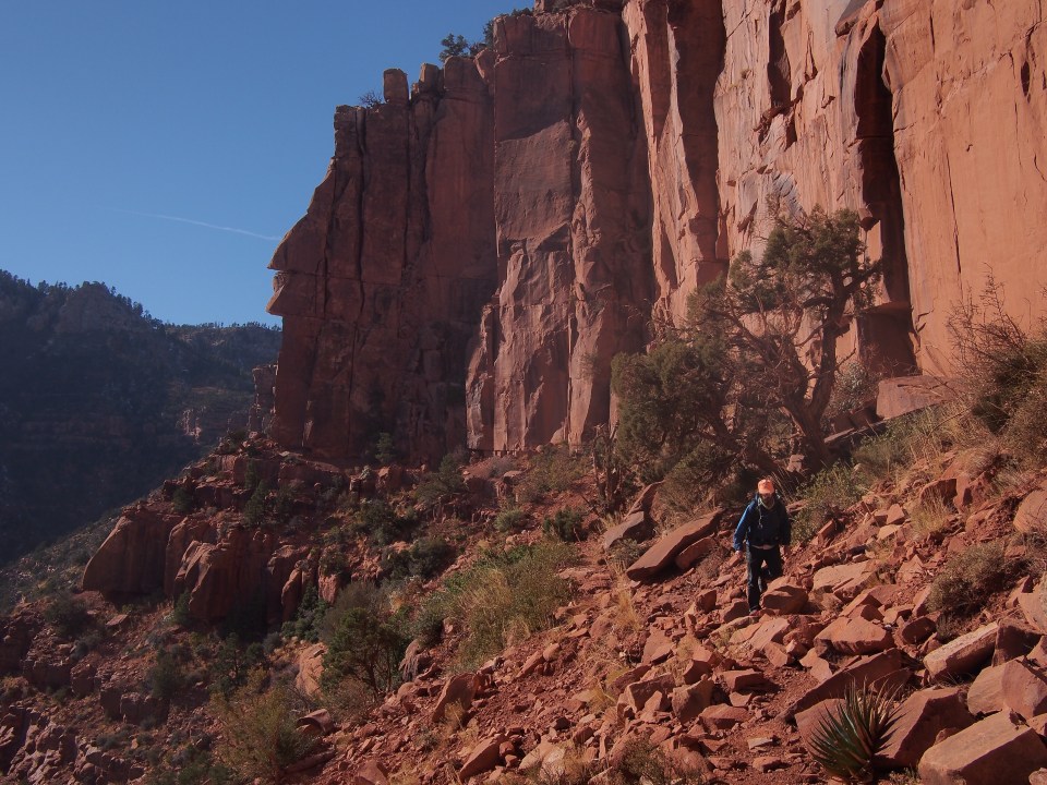
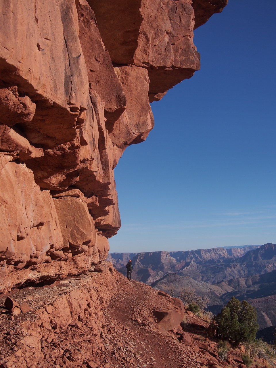
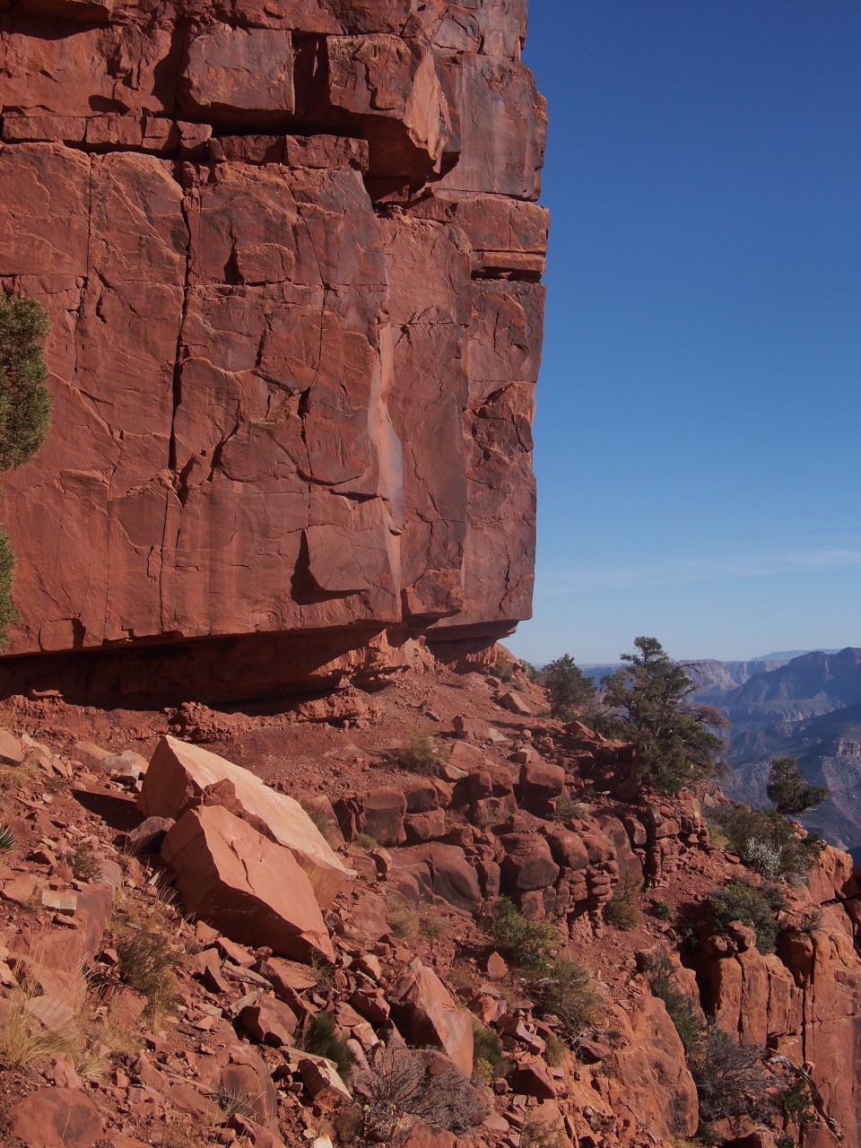
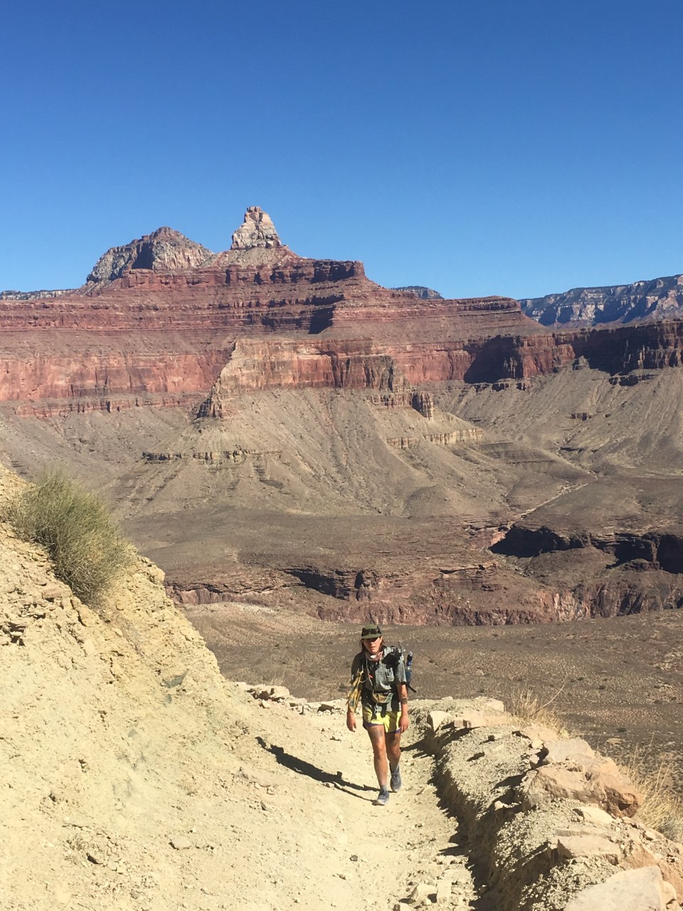
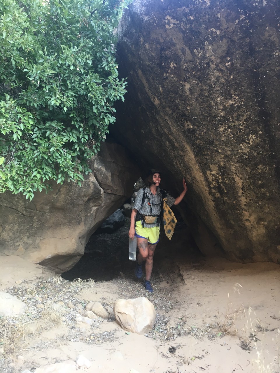
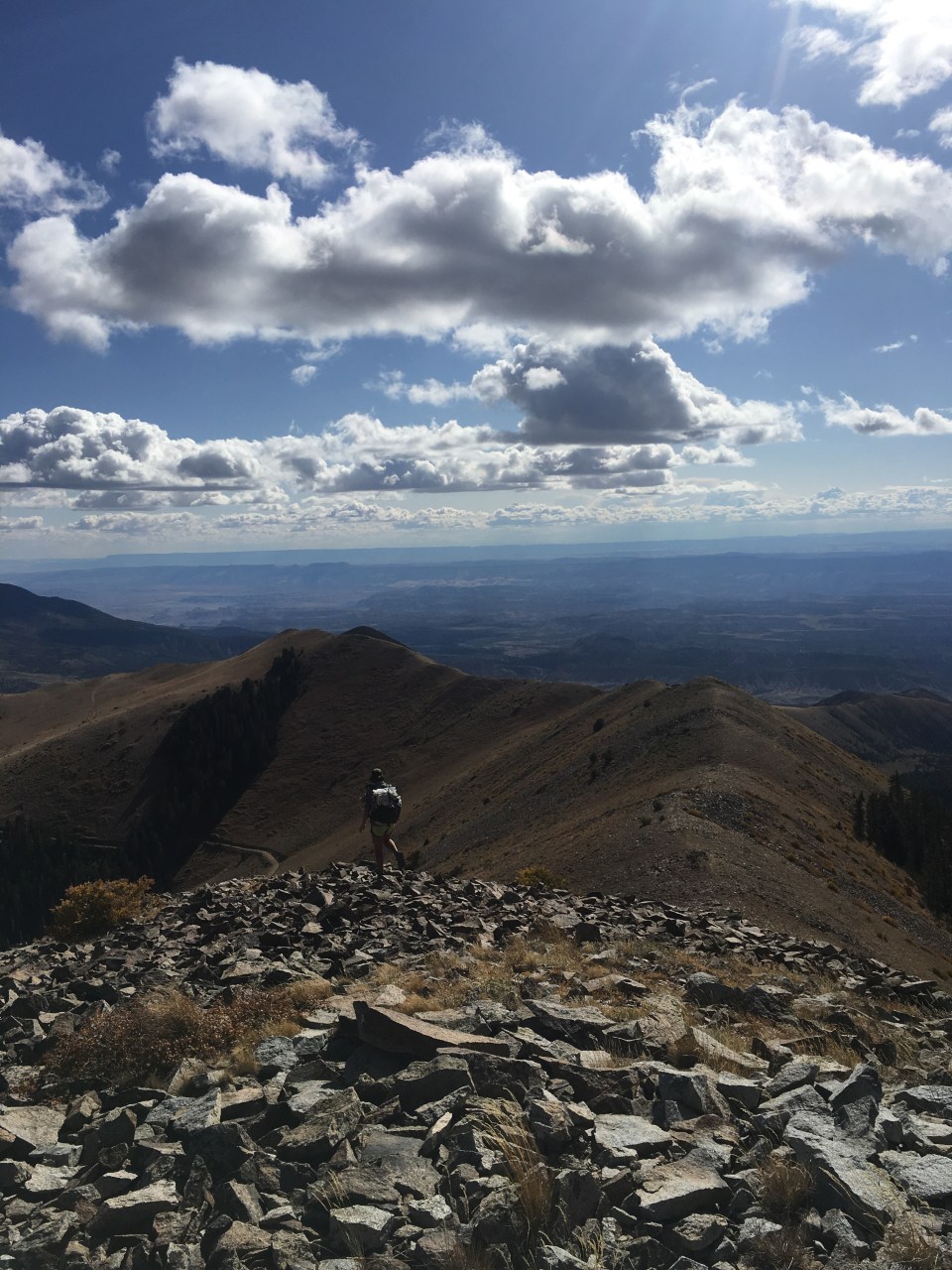
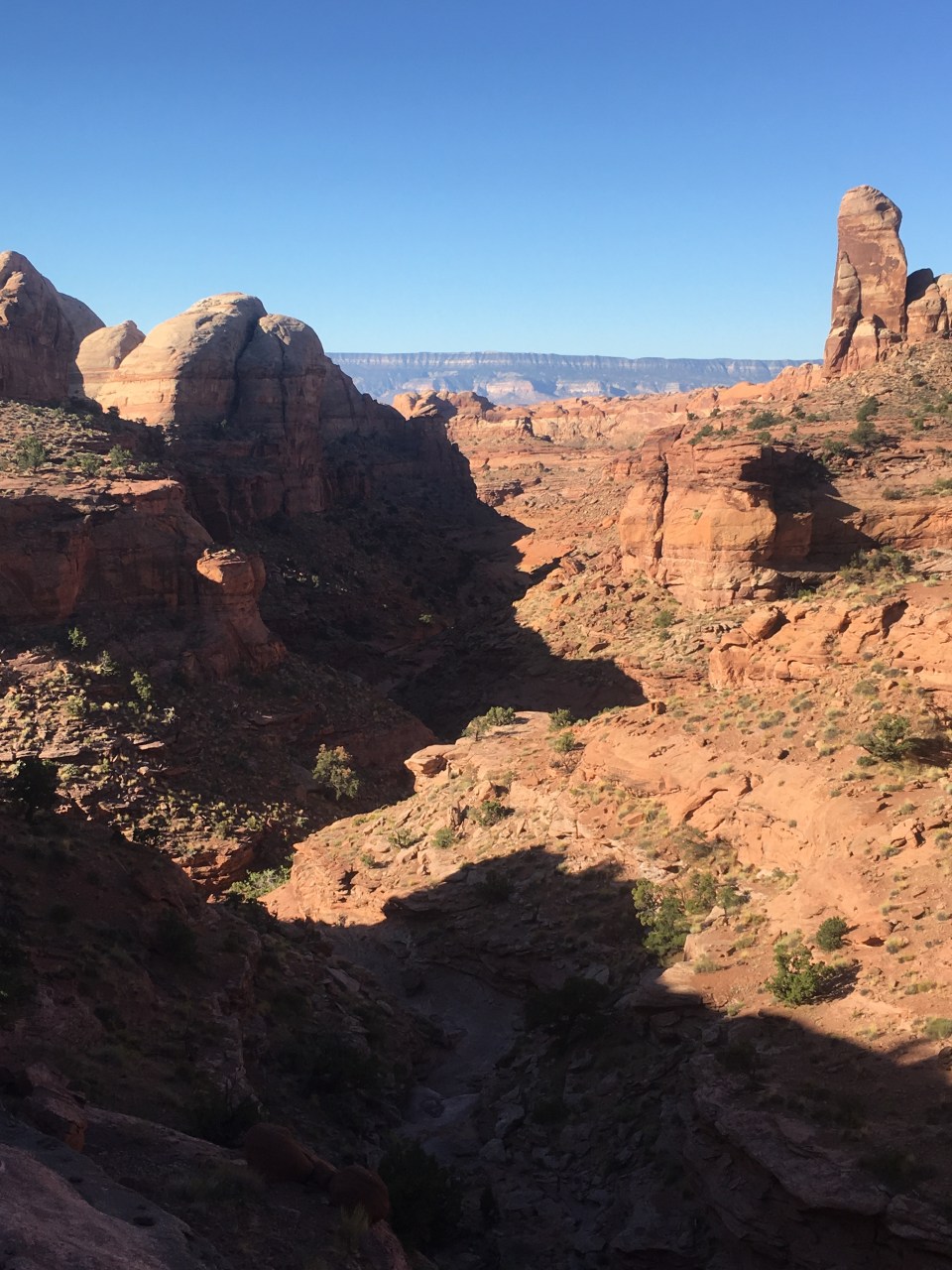
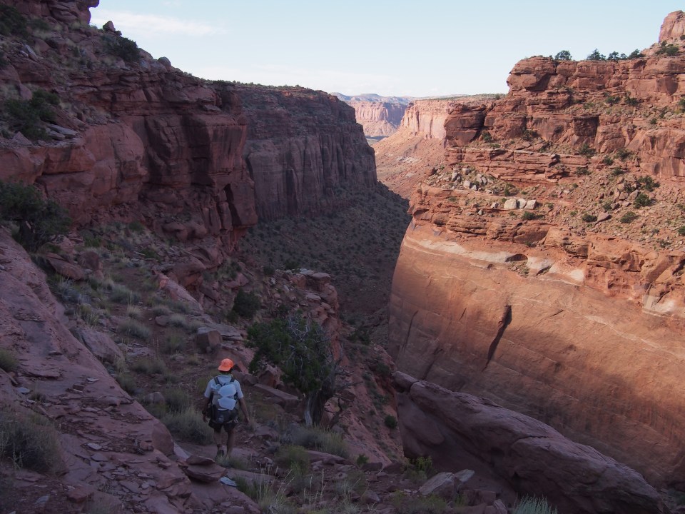
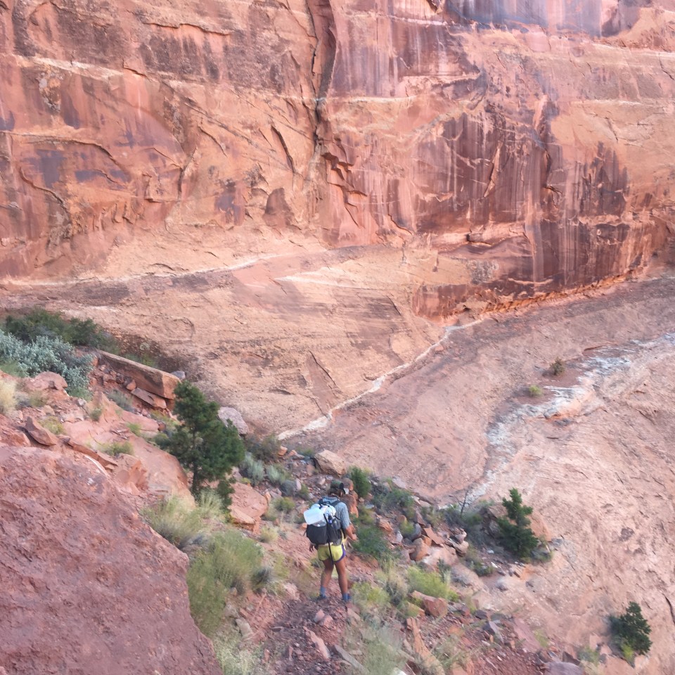
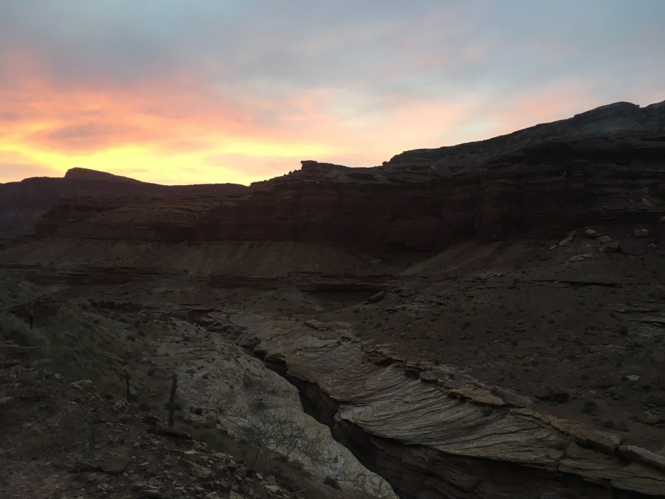
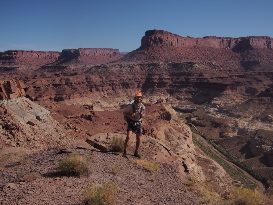
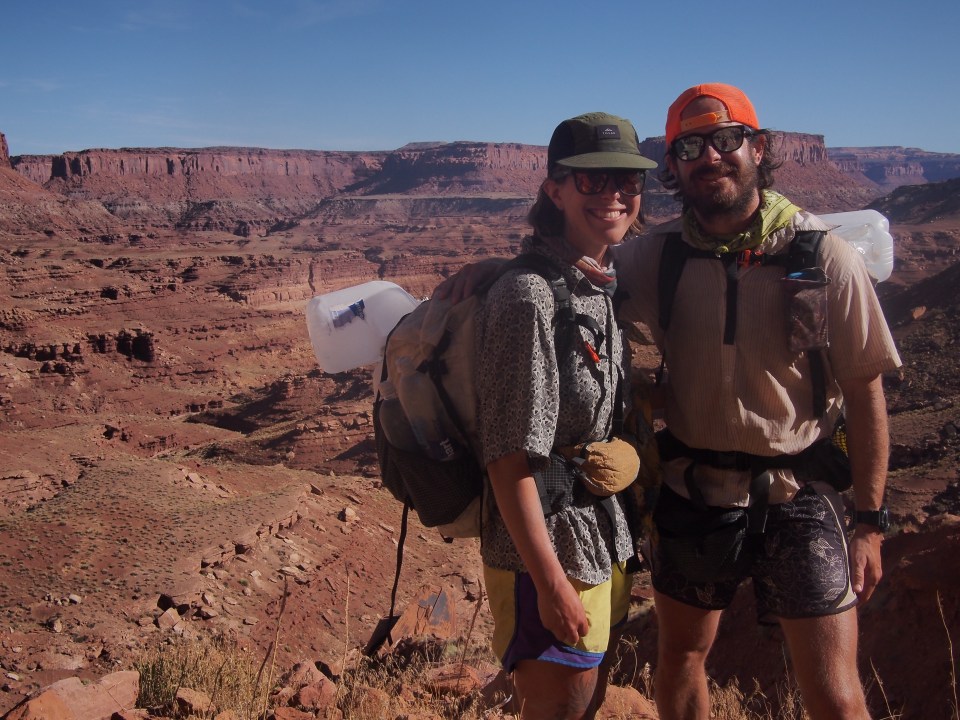
From where we camped we walked 22 more miles of forest roads until finally getting to Monument Point and the edge of the Canyon once again(still never saw a car). Before dropping in we could see to the northwest side of the GC, across the Arizona Strip, and all the way to Zion National Park(I think). We took the Bill Hall Trail that zigzagged steeply down about a thousand feet to the Thunder River Trail. This trail cut across a huge flat red rock area for a few miles before dropping steeply down another thousand feet. We found a spot to camp just before sunset and amazingly are so much warmer down in the canyon. Probably won’t even use the fly on the tent tonight. 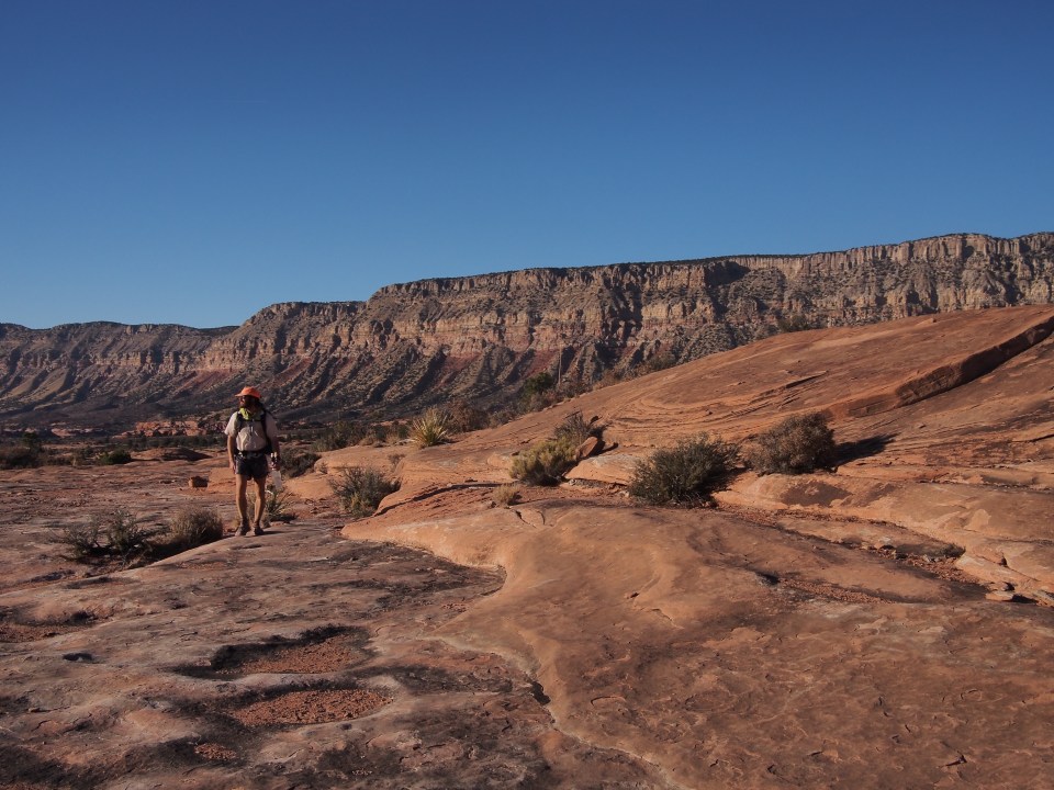
11/5/19…..Hayduke Day 40…..19 miles(12 hiked, 7 rafted)
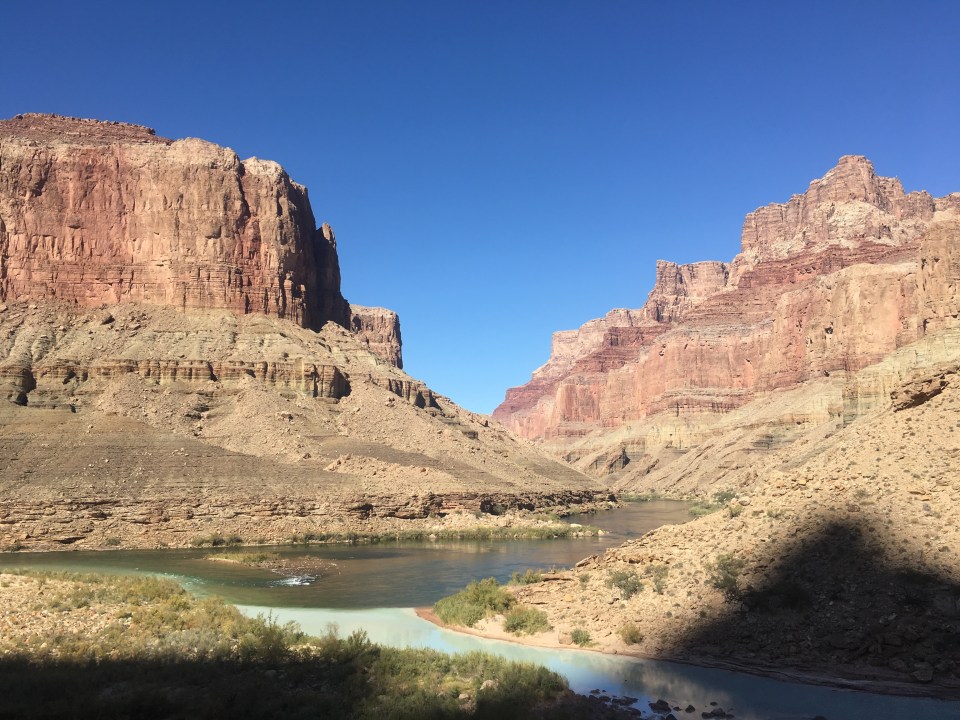
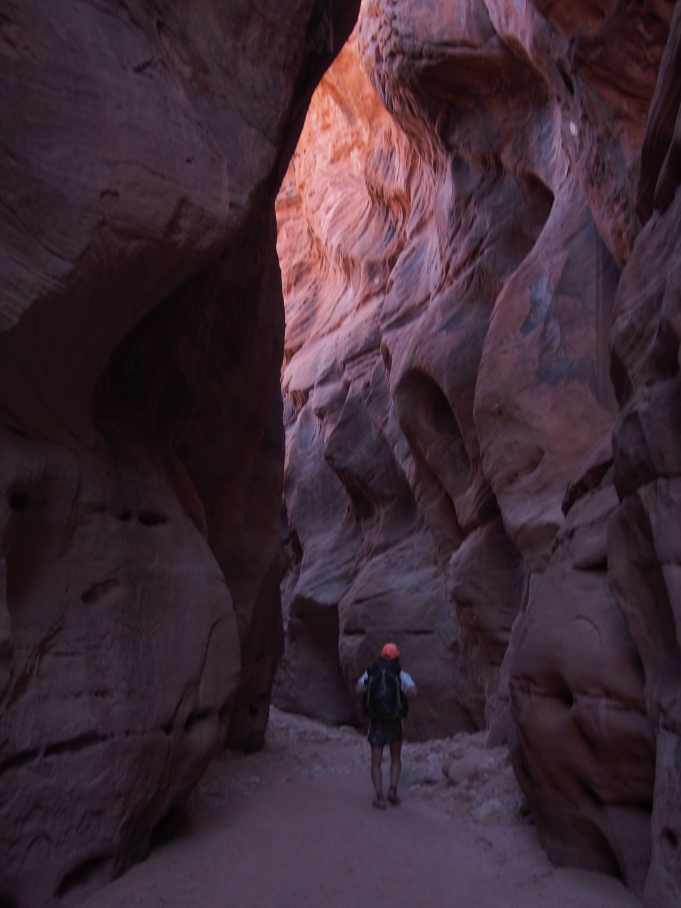
In the first few miles today we dropped almost 2000 feet and soon were at Deer Creek. This was our first reliable water source in 54 miles(the longest water carry I can ever remember doing). We followed Deer Creek as it flows about another mile to the Colorado River. During this mile it cuts deep into the rock creating a super narrow canyon that we walked above on an incredibly narrow ledge and then turns into a tall waterfall that pours into a pool just before the river. It is quite spectacular! Of course I took a quick bath at the base of the falls.
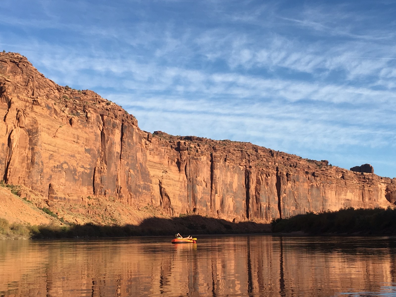
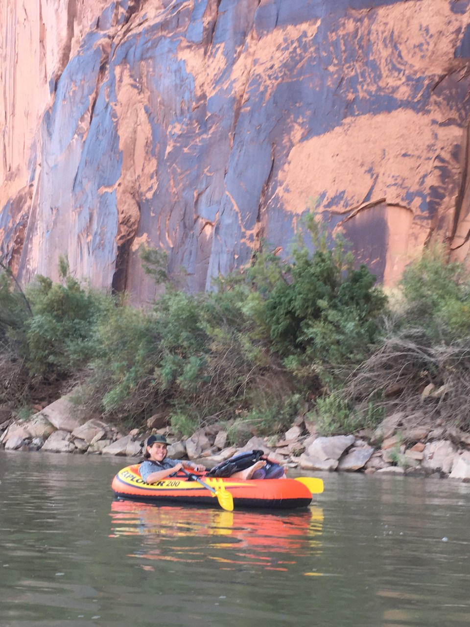
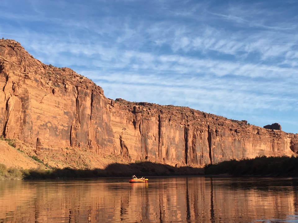
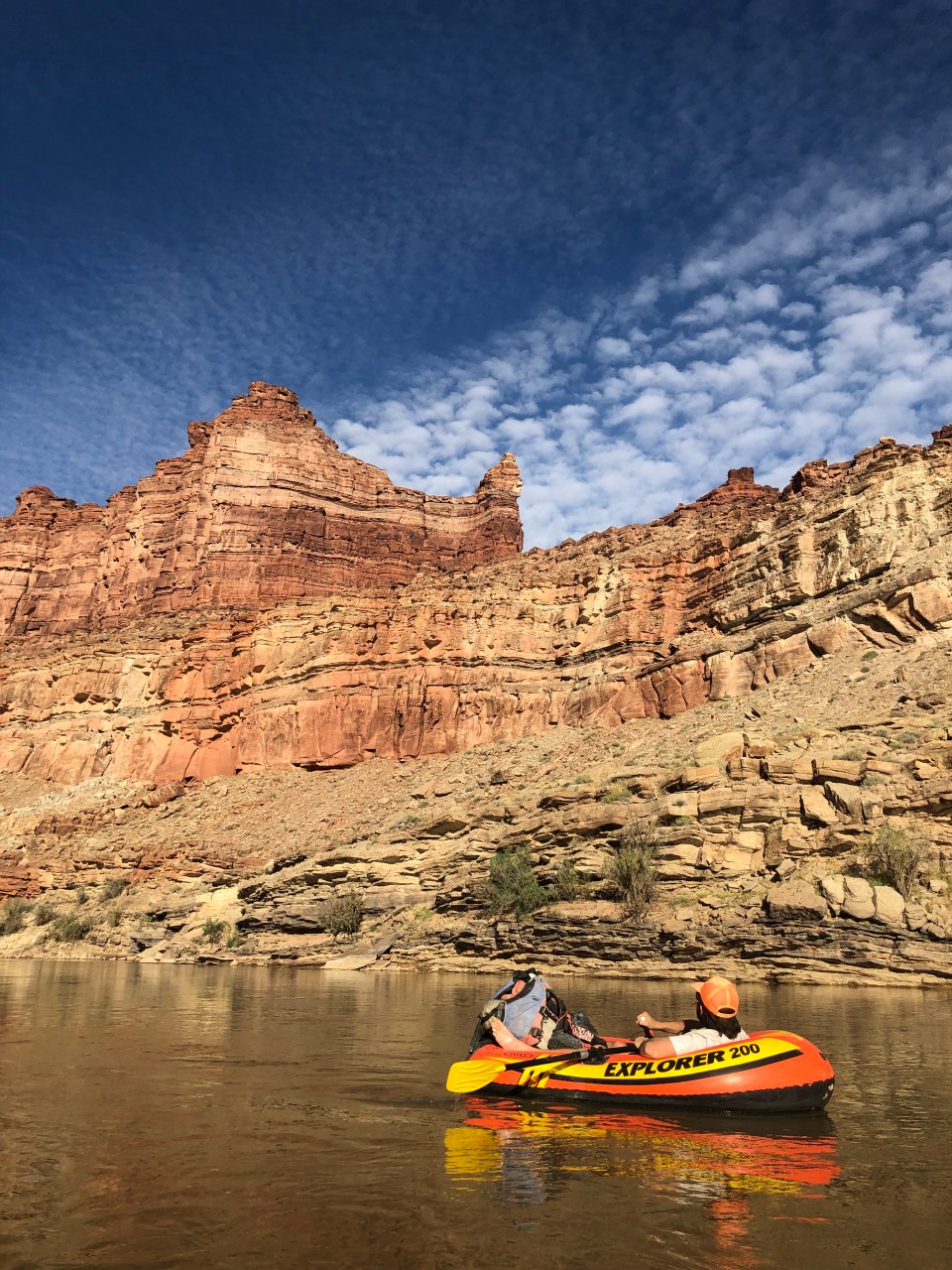
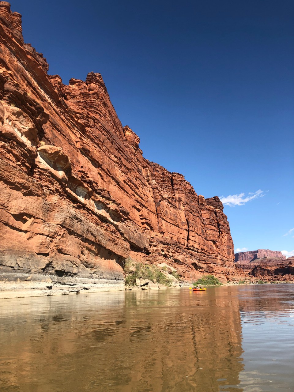
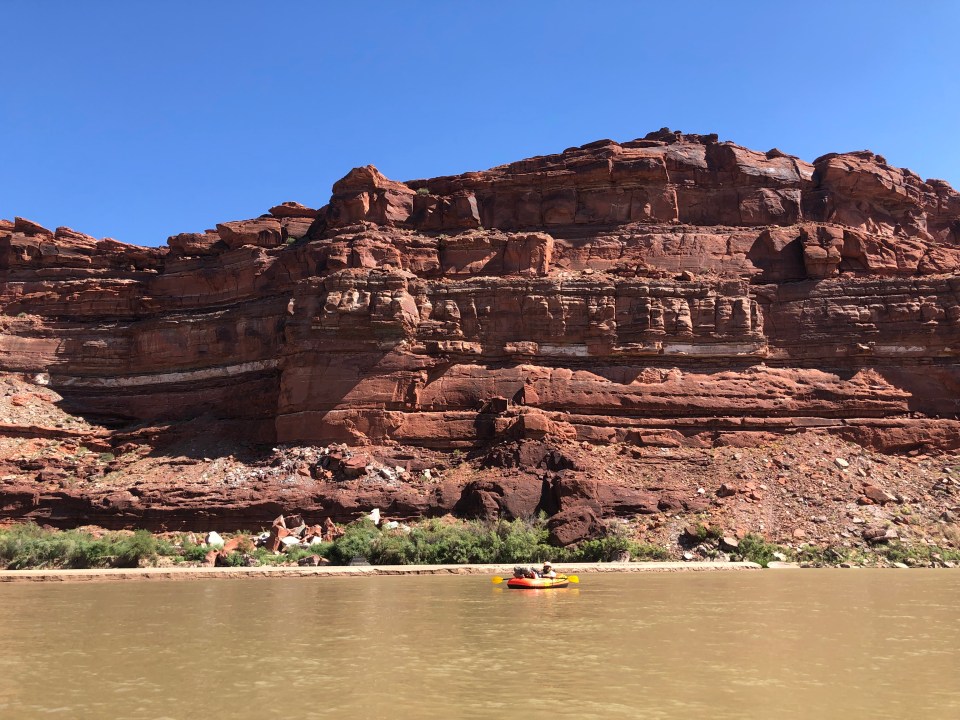
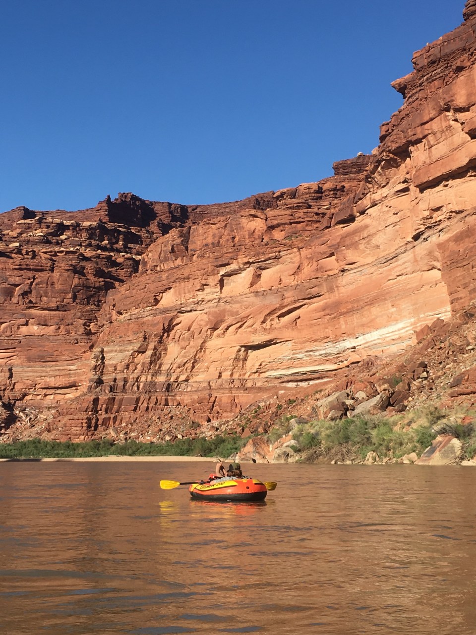
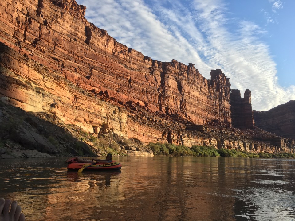
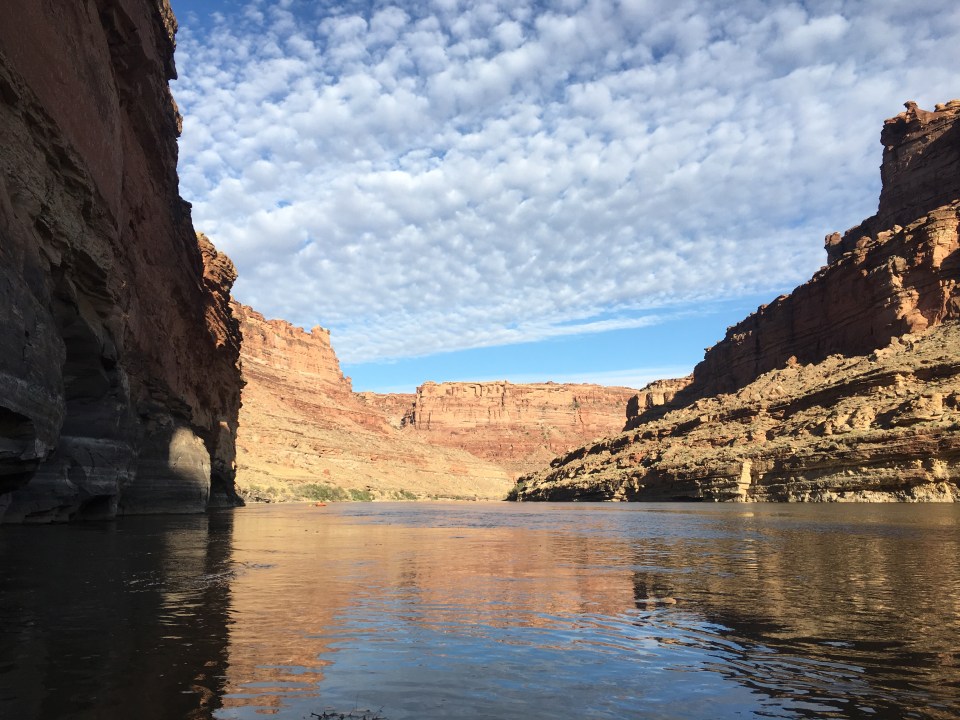
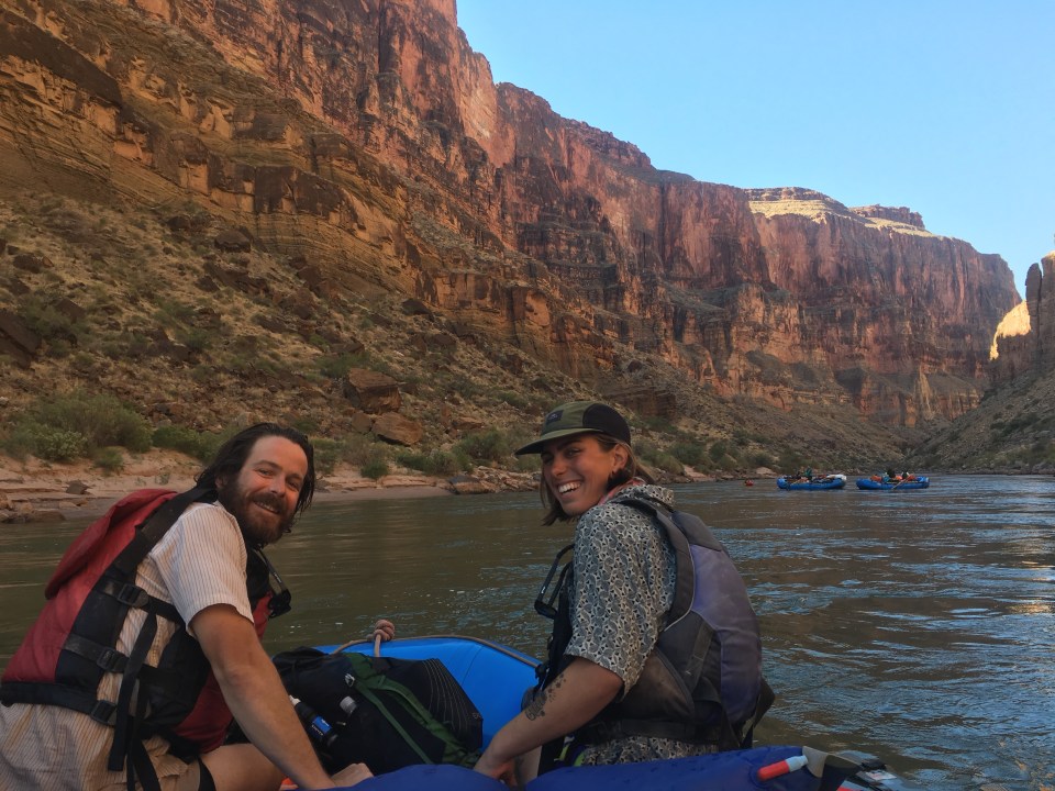
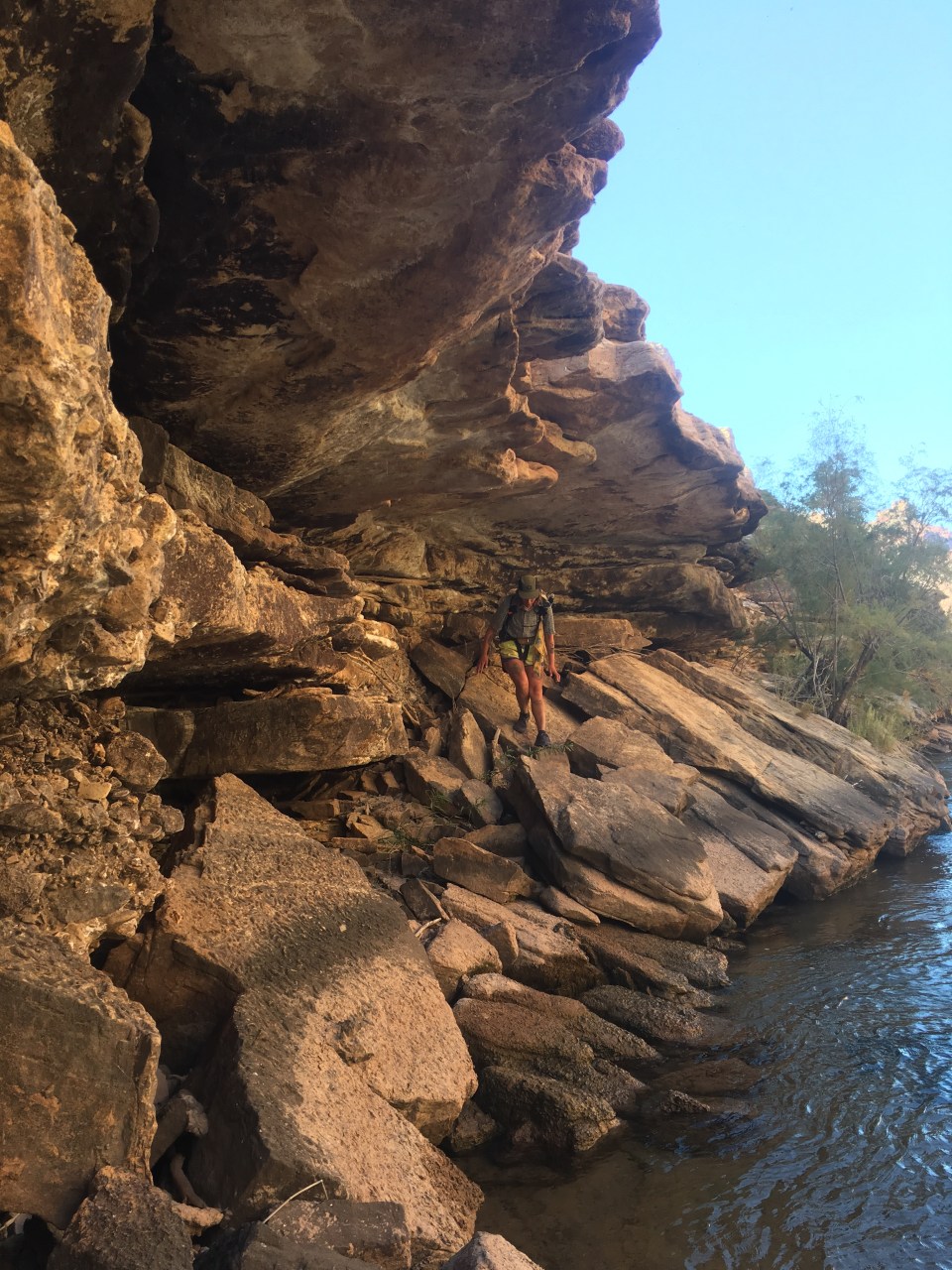
The next 7 miles were supposed to be a very tedious rock hop along the side of the river. We started along this and then followed an animal path higher up to get around some cliffs before reaching a super sketchy section of something of a path through a rock slide. This didn’t look good. Luckily we had just seen a group of rafters breaking camp and decided to backtrack a bit and ask them for a ride around the sketchy section. They were totally cool and happy to help us out, not just for the sketchy stuff either. Kevin our oarsman got us safely through a handful of class 4 rapids and down the next 7 miles to the mouth of Kanab Creek. This was solid fun especially opposed to the tediousness of rock hopping all day. 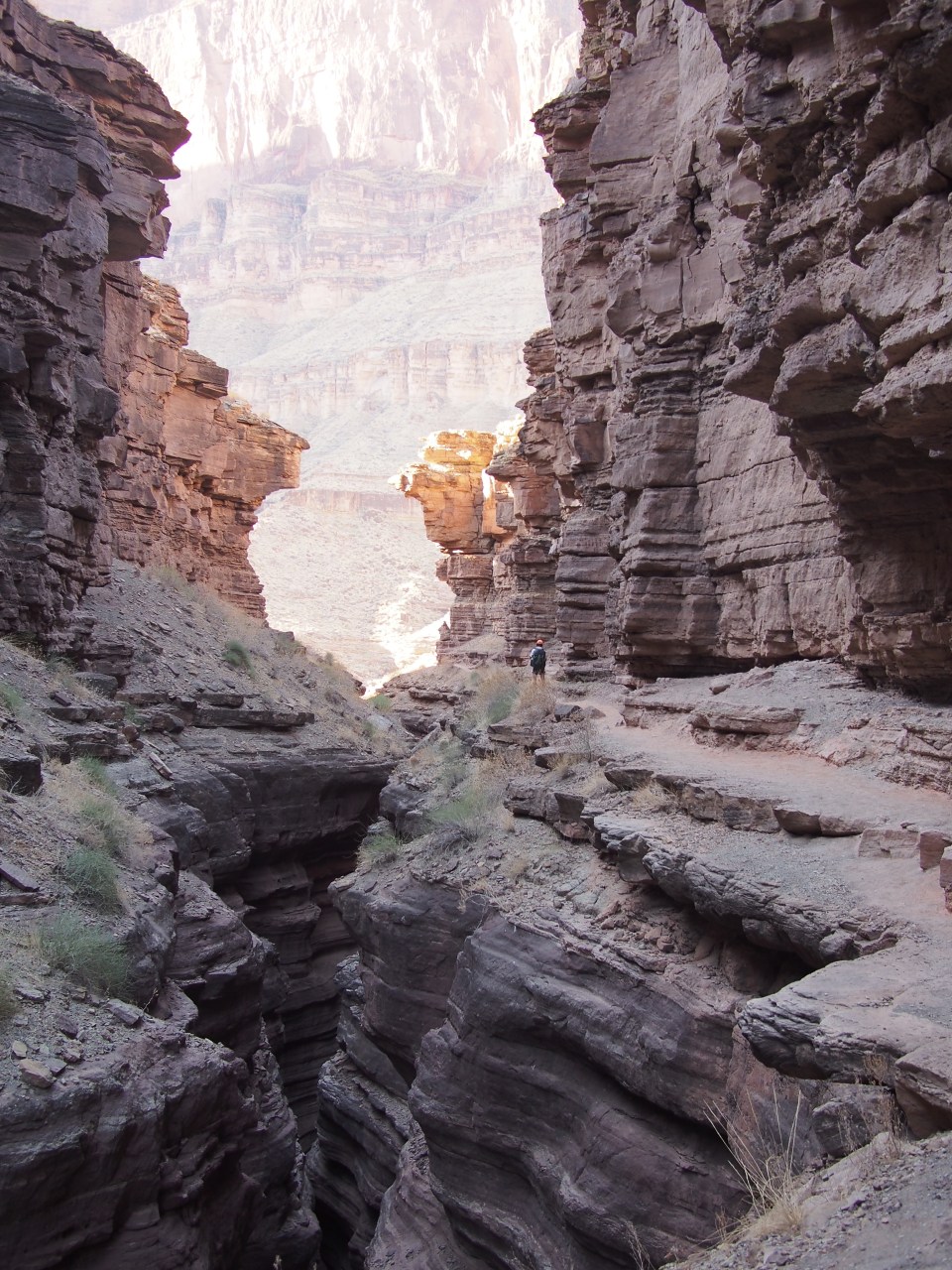

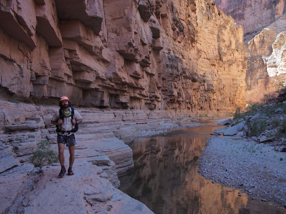
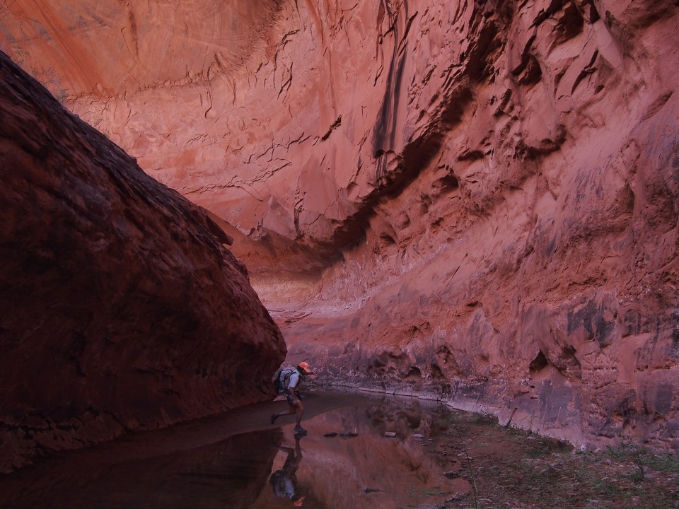
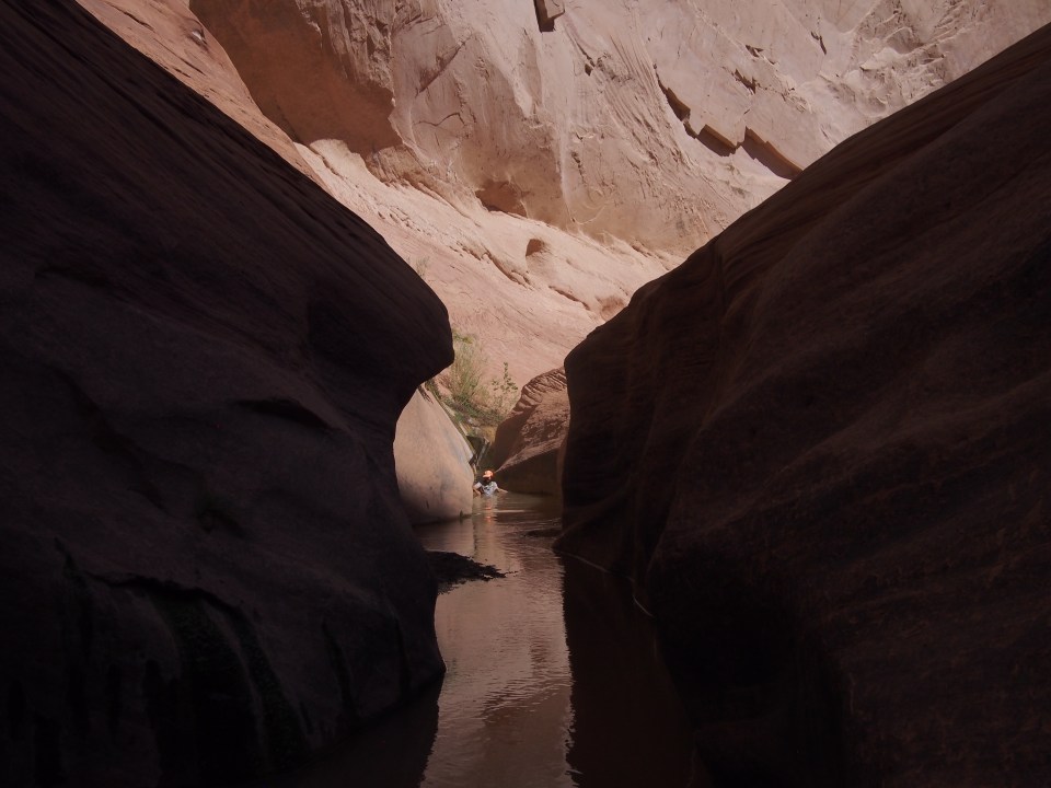
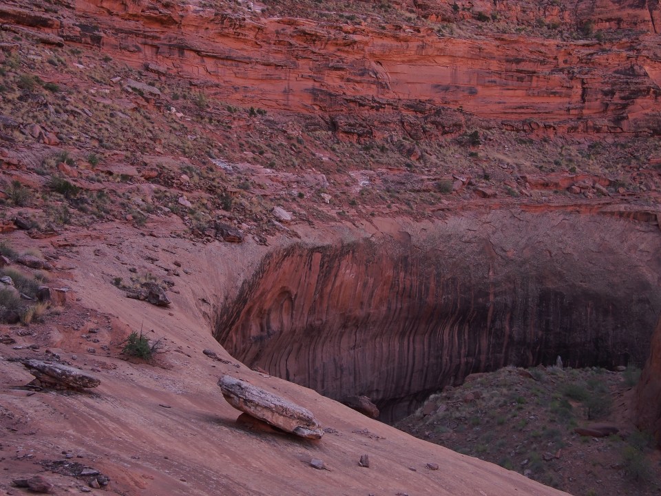
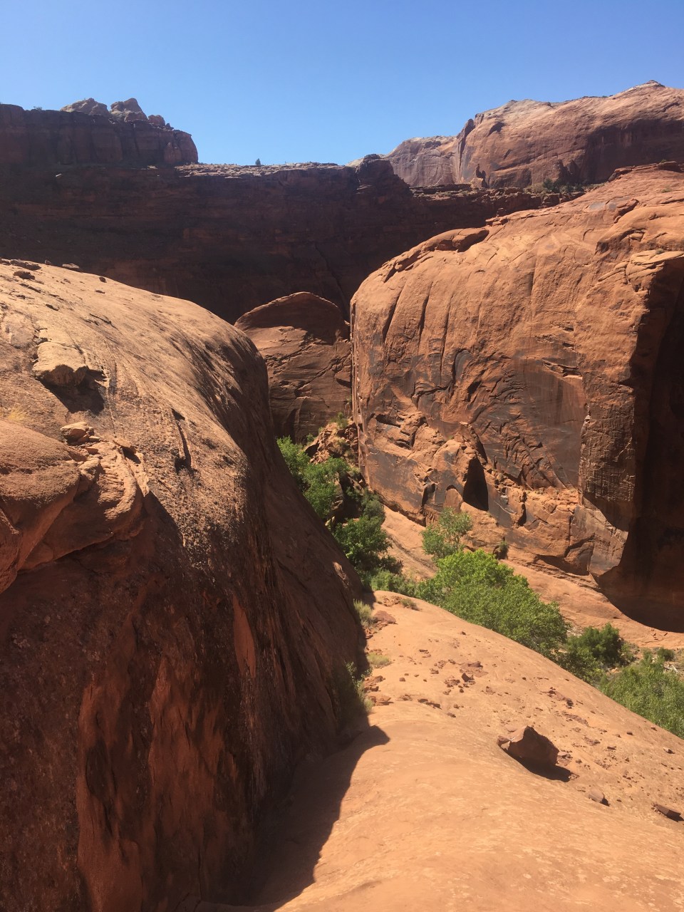
From the mouth of Kanab Creek we left the Colorado river for the final time and started making our way up this canyon. The creek serpentines for miles below very impressive thousand foot cliffs. It’s been slow going as there isn’t any trail and we’ve done a lot of walking through water and scrambling around boulder chokes but at the same time it’s been very awesome and possibly my favorite part of the Grand Canyon. We even saw a golden eagle down here fishing or something. After about 8 miles it was getting close to sunset and we found a campsite that we couldn’t pass up. 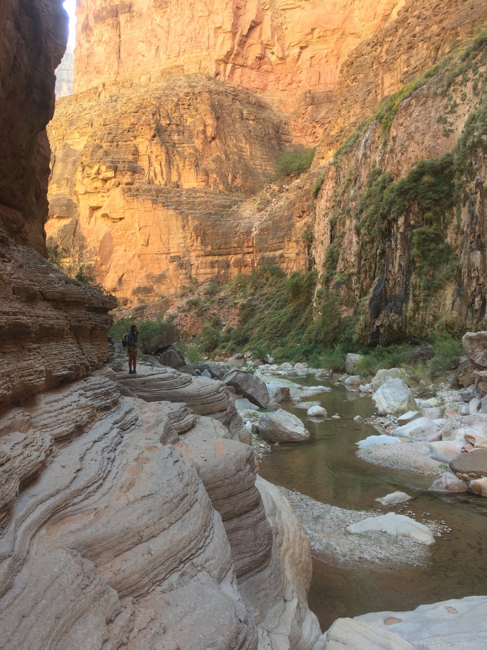

11/6/19…..Hayduke Day 41…..25 miles
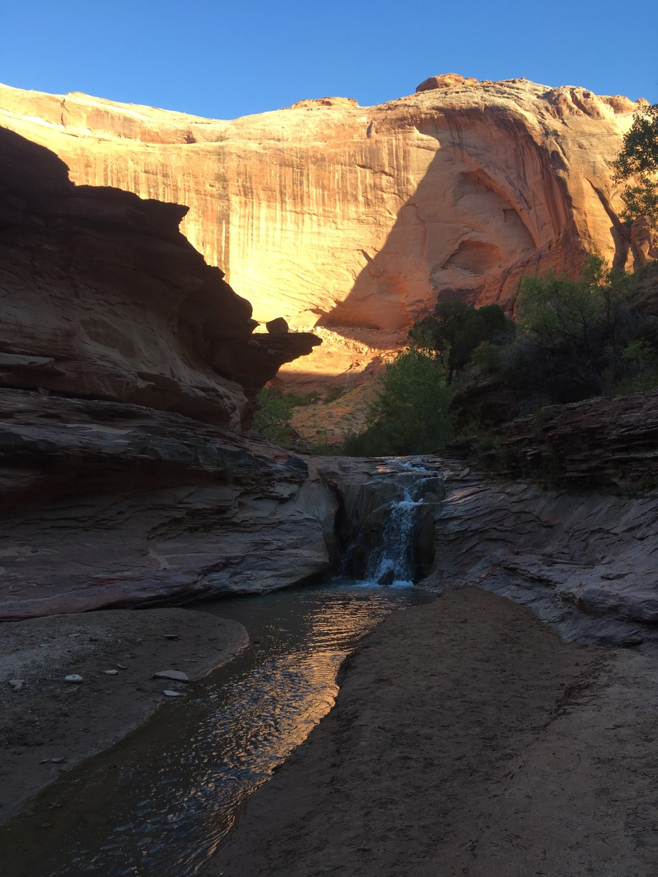
Today started off ordinarily enough. We walked up canyon about a mile to Showerbath Spring which created an amazing hanging garden and I had to resist the urge to strip down and take a shower. The walking became easier in the canyon after the spring and shortly after that the creek all but dried up for awhile(it would be intermittent the next 10 miles so we stocked up on water when we could). Eventually we crossed the boundary of GCNP into BLM land and as we walked the canyon became wider and the walls got shorter. We saw bighorn sheep running across impossibly narrow ledges and amazingly saw not only a bald eagle but a California condor! The thing looked like a pterodactyl. 
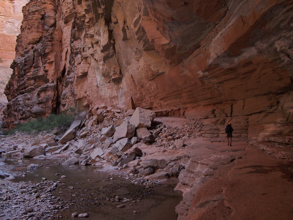
Around 2pm we came to a 4 way canyon intersection. Kanab Creek continued on straight, Lawson Canyon went to the right and Hack Canyon which was our turn went left. Because Kanab Creek had been so bendy going left felt just like another bend in the canyon. This is a confusing and possibly dangerous intersection. We have GPS and knew which way to go but when we got to the intersection there was about a dozen college kids looking for their friend. They were out doing a 2 week adventure course with their school and somehow one member of their party had got ahead, or behind, or went left or right. Nobody had seen him in over 2 hours. He had food, shelter, and water(although there weren’t any water sources nearby) but he didn’t have a map or a phone or GPS. We started down Hack Canyon and told them we’d send him back to the intersection if we came across him. Their plan was to head down Lawson Canyon and I figured he just carried on straight up Kanab Creek and would eventually turn back. Hack Canyon was a dry rocky wash that occasionally had animal paths on either side of it. We were now way more out in the open in the desert and without the canyon walls for shade, the sun was hot. I had forgot all about the missing hiker until an hour and a half later when QB pointed out a big beefy backpack on the side of the wash. It gave me the chills. This was a panic move and who knows where or how far he could have gone. His water bottles were empty so I filled those, and wrote him a note, while QB drew an arrow with rocks. We were at the backpack for about 20 minutes when the hiker came running back towards us. He had dropped the pack because it was so heavy and gone onto look for his friends or water even climbing to a higher vantage point to look for them. Luckily, 2 miles north of where he dropped the pack he came to a road where some cowboys had a camp set up. They gave him water and told him they’d drive him into town so he went back for his pack and that’s where he found us. It was getting on in the day and his headlamp was on it’s last legs plus he had just gone through a hell of an ordeal so QB and I decided to get him back to his crew. She walked with our new friend while I ran ahead and after about a mile ran into a 3 man search party that had been walking up Hack Canyon. Soon they were all reunited and QB and I turned back to carry on our way. When we got to the cowboys we delivered the message that the hiker wouldn’t need the ride after all and these guys hooked us up with some ice cold cokes! They were out here taking tourists on a cattle drive similar to City Slickers. I can only imagine how far the missing hiker would have gone if he didn’t see these guys. At this point the wash had turned to a jeep road so QB and I walked another hour until finding a spot to camp for the night. 
11/7/19…..Hayduke Day 42…..31 miles
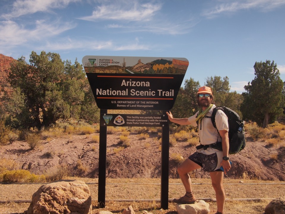
Last night we realized our stove is broken. Actually it’s QB’s stove but it’s still broken. Our original plan for today was to hike about a regular days worth of miles and camp a few hours short of Colorado City then go in and out of town tomorrow doing a quick resupply. Now with our broken stove we needed to get to a gear store and there happened to be one in Kanab which was in range again as the Hayduke kind of horseshoes around the town. As interested as I was in Colorado City I was ok with skipping the Fundamentalist Mormon town and going back to Kanab.
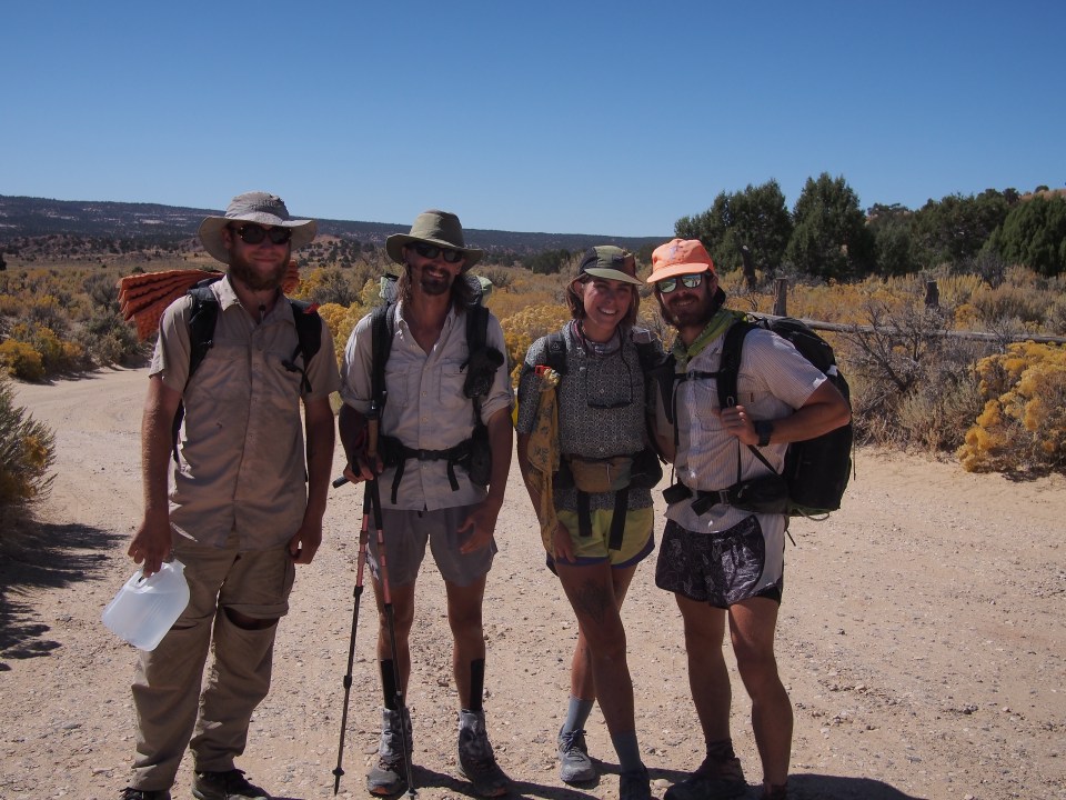
This morning we got an alpine start and were up and crushing miles below the stars by 4:30. There was really nothing to it, just long dirt roads all day with nobody out here. By sunrise we were out of Hack Canyon and walking along the Arizona Strip. It’s pretty boring out here but the walking is fast. We had walked over 30 miles by 3pm and started hitching east towards Kanab on AZ HWY 389. After about 5 minutes a guy in a pickup pulled over and we rode in the back for a half hour to Fredonia where we got picked up by Noah and Gracie who took us another 10 minutes into Kanab. We quickly bought a new stove and food for the next few days then made it to our favorite trail angel’s house. Richard was out of town but Lynn hosted us and of course cooked a delicious dinner, Mediterranean veggie tarts. I couldn’t have asked for anything more than a home cooked meal, a hot shower, and a comfortable bed.
Going the extra mile today(literally) put us back up ahead of schedule and with only 70 or so miles to go we are well within range to finish this thing.
Thanks for reading! Feel free to follow me on insta for more pictures @endlesspsummer and QB @sarahikes
 This morning we watched the sunrise then beat the bag out of another continental breakfast before saying our good byes with QB’s parents and putting our thumbs out. Oscar and Milo were our first ride and they brought us out of their way about a half hour to Junction, UT where we were picked up by Breck who got us another 40 miles into Kanab. In town we stopped at the PO and resupplied at the grocery store. We’re getting very familiar with this town. From Kanab we got a ride from Opie, a helicopter pilot, to Fredonia, AZ then waited awhile before getting picked up by Drew and Nate, two hunters in a tiny Suzuki Samurai. These guys got us up to the store at Jacob Lake where we had a quick sandwich then started walking back the two miles towards the trail. Braxton and Brenna who were taking their time driving from Alaska to Virginia gave us a short lift the rest of the way in their van.


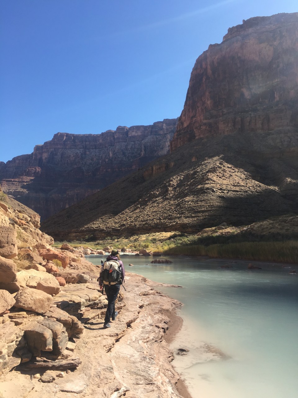
 This morning we walked along Nankoweap Creek for 3 miles until it reached the mighty Colorado. From the mouth of the Nankoweap for 8 miles along the river there was no trail, just a nasty bushwhack. It was scenic, sure, but it was very difficult. Occasionally there would be animal paths here and there but there was lots of bushwhacking through thorny bushes and cacti, scrambling on loose talus, and some tricky route finding. For awhile we were in 1 mph terrain. Then we still had to get across the river. Our trail continued on the far side of the Colorado at the mouth of the Little Colorado River and the only way to get across was to get a ride, but no rafts came. Maybe tomorrow.
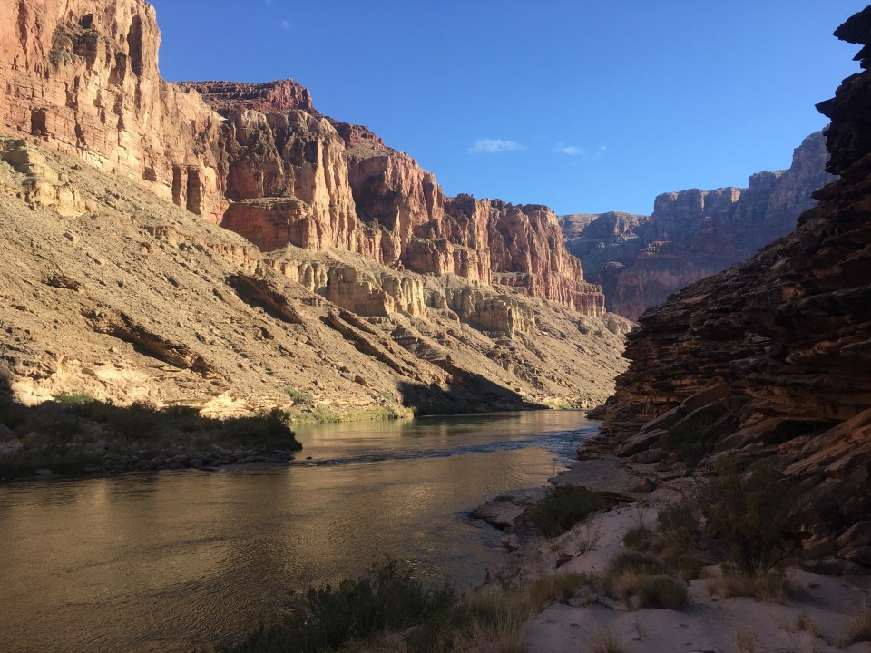
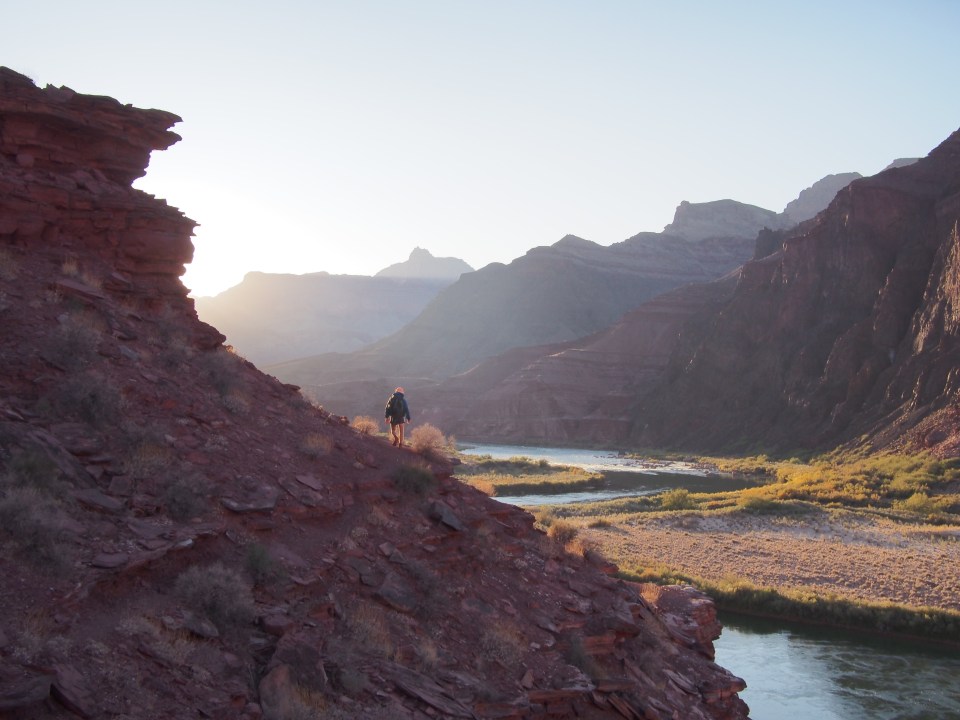
 I won’t say that the Beamer Trail was absolutely terrifying but it had its moments. The trail follows along a bench that has a 500 foot cliff on the right hand side going straight down to the river. There was a fair amount of times where a false step would have been my last. Other than that it contoured in and out of hanging side canyons and provided absolutely magnificent views of the Canyon. In the distance we could see the Desert View Lookout Tower on the South Rim. Last week we were up there with Nancy and Dave looking way down at this trail and I guess I had mistakenly thought the trail was a lot lower. After about 6 miles the Beamer Trail drops down to river level and is much more relaxed. At some point we crossed the intersection with the Tanner Trail and picked up the Escalante Route(not technically a GC trail but felt pretty good to me). We walked a couple miles of this before finding a place to camp for the night under a tiny sliver of a moon and a gazzillion stars.
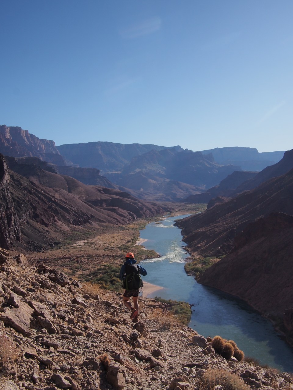


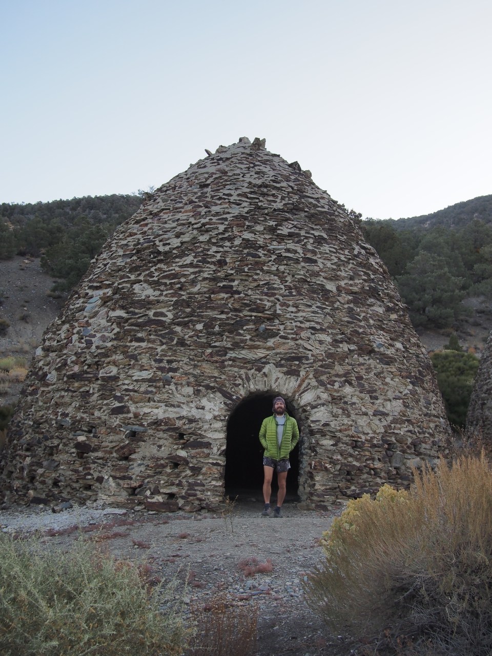 Historic Charcoal Kilns
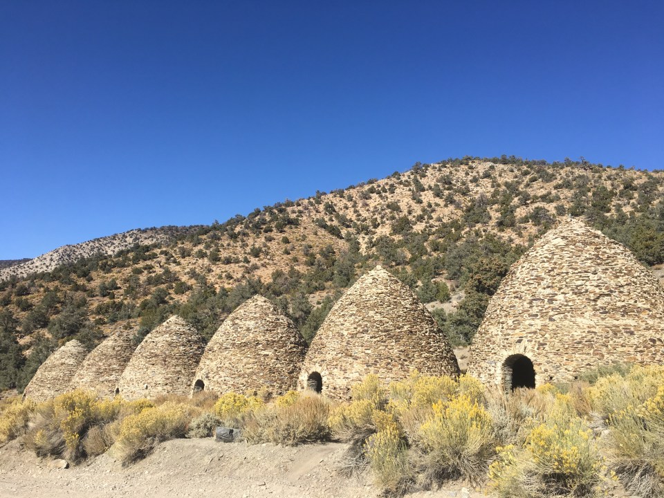


 Turning up Last Chance Creek Canyon we reached decent water for the first time since yesterday afternoon. There was a good amount of water in Rogers Canyon earlier in the day but it was pretty nasty looking. Unfortunately QB slipped and busted her ass in a big puddle of it. I felt bad and everything but sure glad it wasn’t me. After getting water this evening we saw a massive tarantula crawling across our path. Shortly after that we found a rocky shelf on the side of Last Chance Creek to cowboy camp. Hopefully that tarantula doesn’t try to crawl in my fartsack to cuddle.
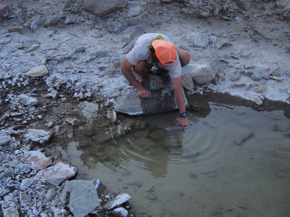


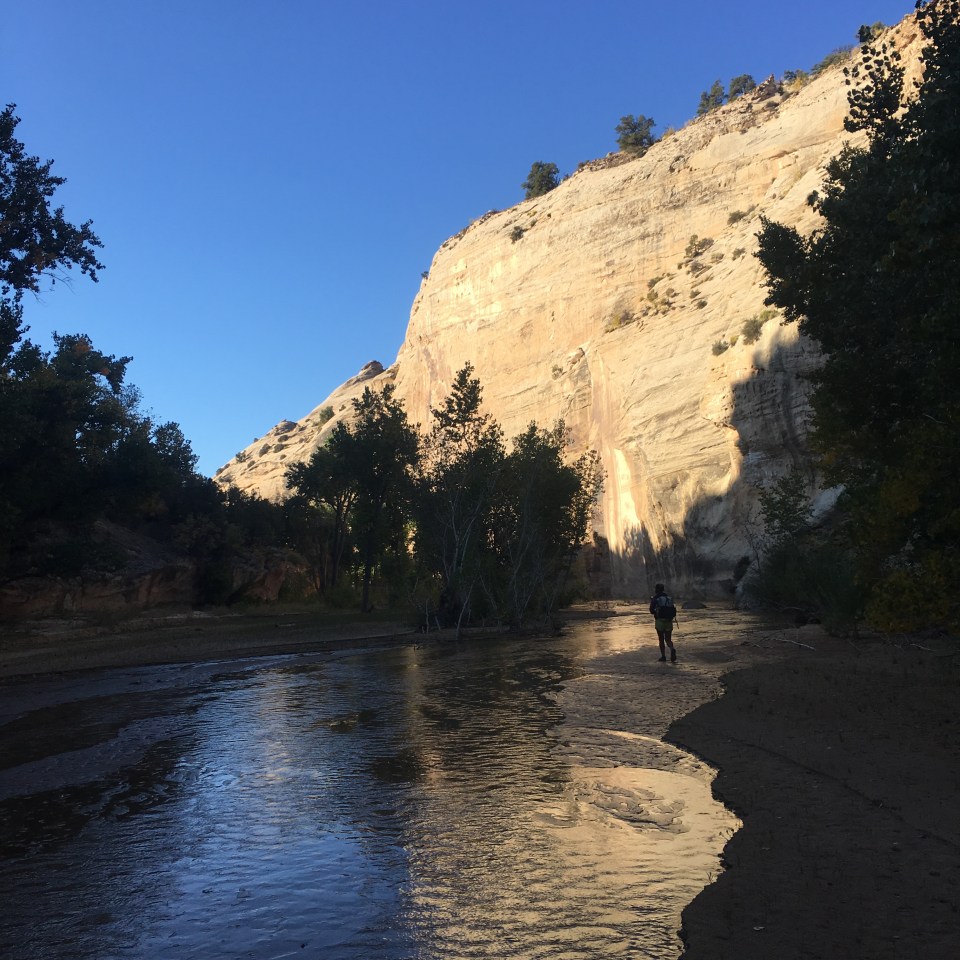

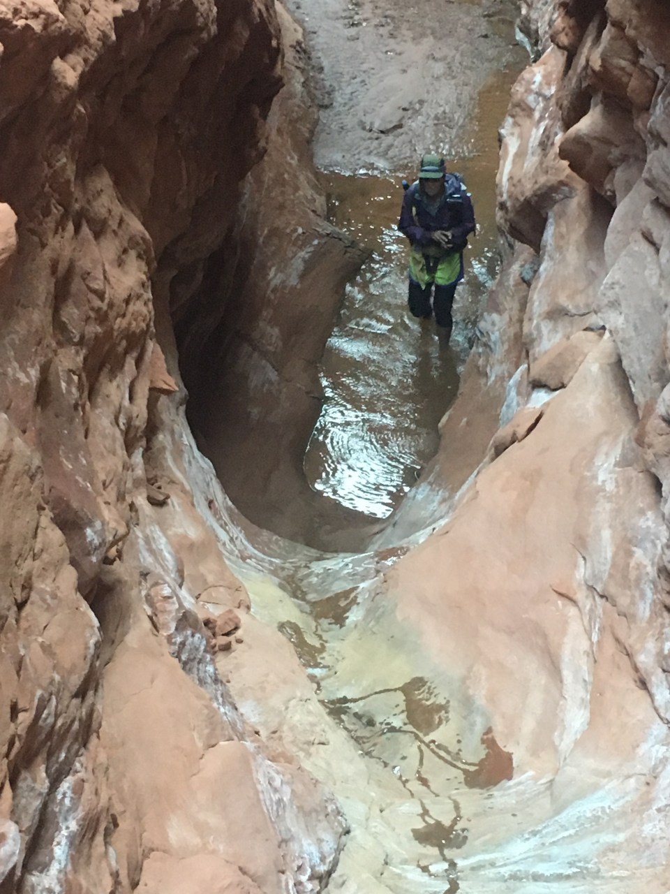
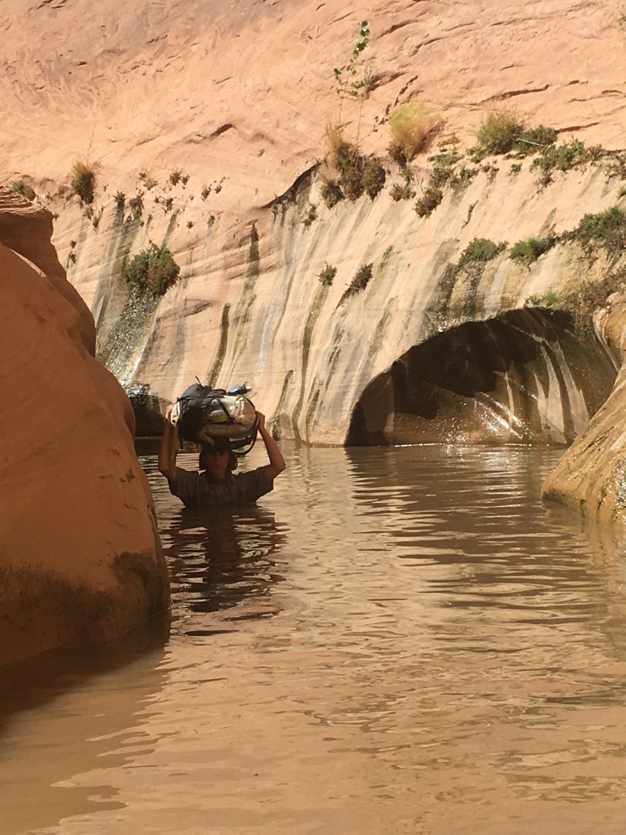


 Often times we would be walking up to our knees and waists through the dark water on slippery mud. At one point we went through holding our packs above our heads and the water was just above my mouth while I was on my tip toes. QB followed me and even though we’re the same exact height, she somehow got to the same spot I was at and had to swim using only her legs as she was still able to hold her pack above her head. I guess my toes are longer. To see some video of this event go to my insta @endlesspsummer.
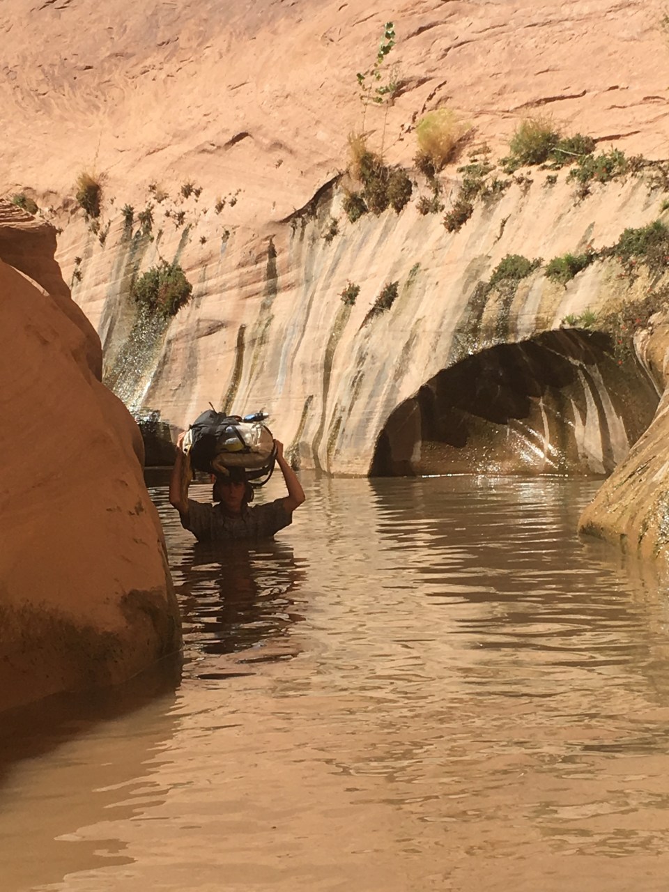 Shortly after the deep stuff, the canyon began to widen and we were dumped out into an area that looked much like before except this time there was water in the creek bed. We followed alongside this for 6 miles sometimes able to find stretches of animal trails and sometimes bushwhacking cross country. There had to have been a better way. At some point we left the boundary of Capitol Reef NP and entered Glen Canyon National Recreation Area. We walked this section of Halls Creek until almost reaching an outstretched arm of Lake Powell. Had Glen Canyon Dam never been built, Halls Creek would carry on through Glen Canyon eventually feeding the Colorado River.
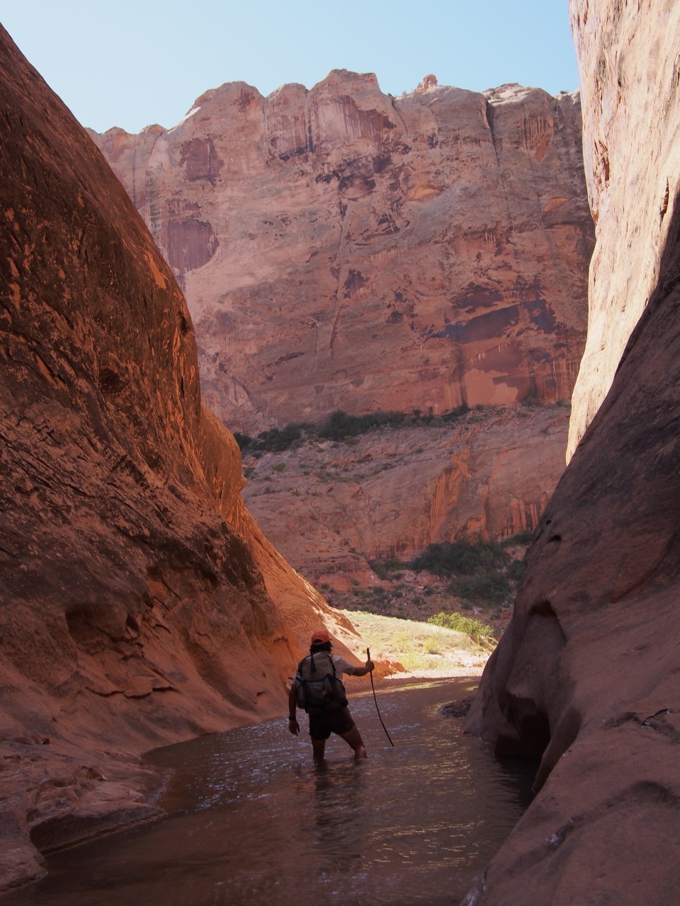
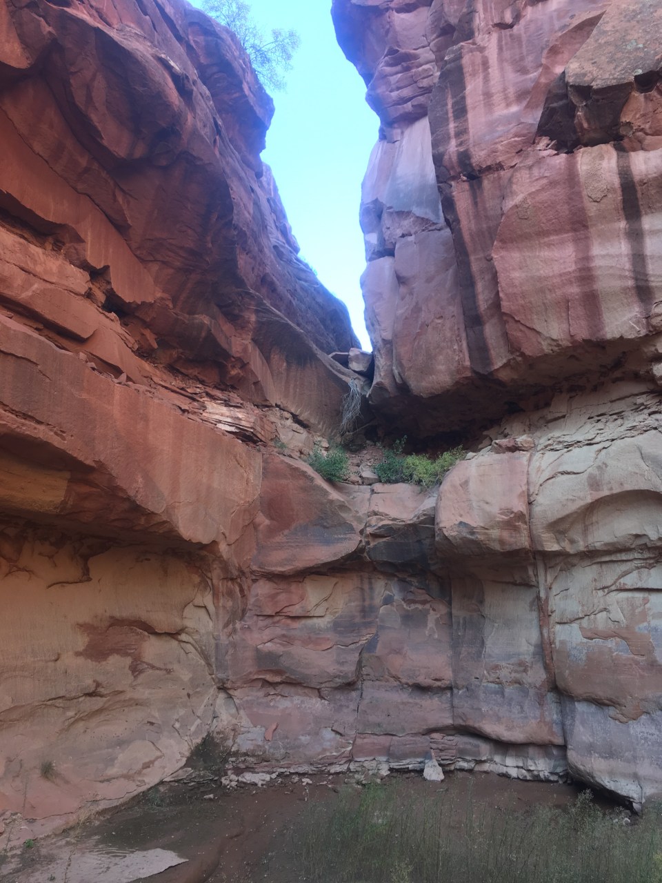
 When we could go no further on the rim there was a spot where we could descend back into the canyon following a cairned route down some ramps and ledges. Back on the canyon floor it suddenly felt like a rain forest, it was cooler, there was lots of vegetation, and a good amount of water. The vegetation created some bushwhacking and the water caused some navigational trickery but nothing we couldn’t manage.
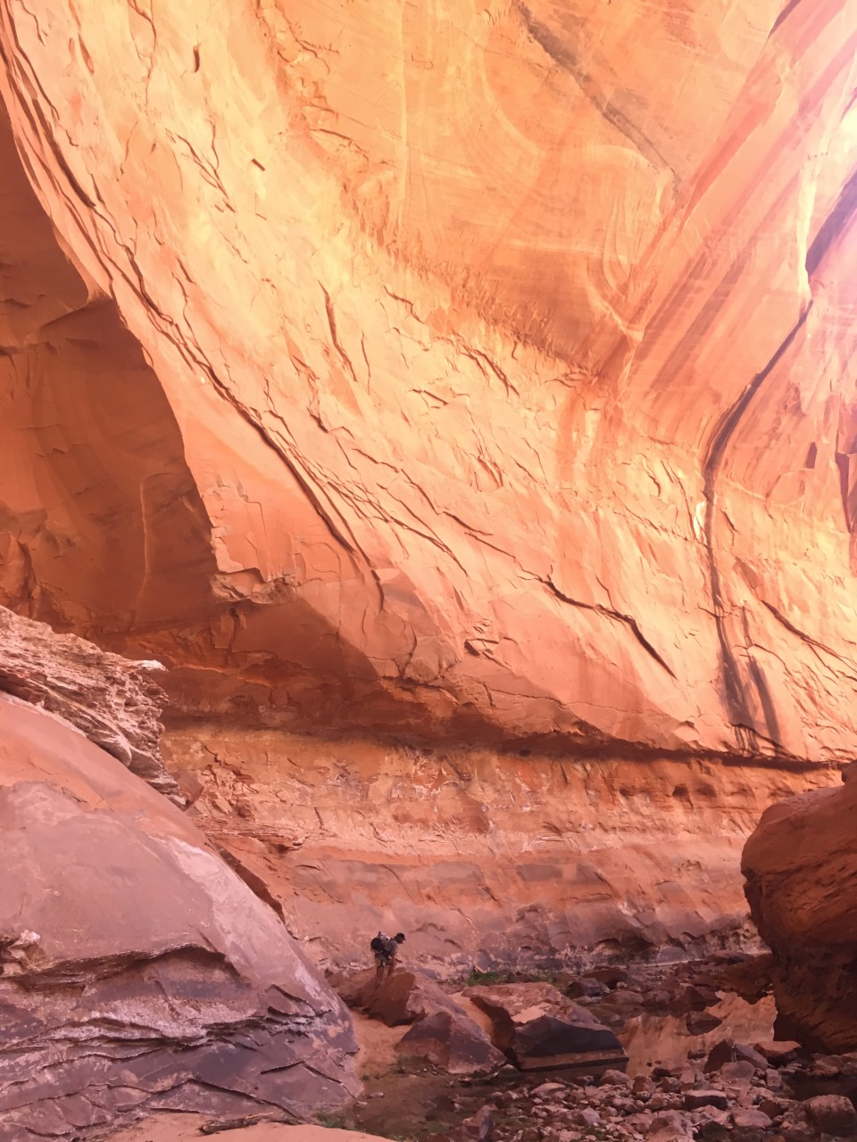

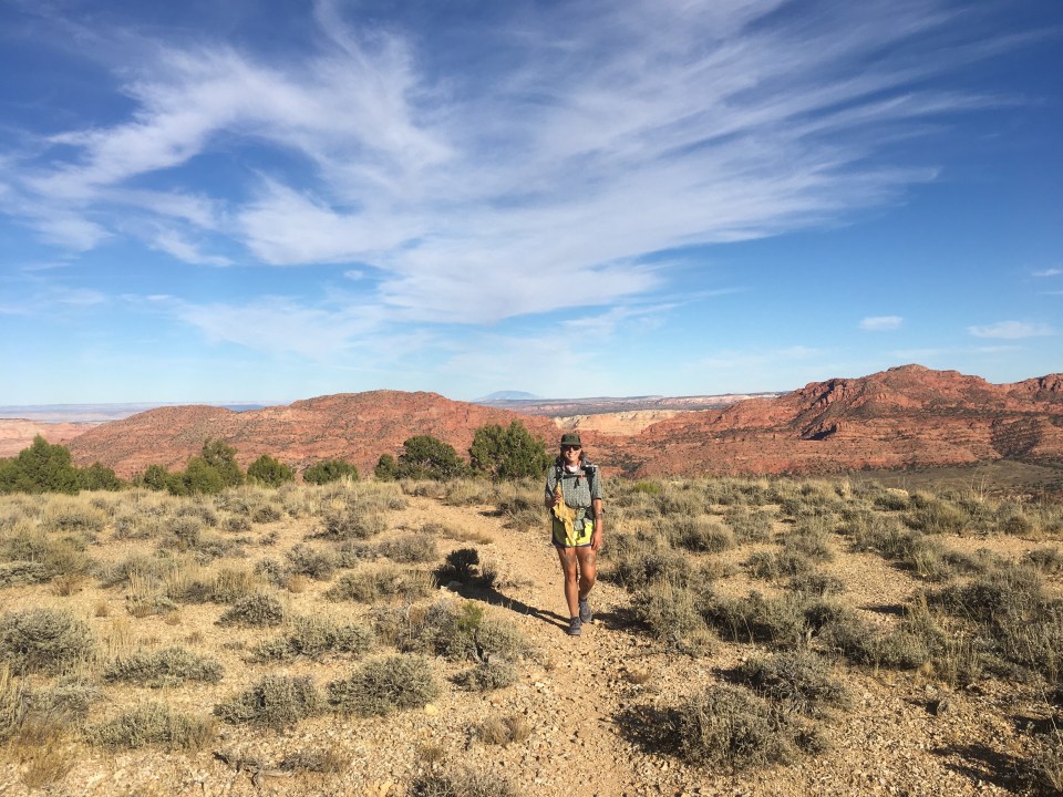
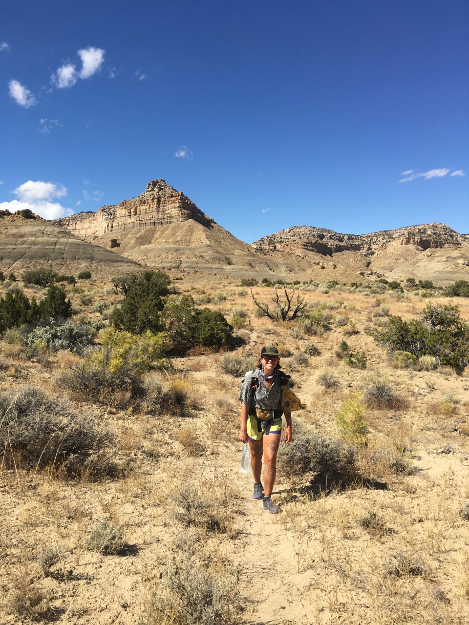
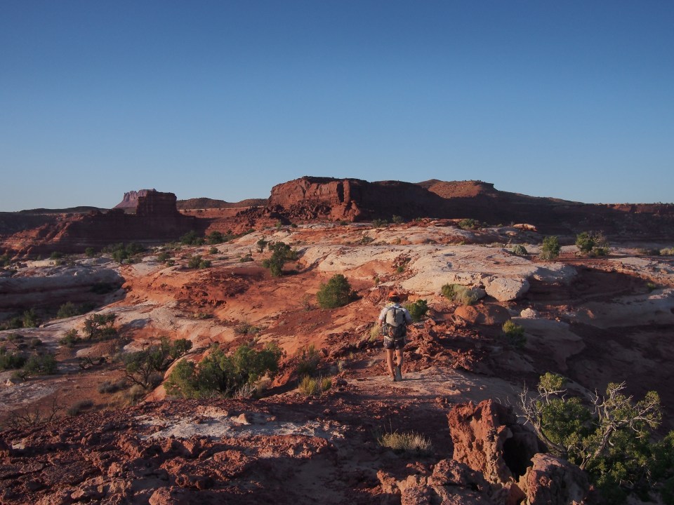
 We walked up the gulch this morning until reaching Hurricane Wash then followed that up for about 5 miles until it became real desert again when we came to a trailhead on Hole-in-the-Rock Road. We were 40 miles out on the dirt road from the town of Escalante with very little traffic so we started walking. After an hour Hazer drove by and picked us up. He’s been interning for the GSENM and was out this way cleaning some remote public bathrooms. On the ride into town he enlightened us on raising cattle, hunting mountain lions, and all things rodeo. It was quite fascinating. Escalante is becoming a busier tourist town every time we come through and seems to have everything necessary to be a good little trail town.
 feel free to follow this blog and follow our instas for more pictures @endlesspsummer and @sarahikes
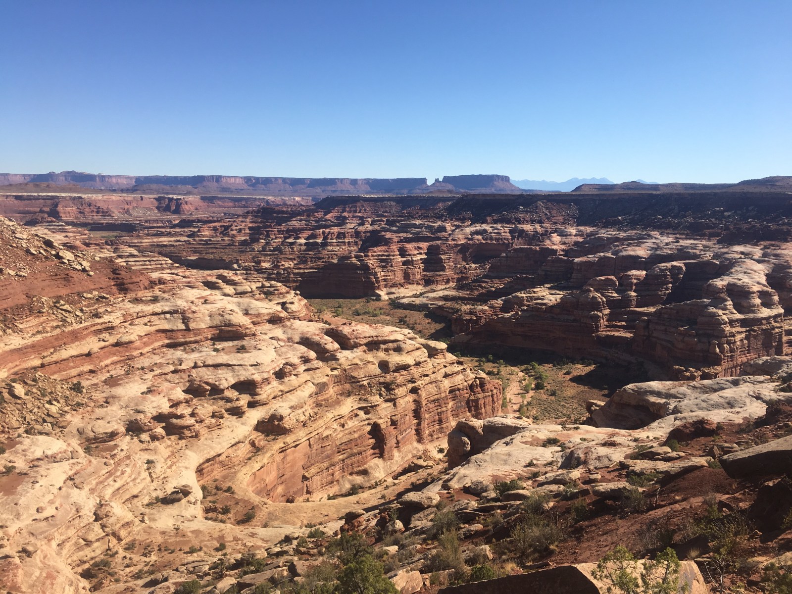
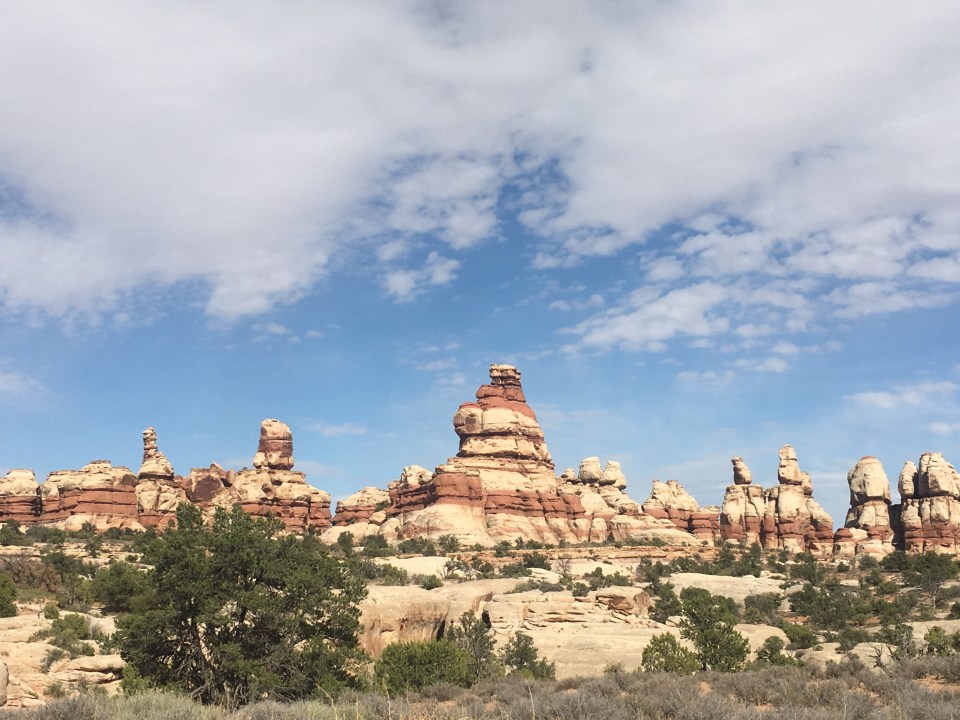
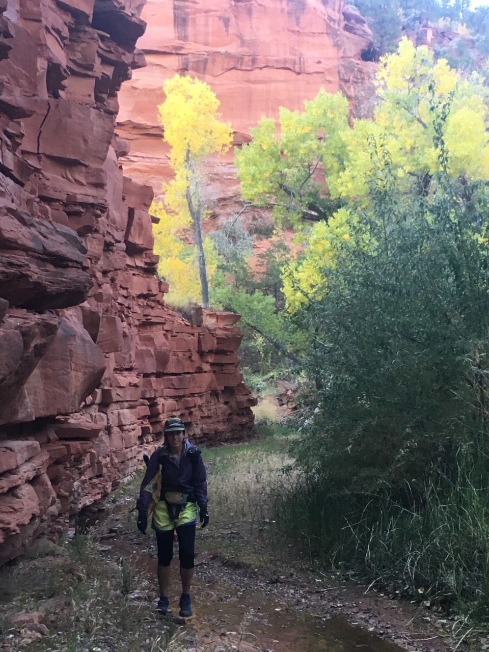
 From there we walked a handful of miles before coming to a ridge that overlooks ‘The Maze.’ This place is just other worldly! Its this huge sea of canyons and looks so unreal. We walked along slickrock for awhile until finding a good place to camp. It was a clear night and a good one to cowboy camp so we decided to forgo the tent.
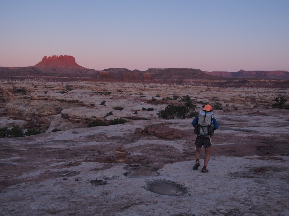

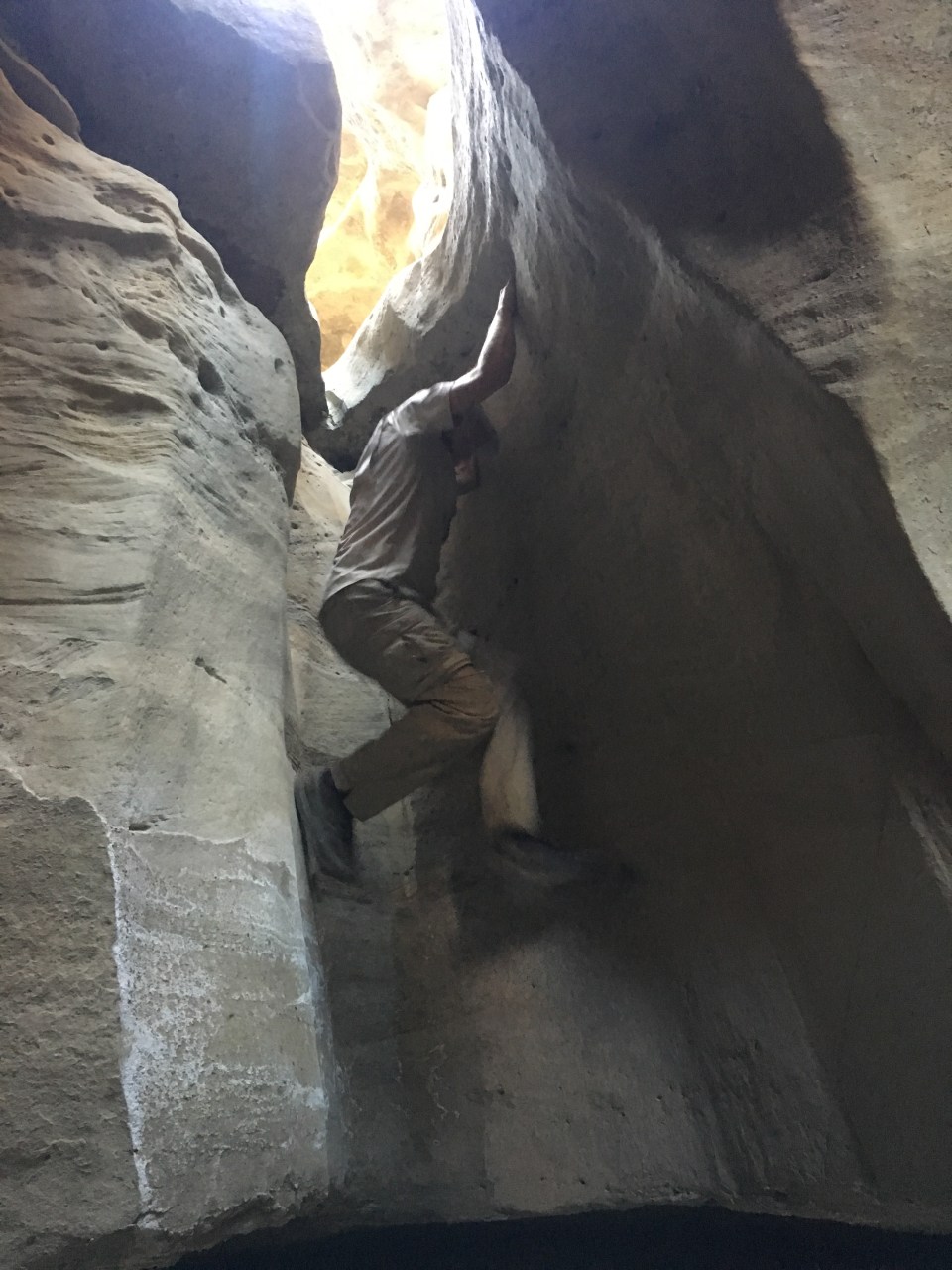
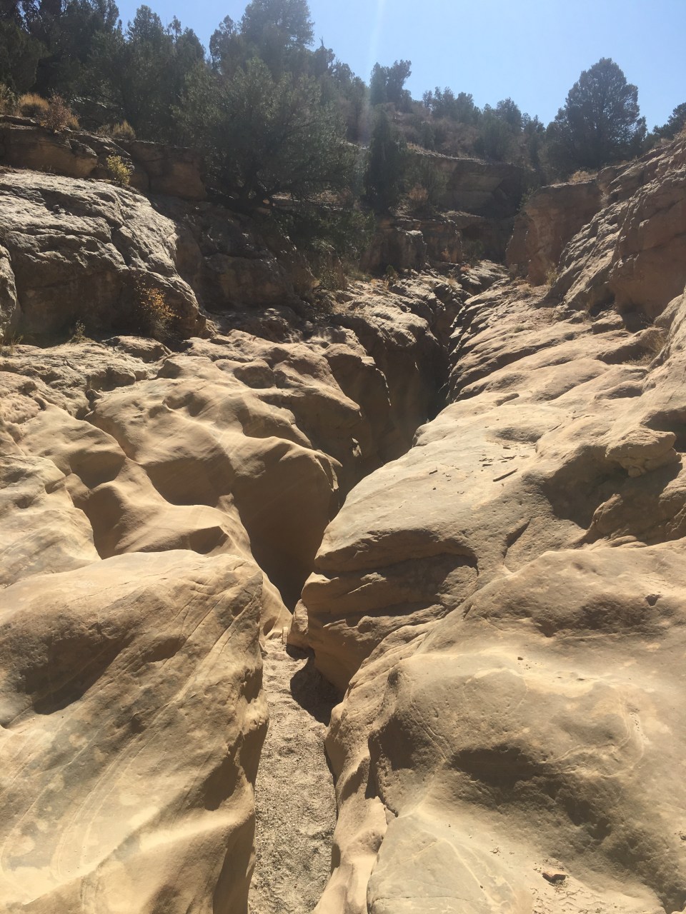
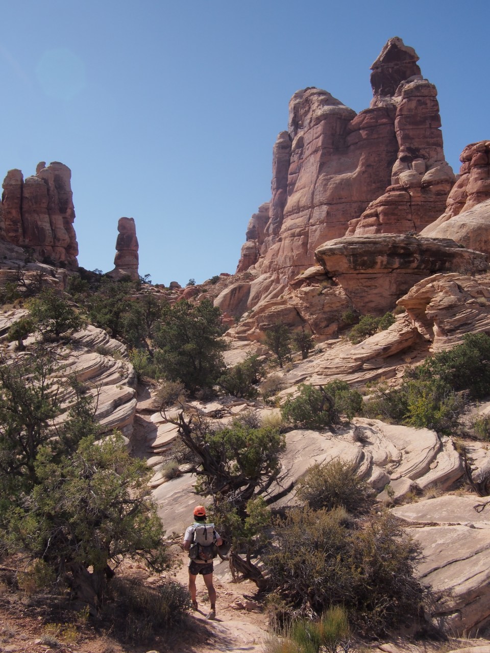
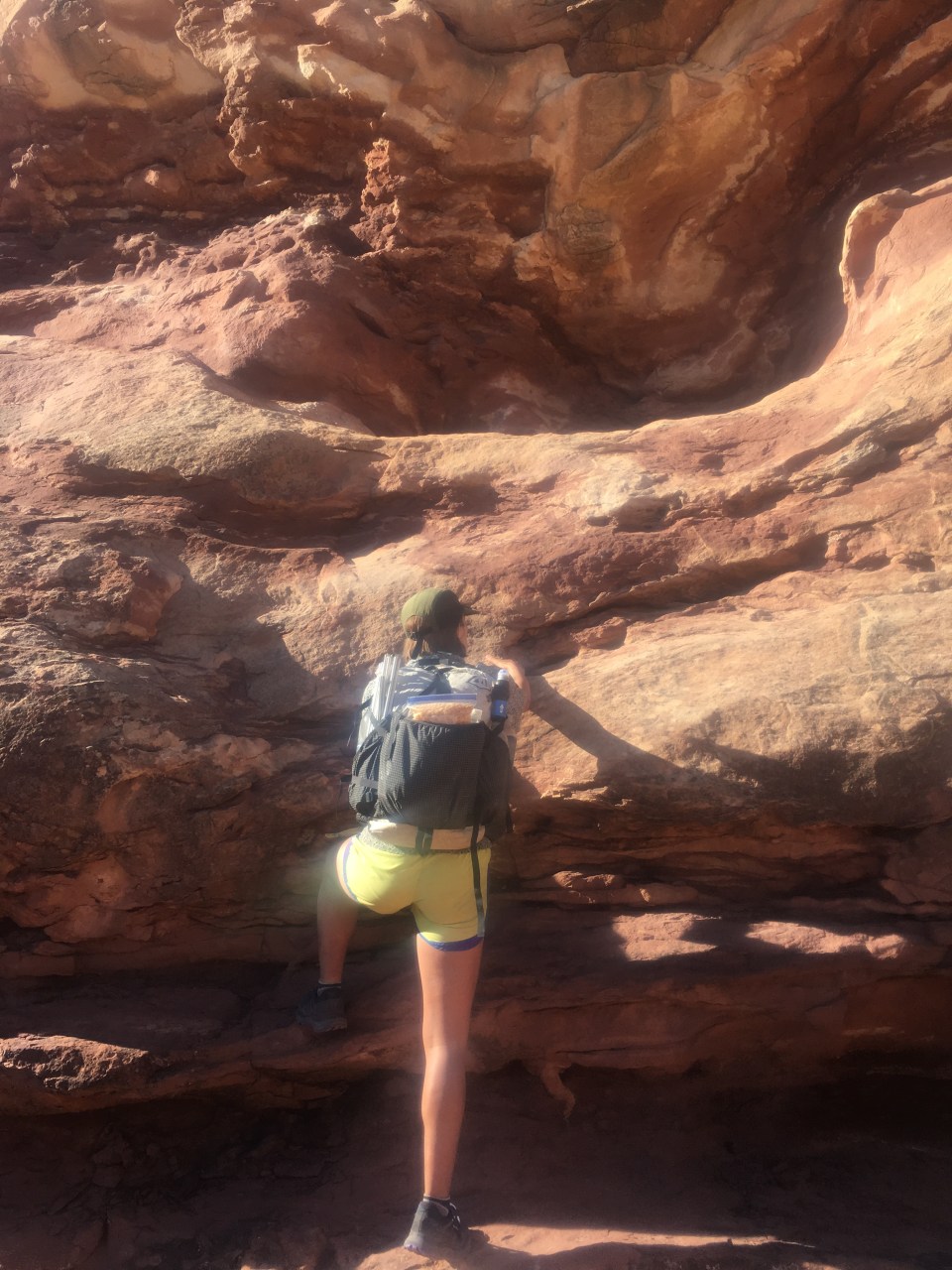
 If you’re planning to come through here note that we didn’t find any water at Maze Spring(doesn’t mean it wasn’t there). We did however come across a pool of decent water just off trail to the right about a half mile beyond where we expected Maze Spring to be. The climb out of the canyon took us up an adventurous route. There were some steep sections with class 3 climbing. At times we had to pass our packs up to each other and scramble up cracks in the rock. There was one ledge we had to shuffle around and then make an athletic move to get up onto the ridge but it wasn’t as scary as anticipated. It was fun.


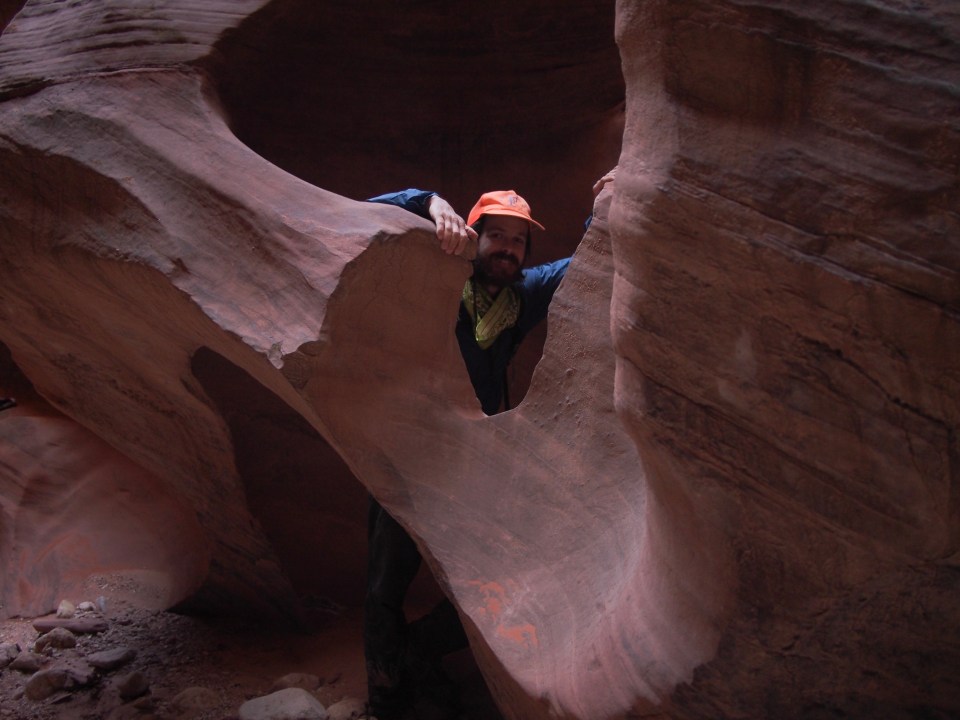
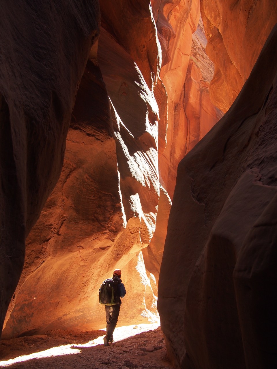
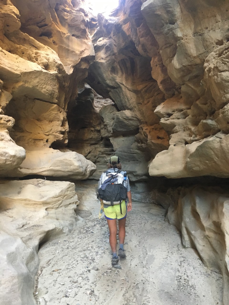
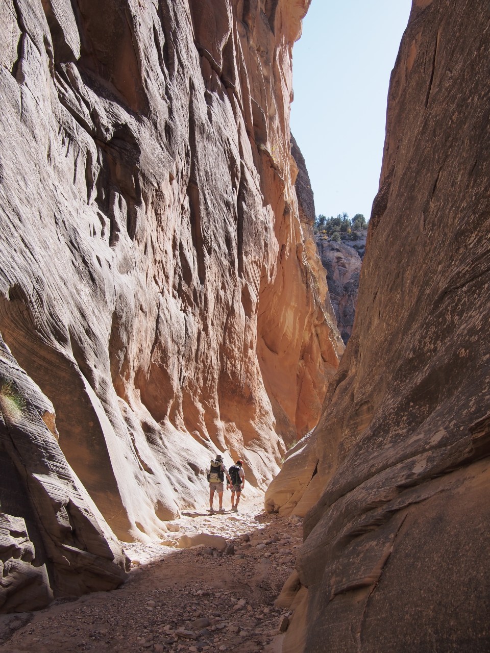
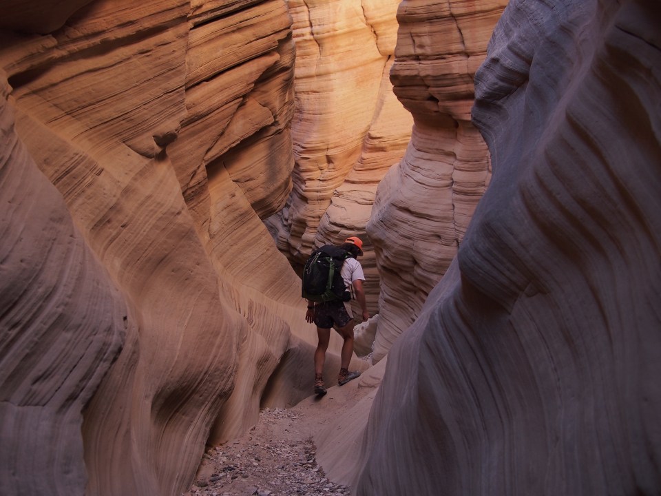
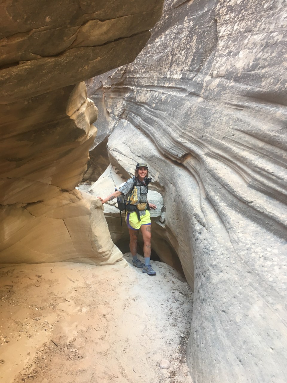
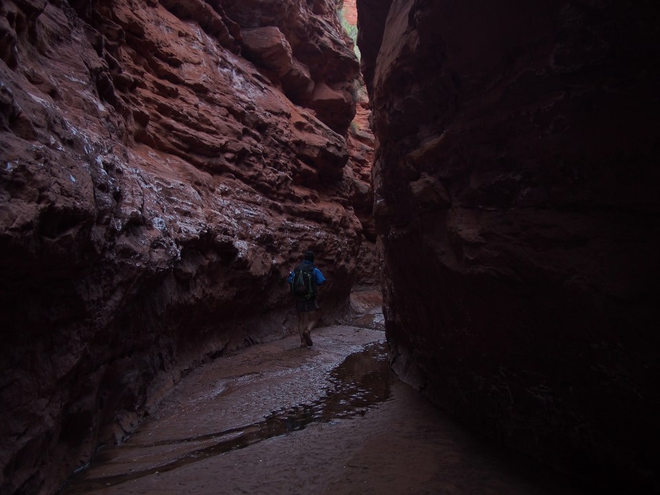
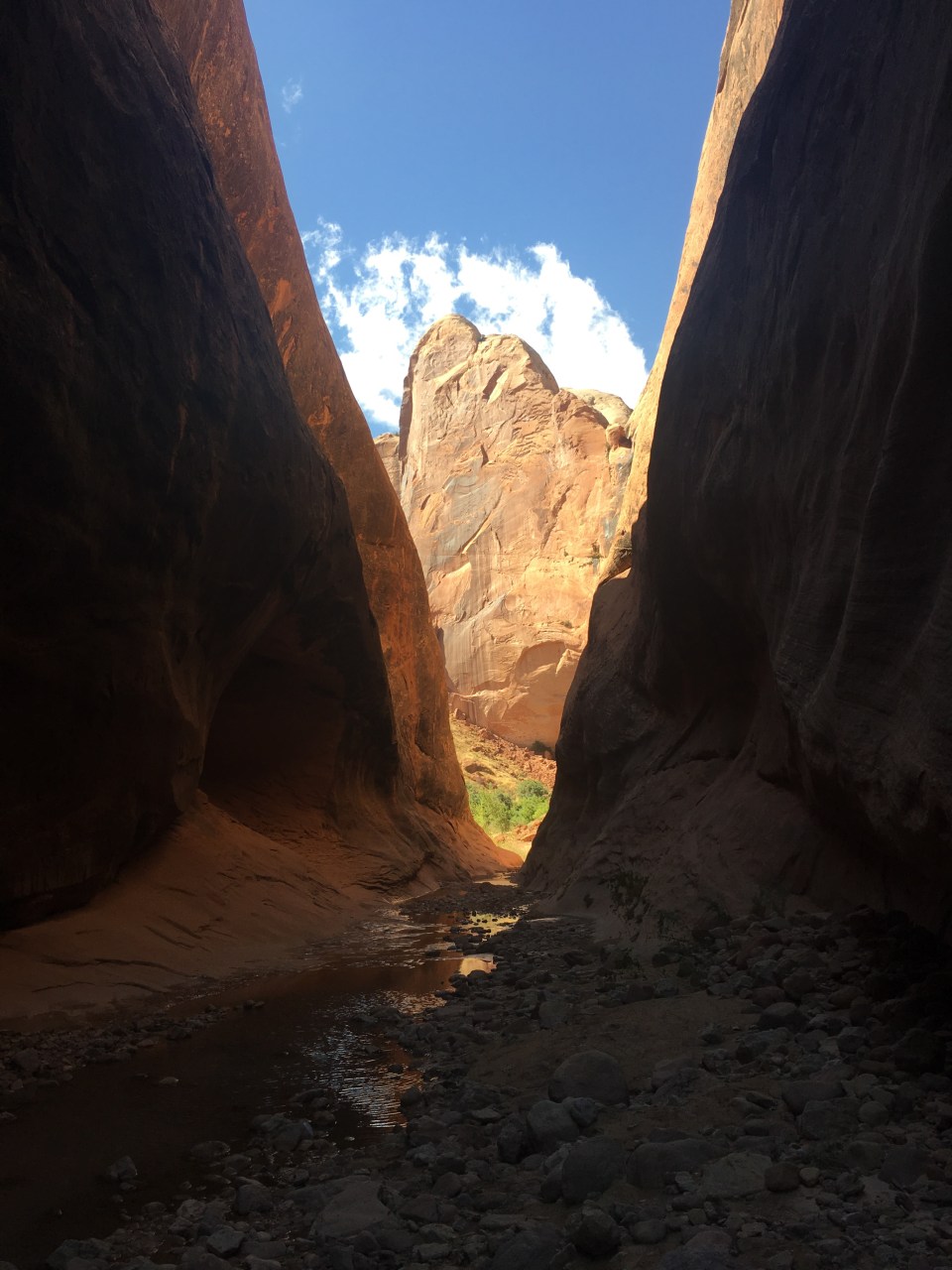
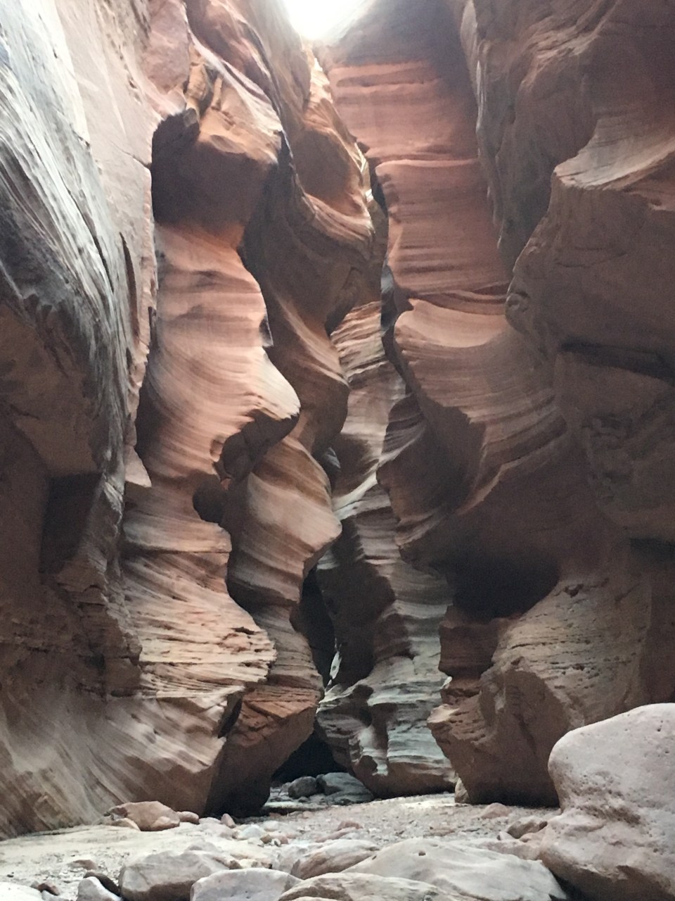
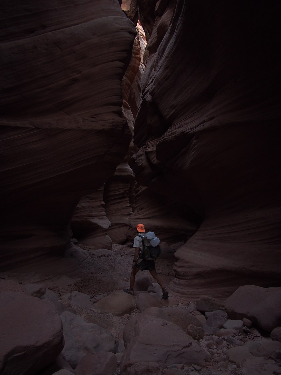
 These slots were rad! They went on for a couple miles and got higher and tighter as we went. Eventually they spilled out into a larger canyon containing the Dirty Devil River.
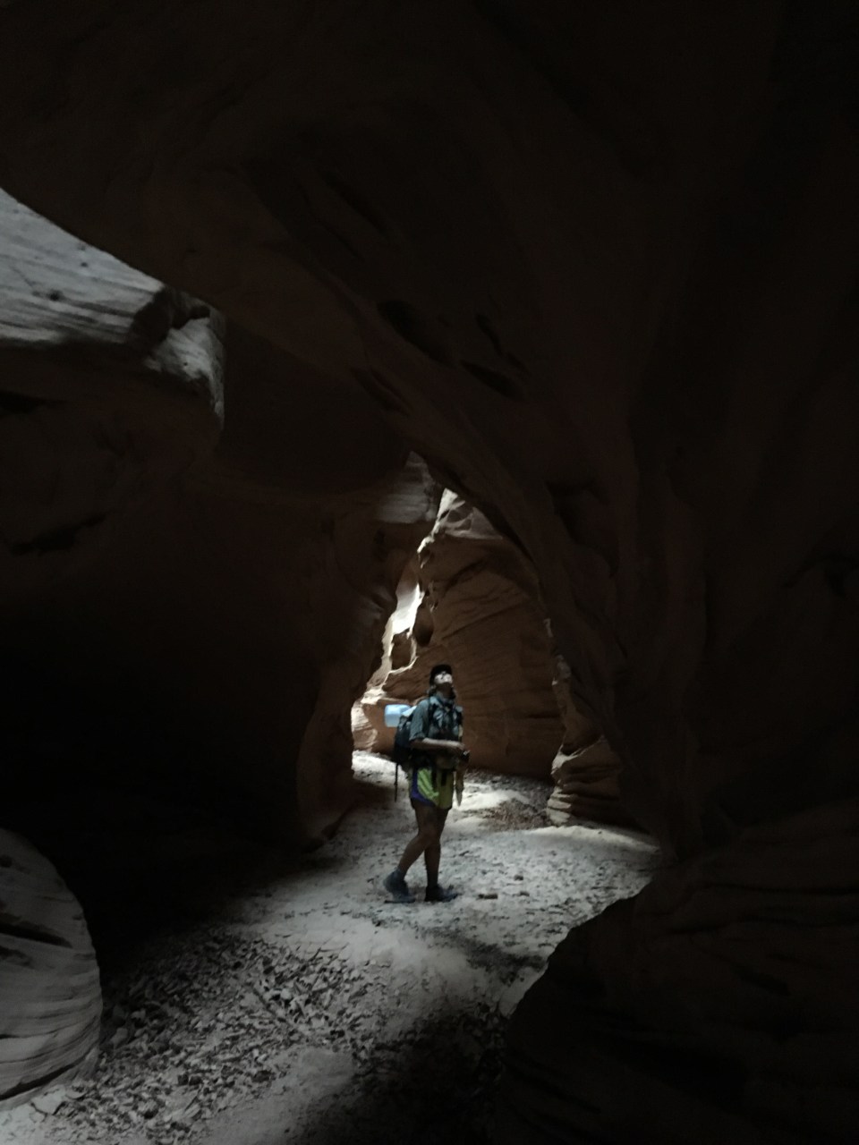
 feel free to follow this blog or find me on insta @endlesspsummer and QB @sarahikes