10/16/19….22 miles….10300 feet of gain
Cactus to the Clouds is a day hike up Mt. San Jacinto in Southern California. It is considered one of the most difficult day hikes in the country(this is debatable of course) because of its massive amount of elevation gain. The climb gains over 10,000 feet in 16 miles with about 8,000 of those feet in the first 10 miles. If you’re here to only read about San Jacinto feel free to scroll down a little, otherwise read on and I’ll fill you in on how QB and I got here from Utah. 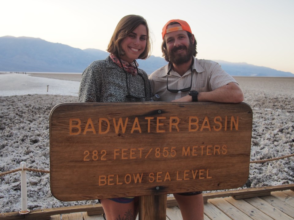
QB and I are currently taking a break from hiking the Hayduke and find ourselves in Southern California. We’re headed to NY for a wedding this weekend and the timing worked out where we had a few extra days to find something to do. First we hitched from Jacob’s Lake in Arizona to Vegas where we rented a car.(All they had left was pickups but the Nissan Frontier we rented would come in very handy. Not only did it help us get down difficult roads but we also filled it with hitchhiking backpackers multiple times and slept in the back 4 nights.) From Vegas we drove to Death Valley NP. What a massive, unique, and beautiful piece of the planet! We ran into some hikers beginning a Lowest to Highest route and gave them a ride to the start, Badwater Basin. The lowest place in North America, this was an awesome place to enjoy the sunset. 
The next day we climbed Telescope Peak, the highest point in Death Valley. This mountain had awesome views 11,000 feet down to the Basin and over 100 miles in every direction. We could see Charleston Peak to the East outside of Vegas and Mt. Whitney to the West among other peaks in the Sierras. 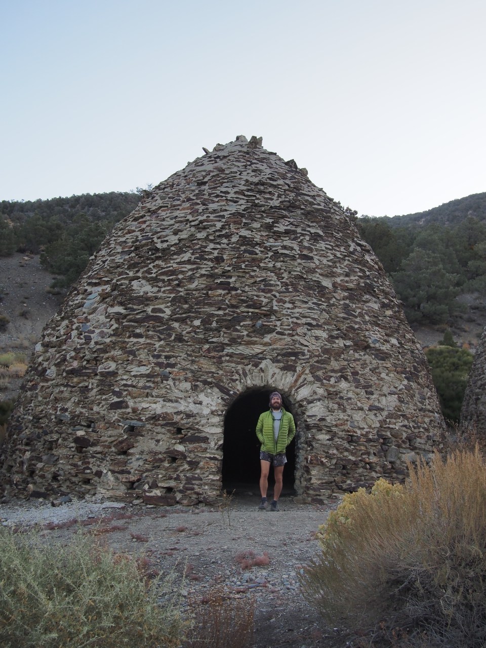 Historic Charcoal Kilns
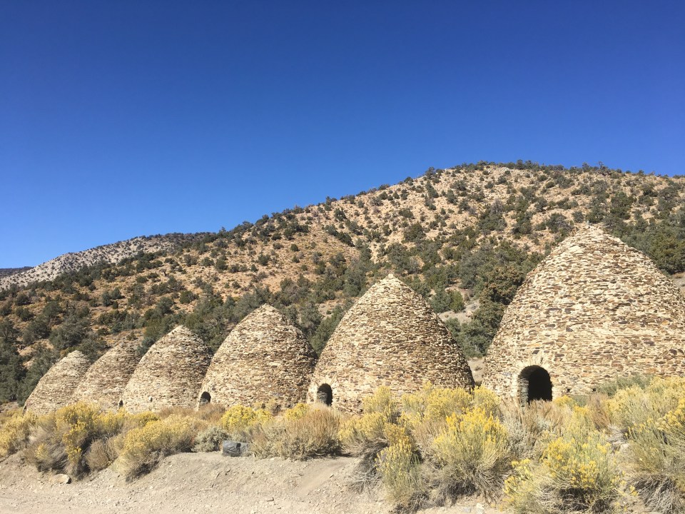
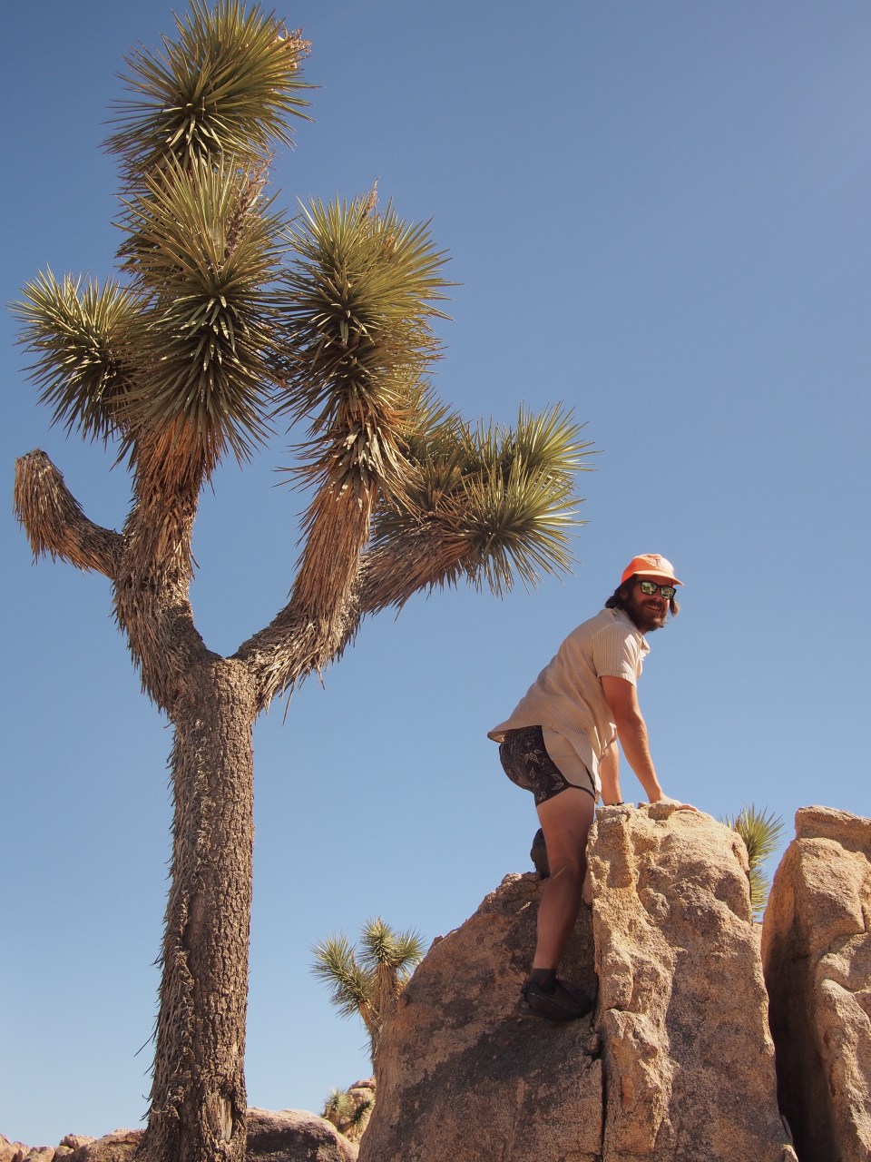
After spending the night sleeping way out in the middle of the desert somewhere, we did a little exploring of Joshua Tree NP. I’ll definitely have to go back there with climbing shoes and crash pads to get the full effect. It’s a beautiful park loaded with Joshua Trees(of course) and millions of buttermilk boulders. Climbing is the real draw for this place. Leaving J-Tree we headed south to Palm Springs. 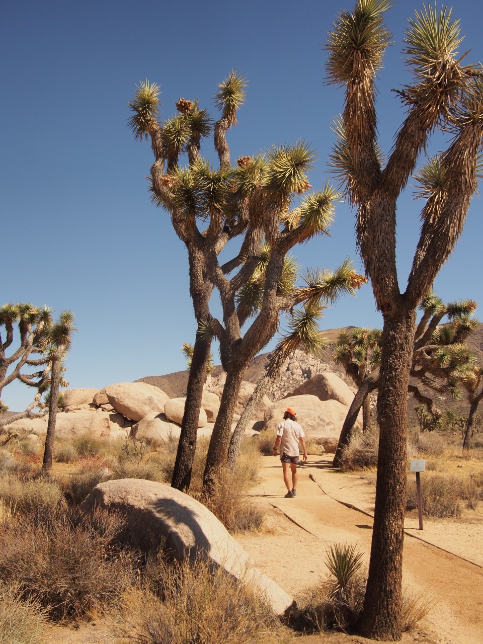
The Skyline Trail up San Jacinto begins in the parking lot for the Palm Springs Art Museum. There is most likely BLM land or another free camping option outside of town but since we wanted an early start we opted for the Happy Traveler RV Park about a mile from the museum. I think we were supposed to have an actual RV but we told the woman all we had was this truck or a tent and she only charged us half price. Half price or not I was still too excited to sleep and instead of getting up at 4 like we planned we reset the alarms for 5. Depending on the time of year, an early start on this hike is a pretty good idea. It was supposed to get up to the mid 90’s in Palm Springs today and would be in the 50’s at the summit. The higher on the mountain you can climb before the sun starts roasting you, the better off you’ll be. 
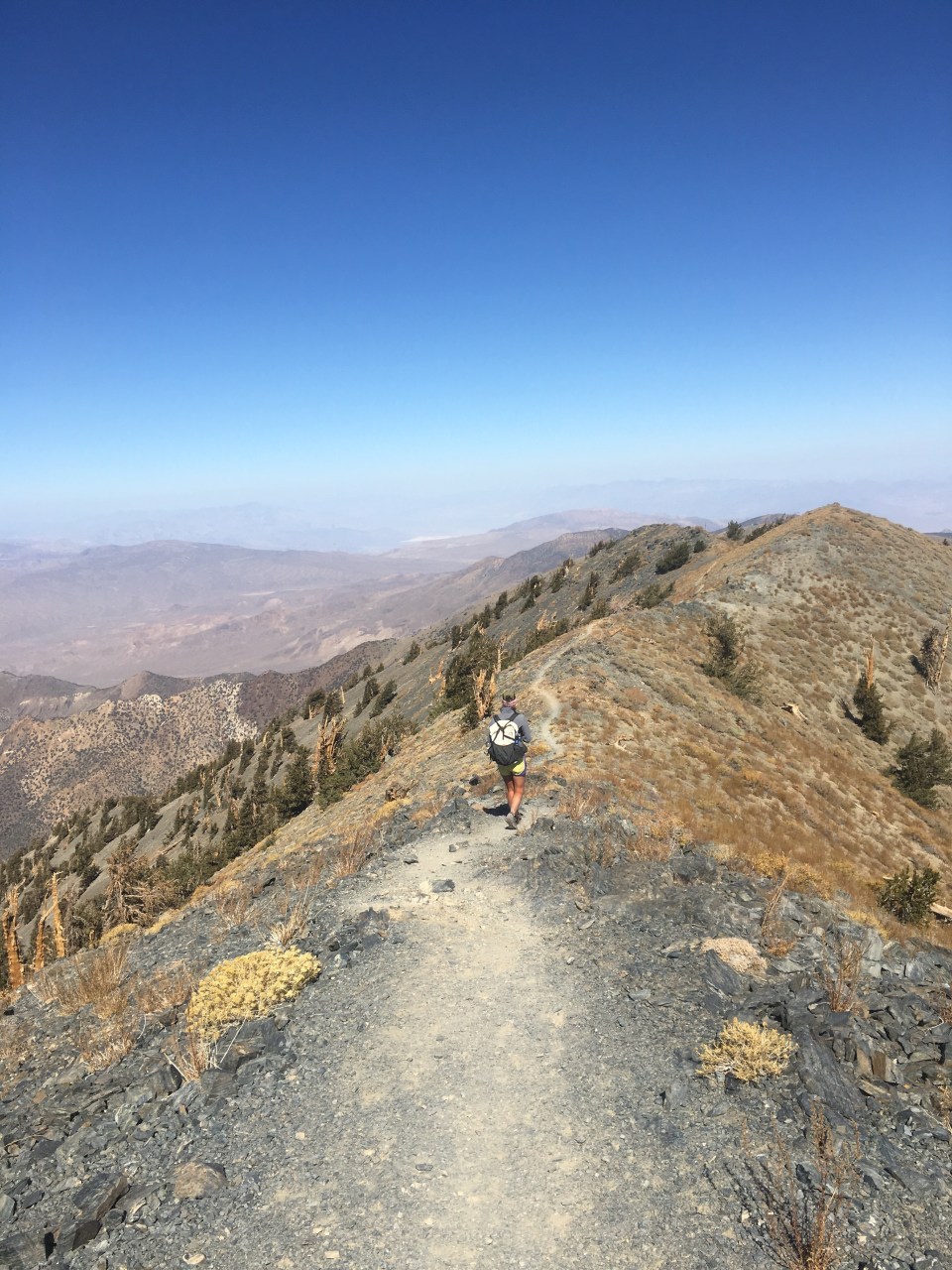
We were on trail by 5:40 and were immediately climbing up steep switchbacks in the dark. It was already warm and the trail proved this was going to be a difficult day. Navigating was relatively easy(just keep going up) and we never had any mountain lion or rattlesnake encounters if that’s a concern. Looking back we could see the lights of Palm Springs spread out below us and enjoyed a very nice sunrise. Going forward we passed every kind of cactus you could imagine, except maybe the saguaro, I don’t remember seeing any of those. Although scenic, the trail was definitely tough, for awhile we were traveling less than 1.5 mph. Especially between miles 8-10, don’t say I didn’t warn you. 

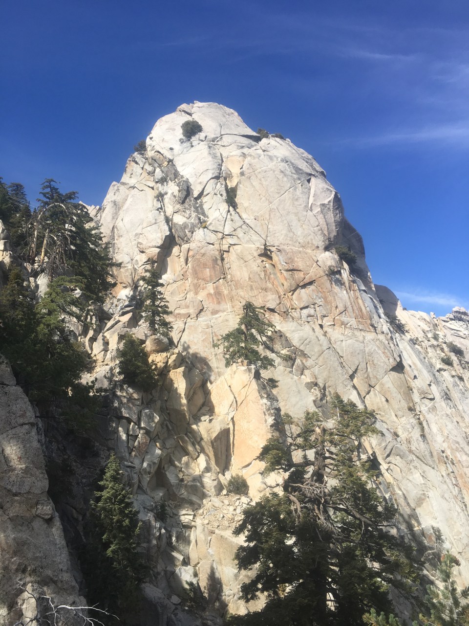
As we got up around the 10 mile mark we crested a large climb and reached Long Valley. This is a huge, relatively flat area filled with massive ponderosa pines and impressive Douglas firs. Places like this are referred to as ‘Sky Islands’ where they tower high above the desert and provide a much cooler climate. There’s a tram that brings people up from Palm Springs and dumps them out up here so when we got to Long Valley there were a fair amount of people. As far as I know we were the only smellies that walked up from museum. 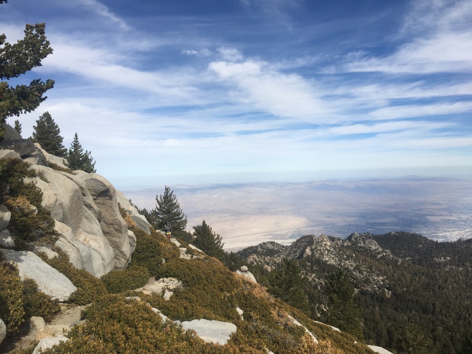

San Jacinto is a state park and to hike beyond Long Valley you need a permit. This is no big deal, we went to the ranger station, filled out a form, listened to his spiel and got the summit permit. There’s also a spigot with potable water here which was nice because there’s no water on the way up. The next 6 miles only had 2400 feet of gain so they were very relaxing and enjoyable. 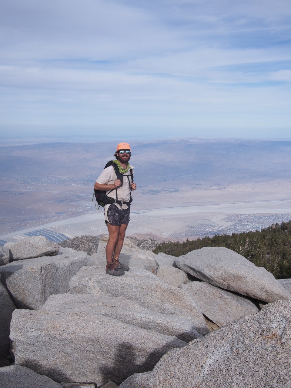
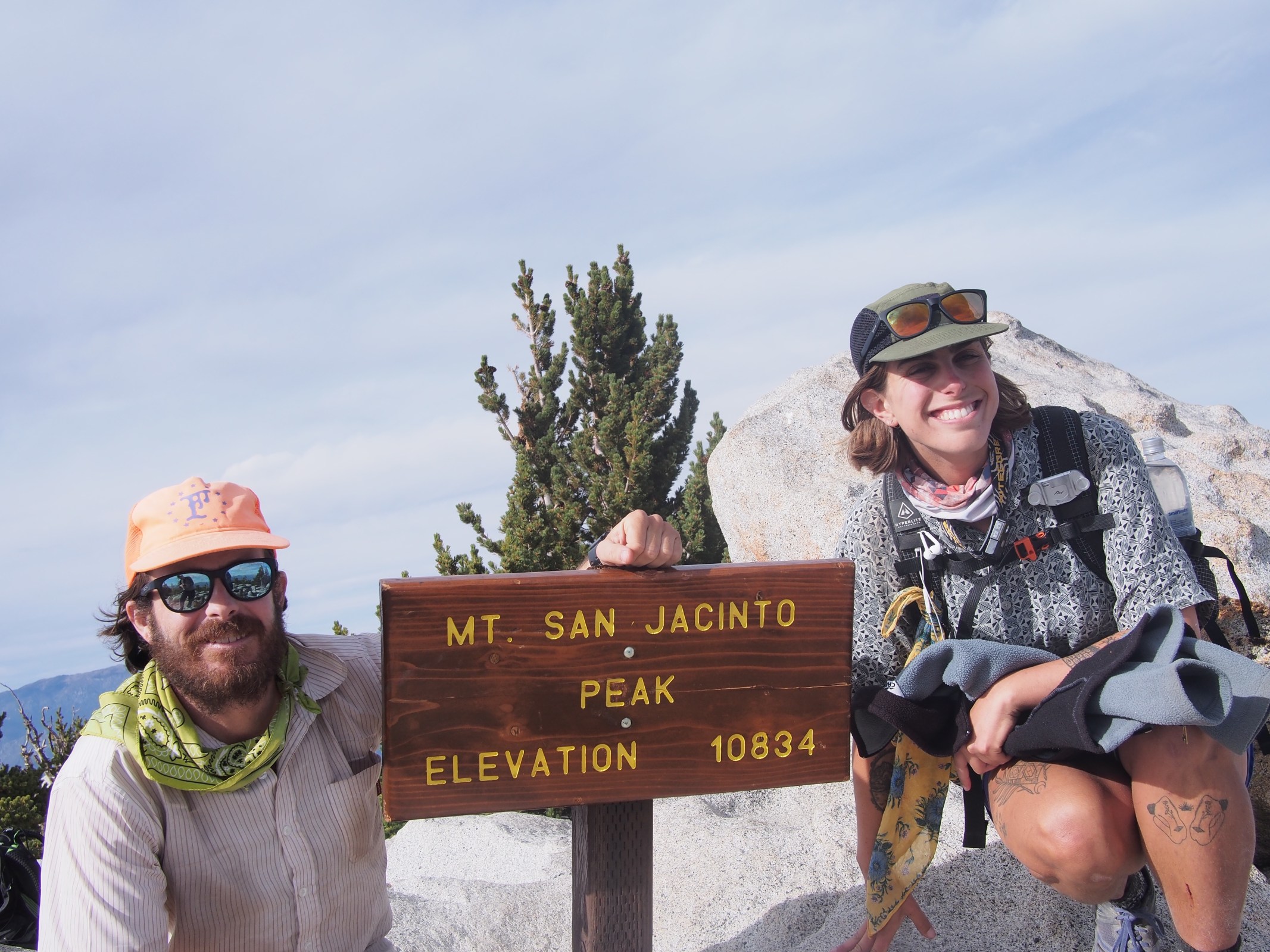
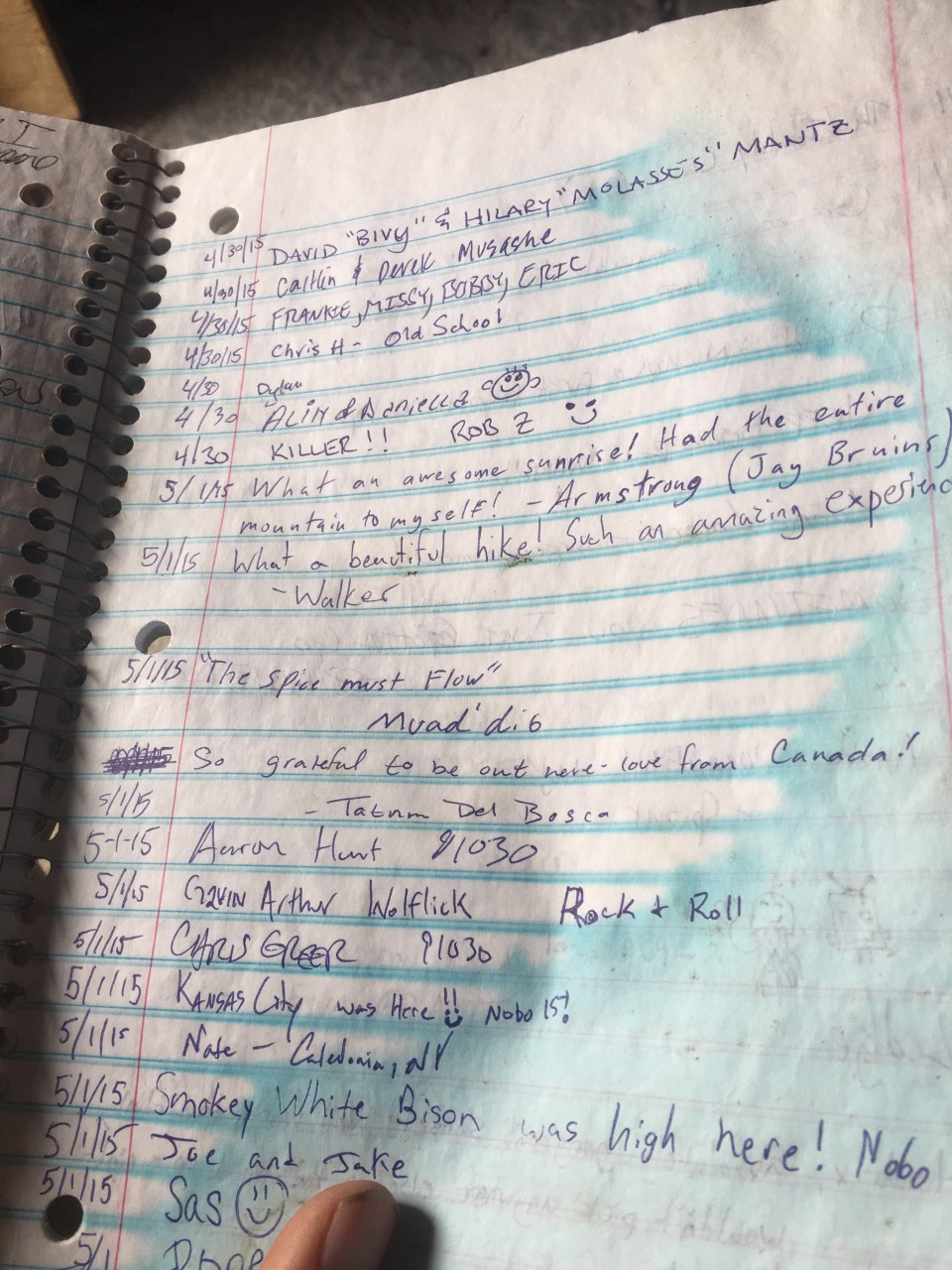
In 2015 QB and I both hiked the PCT and although that trail doesn’t quite go over San Jacinto it’s very close by and a popular alternate for thru hikers. When we reached the stone hut near the top we went in, signed the register and were surprised to find all kinds of old trail logs. It was so much fun to look through and see all these names of people hiked with that year. QB must have been in either too much of a hurry or too stealthy to sign because we couldn’t find her name. Shortly beyond the summit hut was the peak itself that had some awesome views down into the desert. We spent a few minutes up there then retreated the 6 pleasant miles back to long valley and the tram(you didn’t hear it from me but word on the mountain is they don’t charge on the way down). It was just before sunset when we got to the bottom of the tram and we still had to get down and around a few miles back into the city and our rental car. We put our thumbs out and got picked up by Rex and Steve in a Tesla! A Tesla for crying out loud! This was a very classy way to end our hike. After getting back to our truck we stopped for burritos then drove a couple hours north and found a place in the desert to spend the night.
If you’re looking for a fun, challenging, and rewarding hike I’d recommend this one. Start early though, chances are you’ll be using a headlamp at either the beginning or the end of your day or both. All in all it was something like 22 miles total with 10,300 feet of gain. The museum is around 500 feet and the summit is over 10,800. It took us roughly 12 hours and almost 7 if those were during the first 10 miles. The tram runs until 9:45 but I’d check on that beforehand. Good luck! And don’t for get to:
Feel free to check out my insta for more pictures @endlesspsummer and QB’s @sarahikes
