9/25/19…..Hayduke Day 11…..Zero miles
We took the day off today in Hanksville and a nice relaxing day. Overall it was a nice little trail town, had everything we needed anyway. Last night we stayed tented in the RV park and ate at Duke’s Grill next door. Two thumbs up for Duke’s and they served a good breakfast over there as well. Today we’re staying at the Hanksville Inn and although it’s not the Taj Majal they give a very good discount to hikers and cyclists. We left boxes of food at the motel last week while we had the rental car so we didn’t have to rely on the couple of small markets in town to resupply(they were only so so at best). If you ever come through this way Stan’s Burger Shack was a great little restaurant and had awesome shakes. My least favorite thing about Hanksville was the pizza at Bull Market. What can I say, it was the worst pizza I’ve ever had in my entire life.
9/26/19…..Hayduke Day 12…..20 miles
We started hitching this morning around 8am and there were barely any cars heading south on 95. After 20 minutes or so Don, a geologist for the state, picked us up and drove us the 17 miles back to Poison Spring Canyon where we got off the route.
From the highway we took a right onto a 4wd road and started walking towards the beefy Henry Mountains, the last mountain range to be named in the lower 48. We walked dirt roads for the next 11 miles gradually climbing higher until we got to Crescent Creek which was flowing nicely. At one point during this road walk we had to switch roads and unexpectedly do a class 3 down climb into a wash before gaining the other road, it seemed out of place compared to the rest of the morning.
After lunch at Crescent Creek we started uphill on roads again for a couple miles and began to pickup the scent of other hikers, or at least we saw two sets of massive Altra footprints in the dirt(thru-hiker tracks). A guy driving a truck down the road asked us if we were hiking the Hayduke and said something like ‘I’ve lived here all life, never heard of the damn thing and today met two separate groups of people hiking it.’ So I guess there’s a couple of guys ahead of us which is cool because we haven’t met any one else yet. 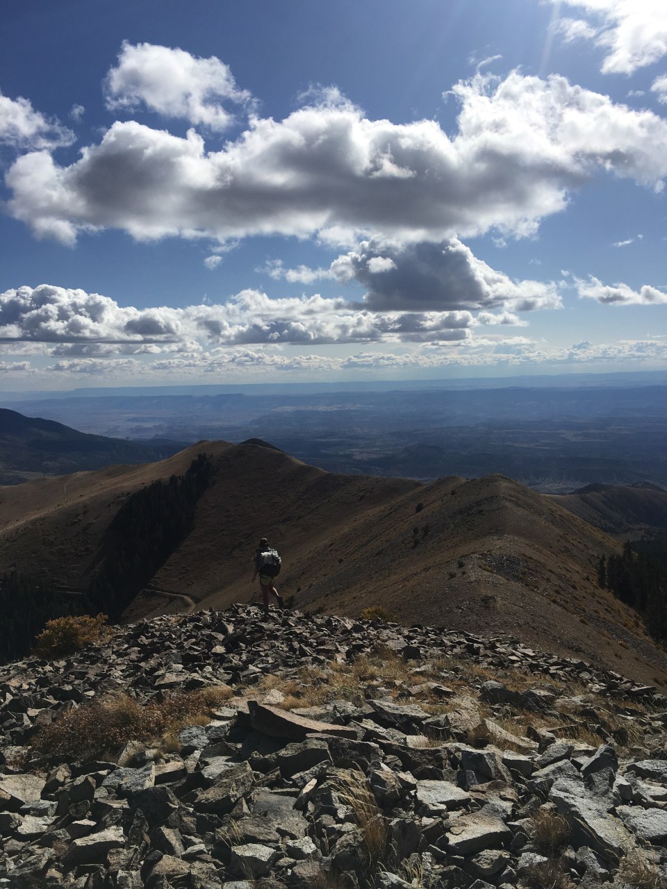
We then left the road following something of a shortcut that climbed directly up a ridge towards Mt Ellen. This was a very steep climb but it cut off about 3 miles of a much more indirect route to the summit. From the highway we gained 6,500 feet to top out at 11,400+ feet on top of Mt Ellen, the high point of the Hayduke. After summiting, we descended along a steep ridge walk and then an even steeper bushwhack before reaching the mostly dry creek bed of Sweetwater Creek which we walked for another mile. This descent wasn’t all that much fun but there were lots of aspen trees that had turned a bright yellow and from our campsite we were rewarded with a magnificent sunset over Capitol Reef.
9/27/19…..Hayduke Day 13…..20 miles
We started downhill from our campsite walking cross country and occasionally following bison trails for a bit here and there. The Henry Mountains are home to one of the last 3 herds of purebred wild bison in the U.S.(you should probably google that fact but I think I’m at least close to accurate). Unfortunately we didn’t see any bison, and I’ve yet to see one in the wild. After a couple miles we got to a dirt road that we walked for 8 miles, climbing up onto Tarantula Mesa and then leveling off. 
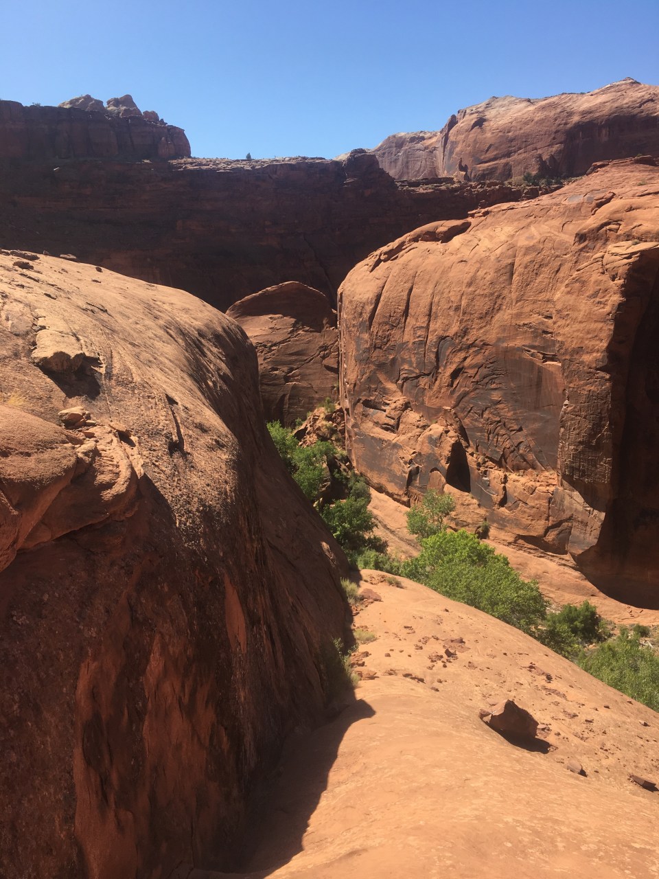
Around lunch time we reached some rain collecting tanks a half mile off route to fill up on water for the last time until tomorrow evening. Getting water out of them was a bit of a chore. I took the cover off and reached down as far as I could with out falling in to get to the water then passed down liter after liter as QB filled our bags and passed bottles up. We each carried 8 liters from there so I did this 16 times. I’m sure there was a better way. From the tanks we walked another mile or so on road with wicked heavy packs then cross country for a couple miles until we reached a cliff on the rim of a big unnamed canyon. To get down this sucker we had to take our packs off and pass them to each other as we down climbed a short rocky stretch then carefully navigated loose scree until we got to a wash at the bottom. The rest of the afternoon became a little more difficult. We walked cross country the rest of the day and navigating the terrain was tough. We followed washes, bison trails, an old mining road, and went in and out of drainages and up and down small canyons all day in the hot sun. Shortly after we dropped into the mouth of Swap Canyon we found a place to camp.(If you’re hiking this and planning to get water at Swap Canyon Spring, there was a small pool but looked filmy and full of alkaline in the creek bed). 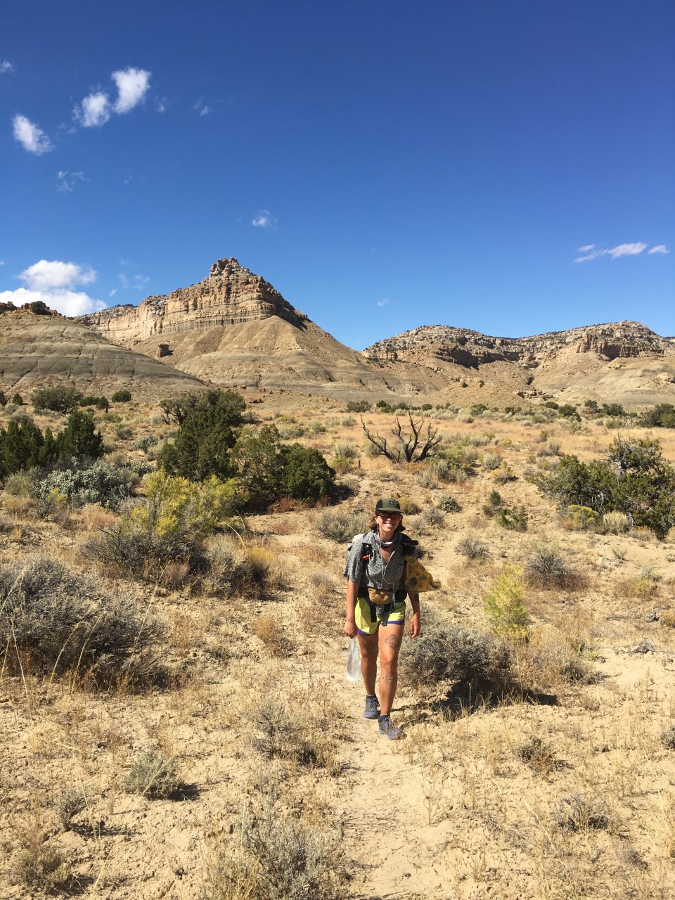
9/28/19…..Hayduke Day 14…..23 miles
Today was pretty rad! From our spot in Swap Canyon we got up and walked a gentle downhill through the wash for a handful of miles until crossing into Capitol Reef National Park. The canyon spilled into the park which is narrow but stretches a long way north to south. We were on the southern end of the park and joined the Burr Trail for a few miles which is actually a dirt road that switchbacks up steeply to the trailhead for Lower Muley Twist Canyon. This place was awesome! 
The canyon serpentined or twisted(hence the name) for about ten miles through huge red rock sandstone walls. There were caves, rock formations, and giant alcoves with huge overhangs where over time water carved away big portions of the walls underneath. Amazingly we didn’t see another person in Lower Muley Twist, granted we aren’t close to the main visitor center but this would be an easy day hike within a national park on a beautiful Saturday(I think) in September. 
Eventually the canyon dumped us out onto Hall’s Creek which is actually a dry wash right now. After a mile or so we reached Muley Tanks, these are huge potholes in the sandstone that keep water in them year round and are just brimming with life, they’re kind of like tiny ponds. This was our first water source in awhile so we filled up and it was pretty good water. We carried on down the wash for a few more miles alongside Waterpocket Fold. This is a giant uplift in the earth’s crust that causes an almost hundred mile long wrinkle of Navajo Sandstone in the desert landscape, it’s very cool. We then found a spot to camp underneath and within a giant juniper tree protected nicely from the wind. At the end of the day instead of following the regular Hayduke and climbing up to Red Slide, we started down an alternate that will take us through Halls Creek Narrows and through some supposedly spectacular canyons. 
9/29/19…..Hayduke Day 15…..21 miles
QB and I cruised this morning for the first 9 miles through and alongside the dry bed of Halls Creek. Stopping just briefly to fill our bottles at Fountain Tanks, a couple more natural potholes holding water. When we reached Halls Creek Narrows the clouds behind us were dark and threatening. It would have been less fun and kind of stupid to carry on through the Narrows with the possibility of a flash flood. We were at a bit of a stand still so we climbed up on the sandstone and planned to take an early and possibly extended lunch to wait for the clouds to dissipate. Luckily for us this didn’t take long and soon we had blue skies and could walk through the canyon without worry. 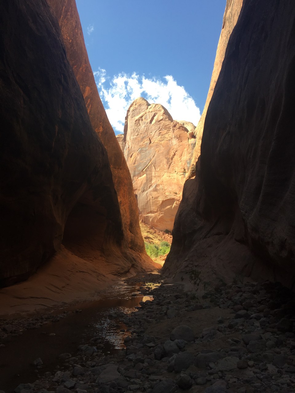
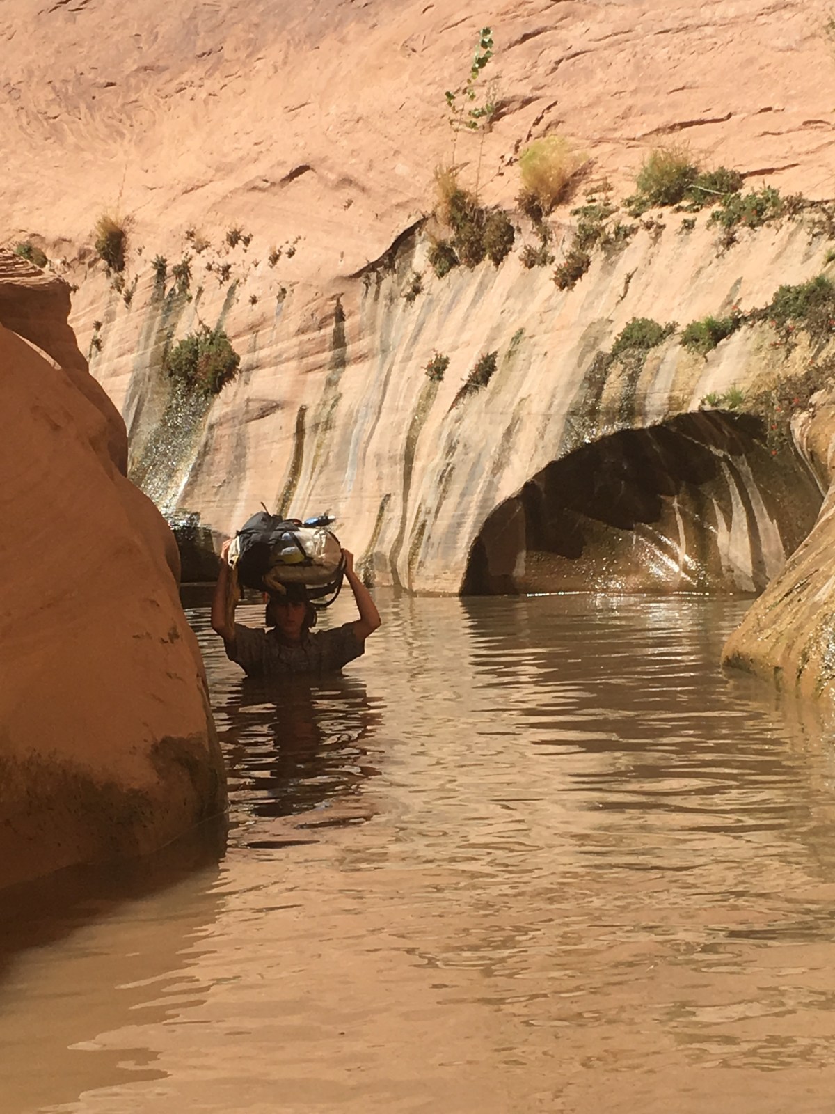
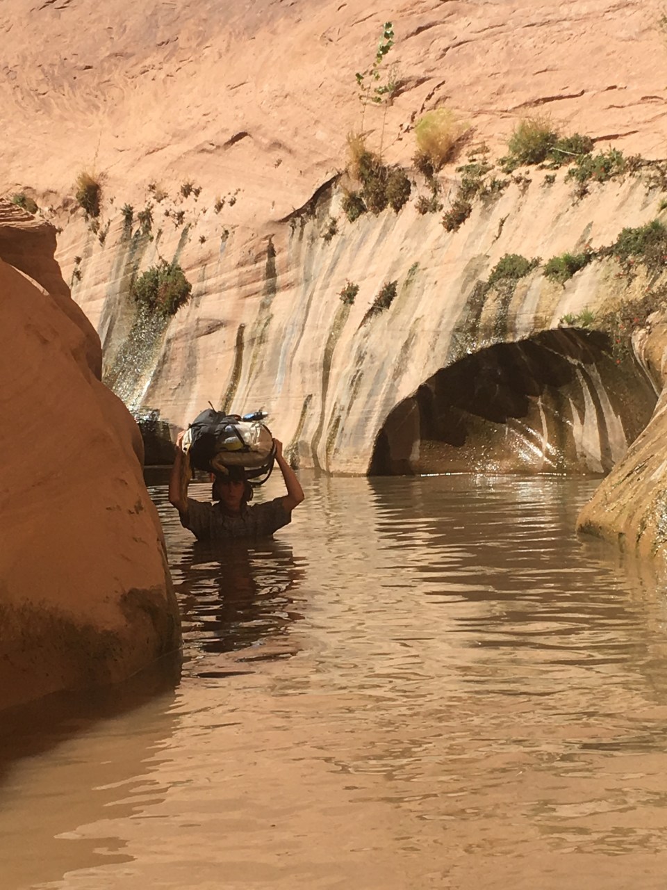
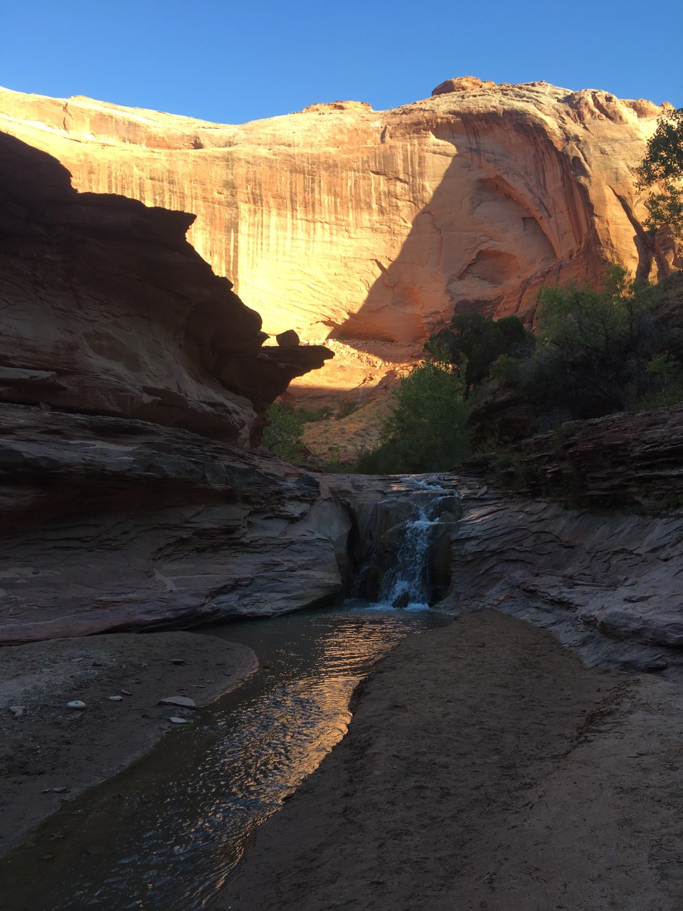
Halls Creek Narrows were so cool! I don’t know if they were technically slot canyons but the canyon got pretty tight. In a way it was similar to Muley Twist as it had the large walls and big alcoves but Halls Creek was tighter and had considerably more water.  Often times we would be walking up to our knees and waists through the dark water on slippery mud. At one point we went through holding our packs above our heads and the water was just above my mouth while I was on my tip toes. QB followed me and even though we’re the same exact height, she somehow got to the same spot I was at and had to swim using only her legs as she was still able to hold her pack above her head. I guess my toes are longer. To see some video of this event go to my insta @endlesspsummer.
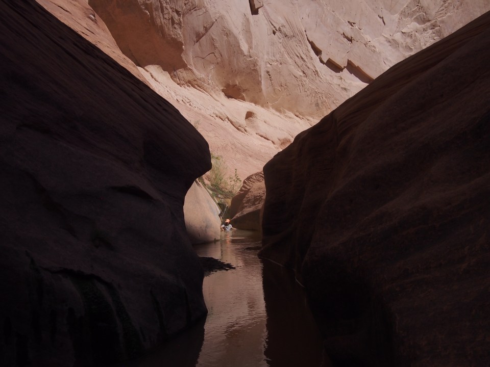
 Shortly after the deep stuff, the canyon began to widen and we were dumped out into an area that looked much like before except this time there was water in the creek bed. We followed alongside this for 6 miles sometimes able to find stretches of animal trails and sometimes bushwhacking cross country. There had to have been a better way. At some point we left the boundary of Capitol Reef NP and entered Glen Canyon National Recreation Area. We walked this section of Halls Creek until almost reaching an outstretched arm of Lake Powell. Had Glen Canyon Dam never been built, Halls Creek would carry on through Glen Canyon eventually feeding the Colorado River.
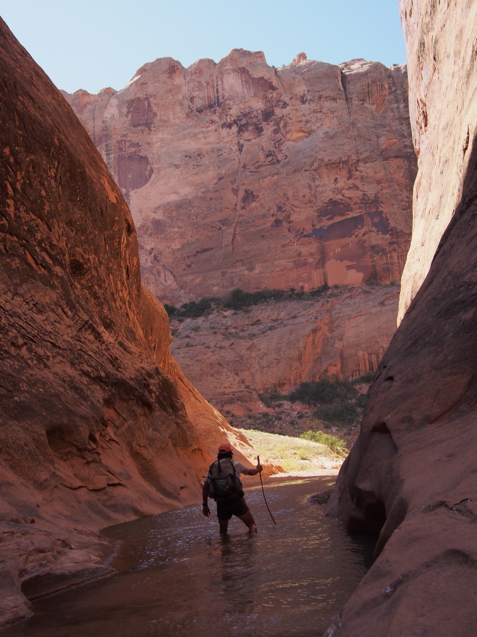
Before reaching the Lake we took a right and started a steep climb up slick rock onto Waterpocket Fold. Looking back we can see the huge red cliffs on the far side of the creek, the Henry Mountains and beyond that way in the distance the La Sals. Our route continues up this slick rock but after a mile or so we found a spot to cowboy camp and call it a day.
9/30/19…..Hayduke Day 16…..22 miles
First of all, there must have been a meteor shower last night or we were in a dark sky park or both because we saw plenty of shooters while laying in bed. Anyway, this morning we climbed a few more miles up the slick rock to the top of Waterpocket Fold while behind us we had a beautiful sunrise over Lake Powell. Once at the top we could see lots of red rock formations, canyons, and in the distance was Fifty Mile Bench a massive feature within Grand Staircase Escalante National Monument(GSENM). 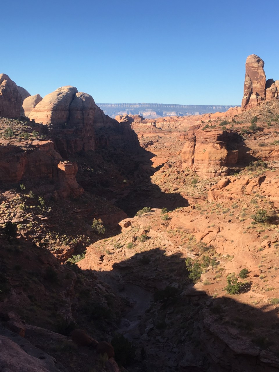
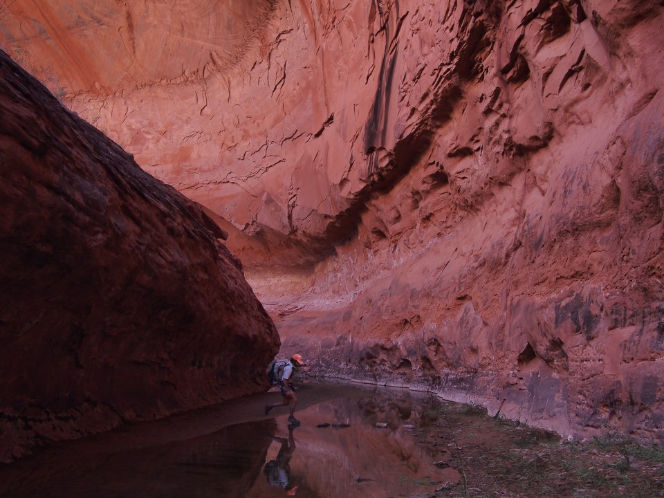
We navigated our way around and then down into a drainage that led into Stevens Canyon. For a few miles we walked through the dry canyon as it snaked it’s way lower and lower. After lunch the route ascended the side of the canyon and we walked slickrock along the rim. This was faster than walking within the canyon and gave a different perspective of what it looked like from above. There were a few sections that looked a bit scary in the distance but as we got to them and were walking them they weren’t too bad. I would call these ‘just don’t look down’ situations. 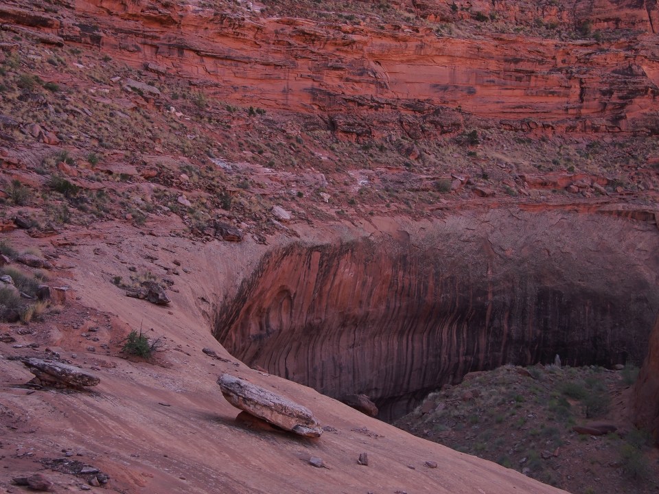 When we could go no further on the rim there was a spot where we could descend back into the canyon following a cairned route down some ramps and ledges. Back on the canyon floor it suddenly felt like a rain forest, it was cooler, there was lots of vegetation, and a good amount of water. The vegetation created some bushwhacking and the water caused some navigational trickery but nothing we couldn’t manage.
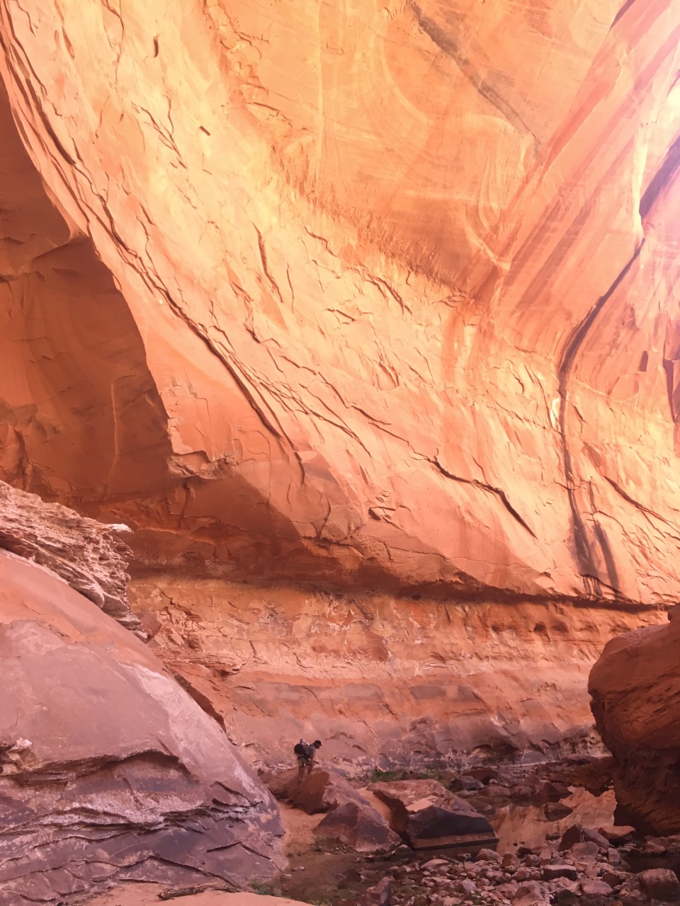
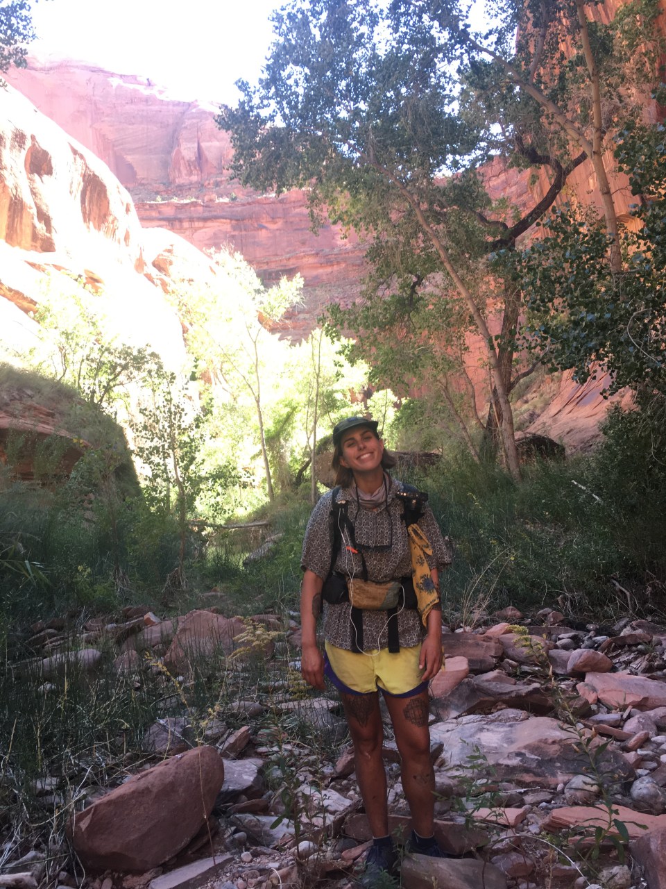
After a couple hours Stevens Canyon dumped out into the Escalante River, another tributary of the Colorado. QB and I went for a quick swim then waded downstream in the shin deep water for a mile and a half. The whole time with great views of the very impressive Stevens Arch. When we reached Coyote Gulch we took a right and walked upstream for a couple hours before finding a place to cowboy camp in the sand. I’ve been down this gulch 3 times now in the last couple years and I’ve yet to see a coyote. Really starting to wonder how they got the name. 
10/1/19…..Hayduke Day 17…..11 miles
Coyote Gulch really does have it all: arches, waterfalls, a natural bridge, pictographs, cliff dwellings, giant alcoves, swimming holes. It’s quite a magical place. Well I guess it doesn’t have hot springs, so maybe it’s not that magical. It’s alright I guess. 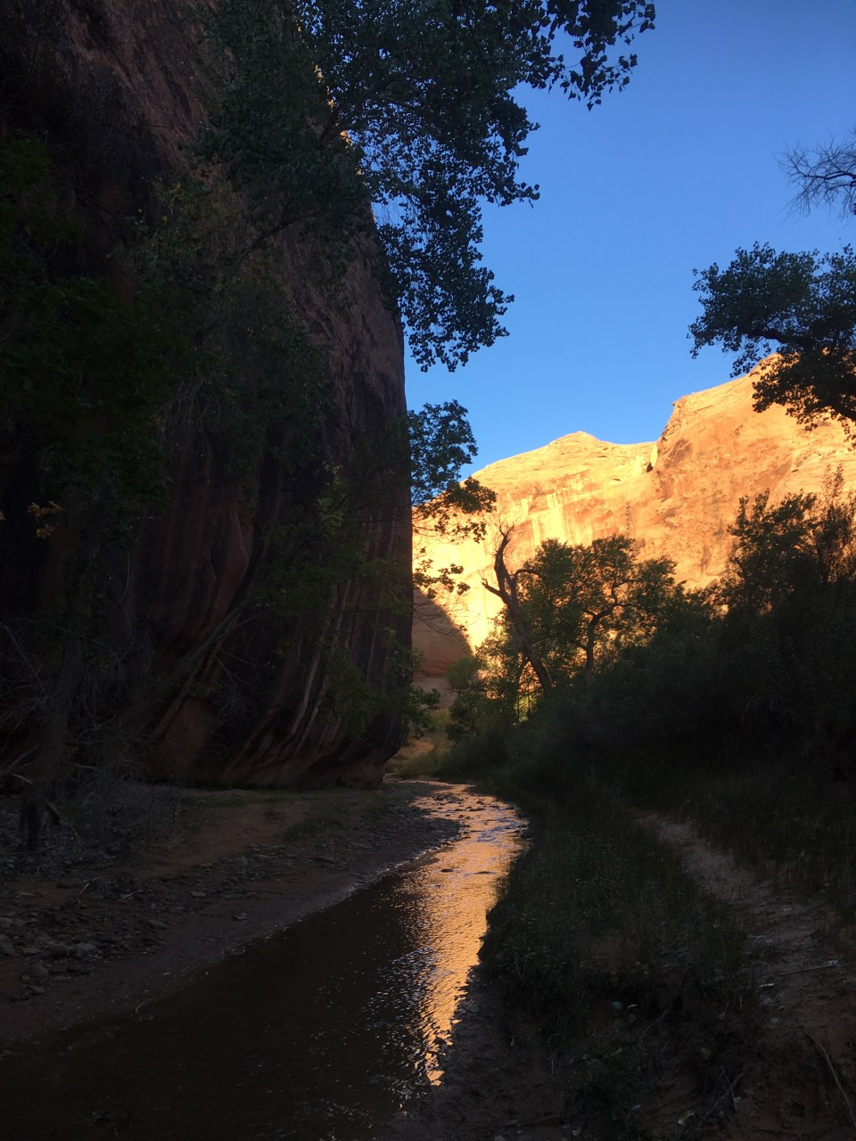 We walked up the gulch this morning until reaching Hurricane Wash then followed that up for about 5 miles until it became real desert again when we came to a trailhead on Hole-in-the-Rock Road. We were 40 miles out on the dirt road from the town of Escalante with very little traffic so we started walking. After an hour Hazer drove by and picked us up. He’s been interning for the GSENM and was out this way cleaning some remote public bathrooms. On the ride into town he enlightened us on raising cattle, hunting mountain lions, and all things rodeo. It was quite fascinating. Escalante is becoming a busier tourist town every time we come through and seems to have everything necessary to be a good little trail town.
 feel free to follow this blog and follow our instas for more pictures @endlesspsummer and @sarahikes
