
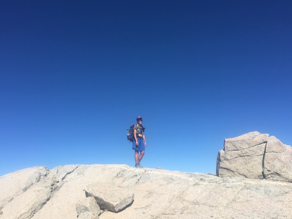
Sept 22 SHR Mile 18
The Sierra High Route isn’t so much a trail but more of a route through California’s Sierra Nevada mountains. It stretches roughly 195 miles from Road’s End in King’s Canyon north to Twin Lakes near Mono Village(or the other way around but we’re going north). Unlike most of the hiking I’ve done, a lot of this route isn’t on trail. There’s lots of route finding, cross country walking, scrambling over talus fields and maneuvering through loose scree, and also some trail. The route parallels a lot of the John Muir Trail(JMT) which also coincides with the PCT and occasionally the route will follow some of this trail for a few miles here and there. This is my first time back to the Sierras since I walked through here on the PCT in ‘15 and I’m very excited. This is a magical place. Hopefully the route goes smoothly, read up to find out.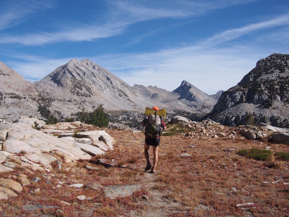
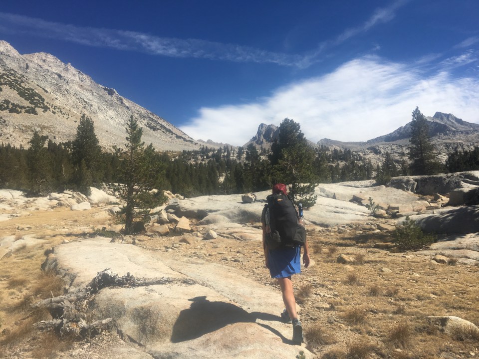
This morning we drove about a half hour from Convict Flat CG to the wilderness permit station at the very end of Road’s End in King’s Canyon National Park. The ranger there was great. I feel like I’ve had my share of experiences with rangers that try to rain on my parade, they try to shoot down my plans, act like I can’t do what I want to do, or just make matters difficult. This guy was cool though, he just did his job and gave us the permits we needed. We left the car at Road’s End and got started shortly after 9 beginning a steep climb up the Copper Creek Trail. The trail was smooth and was all switchbacks but we climbed over 5000 feet right away and my pack was as heavy as it’s ever been. 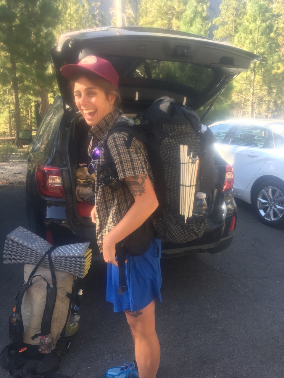
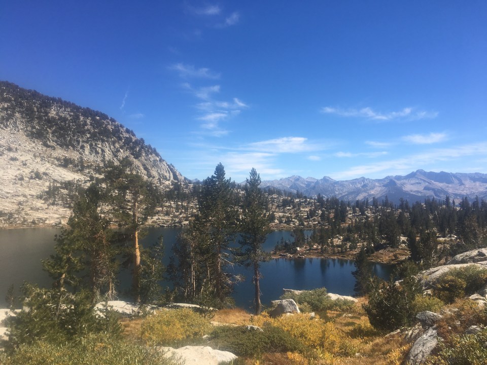
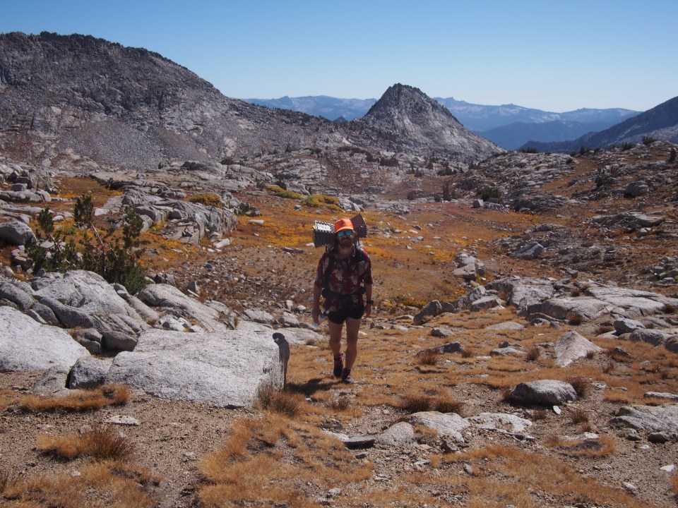
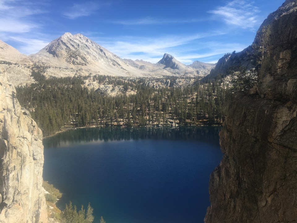
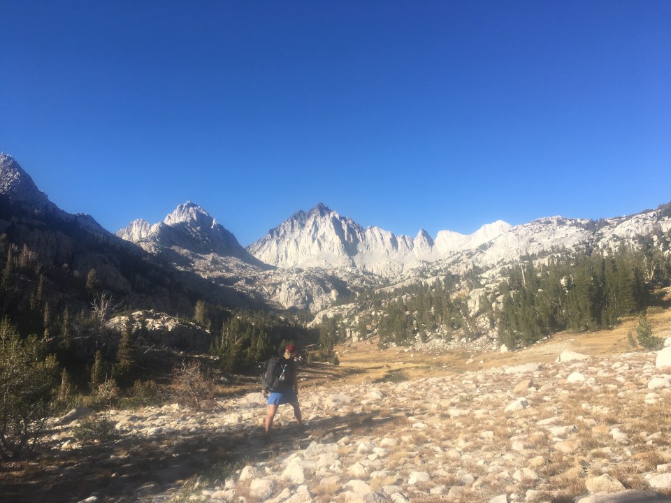
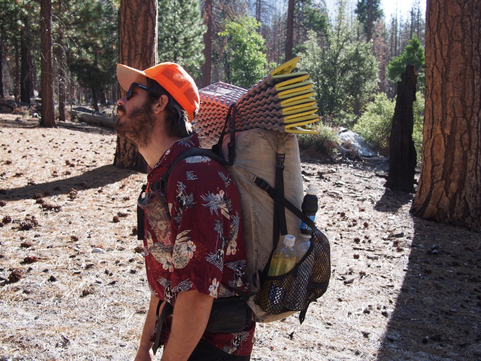 It will be slow going so we figured 6+ days of food for a 118 mile section from here to Red’s Meadow where we’ll get into Mammoth to resupply. We also are required to carry bear canisters through these parks which add about 2-3 lbs. I’m using the same pack I’ve had for awhile a Hyperlite 2400 and it was maxed out. Sara opted for her bigger ULA Om instead of her tiny Pa’lante pack she used on the PCT and the Om was at full capacity. My only gear switch was a Hawaiian shirt instead of a tank top for better sun protection. We’re carrying heavy and climbing high but we’re in the Sierras and the weather is beautiful so it’s all good. From the top of the Copper Creek Trail we did some cross country walking towards Grouse Lake where I just had to go for a quick swim then climbed up Grouse Lake Pass at over 11,000 feet. Suddenly I felt like we were plopped right down in the middle of the Sierras, which we are. There were beautiful turquoise alpine lakes and granite mountains in every direction, with more craggy peaks in the distance and all different kinds of pine trees everywhere. It was awesome. Quite different from the 95 degree Walmart parking lot in Fresno yesterday.
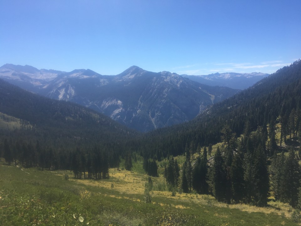

We walked down then up and over Goat Crest Pass, picking are way around scree fields and then down to another lake. This went on for the rest of the afternoon. We’d find whatever we were supposed to be aiming for; a lake, a low lying saddle or a mountain and then just walk towards it.
For navigation, in case you’re wondering, we’re using a couple different routes on Gaia. One route is from a hiker named Swami that Sara found online and the other is from this maniac Jabba who sent me a very similar route with a few alternates to give us some options. We’ll use both of them and probably add a couple alternates of our own and make decisions accordingly. We also have Steve Roper’s guidebook downloaded to give us descriptions of where we should be going and what to look for. 
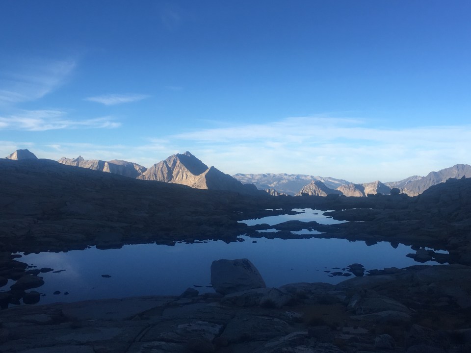
This evening we did end up joining something of a trail for awhile. We followed that around Horseshoe Lakes and after the trail petered out we climbed up onto a saddle and found a campsite near a small tarn(small lake). Perfect first day on the SHR.
Sept 23 SHR mile 35
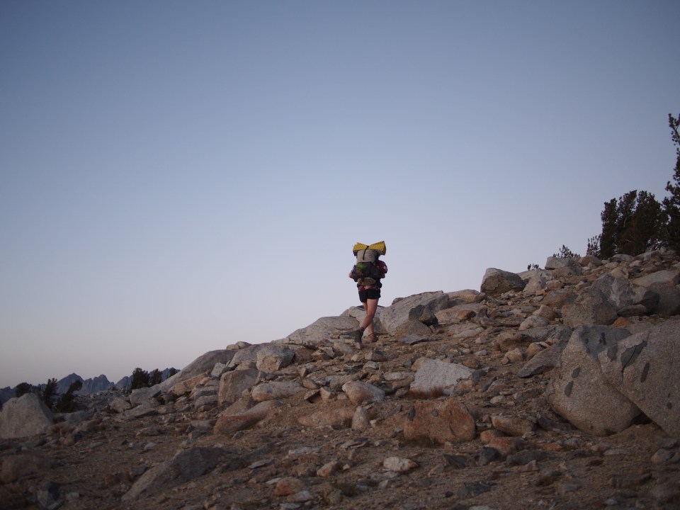
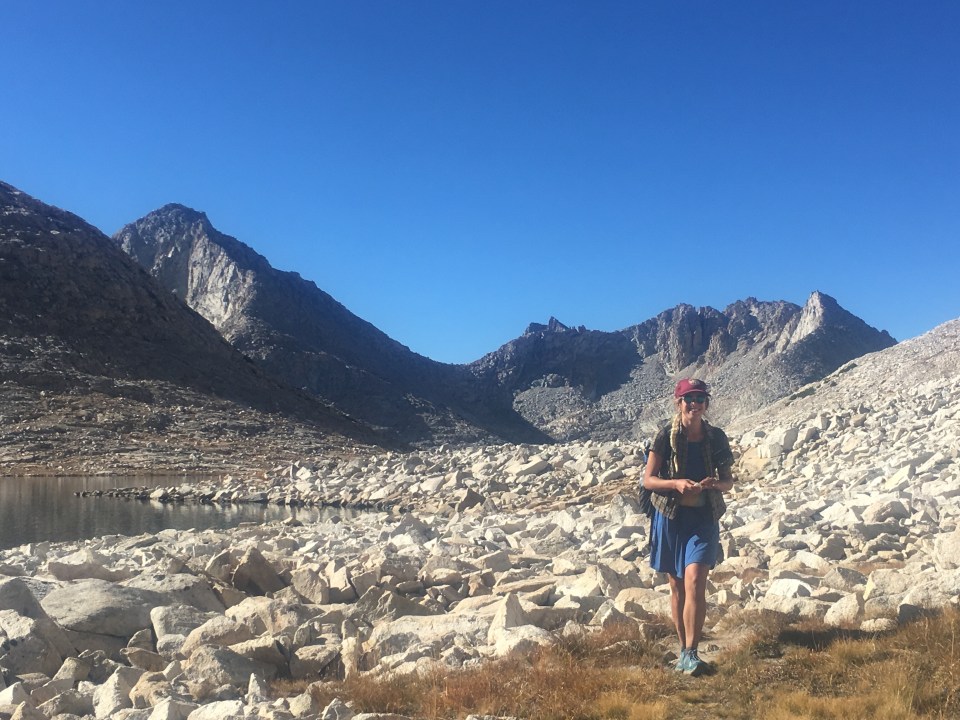
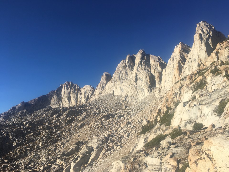
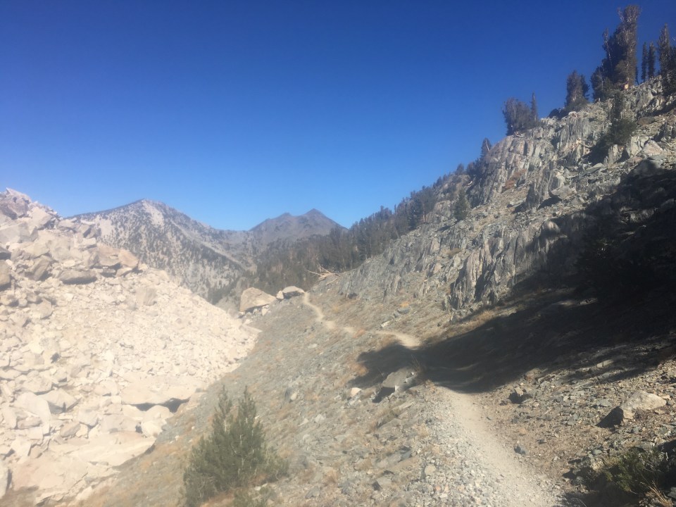
Holy Toledo, Ohio what a day! This might take us longer than I anticipated. Right away this morning we did a little climbing then dropped way down then started climbing again way up towards White Pass. Picking our way through big huge boulders. From White Pass we contoured through a talus field to Red Pass then dropped steeply towards Marian Lake maneuvering through an even steeper gully right at the end. Maybe the most perfect turquoise lake I’ve ever seen surrounded by granite. From Marian we climbed up through a basin containing a bunch of lakes and started making our way to Frozen Lake Pass. Keep in mind this whole time we’re traveling around 1 mph and about to slow down. 
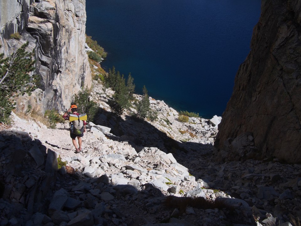


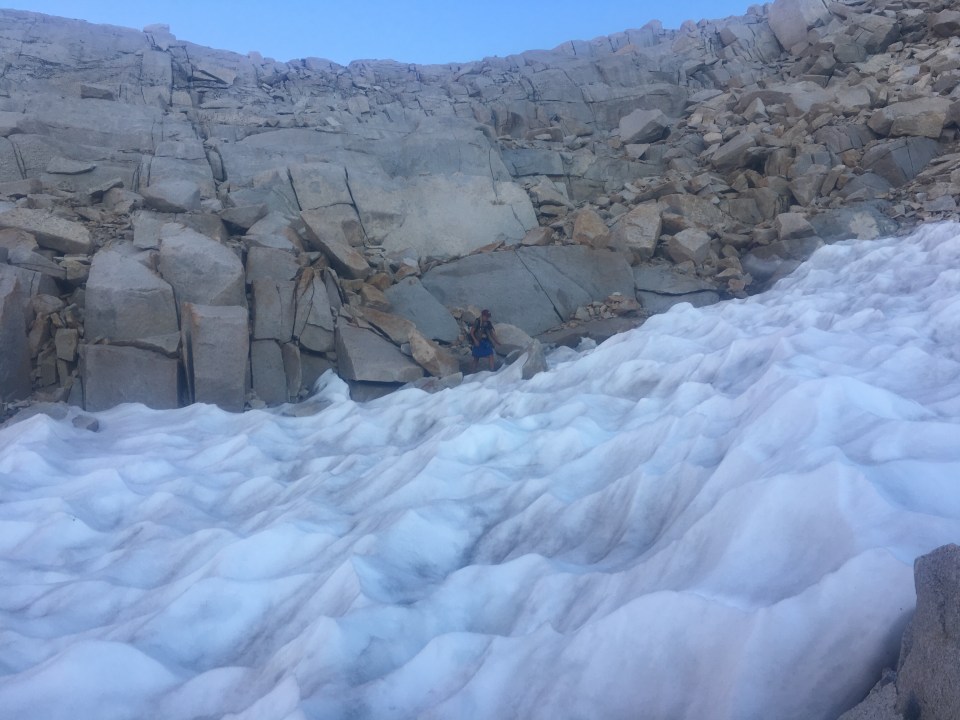
Frozen Lake Pass is a super steep pass up a talus field that at first glance looked impossible. We figured a route would begin to present itself as long as we took it nice and slow. Climbing up the talus field most of the rocks were solid but occasionally there’d be a loose one so as we scrambled up we’d test the rocks before proceeding. At the top of the pass it looked even steeper on the way down beginning we some dastardly loose scree. We descended one at a time, went slowly, and eventually made it down to a snowfield that was a bit easier to traverse. The talus field flattened out for awhile then dropped steeply again for until we got to a little alpine lake. I knew this was the end of the hard section for the day so I went for a quick icy cold swim to celebrate. 
From the lake we walked cross country for a mile or so until we joined the JMT/PCT. Ahh! Home sweet home, the PCT. It was a treat to walk along this nicely manicured trail for awhile and we were able to pick up the pace a bit. Even the trail was tough though, it brought us up and down Mather Pass and along Palisades Lakes but this was a cakewalk compared to Frozen Lake Pass. We hadn’t see another person in the 24+ hours that we were off trail but during the 5 miles we were on trail we must have seen 20 people, mostly southbound JMTers. 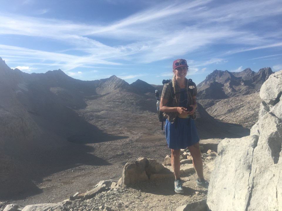
After the lakes we veered off the trail to the right and began making our way up towards Cirque Pass. Instead of nicely groomed trail we were hopping around boulders and scrambling up little cliffs. We got to the cirque below the pass as the sun was setting and decided to leave the rest of it for the morning. 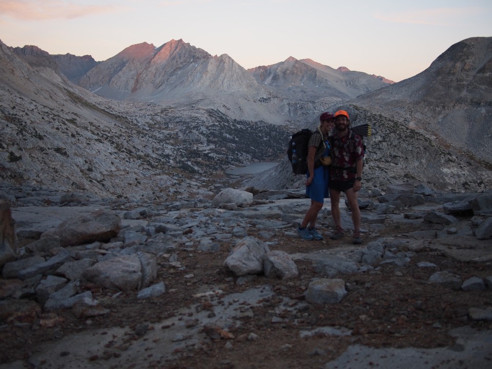
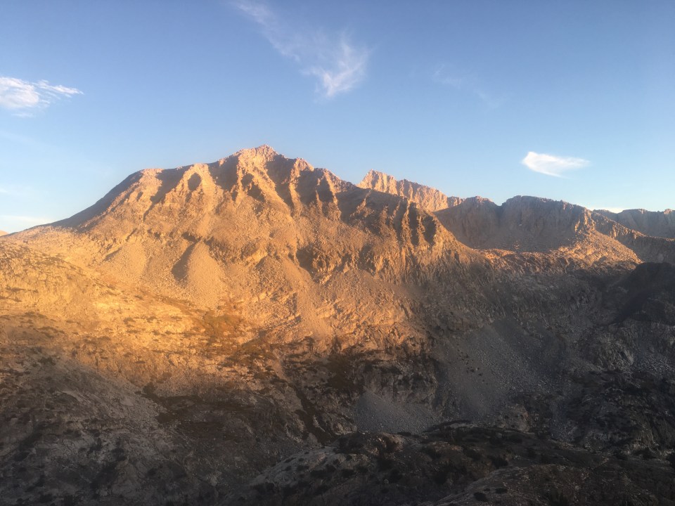
The full moon came up over the peaks and at 11,400 feet we’re camping next to a tarn in one of my favorite campsites of all time. And I saw a shooting star.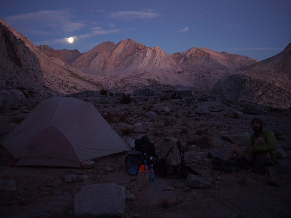
Sept 24 SHR mile 58
Alright I might not need to put myself on extreme food rations just yet, we were able to crank out some miles today and get back on track. 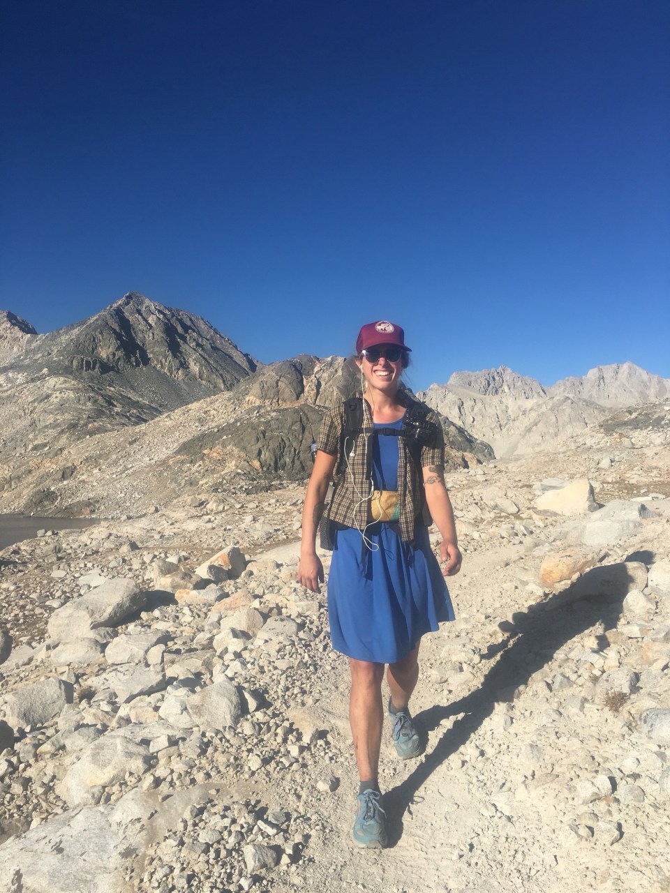


Laying up below Cirque Pass last night proved to be the right move. It took us over an hour to get up and down the pass first thing this morning and would have been dangerous to try that with just headlamps last night. From Cirque Pass we went down to a lake then immediately up and over Potluck Pass. This looked like a formidable wall and unlikely that we would be able to get over it but as we got closer we realized there were all kinds of little ledges and ramps that we could scramble up. From the top of Potluck we could see our next obstacle 2 miles to the north, Knapsack Pass. First we had to drop down off of Potluck and zig zag through a valley going up and down little boulder hills and what not. It’s not difficult or anything it was just tedious and slow walking. These huge valleys in between passes are absolutely incredible though. Because they’re so hard to get to, there’s nobody out here, or almost nobody. I thought we had this gigantic valley to ourselves so I was belting out Phil Collins at the top of my lungs when I saw a couple of figures near the top of Knapsack. We ended up meeting Hurl Goat and Mary Poppins a little later and these are the only other High Route hikers we’ve come across so far. Going up and down Knapsack was a slow process but we were able to take our time and pick safe manageable lines up and down the pass. 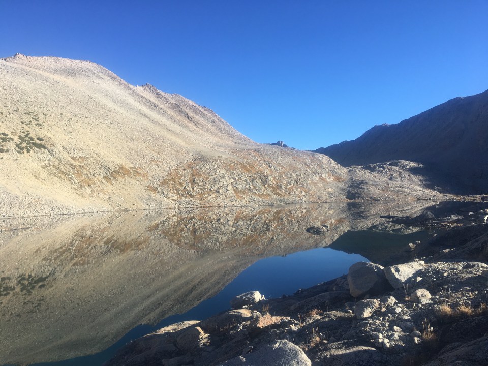

For the next hour we dropped down to Dusy Basin where I went for my daily bath. After another mile or so we joined the Bishop Pass trail that led down into LeConte Canyon where once again we picked up the JMT/PCT.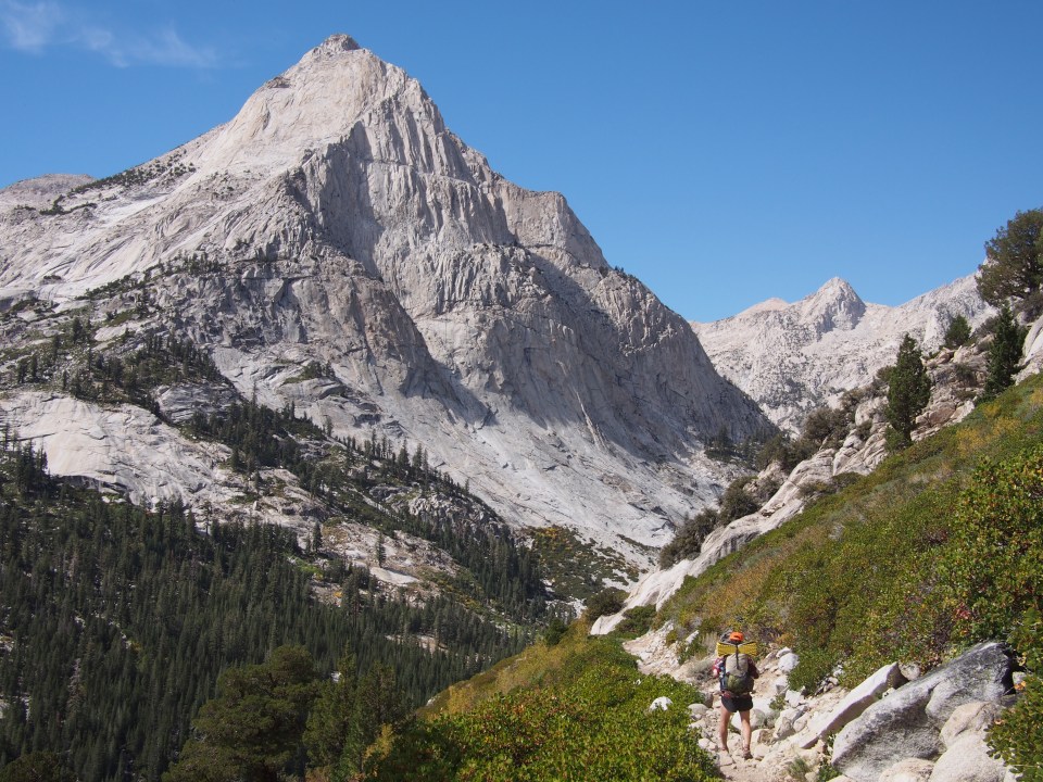

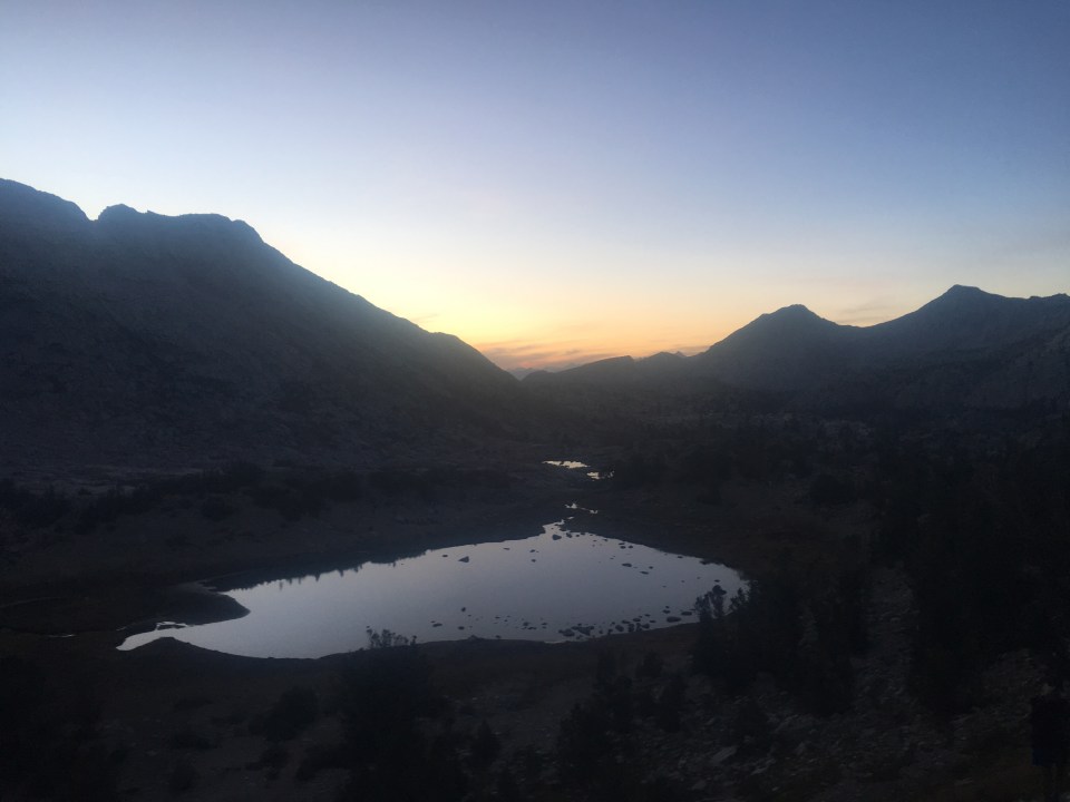
Coming from scrambling across the talus fields of the High Route to walking north on the PCT I felt like a dog with a broken leash. We were able to cruise all afternoon and cover some ground. Even as the PCT climbed up the long and gradual Muir Pass we were able to move quickly. I met a handful of southbounders today on their way to Mexico and really got me thinking about hiking that trail south in the future. Might just be the way to do it. We walked a little bit into the dark tonight but being on actual trail that’s no problem. At the last of Evolution Lakes we found a spot to camp as the moon was coming up. 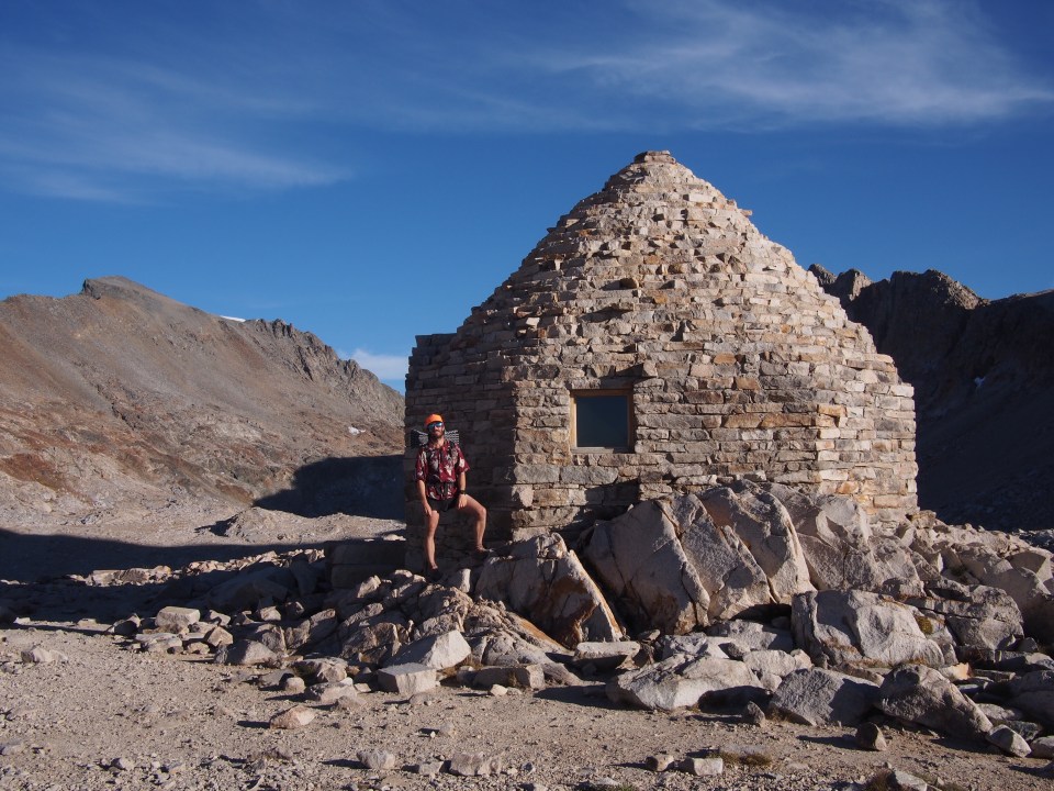
Sept 25 SHR mile 78
This place is amazing. We started this morning by walking about a half mile on the PCT before taking a right onto a steep faint path up towards Darwin Bench, a beautiful spot with a bunch of little lakes surrounded by mountains. 
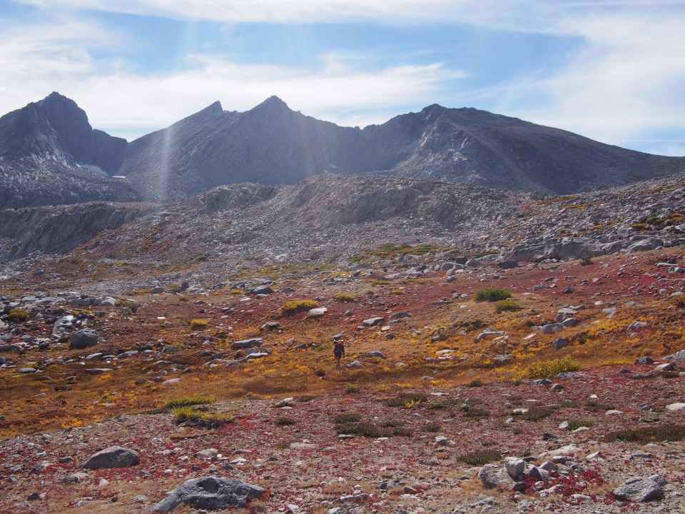
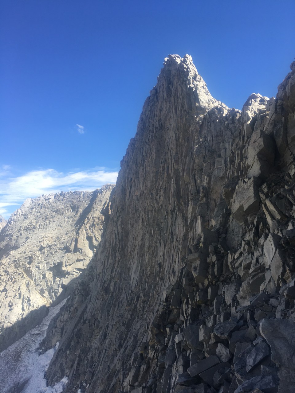
From Darwin Bench we kept climbing and after a little while we could see our next obstacle, Alpine Col(I think col is just another word for Pass, same with notch, gap, and in Nepal; la. They all seem to mean a low spot in a wall of mountains). Alpine Col is daunting. From a distance there looked like no way up and over it. We walked slowly the next hour rock hopping on big boulders along a couple of lakes while looking up towards the col. This only built nervous anticipation. As we got closer a few routes began to unfold and I knew we’d be able to get up it. For some reason I chose a narrow chute of loose scree which looked better than it was. I managed ok but suggested Sara try something else and she seemed to find an easier way. Descending Alpine Col was no picnic either. We had to maneuver around big huge boulders and were very careful picking our lines in order to not get cliffed out. Then when it did finally flatten out we had about a mile of talus field to get through. Looking back I couldn’t imagine having to go up and over Alpine Col from the north side. And this was the easier option! We could have taken Snow Tongue Pass but the description of this one sounded downright harrowing. 


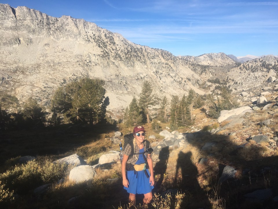
Alpine Col and Snow Tongue Pass are on an 8 mile ridge called the Glacier Divide and I think this is what separates Kings Canyon NP from Muir Wilderness. After we got into Muir Wilderness we took an alternate from the Sierra HR that brought us down along Piute Creek below tree line and then we turned and took a right up French Canyon. This was a relaxing handful of miles compared to what we went through this morning. It wouldn’t last though. From French Canyon we climbed steeply up towards Merriam Lake and then further up to LaSalle Lake where we could see our next challenge; Feather Pass.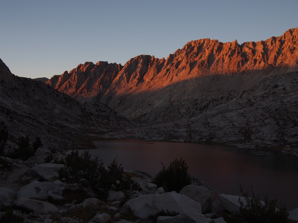
Climbing Feather Pass wasn’t as technically difficult as some of the other ones but it was a big beefy pass at over 12,300 feet that still involved some scrambling and we were in a race against the sun. I thought it was important to have enough natural light to find our way down that we weren’t rushing. Good thing we crushed all afternoon so when we got to the top of Feather Pass at 6 we still had an hour of light to navigate the talus field on the north side. The sun was setting as we walked through this valley of lakes and it was absolutely stunning. We reached Bear Paw lake and have an excellent campsite for the night.
Sept 26 SHR mile 97
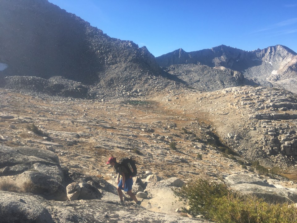
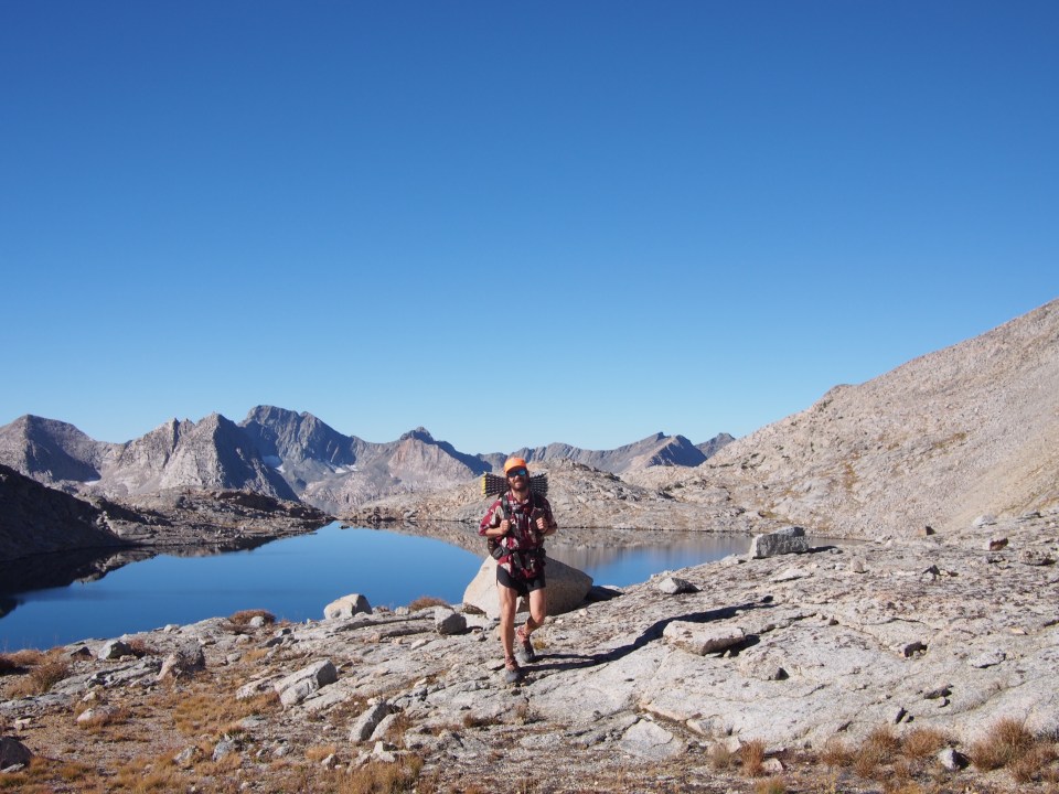
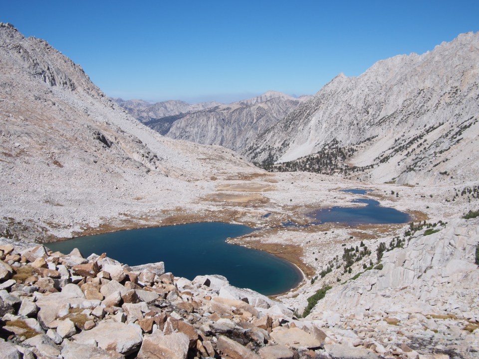
No easy days out here, and I thought for sure today might be one. From our campsite this morning we made our way up and around a bunch of lakes all with bear names. It’s a very beautiful area and feels so far removed from anything. We had to climb a few steep gullies and over some talus but it was rather easy until we got to the top of White Bear Lake Pass. WBL Pass is actually a low lying pass so getting to the top was no big deal but descending the north side requires some slow and careful route finding around cliffs and through a big talus field. This seemed to go on forever and I was amazed looking back at it that we were able to safely get down.We walked another much flatter mile or so and came to Lake Italy(I guess some cartographer thought this long narrow lake resembled The Boot).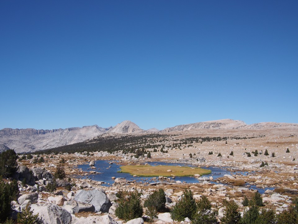

At the lake we ran into our first pair of southbound High Routers, Mike and Steve. I didn’t envy what they were about to climb. 20 minutes after we went our separate ways I came up with the best idea; I should have given those guys the key to my car and then they could have driven it up to the Northern Terminus to pick up their own car and left mine for us, it would have been a win win all the way around! A perfect opportunity like that doesn’t come across often and I blew it, just didn’t think of it at the time. Sara said there were too many variables and chances it wouldn’t work out, but I don’t know.

From the northern end of Lake Italy we blasted up a steep slope to Gabbot Pass. There was nothing tricky about it just good strong hiking to get to the top and it was the last time the route goes over 12,000 feet. On the north side of Gabbot was lots and lots of talus to get through but it never seemed too steep just time consuming. We eventually dropped down a path of loose scree to beautiful Lower Mills Creek Lake and found a rock to jump off into the icy cold turquoise water. We ate lunch at the lake and then followed a faint path steeply through forest down to Second Recess(whatever that is, some kind of geology term). I wasn’t crazy about this particular decline, I was slipping and sliding and struggling to find the trail. Once we got to Second Recess though we had a half hour of quite relaxing trail until we picked up a super steep trail up to Laurel Creek. Sara and I both blasted uphill then walked through a valley to Laurel Lake at the bottom of Bighorn Pass.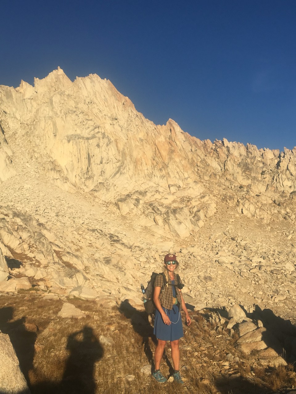
Bighorn Pass was quite steep and was much grassier than the other passes which made it unusual. There was nothing technical here and we didn’t take our time ascending because once again daylight was an issue and we still had another major obstacle. From the top of Bighorn we had to contour and climb over to Shout-of-Relief Pass. This was a bit tricky. It wasn’t super far or anything just littered with big huge boulders that we had to work our way around. There were a bunch of little climbs and drops and careful route finding involved before being able to let out a Shout of Relief. From the top of this pass we had a rather gentle and enjoyable walk down about a half mile to the closest tarn where we set up camp in some trees on a cozy pine needle floor.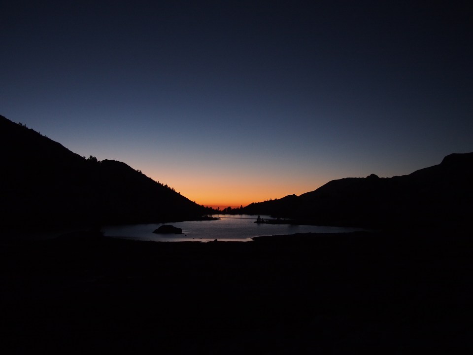
Sept 27 SHR mile 118
Today was an easy day. The first three miles took forever walking cross country and finding our way downhill through a lake basin and all kinds of cliffs and stuff until we got to the McGee Pass Trail. From there we walked a nice smooth mile until the High Route rejoined the PCT. The trail climbed steadily up some nice switchbacks to Purple Lake Pass(probably not the real name) then we just cruised for half a dozen miles.

The High Route veers off the PCT to go up towards Duck Pass but we elected to walk trail for the next 10-12 miles so we could get to Red’s Meadow then down into Mammoth for the night. It was absolutely delightful to just walk along a peaceful trail all day. We’ve had a long 6 days out here and getting into town was a priority.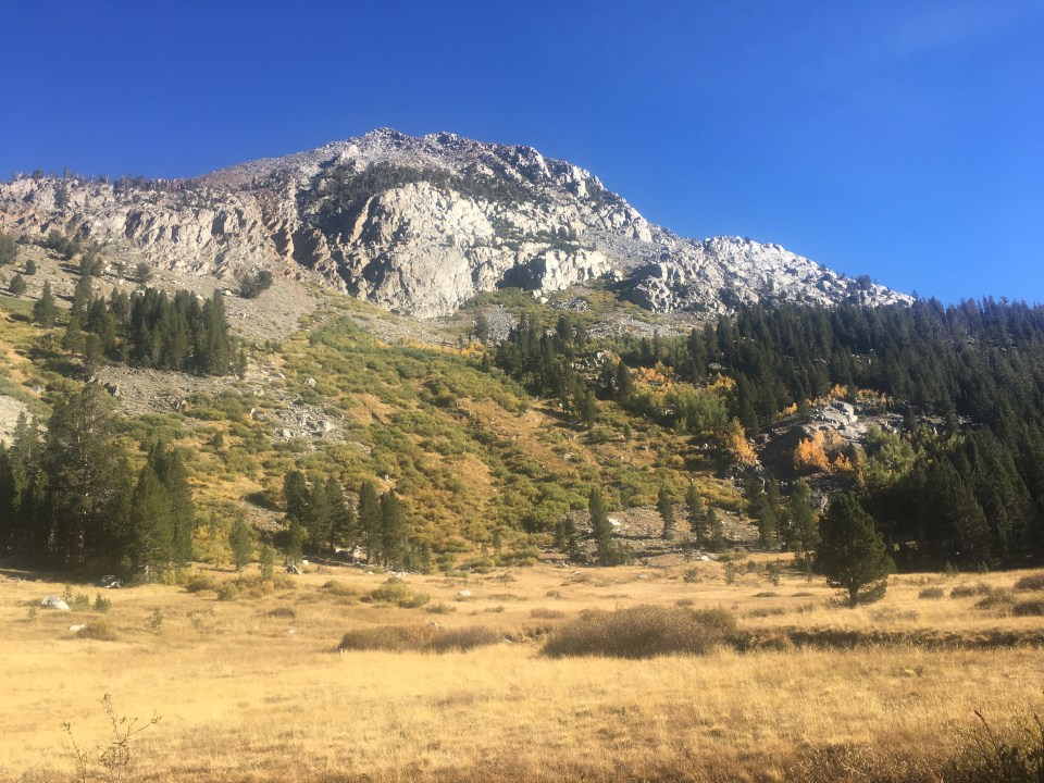 Red’s Meadow is a mule packing station with a little campground, small restaurant, and small store. It’s not really ideal for resupplying although some hikers mail themselves packages here for a hefty fee. In the past I’ve taken a bus into the town of Mammoth but I guess they only run it on the weekends during September. We heard there was a trail angel running shuttles back and forth so I got his number and gave him a call.
Golden, who just finished the PCT, was spending some time in the area driving hikers around. Thankfully he drove the hour round trip for us and entertained us along the way, telling us about when he used to hang out with John Cazale (Fredo)in Brooklyn back in the 70’s.
When I was in Mammoth in 2015 I went to this place Giovanni’s and had Spicy Thai Pizza then talked about it for a couple thousand miles. Today I had that pizza again. Now I guess it’s a tradition. After pizza, Sara and I did all the town stuff: got our resupply done for the next section, showered, did laundry and got a room for the night. Not all in that order.
We’re hoping to get back on the route tomorrow afternoon and travel 77 miles over the next 4-5 days to the Northern Terminus at Twin Lakes up near Mono Village.
Feel free to follow this blog or find me on insta @endlesspsummer and Sara/QB @sarahikes

Your narration of your experiences on the trip is first rate and your pictures are fantastic. Thank you for spending the time and effort to make this such an excellent blog. You are showing me places that due to my age I will probably never see in person.
LikeLiked by 1 person
Thank you so much and it’s been my pleasure
LikeLike
Darwin Beach looks amazing!
LikeLiked by 1 person
Darwin Beach looks amazing!
LikeLiked by 1 person
Yes that place is incredible
LikeLike
Oh man, beast mode you guys! Just reading this on your blog. I was actually out there in 2018 too but bailed way early- 1st day a lil destroyed only got to Grouse Lake, day 2 made some bad choices with nav and camped below either White or Red pass (I forget), day 3 sprained my toe dancing barefoot like a weirdo during my lunch break before Frozen Lake pass and had to bail off afterwards, felt nervous with a big ol toe and doing it alone. I did get back on trail and do a sorta SEKI loop tho. Beautiful trail hope to get back!
LikeLiked by 1 person
Oh right on! I love the Sierra, do you have plans to get back to the high route?
LikeLike
Someday…dipped back into civilization for a bit and I think only able to do couple day, maybe a week trips for a few yrs it’s looking (and maybe like 1 2-week once a year). Trying to see what I can fit in.
LikeLiked by 1 person