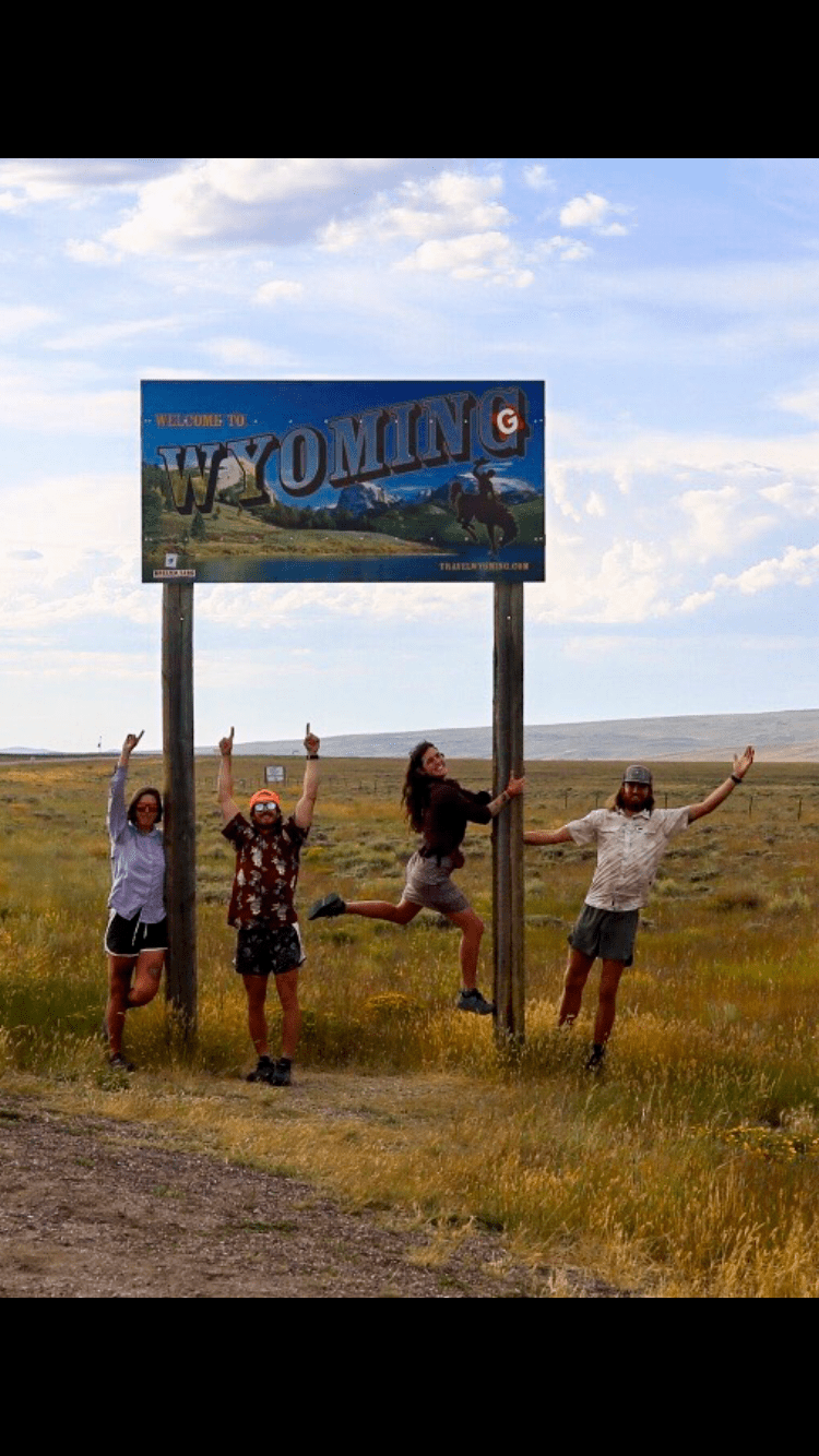
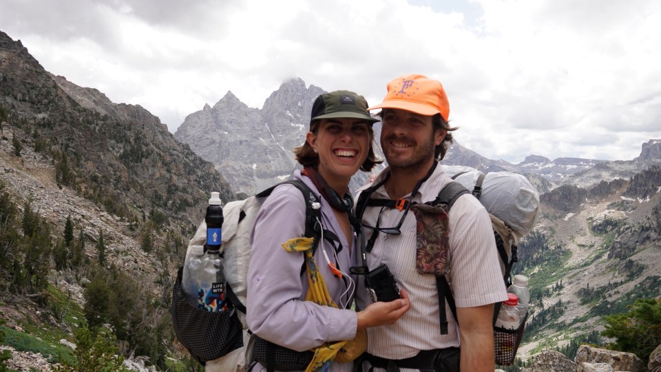
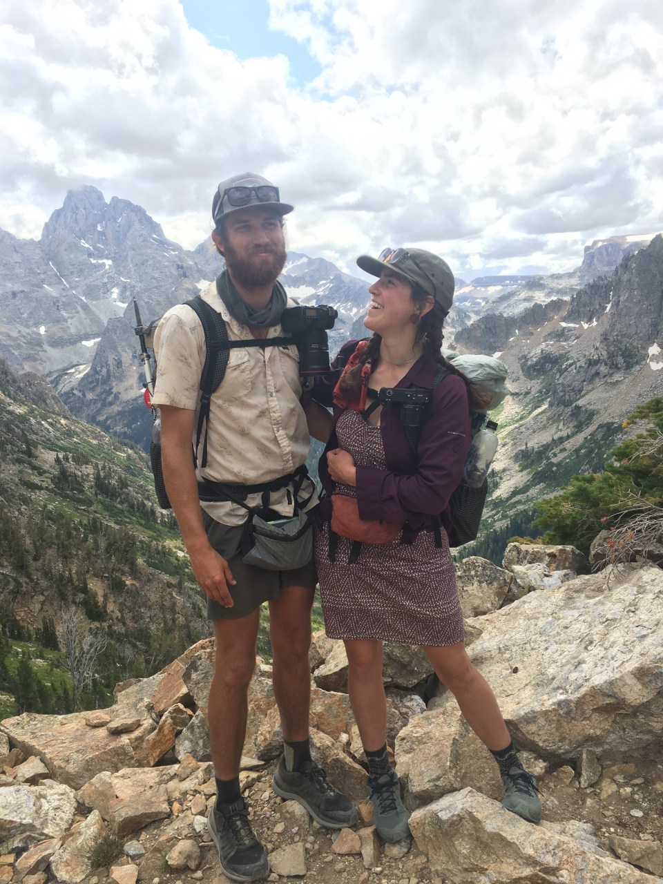
The Wind River High Route is exactly what it sounds like, a high route through Wyoming’s Wind River Range. There are basically 2 well known routes: the arguably more popular route by Alan Dixon or the more aggressive version by Andrew Skurka. The two routes often overlap but have different starting and ending points. We started on Skurka’s route at the Bruce Bridge trailhead outside of Lander hiking south to north with the intention of staying on his route. As we moved along we took different alternates depending on what we thought would be more enjoyable and ended up finishing on Dixon’s route at the Green River Lakes trailhead outside of Pinedale. 
8/26/19…..WRHR Day 1…..3 miles
We slept at the Holiday Lodge in Lander, WY last night and slept in just a little because we were in no major hurry today. Our only objective was to get on trail at some point and get a few miles in.
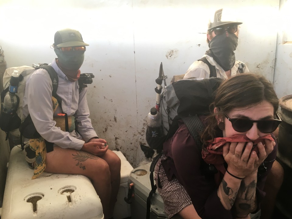
Walking downtown to take care of a few errands we ran into 4 southbound CDTer’s; Whiz, Dad Jokes, Golden, and Sultry Bear. It really felt like the Seinfeld episode when they meet their doppelgängers. While resupplying at the supermarket, a couple of Garbelly and Critter’s friends; Heath and Julie came to pick us up and drive us out to the trailhead. These 2 have been traveling in their van and climbing all over the Winds putting up first ascents. We still had a little hiccup with Budget rent-a-car, so while Critter dealt with that whole situation we hung out in the parking lot.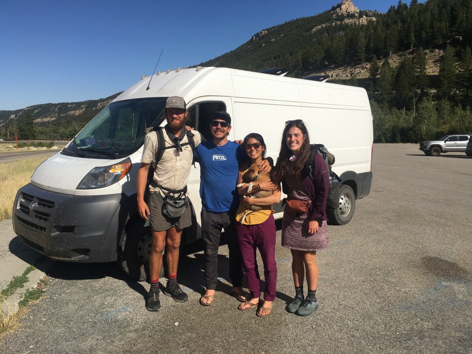
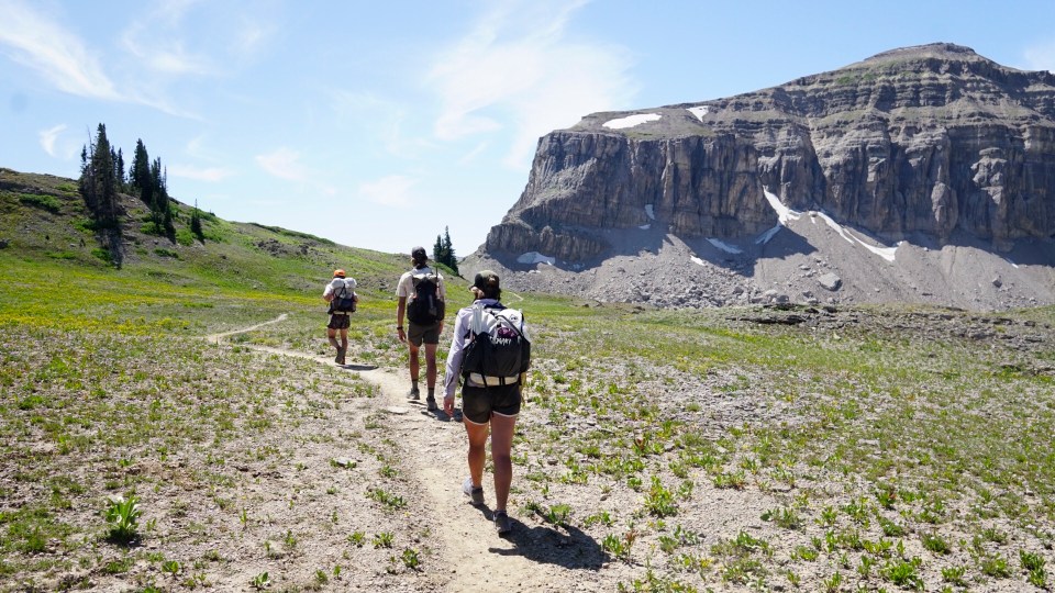
Heath and Julie dropped us off 10 miles outside of Lander at Bruce Bridge around 4:30. After a couple miles we caught up to this family that was headed to a rock you could slide off into a swimming hole. We took the side trail with them and we all opted to skip the sliding rock and I just went for a swim to see how deep it was (not very). We got back on trail and found a place to camp a mile or so later. Tomorrow we should be getting into the good stuff, today we walked along Po Po Agie River among scrub brush and pinyon pines. Soon we’ll be getting into the alpine areas of the Winds.
8/27/19…..WRHR Day 2…..17 miles
Today could easily be split up into 3 distinct sections. The first dozen miles or so were really cruiser. We gently gained a few thousand feet while while walking through pine trees along the PoPo Agie(pronounced popo zsa) river. Around noon time we reached Deep Creek Lakes, just in time for lunch. We stopped basically right on trail facing the lake and not 100 yards away there was a couple bathing in the buff. They had to have noticed us but that didn’t stop them, they just kept doing what they’re doing. I’m cool with it, and apparently they are too.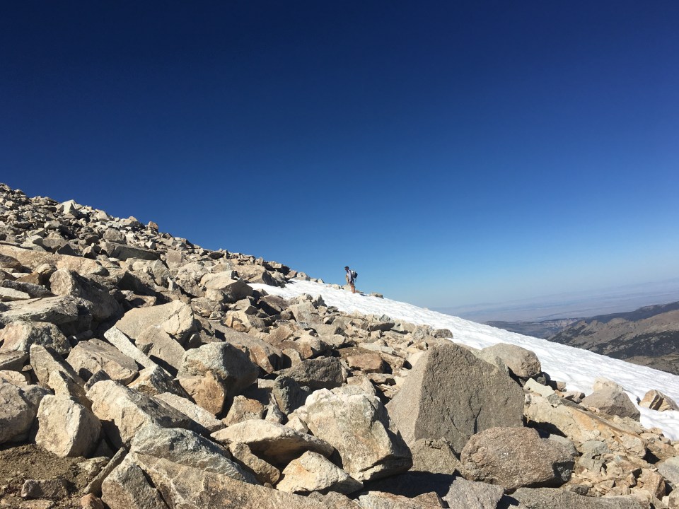
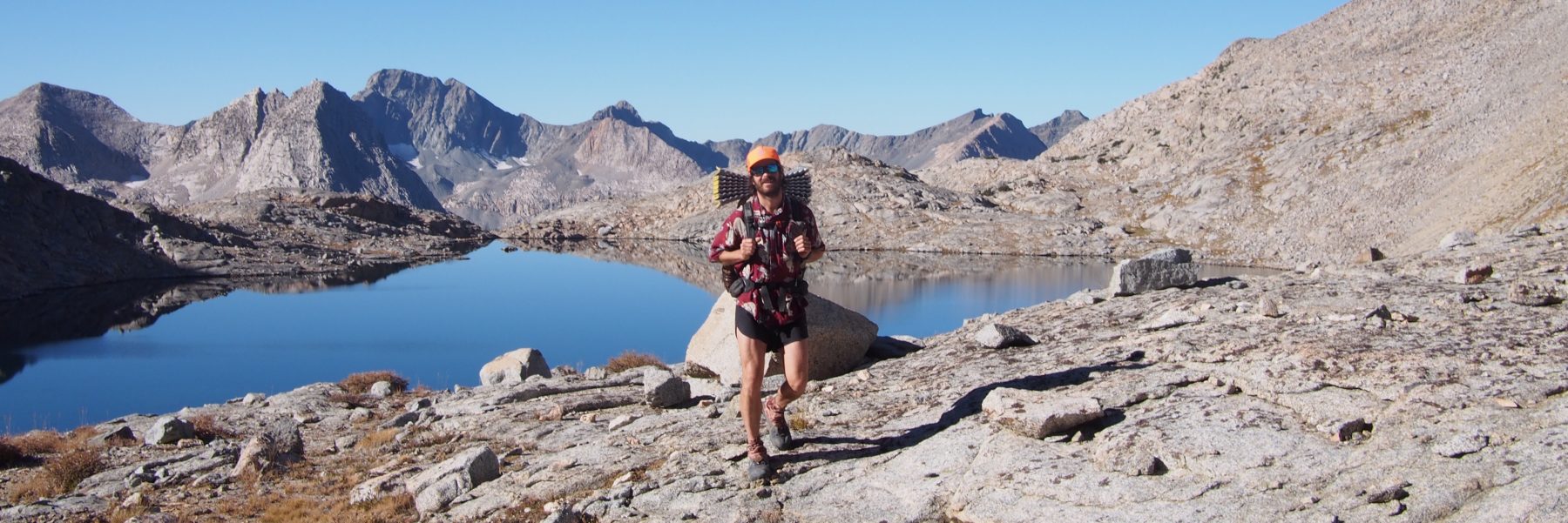
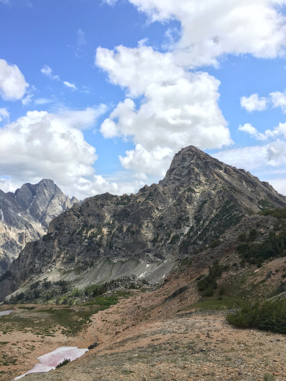
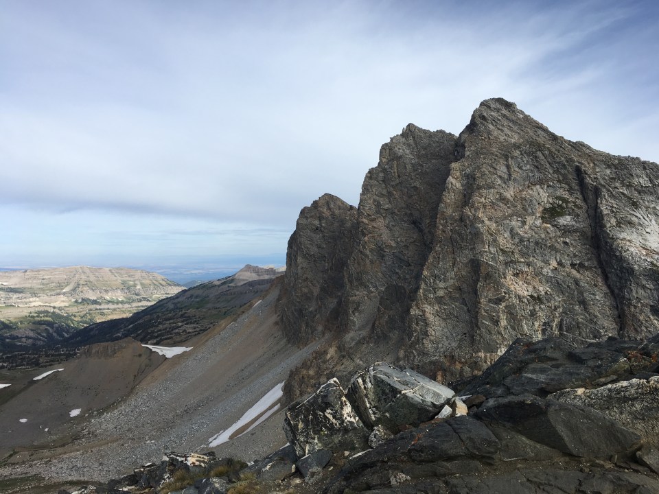
Today part 2: After lunch we left the trail and very steeply climbed up to Wind River Peak. I was all about this climb. It was a steady climb and there were big rocks to climb up and over but they were solid with very little sliding around. The climb from Deep Creek Lakes to Wind River Peak gained something like 2600 feet over 2.5 miles topping out at 13,192. It’s tough to move faster than a mph on that stuff. At the top we had absolutely incredible views of the Winds. We could see the Cirque of the Towers, Gannett Peak, the City of Lander and Frozen Lake which I swam in while on the CDT in ‘17. 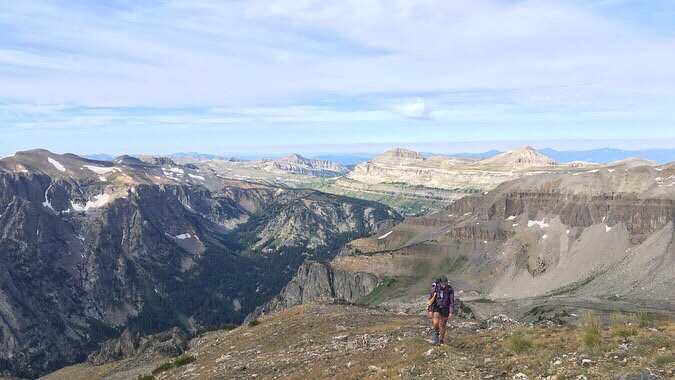
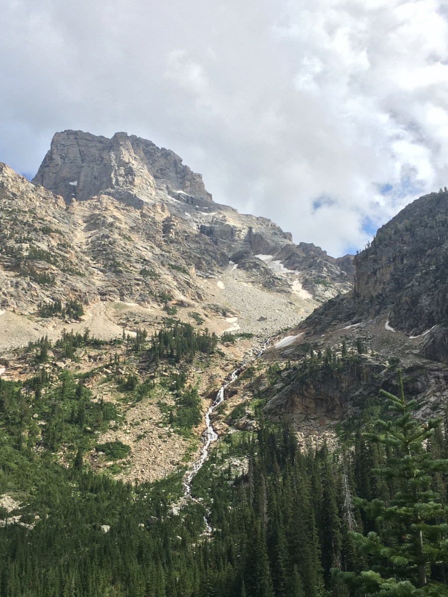
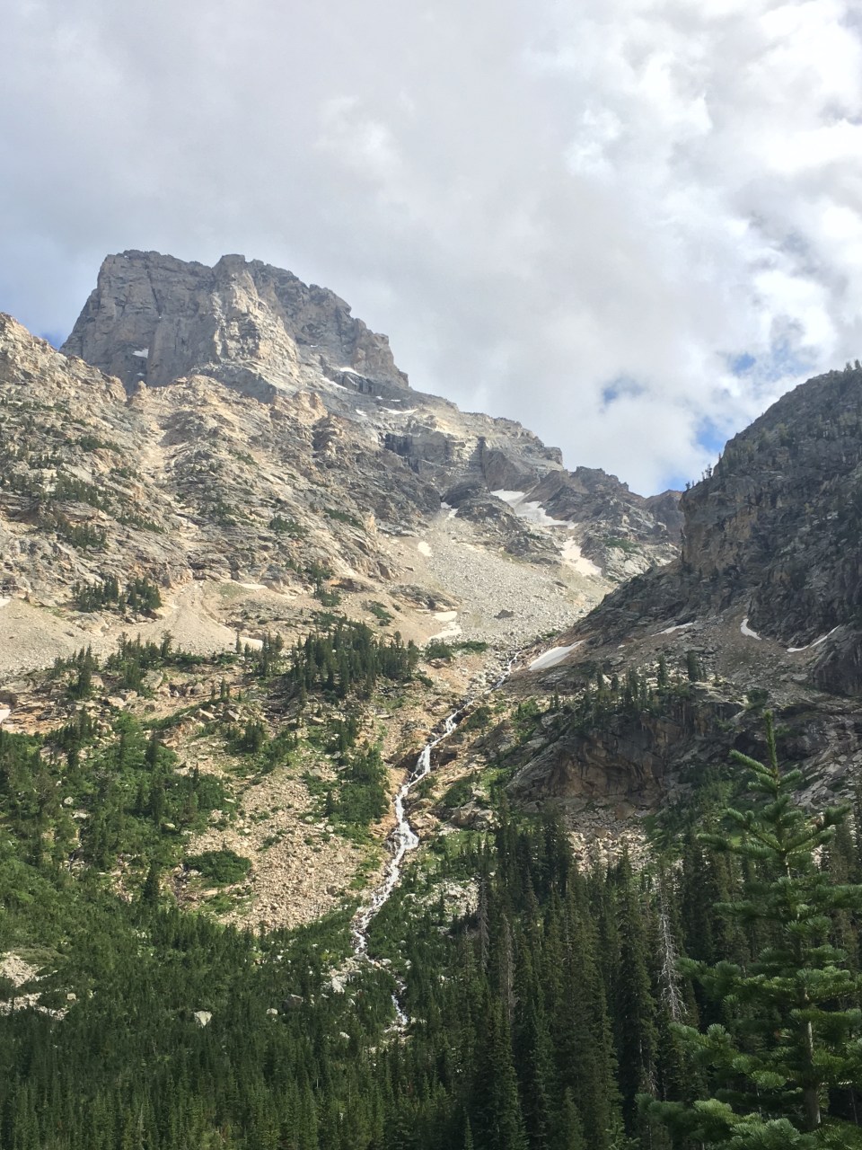
Part 3: The Descent. This was by far my least favorite part of the day. We started off by walking down a steep boulder field with stable medium sized talus. This lasted for a half an hour until we got to the West Gully, supposedly one of the most difficult parts of Skurka’s route. It sucked. It was super steep with scree and medium to large loose talus. Surfing on gigantic rocks downhill is no fun. For some reason QB loves this shit, I on the other hand wouldn’t mind if I never walked on loose talus again(I have a feeling I will be though). Garbelly and Critter weren’t fans of it either, Critter said it was the dumbest trail she ever walked down.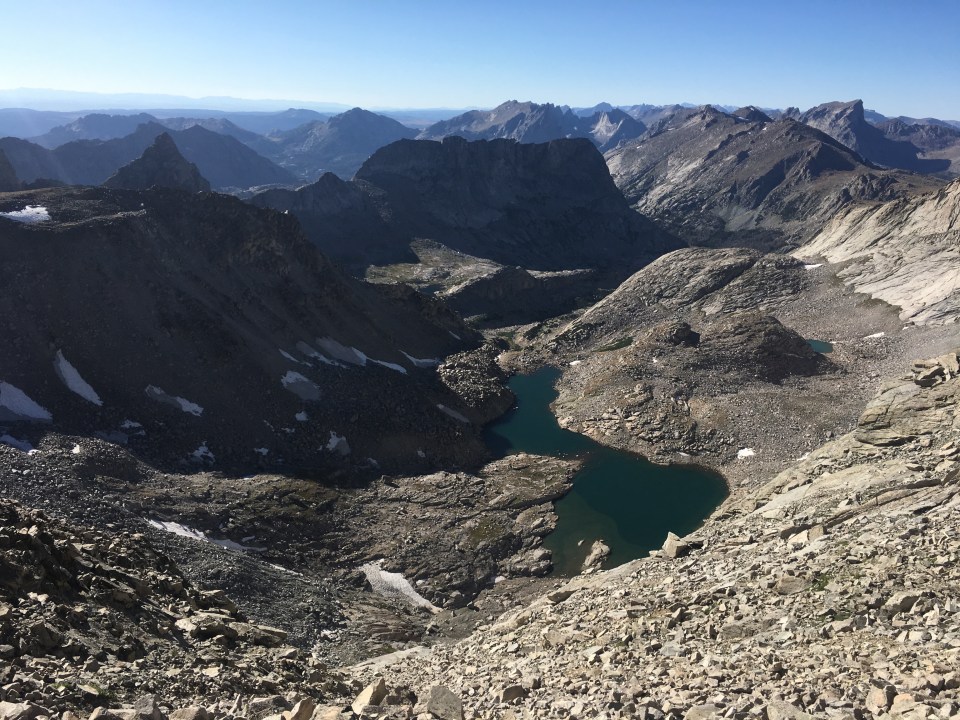
There was a section that was a class 3 scramble down some bedrock that wasn’t too bad, and another part that was covered in snow and I was able to shoe ski down it. Other than that the talus seemed to go on forever. Eventually we got to an unnamed lake that we walked around and then the route dropped again for awhile. Finally we got low enough and found a couple spots to put our tents. It’s an incredible campsite, in the shadow of East Temple Peak in a valley with no trails that I bet not too many people make it back here.
8/28/19…..WRHR Day 3…..17 miles
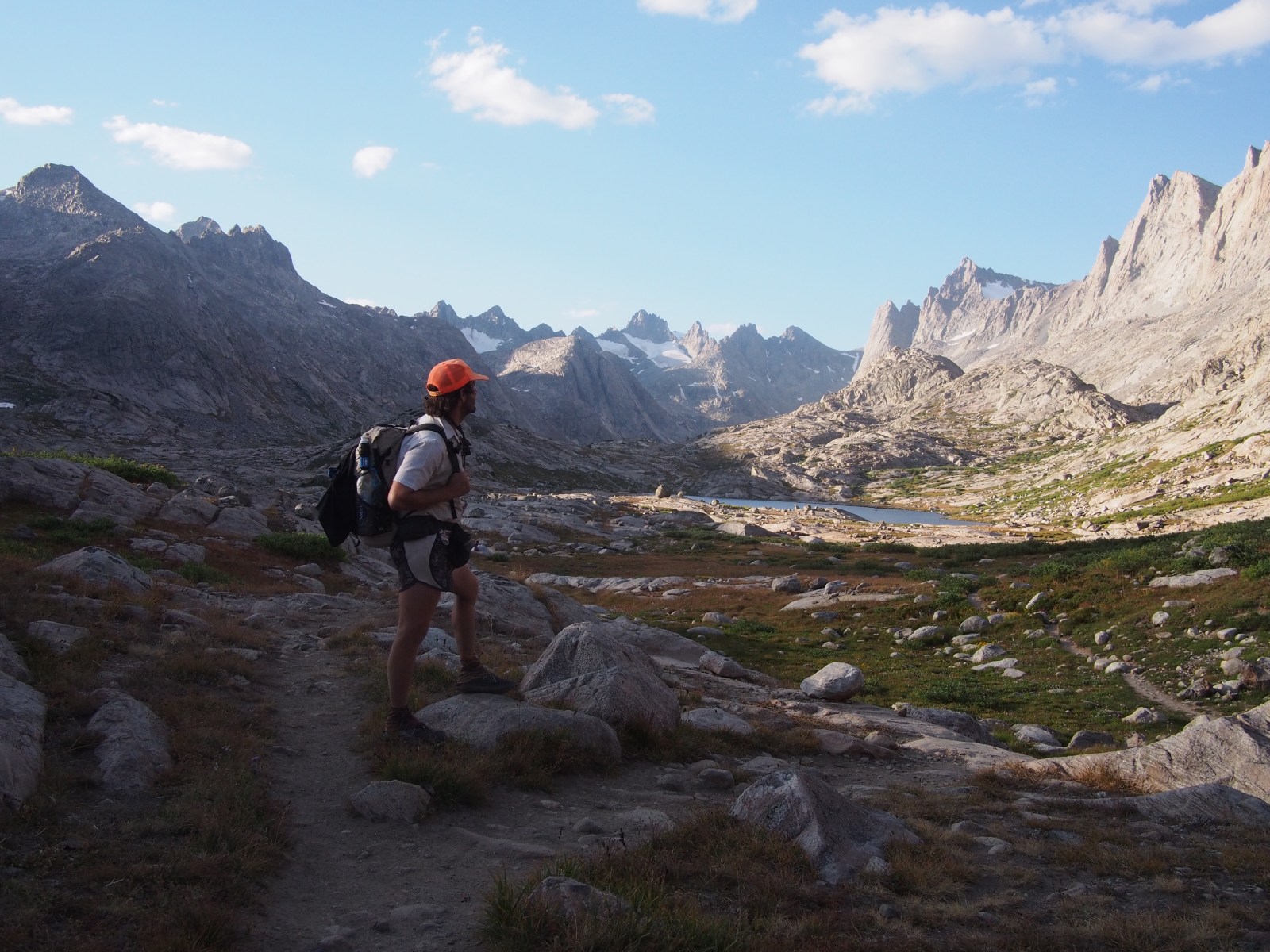
When I got up in the middle of the night to take a leak(per usual) the Milky Way was visible and the stars were absolutely spectacular. This morning the stars were gone of course but the day was still beautiful. We rock hopped down a few hundred feet and walked along a couple of lakes. Critter tied a fly to her trekking pole, threw it in the water and almost caught herself a sizable cutthroat trout. We dropped down again and walked by Big Sandy Lake before starting to climb towards Jackass Pass. 
From Jackass Pass we could see down into the Cirque of the Towers. The Cirque Route is a popular alternate off of the CDT. In ‘17 QB and I attempted to get over to it but there was still too much snow on the passes to get there comfortably. We figured we’d just come back in a couple years and do a high route through here. Today we walked right down into the Cirque to Lonesome Lake and it was everything I’d ever dreamed of and more. We ate at the lake and I went for an invigorating swim before the afternoon climb up Texas Pass. The Skurka Route goes over New York Pass that leads to the same valley but that one looked super sketchy, Texas Pass was steep on the way up and steep on the way down but nothing too difficult or scary. 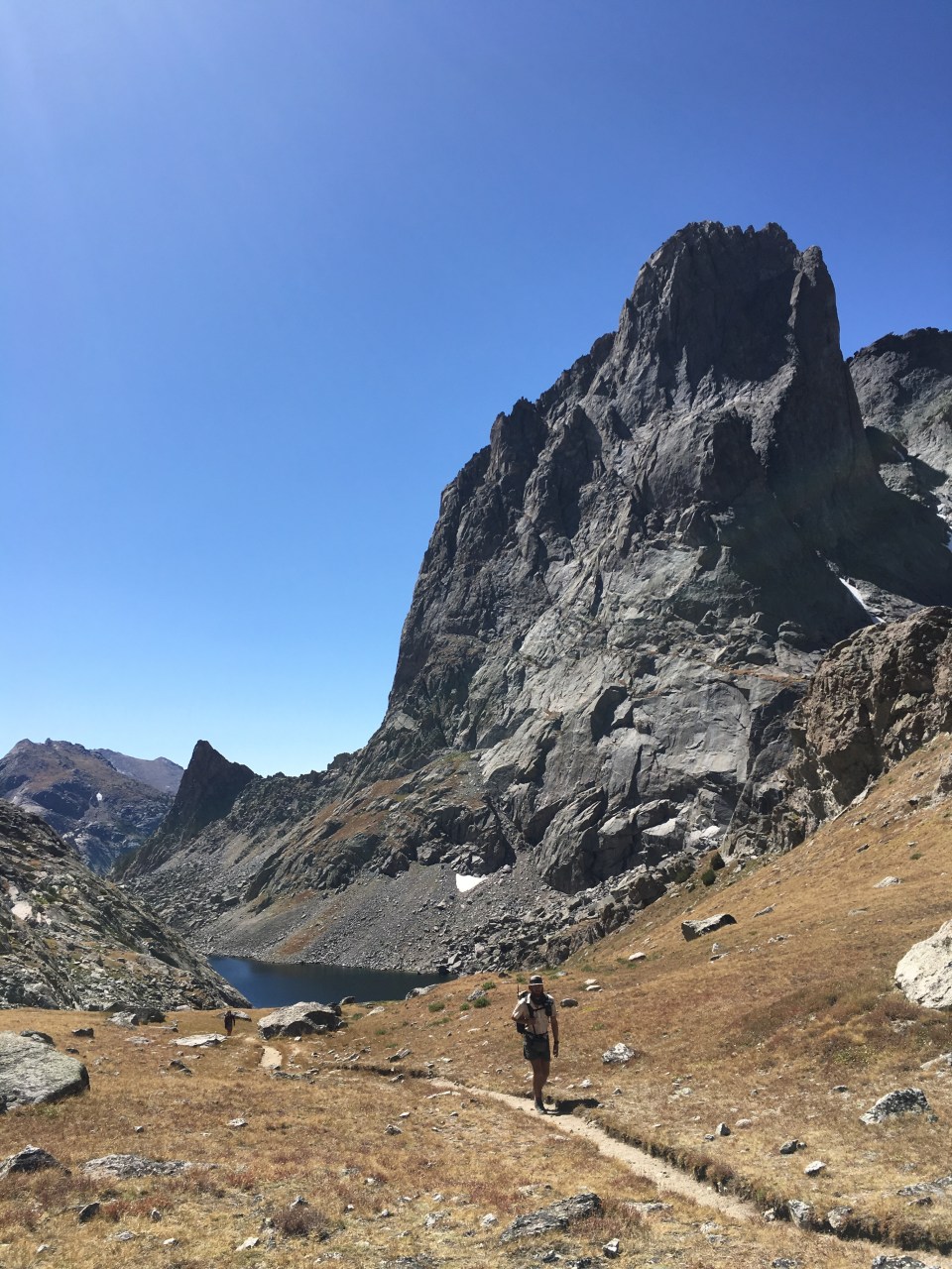
On the other side of the pass we walked by 4 lakes then walked on smooth trail for half a dozen miles along a river. It was pleasant and easy going especially compared to the rock hopping that makes up a lot of this route. We found a campsite next to Maes Lake, there seems to be a fair amount of people over this way but none within earshot which is nice. 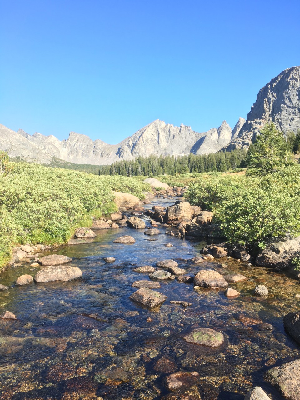
8/29/19…..WRHR Day 4…..13 miles
Don’t get hung up on mileage totals, it really doesn’t mean much with this off trail stuff.
This morning we walked along Maes Lake and Pyramid Lake then followed an animal path to the base of Raid Peak Pass where we left the trail and started climbing large talus. It was a nice climb to get the blood going and there were exceptional views from the top. We dropped down a moderately dicey descent to Bonneville Lake and then immediately started climbing up to Sentry Peak Pass. This was a fun climb up with a lot of hand over hand scrambling. At the top we came across an adult Nols Class coming from the other direction that were on a trip that would last 23 days. They were cool but there was 11 of them in a place I didn’t expect to see anybody. It’s a bit overwhelming to see that large of a group out here. 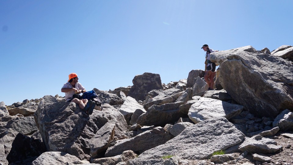
We walked down from Sentry Peak Pass picking our way over large talus and then navigating around thick willows at the bottom by Lee Lake. At the lake we ate and of course swam. From Lee Lake we followed very faint animal trails on some flat tundra until we got to Middle Fork Lake and the bottom of a stiff climb. This was just a very steep traverse up a dirt elk path that didn’t last all that long just enough to work up a post lunch sweat. When it flattened out into a hanging valley there was another lake, Bewmark Lake, and QB and I jumped in real quick. From here we gradually climbed until we topped out for the day on Photo Pass (if you’re planning on doing this route, from Photo Pass until Europe Peak we’ll be within Wind River Reservation and need special Tribal Permits). The descent down this one sucked, it was a super slidy gravel path. It didn’t last forever and we soon found ourselves camping in a really nice forest next to a river. 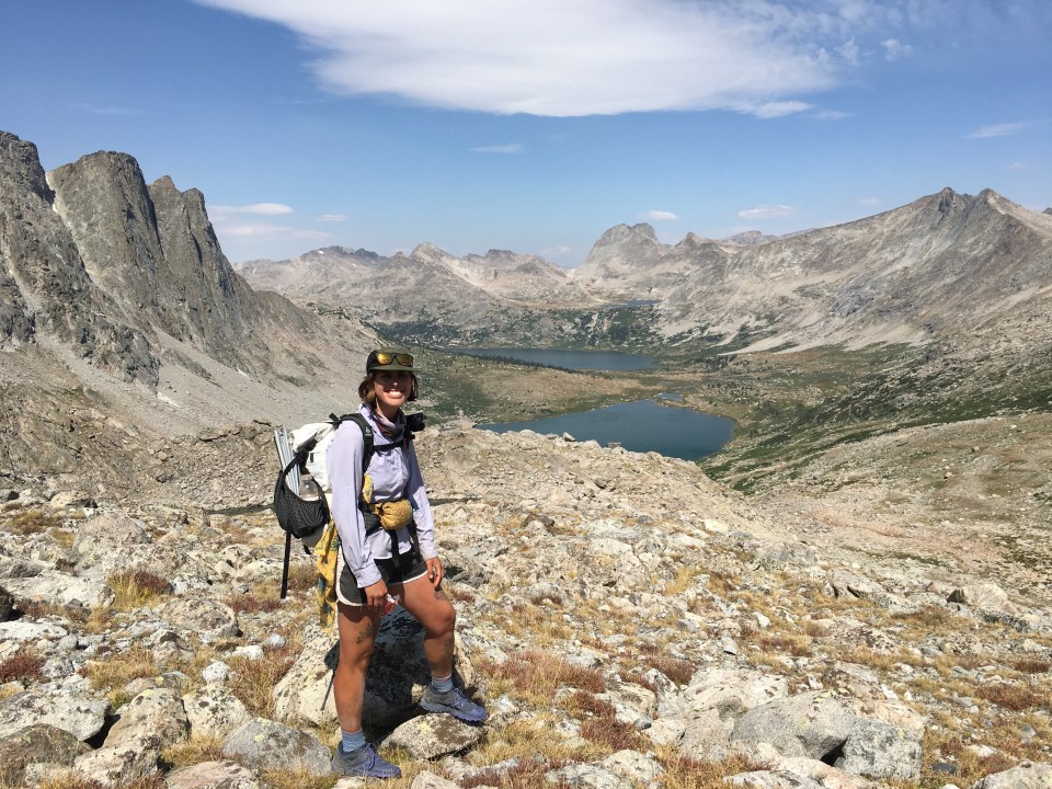
When we were in Lander I picked up some minimal fishing equipment. While waking I found a good stick and Critter, who’s a fly fishing guide by trade, tied my fly on and we went down to the river. She showed me what to do and where to throw it and within a few minutes I had a decent sized cutthroat trout in my hands. The first fish I ever caught on a dry fly. 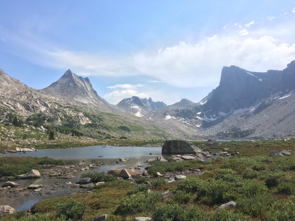
8/30/19…..WRHR Day 5…..15 miles
From our campsite this morning we crossed a river and then started climbing uphill searching for some kind of a trail. There were elk trails here and there that got us above treeline where we rockhopped on large talus and scrambled up short sections of bedrock until we got to Europe Col(similar to a pass). I even wore my microspikes for the first time out here to walk up through a small snowfield. 
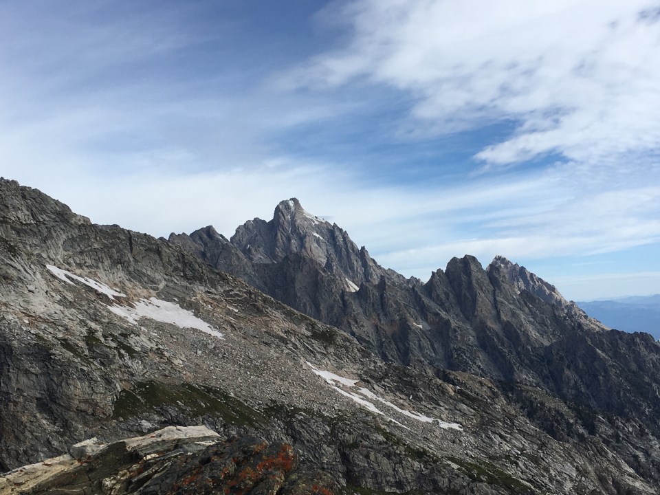
From Europe Col we got a good look at the main feature of the day, Europe Peak. There was a good amount of buildup about this mountain and the route we’re taking up it. Besides the West Gully this was supposedly the other crux of the route. The tricky part of the climb was described in Skurka’s guide as a 15-20 foot slab that had a class 3 scramble up to a Knife’s Edge. This produced a fair amount of anxiety for me. Getting to the slab was no big deal, there were lots of short ramps and ledges with a good amount of vegetation and the rocks were stable. Critter then Garbelly went up the scramble first and were able to identify where the good hand and foot holds were. It really wasn’t that bad but it felt a little too exposed for my liking. After walking across a narrow knife’s edge with long steep drops on either side we walked up over a boulder field to the summit of Europe Peak. 
From the summit we walked down along a ridge with rocks and tundra for most of the afternoon until we got to Golden Lakes. We walked along a couple beautiful lakes and then climbed up to a valley where we could see Skurka’s next obstacle, Douglas Peak Pass. The climb up this pass looked obnoxiously difficult and the description in the guide going up and over it sounded ridiculous. The 4 of us decided to skip it. There was a lower route to the east of the pass that adds a couple miles but I’m sure saves time overall. The alternate was very pretty and took us by Camp Lake where we are appropriately camping for the night. 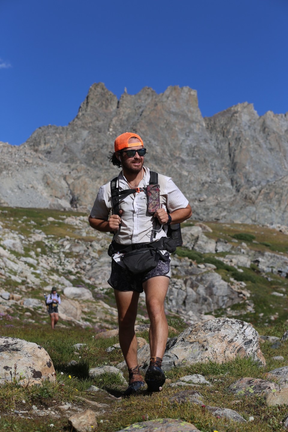
8/31…..WRHR Day 6…..14 miles
What a day! Right away we started climbing from Camp lake, where we slept, to the Alpine Lakes Basin. We climbed uphill across boulders for about an hour until we had to do this gnarly down climb on the side of a cliff next to a lake. It’s supposedly a class 3 or 4 climb (depending on what guide book you look at) but we climbed down the cliff too early and made it harder on ourselves. Garbelly went first and we used an assembly line of passing all the packs down so we could climb without them.
Safely at the bottom of this cliff we slowly started traveling through the alpine lakes. It was all large talus that we had to navigate and a few times where we had to climb up some short cliffs to get around bluffs by the lake. We had to have been traveling at less than a mph. Eventually we got to the bottom Alpine Lakes Pass where we had a nice stiff climb to the top.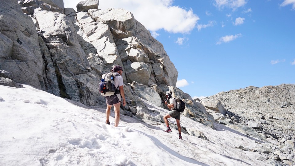
Once over Alpine Lakes Pass we had a decision to make; we could either continue on the Skurka Route or take the Dixon Route. We had a team meeting at the top of the pass and made the decision based on what would be the most fun. The Skurka Route is the one we started and seems to be the higher, more aggressive and remote route. I’m sure it’s beautiful but the description made it sound tedious and would probably take longer. The Dixon Route seemed pretty awesome, besides going through some beautiful valleys it would be lower and also included a couple features that I missed while hiking through here on the CDT, we’d also be able to move a little quicker since there was a fair amount of trail.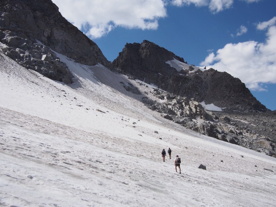
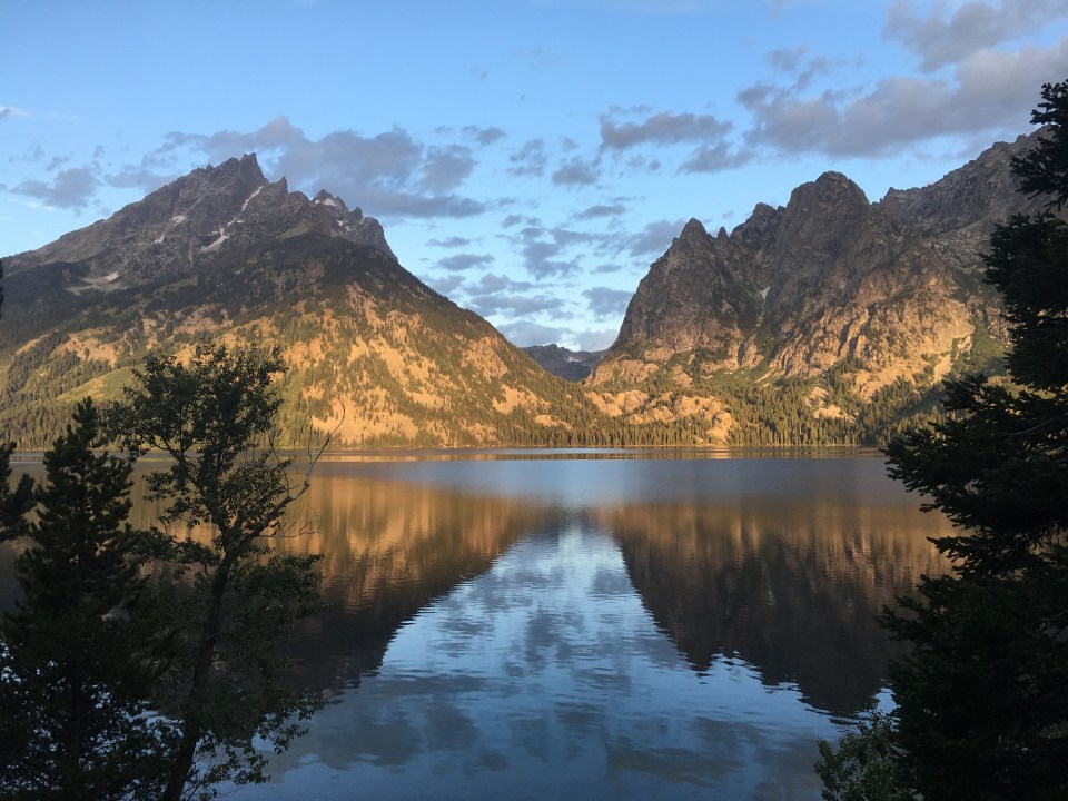
We chose the Dixon Route and headed left over Knife Point Glacier to Indian Pass. Walking across the glacier was pretty rad, we used micro spikes and contoured along the side of the mountain kicking in steps where we had to. Once up and over the pass we dropped into Indian Basin. This was my favorite part of the WRHR so far, huge sharp mountains everywhere, lots of lakes, wildflowers and there was even trail, something we hadn’t had for awhile. Plus I got to swim in some ice water for the first time in a couple days.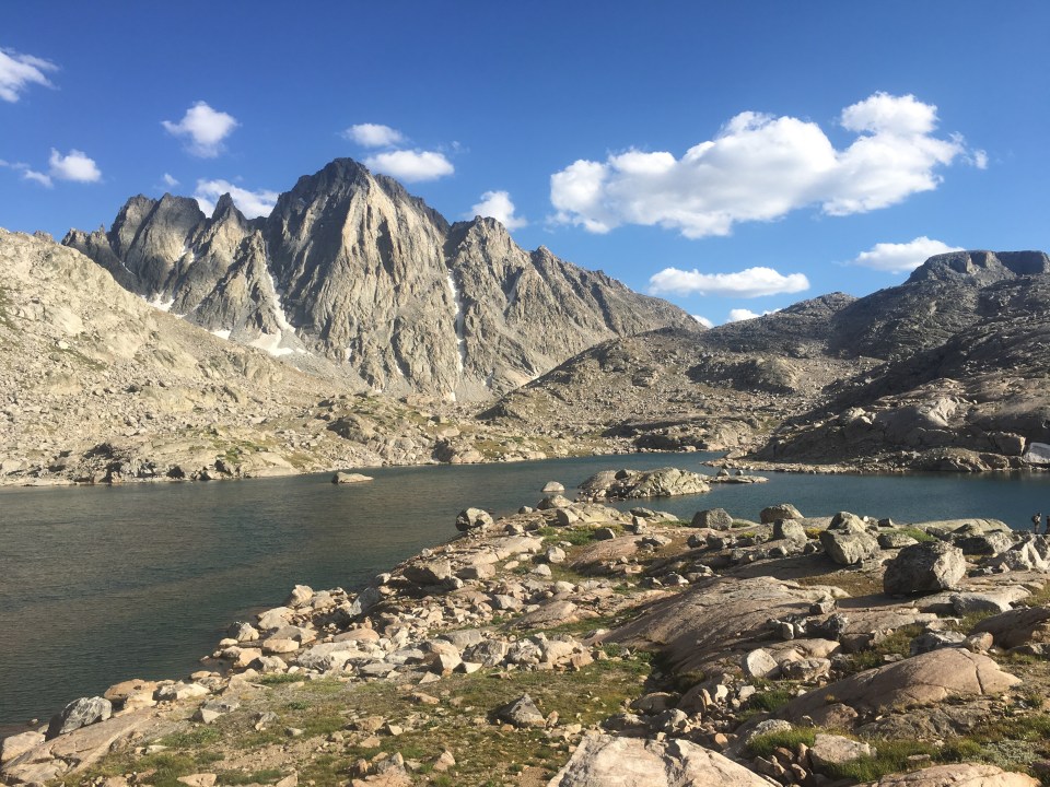
We walked a few miles through Indian Basin and into the incredible Titcomb Basin and found an awesome place to camp on a hill among the rocks.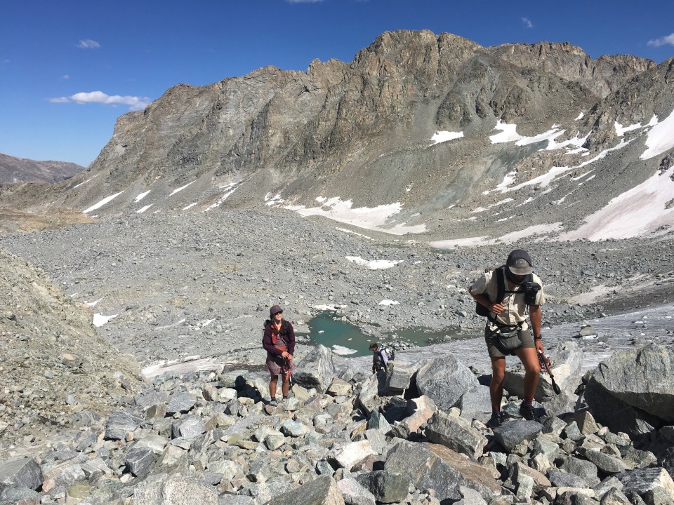
9/1/19…..WRHR Day 7…..20 miles
This morning we walked along the Titcomb Lakes towards Knapsack Col. The route through Titcomb Basin and over Knapsack Col is a popular alternate for the CDT. In ‘17 QB and I skipped it and elected to stay on the regular route since we had already sent our snow gear home. Glad we were able to get back here for this highlight.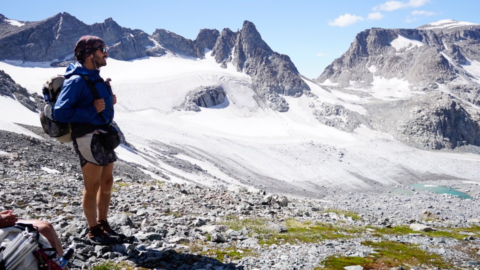
On the way up to the col we were joined by L-Fox, a CDT hiker who recently retired from a career in the Czech special forces and still works part time testing parachutes(sounds like a dangerous job). This dude was a badass, he bombed through a dicey boulder then took the riskiest line possible to the top. The rest of us took our time navigating the boulder field then ascended up a loose scree field until we climbed through a snow cornice at the top while L-Fox waited for us. It was a difficult pass but the way down wasn’t too bad and the views were magnificent. We passed a glacier that forms the headwaters of the Green River, a major tributary of the Colorado, then followed these waters for the rest of the day.
We ate lunch by Peak Lake, where QB and I swam in some icy cold aquamarine glacier water. After lunch we had one more small pass, Cube Rock, then started the descent out of the Winds. We walked through a narrow rocky valley until that gave way to a pine forest. We dropped a few thousand feet and were back to the CDT walking along the Green River(it actually is green). There were a handful of former thruhikers we came across who were beginning the WRHR, some who were on the PCT in ‘15 just ahead of me.
At our campsite we met a couple, Lewis and Laura(Little Shark), who were friends with our buddy Smiley. They joined us for supper at our spot beside the Green River in the shadow of Squaretop Mountain.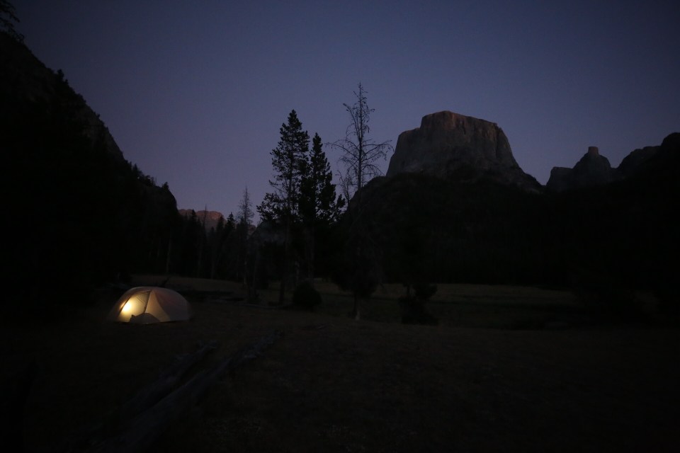
9/2/19…..WRHR Day 8…..6 miles
Essentially we finished the route yesterday but we still had to hike out and catch a ride to town.
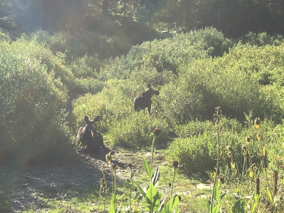
This morning as we walked the trail along the Green River we spotted a beefy bull moose and his girlfriend eating breakfast. In ‘17 we had camped nearby and had seen a bull moose in almost the exact same spot. I know what you’re thinking but there’s really no way of knowing if it was the same moose.
After walking by the Green River Lakes we got to parking lot for the campground and the first car that came by picked us up. Dennis and Marilyn had been camping out here in their trailer for the past two weeks. They had a canoe on top of their pickup, were pulling their camper, and had the truck full of supplies. We were able to move some stuff around and the 4 of us stuffed ourselves in the back. The road from the trailhead to the parking lot is 18 miles of washboard dirt road that gets grated once a year and it hadn’t been recently. That took about an hour and then we went another half hour to Dennis and Marilyn’s house in Pinedale where they offered up their showers to us. We showered and hung out with them on their patio eating popcorn and drinking ginger ales. It turns out they knew John who gave us a ride last week and had actually got a ride from him once when they were in a jam. Small world, but I already knew that.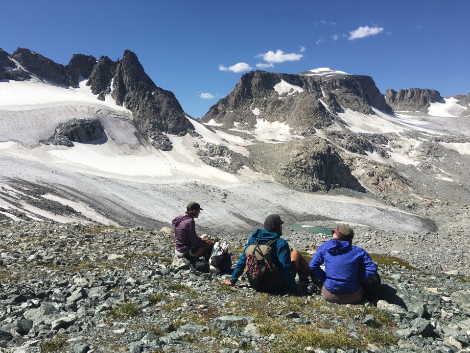
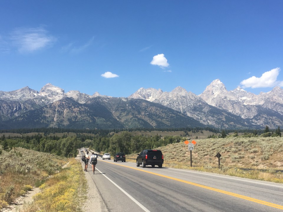
Two thumbs all the way up for the Wind River High Route. If you’re looking for an off trail backpacking route that will test your abilities and also has intense scenery I highly recommend it. As for us We’ll most likely stay in Pinedale tonight then start making our way down to Northeast Utah tomorrow to start the Uinta Highline Trail in the next few days.
If you like what you read feel free to follow this blog or find us on insta: @endlesspsummer @sarahikes and Garbelly and Critter’s blog trailingthought.com and their insta @ourtrailingthought
 Eventually we got to the top of Hurricane Pass and then crossed the boundary of the park into Jedediah Smith National Forest. Since there were no permits within the park we’re camping here tonight in the Alaska Basin by Sunset Lake.
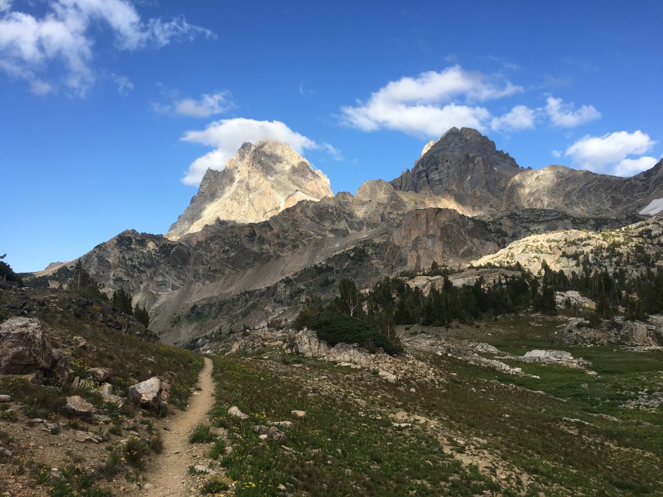
 From the summit we backtracked down until we were on the other side of Buck Mountain Pass and back in Alaska Basin. We passed a bunch of lakes before stopping at one to eat lunch and swim. My toe is bruised and it was still bleeding so after I swam I cleaned it and redressed it. Other than that it doesn’t hurt as bad as I thought it would.
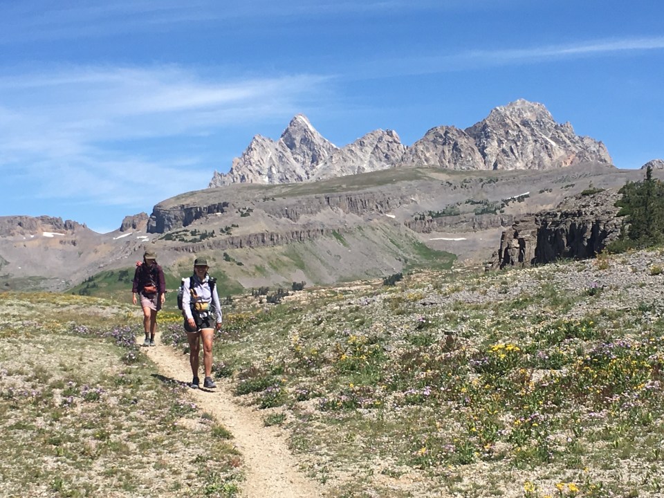
 follow us on insta: @endlesspsummer, @sarahikes and @ourtrailingthought