Endless P Summer

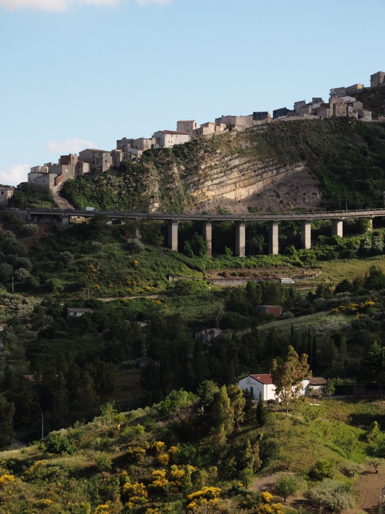
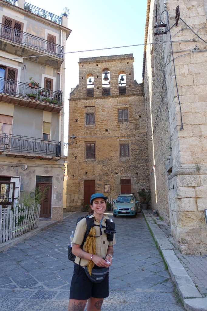
Day 5…6/7/25…12.4 miles…5000 ft gain…Onda to Manganu…Stages 8 and 7

Today we did stages 8 and 7. The North really starts at stage 9 but for the sake of making it simple I’ll split these 2 posts right in half. Stage 8 was great, downhill from l’Onda and then cruised through a beautiful forest before a stiff climb up to Petra Piana. In the forest there was a handful of stone huts where you can buy cheese and charcuterie. Bummer we went through there so early before the cheese slingers were open.

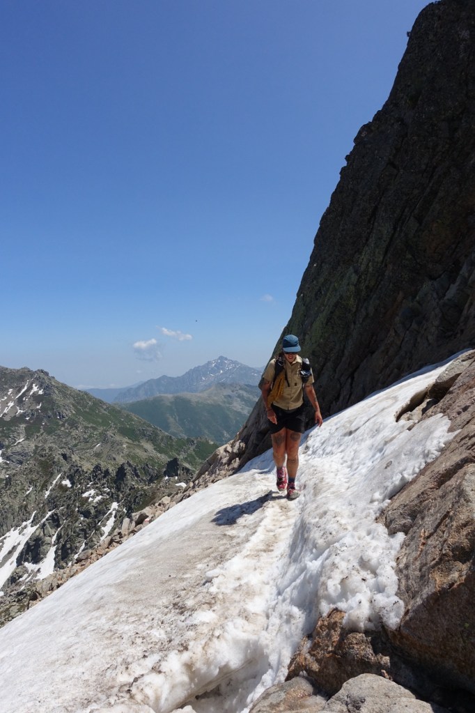
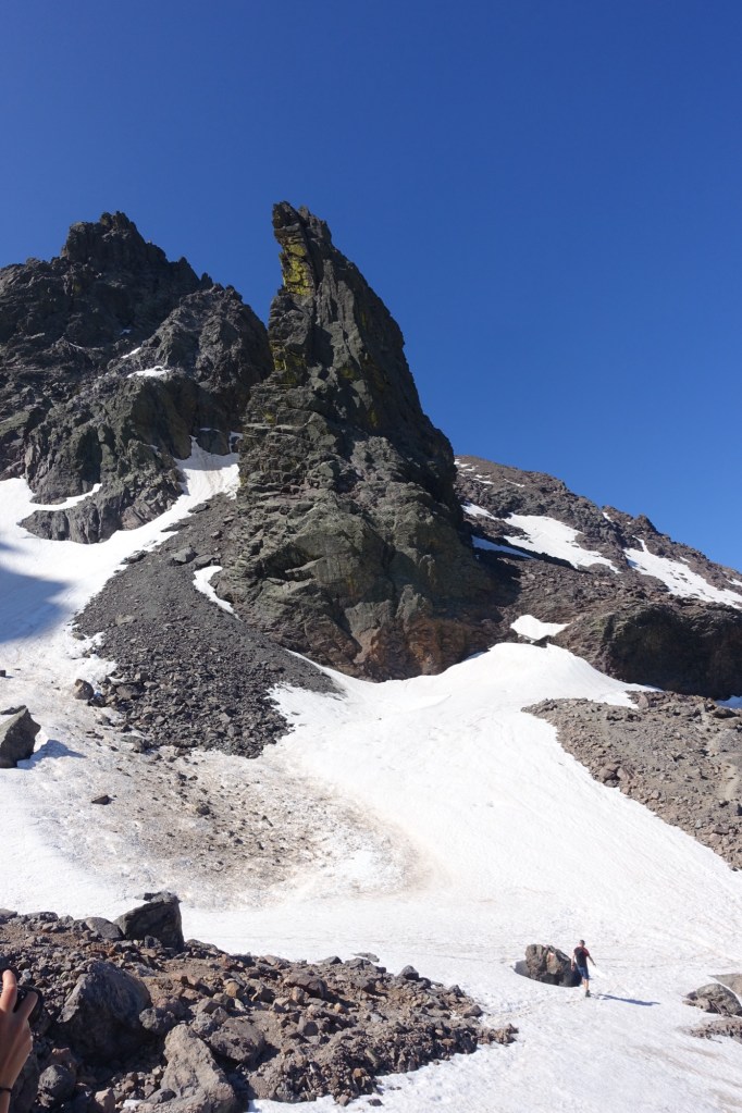
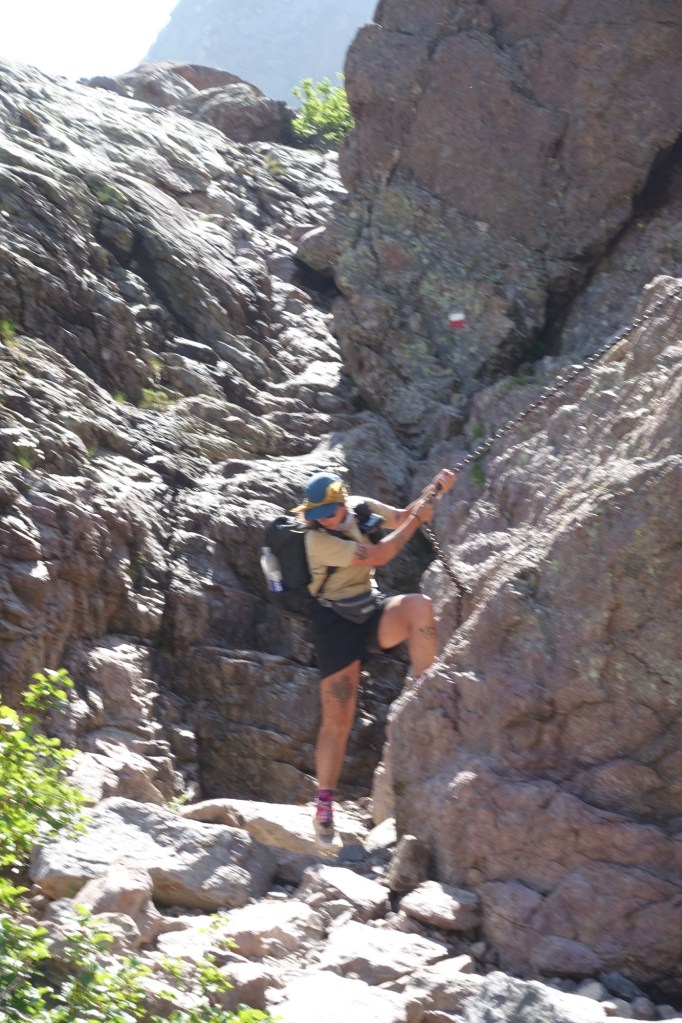
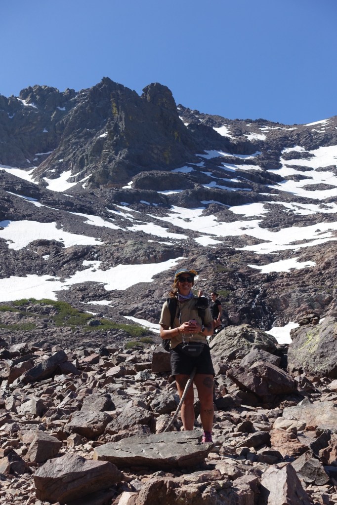
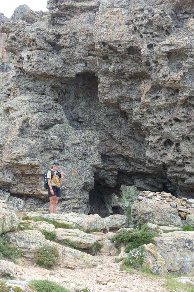
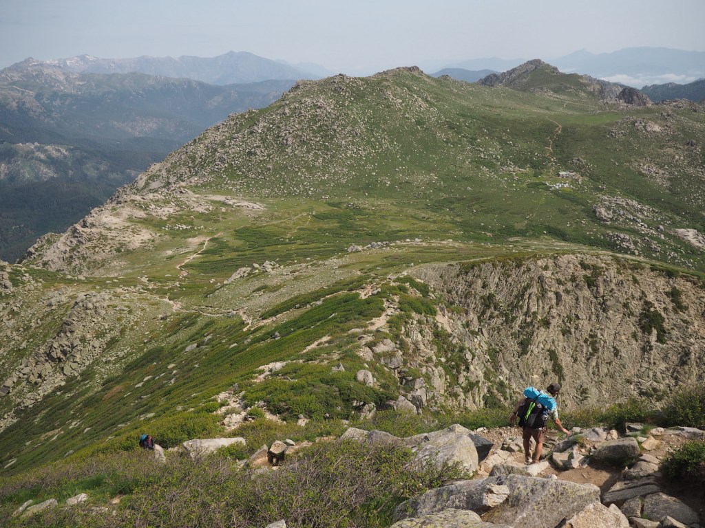
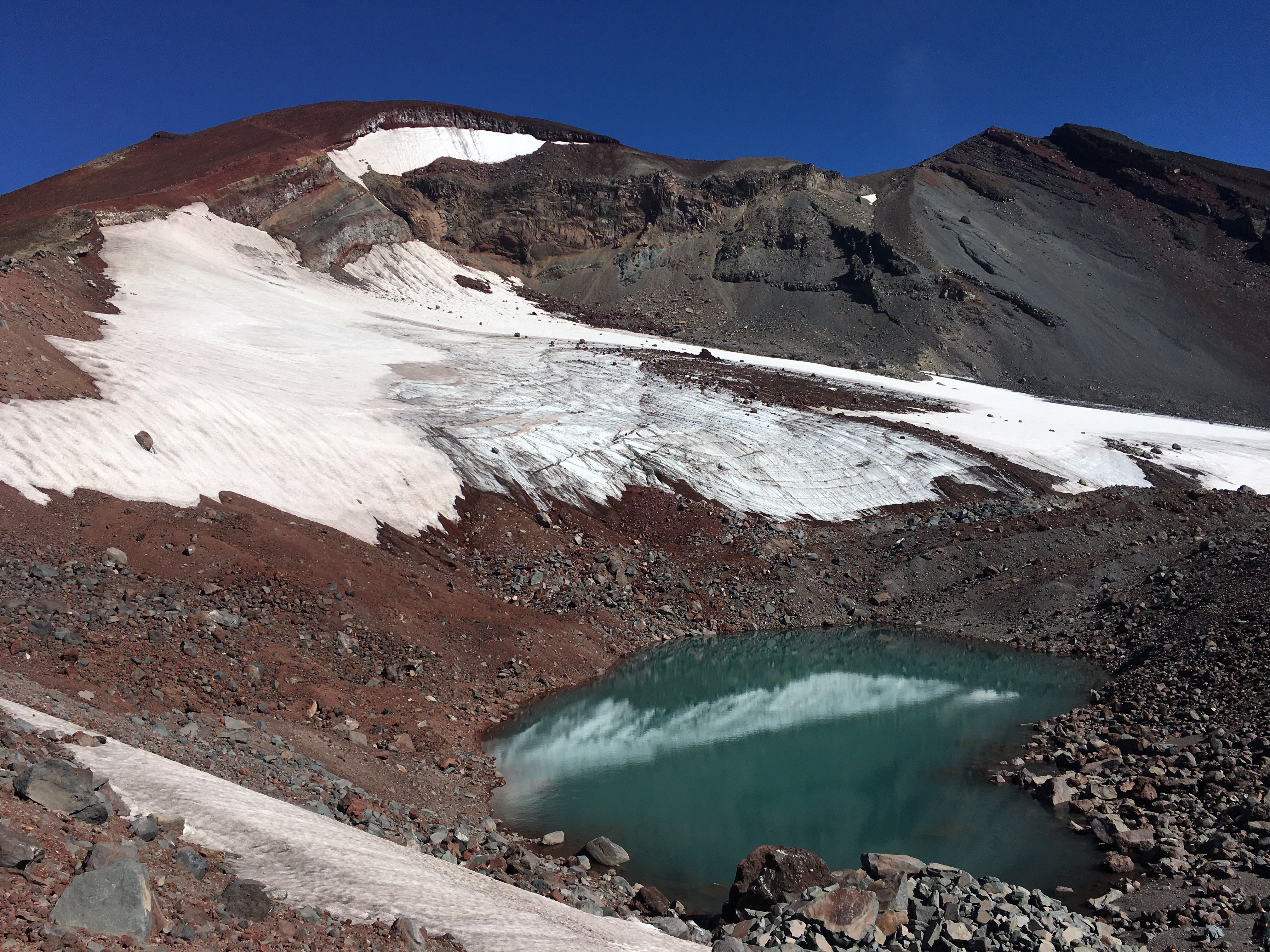
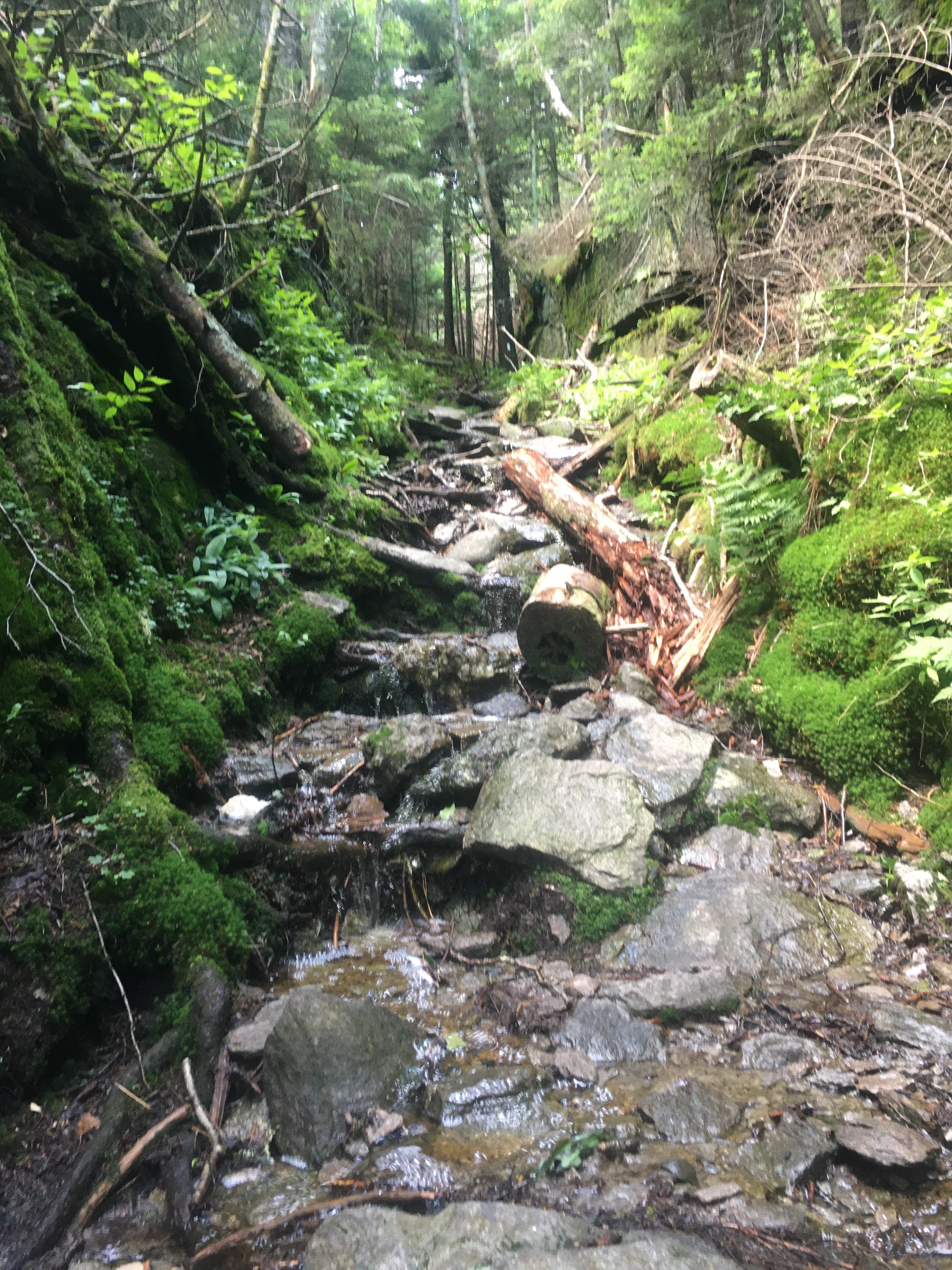
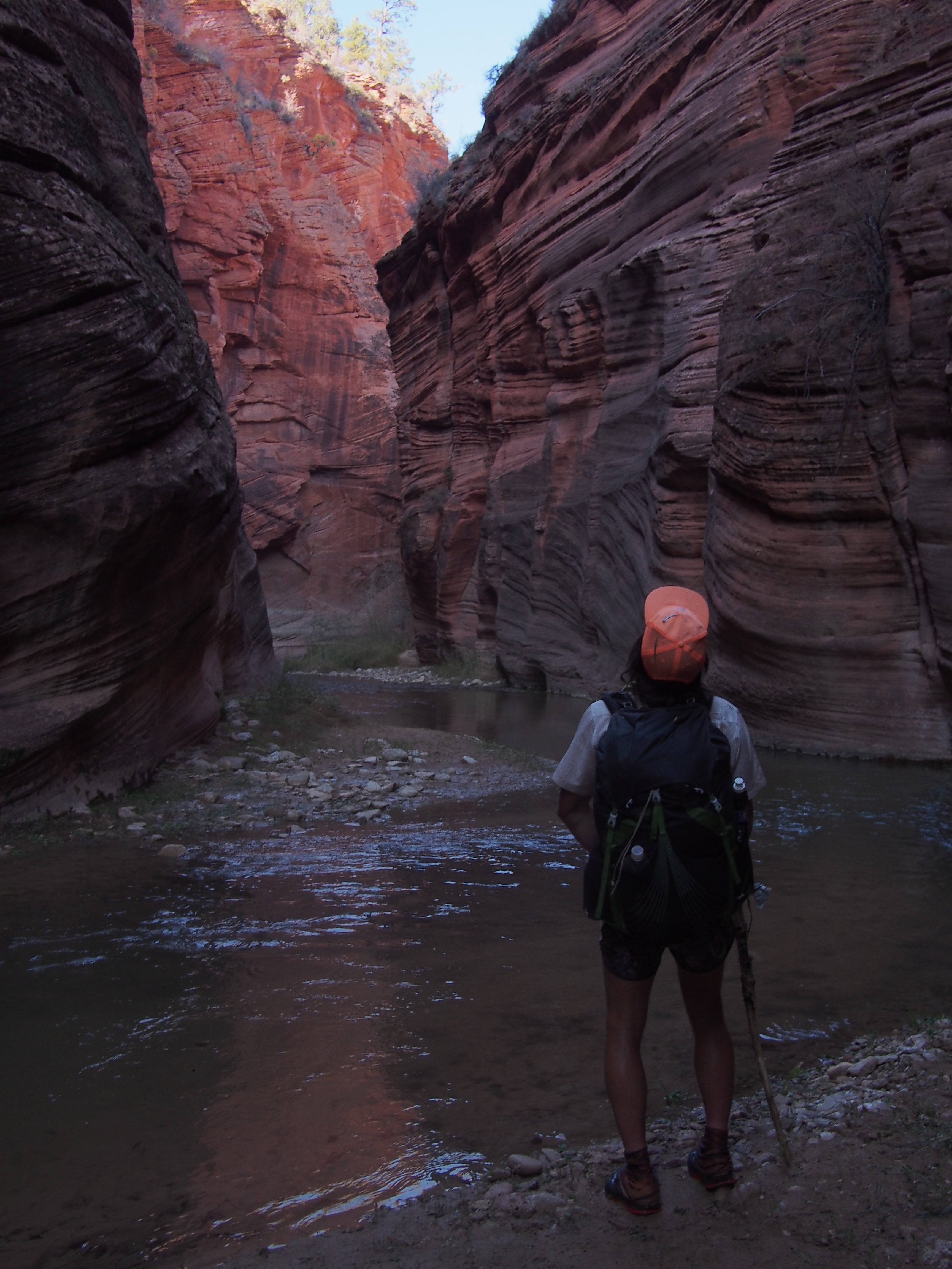
We ate a bunch of peanuts and drank soda at Petra Piana before attempting the notorious Stage 7. This is one of the stages I’ve been pretty nervous about and it lived up to the hype. While it was quite intimidating to me, it was also incredible to be up in these gorgeous mountains. There was a fair amount of scrambling, some boulder hopping, and climbing with the use of a built in chain. A handful of times we had to cross snowfields, some spicier than others, and fortunately we’ve been carrying our micro spikes for this very occasion. I feel like some things look sketchier from a distance and when you get to it, it’s not quite so bad. Maybe just a little sketchy. 

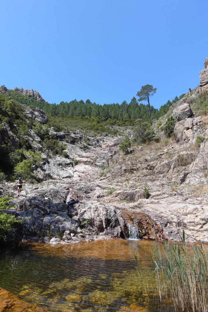
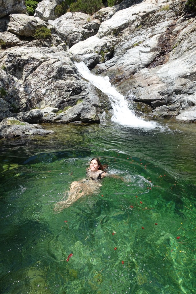
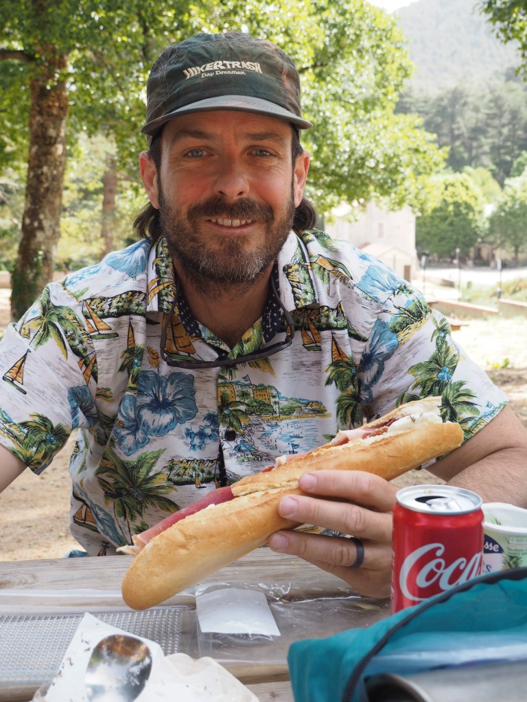
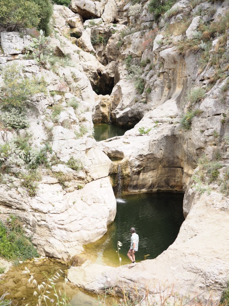
It was a long descent to the refuge and it felt great getting thru a challenging section. There was a river with pools to swim in next to the camp so QB and I spent about an hour swimming and relaxing by the water. Seriously A++ for swimming holes on this trail. Dinner was a can of tomato sauce and a package of spaghetti that we bought here at the refuge and cooked with the stoves they provide. Took forever to boil the water!

Day 6…6/8/25…20.8 miles…5040 ft gain…Manganu to Tighiettu…Stages 6 and 5

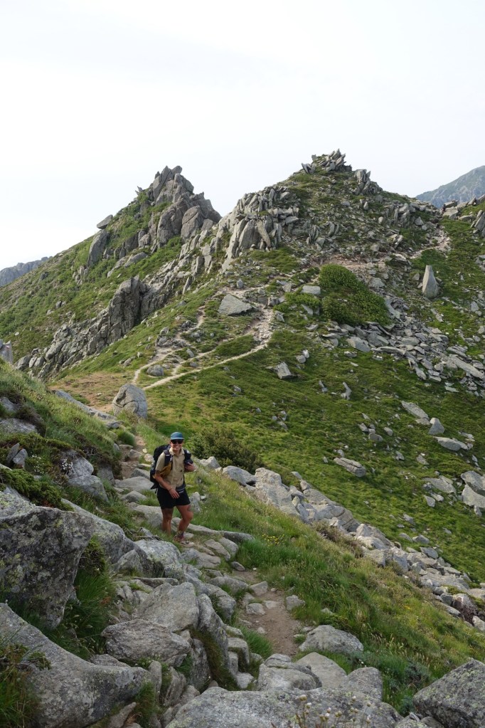
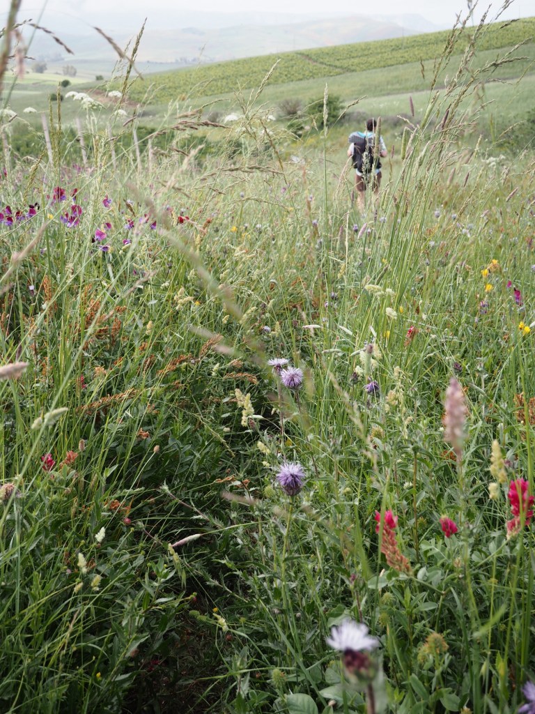
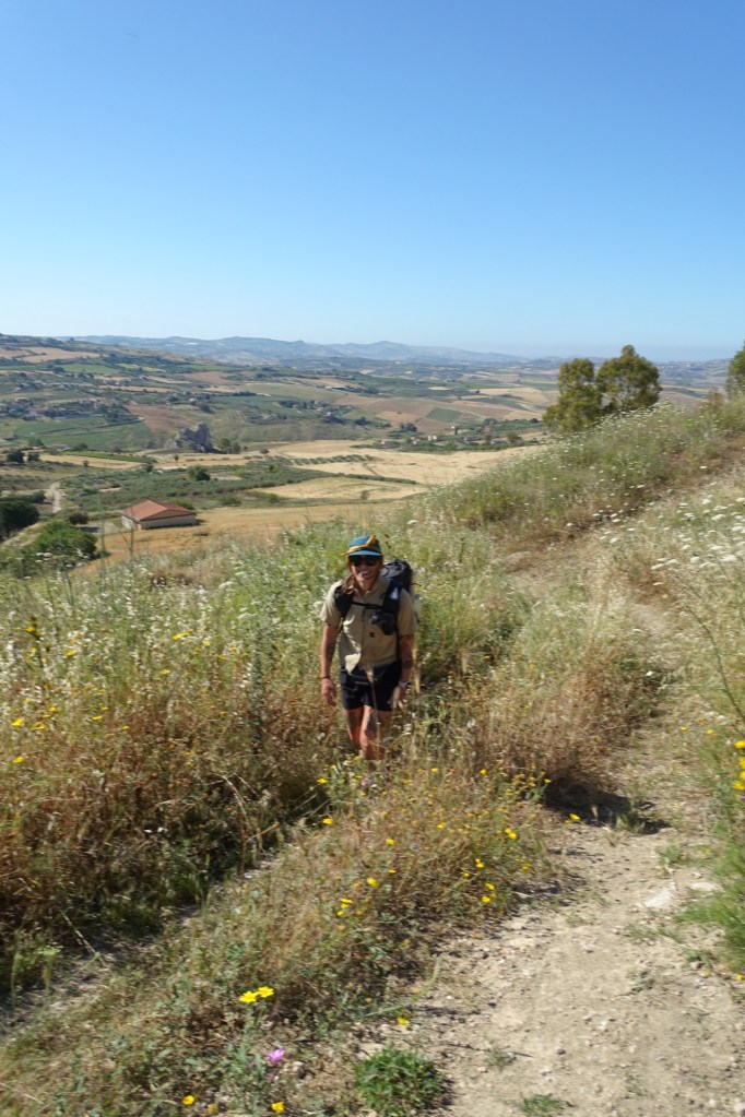
Stage 6 was so cruiser, I loved it. Most of the morning we were walking thru lovely flat meadows and definitely earned it after yesterday. Felt like I was on some of the easy stuff on the PCT. After the meadows was little rocky ridge with some good views.

We stopped for lunch at a little store at Castel de Vergi at the bottom of a ski mountain. Ham and cheese and butter on a baguette, a French classic. After lunch we started on section 5 that was packed with people cuz I guess it’s a Sunday? Also a very pretty area and there’s hiking and rock climbing and swimming and cheese for sale and what not. For most of the section we walked up into a really cool canyon. I swam in the headwaters of the Golo, the longest river in Corsica. 

Originally we had reserved a spot at refuge de Ciottulu. This was halfway through section 5 and we wanted to continue to the next refuge. No sweat, we checked in and they said that it’s fine to change your reservation. So if you’re reading this blog as a how to manual-just remember that. We continued to a pass and dropped down a steep descent, then got a 1 mile head start on section 4. The upcoming 4 and 3 have been looming over my head as the hardest parts of the trail. I heard there’s a lot of snow and they’ve got me a bit nervous. Fingers crossed it goes well. *Oh yeah, dinner was a couple cans of ravioli bolognese topped with leftover Corsican cheese from lunch and a bag of gummy bears.  

Day 7…6/9/25…8.7 miles…5572 ft gain…Tighiettu to Carozzu…Stages 4 and 3

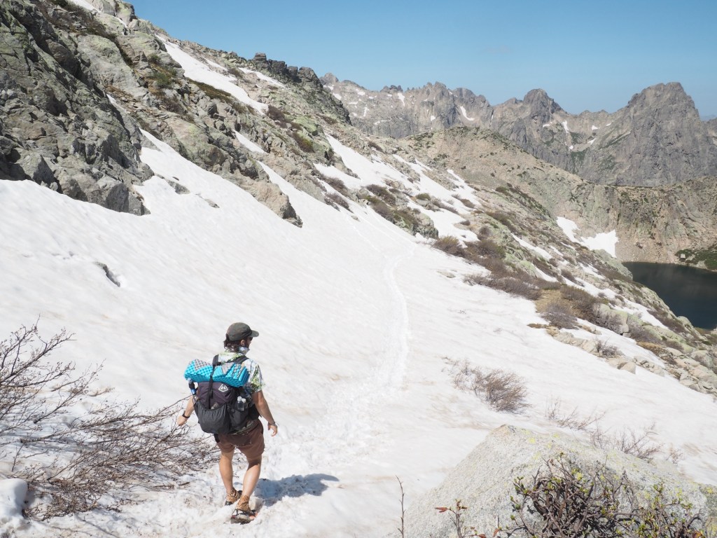
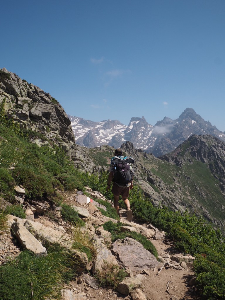
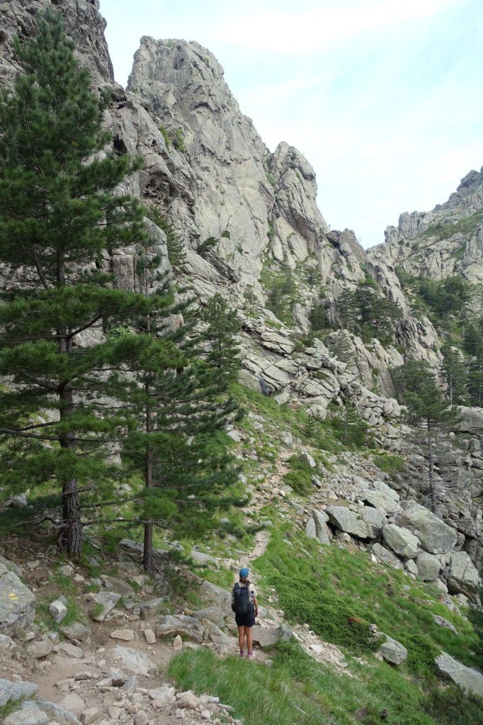
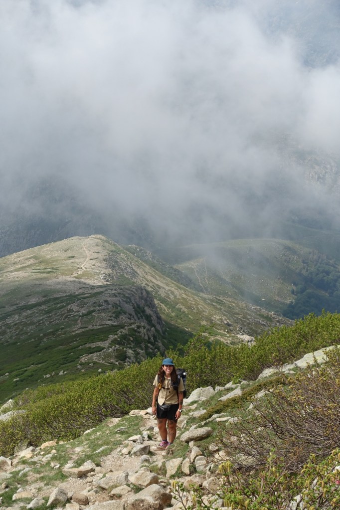
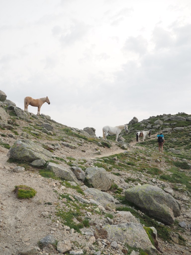
Man, these are the days! I did not want to hike either of these stages, I also didn’t want to skip them, I just wanted them to be done. There is a fair amount of fear mongering about how hard and scary the north is. And it worked on me, but I’ve said before and I’ll say it again, “Never trust a southbounder.” Still it was maybe a little scary and definitely hard. The main reason we hiked north was QB’s strategic decision to give the snow a few more days to melt and it was genius. Everyone has been telling us how steep and how much snow we’ll have to traverse but it’s been really hot this past week and a ton is melting every day. It would have been much harder going with the herd.

The wind was howling overnight and I was not looking forward to being high on a steep pass in the blistering wind. It almost completely dissipated as we started to walk this morning. Then QB saw 2 feral pigs along a ridge across a ravine from us. These weren’t the same as the wild boar I saw back on day 2 but looked more like they escaped from a farm, far far away from where they live. I took this as a good omen. We then scrambled up slabs and reached a scree field where there was a pair of perfect wooden hiking sticks on the ground so we each took one. At the refuge we had even tried to buy a pair of hiking sticks to help with the snow but they were sold out. There would be barely any snow but the sticks helped us out a bunch on walking on the loose scree. 

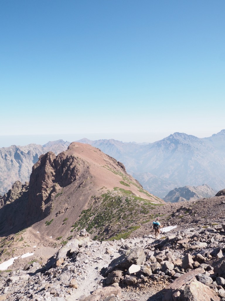
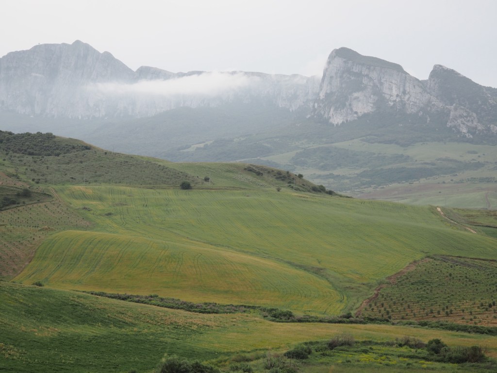
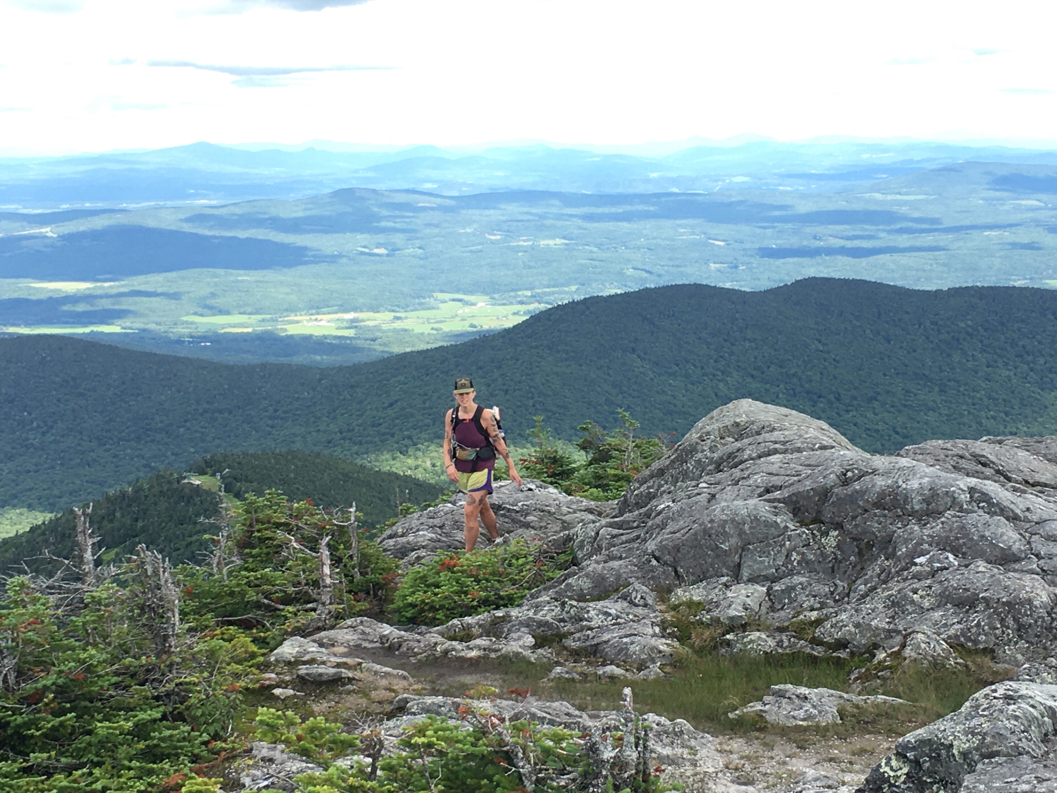
We got to the top of a pass, Bocca Crucetta, then traversed up to the shoulder of Monte Cinto, the tallest peak in Corsica. The way down was super steep, but there was barely any snow and we just went very slow and carefully. There was hardly anything that was exposed or uncomfortably airy. It was crowded as we descended and we must have seen hundreds of hikers going up. 

About halfway down I saw 2 guys sitting on the side of the trail and 1 was taking his own pulse so I figured something was up. None of us spoke the same language, not even close, but QB and I talked to him with our google translate app and he was having chest pains and had an elevated heart rate. He was 73 and pretty uncomfortable, there was no way he was walking out of these mountains. QB climbed back up trail a bit to the next group of people and found someone to call for a rescue. I stayed with him and then the next woman to get to us was a french speaking cardiac nurse. What are the chances, including QB, 2 cardiac nurses show up while you’re in the middle of a medical situation? She took over the scene and by this time a handful of hikers had gathered. We transferred care and our job was done so after an hour of being on scene Sara and I were basically told we should continue down the trail. This was one of those too many cooks in the kitchen situations and after the guy took an aspirin he was feeling a bit better instead of declining and his heart rate was coming down. 

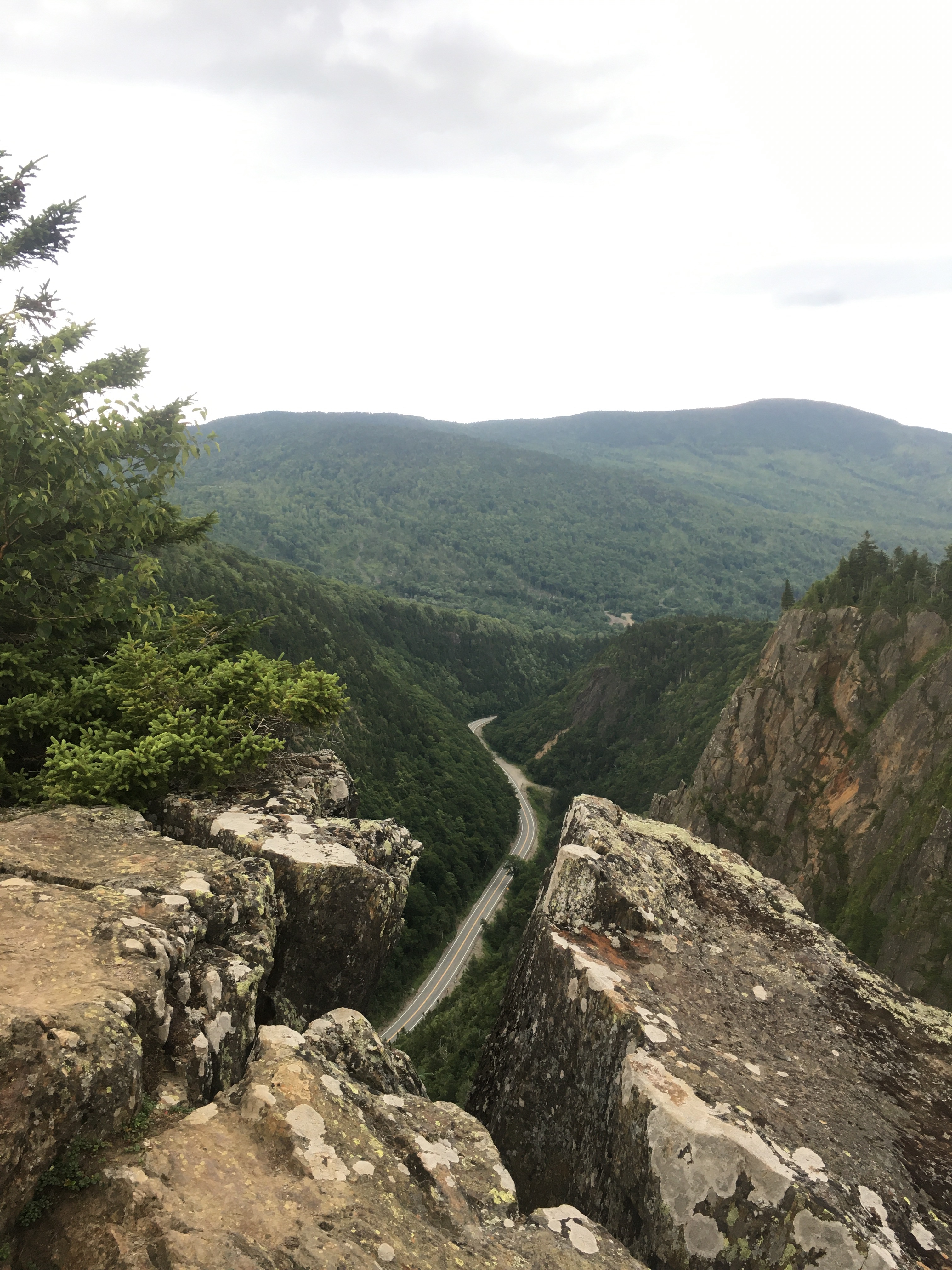
As we walked out we watched the helicopter fly up the valley then lower a couple of techs on a cable and eventually pull up the patient in a litter. He was in quite a precarious position and it would have been impossible to land a helicopter. Plus the whole scene unfolded next to a huge spire so it didn’t look like the helicopter could even get that close. They got it done though. Very impressive! It took me and QB another hour and a half to descend down a steep slope with a bunch of class 3 and 4 scrambles, some with built in chains. At the bottom of one scramble was a puddle of blood. We later learned someone made it into the refuge at the bottom with a head wound an hour before us. At the parking lot at the trailhead, the helicopter was unpacking the chest pain patient just as we were getting there so we checked in on him and he was doing ok. 

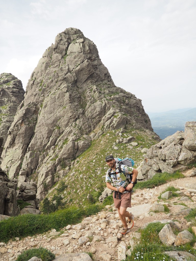
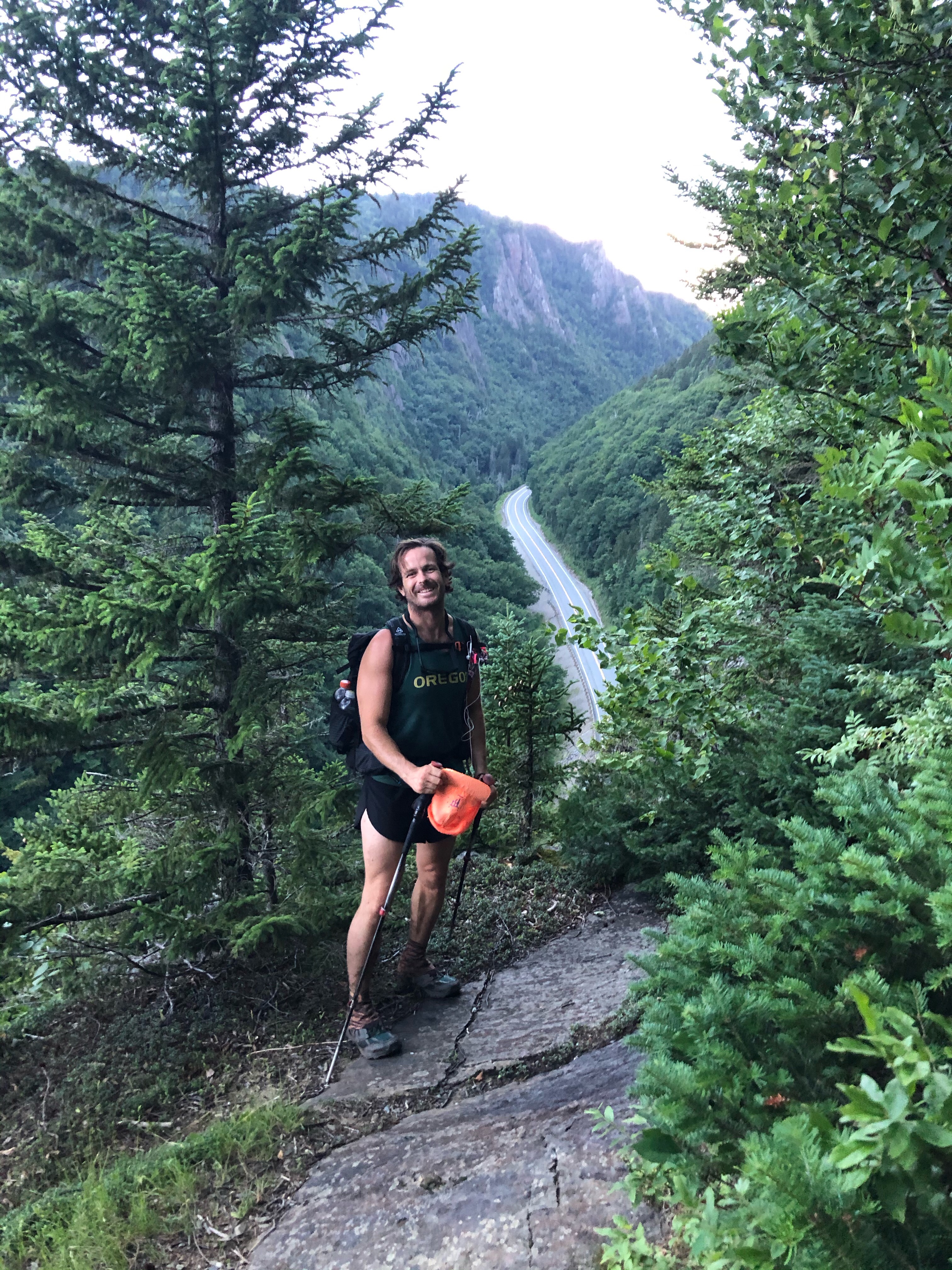
What a morning! We got sandwiches for lunch at the bottom of Asco Stagnu ski mountain and were on to our next objective: Stage 3. This was a 3 mile section that the book said should take 6 hours. It didn’t quite take us that long, sure was tough though. The first mile climbed almost 2500 feet and then we traversed a ridge and descended even further. I watched one guy fall right in front of me and crack his head, it didn’t seem so bad and he had a bunch of people around to hold his hand so we were dismissed quickly. Didn’t need to have 2 medical aids today. 

Finally made it to Carozzu which feels like the busiest and maybe the grossest campsite of the trail. We got the very last tent site down in a gully. If this were a rafting trip we’re in the groover spot. 

Day 8…6/10/25…12.8 miles…3823 ft gain…Carozzu to Calinzana…Stages 2 and 1

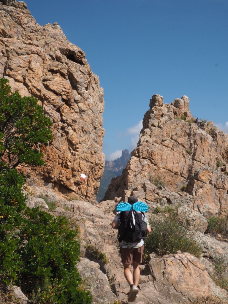
GR20 wasn’t letting us off the hook easily, Stage 2 was rugged! We slept good in our little hobbit hole then climbed out of the tent and then thousands more feet directly up a steep mountain pass. From the first pass we had to traverse along a rocky ridge with lots of little scrambles up, down, over, under and around rocks. We got to another pass and began a long and tedious descent towards refuge de l’Ortu and the end of the segment. This was basically slower than 1 mph territory. 

We had crepes for lunch at the refuge and then were on to finish this thing. Stage 1 isn’t ‘easy’ for us but if we were going south it would be way harder. It’s a massive effort because you’re basically climbing up 5000 ft in 7 miles, into the mountains from near sea level. For us it was all downhill. Still kinda tough though. There was about a mile of it that was lots of downhill scrambling, some with chains for assistance. What didn’t help was we had to keep waiting for people climbing uphill. Watching these people going uphill on their day 1 was like watching lambs going directly to the slaughter. I felt bad for these suckers, some of them just didn’t have a clue what they were in for. People kept asking us how long until the top, in French. A long way baby lamb, a long way. 

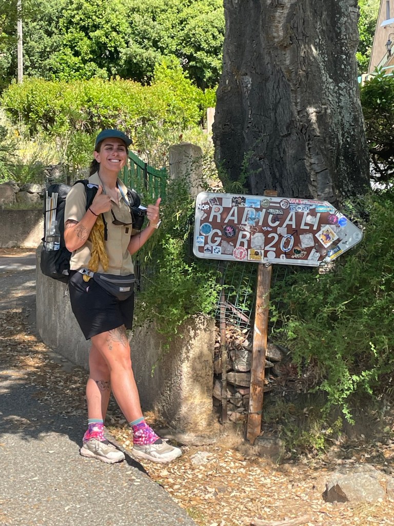
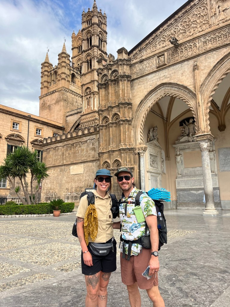
Next there was about 3 or 4 miles of dusty trail downhill to Calinzana. Other than being exposed to the hot sun it was easy walking. At the bottom we passed through a gate and into the town of Calinzana and that was that. No fanfare or nothing. We walked through the town, stopped at a little store which is basically where everyone starts from and started hitching. Quickly we got 2 rides and got into Calvi on the northwest coast of Corsica where we’re staying for the night. A well deserved nice meal, shower, laundry, and a bed. Couldn’t find any of that wild boar stew though.

Final thoughts:

The GR20 was tough! I was in good shape going into it but other than that I didn’t really know how hard it was going to be. I would say the terrain isn’t that far off from doing a high route in the U.S. Logistically it was easy to get food, but I’m not a fan of having such limited camping opportunities although I understand why this system exists. Water was easy. Swimming was excellent. Everybody showers and does laundry here daily-I’m not doing that. I take baths when I can and put on the same smelly clothes and wash them at the end like real hiker trash. Anyway I recommend this trail if you’re in for a challenge but maybe not before early June.

Thank you for reading! Make sure to go back to the first half if you haven’t already

Day 1…6/3/2…8.4 miles…3573 ft gain…Conca to Bivouac de Paleri…Stage 16

QB and I started the day at our Airbnb in Bonifacio, a true gem of the Mediterranean (from what I’ve seen of it, which isn’t much). We took two buses and got to Sainte Lucie de Porto Vecchio. From there we walked about a mile with our thumbs out and got picked up by Florence who drove us the next 3 or 4 miles to where the trail starts-basically in her backyard. 

The first mile was a stiff climb and then we were in the mountains. Granite peaks all over the place, it’s been really cool. At 3 miles in there was a series of waterfalls and pools, perfect for a dip. The rest of the walking today was challenging especially with the heat. Not the hardest thing I’ve ever done but it wasn’t cruiser. Short mileage but a fair amount of elevation gain. 

Wild camping is forbidden in Corsica. I guess if it was allowed then people would be absolutely everywhere since this trail is packed. So every night we have to camp outside of Refugios at a cost of 9€ pp. It’s double if you haven’t reserved it ahead of time and more if you want a bunk inside. We can’t just go as far as we want and throw down a tent wherever, Because of all that we scheduled an 8 day hike and today is a predetermined short first day.

The adjustment to this style of hiking will take some getting used to. For instance, everybody here is showering and maybe even washing their clothes? Seems odd to me. 

Day 2…6/4/25…19.2 miles…7,995 ft gain…Paleri to Usciolu…Stages 15, 14, 13

Got an early start today and we’re walking before 6. We had to cover a few miles just to get to the end of stage 16. The GR20 is broken up into 16 stages and is designed to be done in 16 days. We’re attempting to do it in 8 days which we thought beforehand would be reasonable. And most people do it north to south, we’re walking south to north and the guidebook and most info is based on hikers walking south. So everything is in reverse therefore stage 16 is stage 1 for us. Since yesterday was a short day, today and is gonna be a fair amount beefier. Anyway, we walked into Bavela around 8am, the real end of the first stage and took a quick break. We picked up a couple ham and cheese baguettes here to eat for dinner tonight.

From Bavela we opted for the alpine variant for stage 15, a spicier line than the regular trail that goes out and around. This variant brought us way up into some really cool mountains. It was steep up and down, even descending with built in chains at one point, but nothing too airy. Just before we got to the end of stage 15, I took a dip in a river so I got my “shower” out of the way early. 

We ate a few snacks at refuge d’Asinau then began a rigorous climb up Monte Incudine. It was seriously difficult, has me doubting a bit if we can complete this thing in the time we gave ourselves, especially since everyone is warning us the north is supposed to be more difficult. After the peak we had some cruiser downhill and then some pleasant miles through something of a plateau. I spooked a wild boar, never seen one before. I know they’re out here because wild boar stew is a famous Corsican dish but not sure how rare they are-I’ll let you know in a few days. 

I thought we were home free this evening but the last 3 miles were along a spine of a few mountains, nothing too crazy just slow going. Got into refuge d’Usciolu just before 7 and wolfed down our sandwiches. We hiked for 13 hours today and covered only 19 miles. That included stages 13,14, and 15, as well as finishing stage 16. The footing is difficult and there was some serious elevation gain which I don’t think is out of the ordinary. Definitely feeling like maybe we bit off more than we can chew. We’ll see. They say it’s the most difficult trail in Europe and so far I believe it.

Day 3…6/5/25…19.4 miles…5,314 ft gain…Usciolu to Capanelle…Stages 12 and 11

Ran into our first Americans today(besides each other) a father and 2 sons from Tennessee who have previously hiked the AT. This trail is crowded and it seems like everyone is speaking French. The language barrier is more challenging than I anticipated, I mean most people can speak some English after you ask them but my French is abysmal. Working on it. Mastered “merci” and “bonjour.”

The walking today was chiller than yesterday. Stage 12 started uphill and then was slow going as we walked back and forth between mountain peaks along a ridge. After a few hours we dropped down and it was more mellow. We stopped at Col de Verde for lunch. I asked for 3 ham and cheese sandwiches, 1 to split now and 1 each for tonight. Then I asked the waitress for 2 of them to go. Now these aren’t your typical ham and cheese sandwiches, they’re aged cheese and cured meat on foot long baguettes, plus butter. Absolutely delicious. She brought me 5 of these things. Sadly I had to send 2 back after we cleared up the confusion. 

This afternoon the trail was really chill. Actually had 2 perfect swimming holes and I couldn’t help myself and swam twice. Never showering again. We got in to Capanelle at the base of a ski mountain and paid 20€ to tent here. Then we ate our sandwiches. 

Day 4…6/6/25…17 miles…5000 ft gain…Capanelle to l’Onda…stages 9 and 8

Did stages 10 and 9 today. 10 was cruiser, nice trail brought us mostly downhill all the way to the town of Vizzavona. This place is basically the split between the north and the south sections of trail. There’s a train station here so you can access the start of either side, or you can bail. For the sake of splitting this blog post into 2 North and South, I’ll include stage 9 in the South although it’s technically part of the North.

They have a couple restaurants in Vizzavona but we got here around 10 and they don’t start serving food until 12. Like, doesn’t anyone around here know how to make a euro? Instead we bought all the makings for ham and cheese baguettes at a little shop and picked up a few snacks for the rest of the day. 

The walk out of Vizzavona brought us along a river for awhile with some dope waterfalls! And there was a bunch of emerald pools below them perfect for swimming. Four days in a row now, still starting to smell a little funny though. After our swim we climbed steeply up onto a ridge and then down the other side. Most of our elevation gain was in the last few miles today and they were slow going. 

We got to refuge de l’Onda and set up our tent among a million others like we were at Woodstock ‘99. I took a little bird bath and scrubbed my Hawaiian shirt with some dish soap. QB cooked up the hiker trash special, ramen and rice. 

Thanks for reading! Stay tuned for the next post to read if we made it through the north or not…

This route is an ancient pilgrimage across Sicily, from Palermo south to Agrigento. It’s 130 miles give or take(I don’t care what the guide book says) and we did it over the course of five days. I walked with my hiking partner/wife, QB/Sara. The route basically goes from cathedral to cathedral and stopping at churches along the way is encouraged? Neither one of us is all that religious but nobody checks so we’re good to go. It’s both of our first “Camino” style walk. Anyway, here’s my account of the MVF.

Day 1…..5/23/25…..20.3 miles

Palermo to Santa Cristina Gela 

Last night Sara and I flew from Porto, Portugal to Palermo, Italy. From the airport we took a shared taxi 45 mins for 8€ pp. The owner of the AirB+B tried to tell us that at 8:30 pm you won’t be able to get public transportation and she would send us a private car for 55€. I don’t think so lady; there were plenty of buses, cabs, and trains. 

Our AirB+B was less than a mile from the Cathedral where this whole thing starts but first we had to run one little errand which added a couple miles. We went to the Casa D’Amici hostel where they have the passports. This is my first Camino so I didn’t know this. You take your passport with you to the different cathedrals along the route and they stamp it-you know, for proof.

At the Cathedral of Palermo we toured the ancient building from the 1100’s and went to get the MVF guidebook. The Liberia Paoline Bookstore across from the Cathedral is the only place that has it. Just go in there and tell one of the nuns what you’re up to and she’ll help you out. 

Now we were on our way. First of all, almost all pavement all day. It was a few miles of walking through the city of Palermo, it wasn’t pretty, and then we started to climb. We walked into Monreale and did a lap around  town before getting our passports stamped in a massive cathedral. 

From Monreale we followed busy roads down and then back up to Altofonte where we got lunch and met 5 other pilgrims or pellegrinos. I guess we’re in the bubble. I would say QB and I are doing this route more of a cultural experience since neither one of us is religious so I’m not super comfortable calling myself a pilgrim. Pellegrino is cool though, I like that. Dish of delicious lasagna for lunch, I like that too. Then we assaulted some stairs and walked roads the rest of the day into Santa Cristina Gela.

SCG is a little town. We rented a room for the night from this woman Sylvana for 50€. You really can’t wild camp in Sicily so I guess we’re renting rooms every night? We’ll see. So far it’s quite luxurious opposed to thru hiking. Dinner was bruschetta and heart shaped pistachio raviolis. 

Day 2…..5/24/25…..31.3 miles 

Santa Cristina Gela to Prizzi 

We dropped the keys off to Franco at the bakery and grabbed a couple pastries for breakfast. The beginning of the day brought us up out of town on some trails with views of Lake Piana. We then dropped down on an overgrown trail that had some tall hay or wildflowers or just general vegetation. Whatever it is, I’m allergic to this stuff and it was all over my arms and legs. I was covered in hives and itchy so I took a Benadryl and survived. As of now anyway. 

The route passes through the tiny town of Tagliavia where we stopped to check out the church and get our passports stamped and enjoy a quick espresso. South of Tagliavia, there was a little detour to Gole da Drago that I really wanted to see so we went out and back about a mile each way to see this series of waterfalls. They were cool, if not a bit tricky to find, and were helpful washing some of that stuff off my arms and legs. 

Next up, Corleone, of “The Godfather” fame. It seemed pretty quiet there this afternoon and the churches are closed on Saturday so we got our passports stamped at a local pizzeria instead. After splitting a pizza with anchovies, QB and I were on our way. *a bird shit on me in Corleone. QB had a bird shit on her in Lisbon last week so I guess we’re even. 

Because you can’t camp along this trail and can really only stay in town you can’t really fly by the seat of your pants. Most pellegrinos walk from SCG to Corleone and stop for the night. Since we only gave ourselves five days total we have to push another 12 miles or so to Prizzi. Typical. 

The rest of the afternoon was rolling Sicilian countryside to the town of Prizzi up high on a hill. We stayed at a hostel here where we met 2 other Pelegrinos, Daniel and Stella from southern Italy. Dinner was rigatoni licorice and spaghetti carbonara and ate at a nearby Trattoria. 

Day 3……5/25/25…..25.2 miles 

Prizzi to San Giovanni Gemini 

Tip-toed out of the hostel this morning so not to wake our Italian friends who were still sleeping. On our way out of town grabbed some ricotta filled pastries for our morning walk. 

Another beautiful day in Sicily. The path this morning was mostly dirt roads that brought us into a couple different forests, which we haven’t seen too much of out here. We caught up to an Australian couple Bob and Faye, veterans of Caminos all over Europe. They walked into Castronova de Sicilia with us and we found a spot for lunch that was open on Sunday. Pizza/calzone/rice balls or arancini if you were wondering. Castronovo is a delightful looking town carved right into the side of a mountain. 

QB(or Regina B in Italian) and I walked another 8 or 9 miles this afternoon into San Giovanni Gemini. It’s hard to tell specifically how far everything is until it’s done. The trail is well marked, however it’s in kilometers and even though the conversion to miles is no sweat, all the signs seem to be a bit off, as well as the guidebook. Anyway the walking was chill. There were some caves that are cool and Regina B stepped on a green snake, supposedly. According to her it slithered away unharmed.

We rented a room for the night in San Giovanni Gemini. It’s directly next to the town of Cammarata, high up on a mountain and a bit of a busier place than we’ve been used to. On the way back from dinner (pizza/panini’s/gelato)  we saw a ton of young people walking around wearing the same leather jacket. I felt like there was a flash mob or something-it was very strange.

Day 4…..5/26/25…..27.3 miles 

San Giovanni Gemini to Racalmuto 

Hot one today! Blue skies and sunny. We got pastries at a bakery on the way out of town, pretty much our standard breakfast. Today we passed through towns about every five miles.

First was Acquaviva Platani, we met Senor Federico there and he told us about his 11 years in England and how he made enough money to build 3 houses in Sicily. He sent us on our way to Sutera where the ridge walking into town was one of the highlights of the trail for me. Sutera is this town built around a mountain sticking right out of the middle of it-I’ve never been to any place like it. We ate some baked ziti there for lunch and moved on. 

As we were walking through Campofranco, Rosetta pulled us into her house. She and her husband Antonio filled our water bottles and stamped passports. (The people in Sicily have been wicked nice, always welcoming us and beeping and waving.) A few miles later we had to ford a knee deep river, not something I expected. We then crossed paths with multiple shepherds with their flocks and sheep dogs. These things are built to take down wolves. All they did was bark a little at us. We also got eyes on Mt. Etna today, far to the east, looks like it’s erupting. 

Tonight we’re staying in Racalmulto. Got ourselves a nice room with a balcony and everything. Like I mentioned earlier, luxurious living for thruhikers. Pizza with sardines for dinner. 

Day 5…..5/27/25…..26.2 miles

Racalmuto to Agrigento

Finito. Did the damn thing. It was another hot one out there today. I don’t think we realized how lucky we were the first three days that we had decent cloud cover, because today and yesterday were hot! With limited shade. Felt like the Mojave out there. 

This morning our walk was uneventful until the trail was so overgrown that I couldn’t see my feet and suddenly fell in a hole up to my chest. WTF MVF? Lucky I didn’t get hurt. Besides that it was a lot of pavement and a handful of towns. The best part of the walking today brought us up on a ridge where we could see the Mediterranean Sea to the south. 

In Joppolo Giancaxio I got a sausage and onion sub for lunch. I’m telling you, it was so good. Sara got a chicken sandwich and I just know she had food envy when she tried some of mine. 

The last ten miles into Agrigento weren’t my favorite. We aimed for Cattedrale San Gerlando which we could see high up in the city on a hill. The destination of this whole pilgrimage. Overall I enjoyed this route and I definitely like Sicily. Walking into Agrigento was just kinda beat. We got to the church and they sent us around the corner to a museum to get our final stamp and ticket to tour the church. It was about to close for the day so we’ll go check it out tomorrow and celebrate with a victory pizza instead. Or pasta. 

Day 1…..24 miles…..Near Scott Pass, OR

The 3 Sisters are three beefy volcanos lined up north to south within the Oregon Cascades. The loop we are hiking is roughly 45 miles with then another 10 or so to summit South Sister and back.
Yesterday afternoon we climbed the ski mountain Mt. Bachelor just south of the Sisters then slept in the car not far from the trailhead. We started this morning from the Devil’s Lake trailhead on the South Sister approach trail. This was a good climb for about a mile and a half until it intersects with the Moraine Lake Trail. We followed this for 3 miles until joining the good ol’ PCT. 

Going clockwise the next 20 miles was smooth sailing on the PCT. I didn’t think I remembered this section but as I was hiking it all became very real, I could recall people I met and conversations I had while walking this section of trail 5 years ago. Today we passed through the Obsidian Creek area which is very cool but does require some red tape. You’re supposed to get a permit to
walk through at $3 pp. I didn’t remember doing this at all in ’15 but then Sara reminded me the PCT covered all these little permits. Anyway there’s some cool waterfalls, an excellent spring, and lots and lots of pieces of obsidian everywhere. Sara explained to me how obsidian is formed and if I listened more carefully I could relay that information to you. It’s basically when volcanic rock cools super quickly it becomes smooth and glass like, I think. Sure does look cool. We walked another 5-6 miles, passed through some lava fields, had great views of not only the Sisters but the other Cascades to the north and then turned off the PCT onto Scott Pass Trail and found a campsite shortly afterwards. Day 2…..22 miles…..near Moraine Lake


Very shortly after breaking camp the trail led us into a huge burn. Good thing we camped when we did, neither of us like to sleep in a burn when there’s a million dead trees hanging around waiting for a stiff breeze
to knock them over. The burn lasted about 10-12 miles and the last 2 miles or so  we had a bunch of blow downs to navigate around. It wasn’t all that pretty. The rest of the day was nice though. We started on Scott Pass trail and soon took a right on Green Lakes Trail which we’d be on most of the day keeping North, Middle, and then South Sister on our right. Near the end of the day we took another right turn to get back onto Moraine Lake Trail which we had started on. 
For most of the day we thought we’d have a shot at summitting South Sister this afternoon but we ended up taking our time. Instead we swam in a couple beautiful mountain lakes opposed to crushing all day and hoping we had enough daylight. We found a campsite just past Moraine Lake off the trail up South Sister very close to where we started yesterday morning. The plan is to summit in the morning then make our way back down to Devil’s Lake Trailhead. 

Day 3…..10 miles…..car


In order to go light on our climb this morning we left our tent set up and our sleeping bags inside then crossed our fingers and hoped nobody would mess with our stuff. Nobody did. From where we slept it was 4 miles to the summit with something like 3500 feet or gain. The first 3 miles were a solid climb with relatively easy to follow trail until we gained the ridge. The ridge itself, if you didn’t know any better, may have appeared to be the top of the mountain. It wasn’t. From there you could see up another another 1200+ feet to the summit of the volcano. Looking up there was a massive glacier to the right and a gigantic slope of red sand to the left. There appeared to be a very thin steep trail dissecting these two sections of the mountain and then the trail cut left across the steep red sand slope. It was actually
quite steep but nothing crazy.

We had small switchbacks all the way up until it cut left and it was much wider than it originally appeared. Once we crossed the red sand we reached the caldera and easily walked around the frozen lake inside of it to the summit of South Sister at 10,363 feet. From the top we had incredible views in every direction especially to the north where we could see the Cascades in a line all the way up to Mt. St. Helens. There was hardly any wind, not a cloud in the sky, and the smoke from nearby wildfires didn’t seem that bad. A beautiful day. On our way down we passed a million people so it seemed we beat the rush. There was even a wedding party climbing to the top where the couple was to be married on the summit. We gathered our gear that was untouched and walked two more miles back to the car. We drove half an hour to Bend with the gaslight on, ate burritos in town and bathed in the Deschutes River. 
This loop was pretty cool. A nice little backpacking trip. 

Undoubtedly the highlight was climbing South Sister. I remember when I hiked the PCT I heard some guys went and did this and it seemed like a fun side trip. Probably have to do it again next time I thru hike. 

Thanks for reading! To see more pics check out our instas: @endlesspsummer @sarahikes and feel free to follow this blog of course

Sent from my iPhone

8/12/20…..10 miles…..Edna Lake

*Note that I dropped my phone in the ocean since we returned from our honeymoon so I lost a lot of pictures. The ones you see in this post are probably from Sara’s camera or ones I have recovered from text messages. This is why there aren’t as many shots of my beautiful bride as there should be. 

I don’t know if this hike has an official name but Sara came up with a 45 mile hike in the Sawtooths and we’re 11 days into our honeymoon so the Sawtooth Honeymoon Loop is what we’re going with. It’s not really a loop though, more of a figure 8 and even more than that the route is shaped like a barbell or a pair of eyeglasses. It’s 2 roughly 20 mile loops connected by a section of trail about 2 miles long that we’ll do twice. If this is how you actually draw the number 8, you’re doing it wrong. I may also refer to it as the ‘honeymoon barbell.’ Ok, I’m getting way off track here.

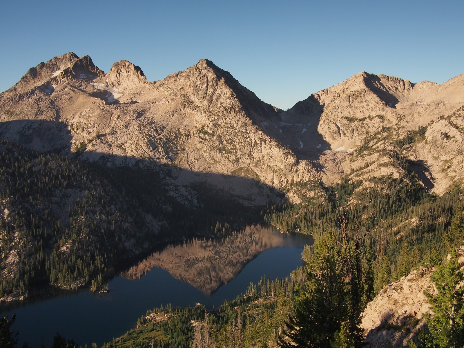
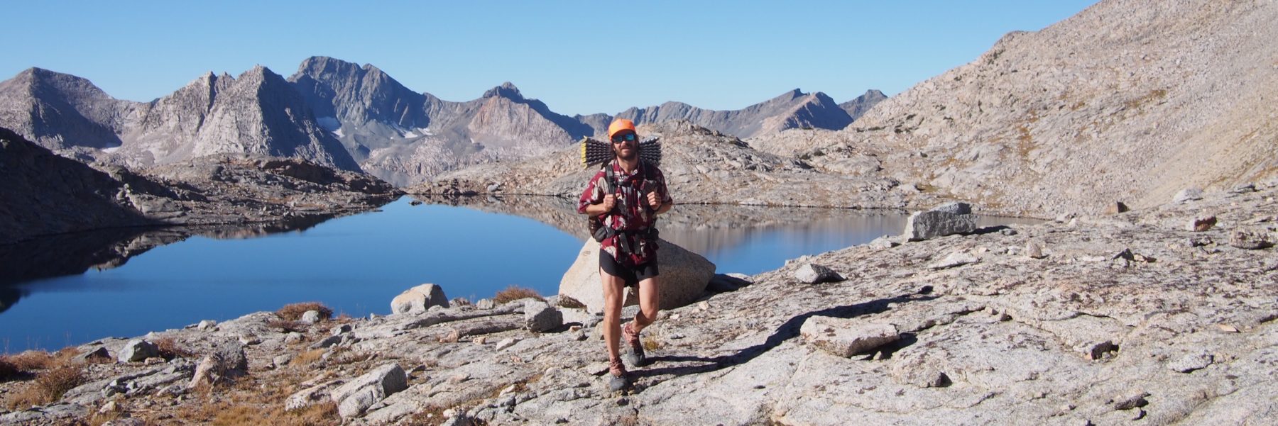
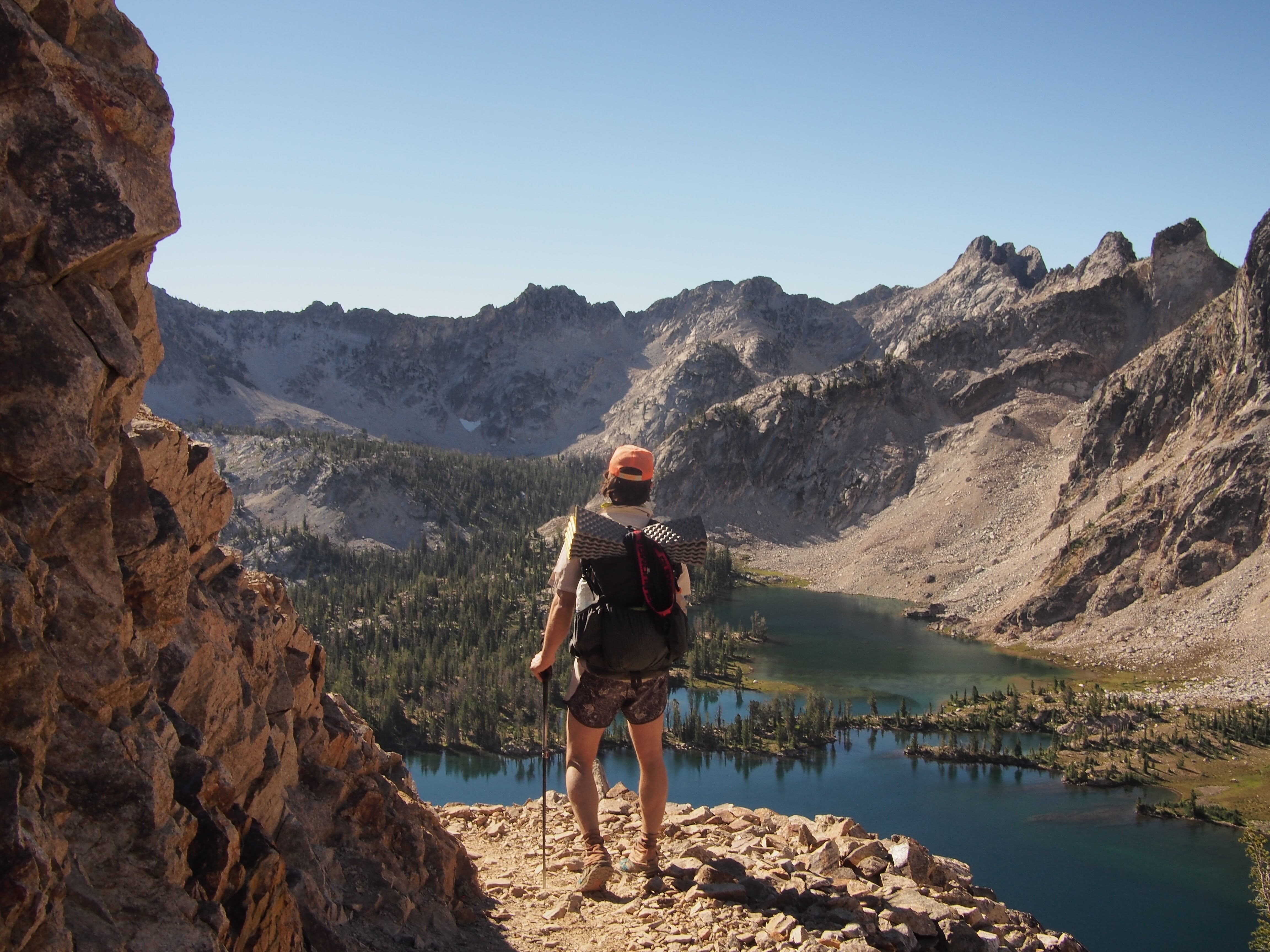
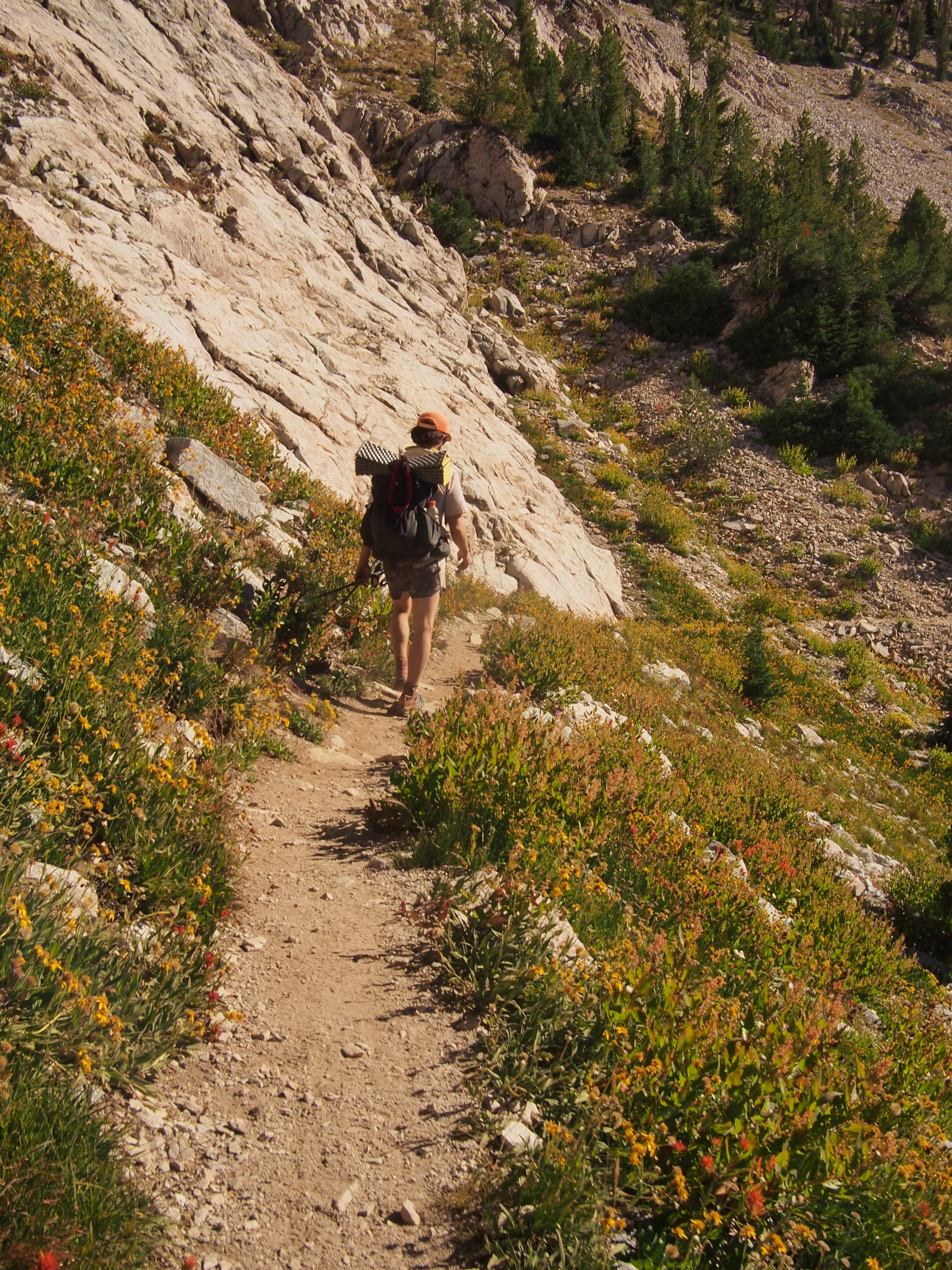
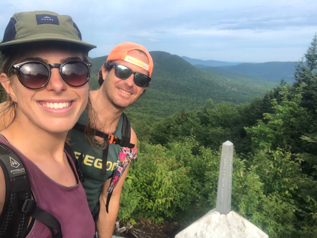
If you’re still reading let me give you a little background. We’ve been driving west across the U.S. for the past week and half hiking, running, catching up with friends, checking out new places, and sleeping in the back of our Subaru while trying to tip toe delicately through the country in the time of COVID. Today we woke up in our friends Tami and Kasey’s driveway in Boise and drove a few hours to the Sawtooth Mountains in Central Idaho. I’ve been meaning to explore these mountains since I first hitchhiked through the state 5 years ago. Sara’s never been here either so this place is brand new to both of us. From the Tin Cup Trailhead outside the town of Stanley we walked about 10 miles into some amazing scenery. The trail is well graded and the walking was simple. Since the trail wasn’t too strenuous we took our time stopping to drink out of ice cold springs and taking in the views. Right away there were mountain lakes, then waterfalls, and jagged peaks like the teeth of a saw(hence the name). We started the first loop going counter clockwise, climbed up to Sand Mountain Pass then down to the intersection of the second loop. For the second loop we’re going clockwise and camped at the first lake we came to; Edna Lake. We got a sweet spot on a little peninsula and the tent is tucked in between some big rocks and pine trees. The lake is bright blue, clear, and cold. Just the way I like it and perfect for an evening swim. Supposedly there will be a meteor shower tonight, ‘the Perseids,’ so fingers-crossed the sky is clear and we stay awake for a few shooters. 
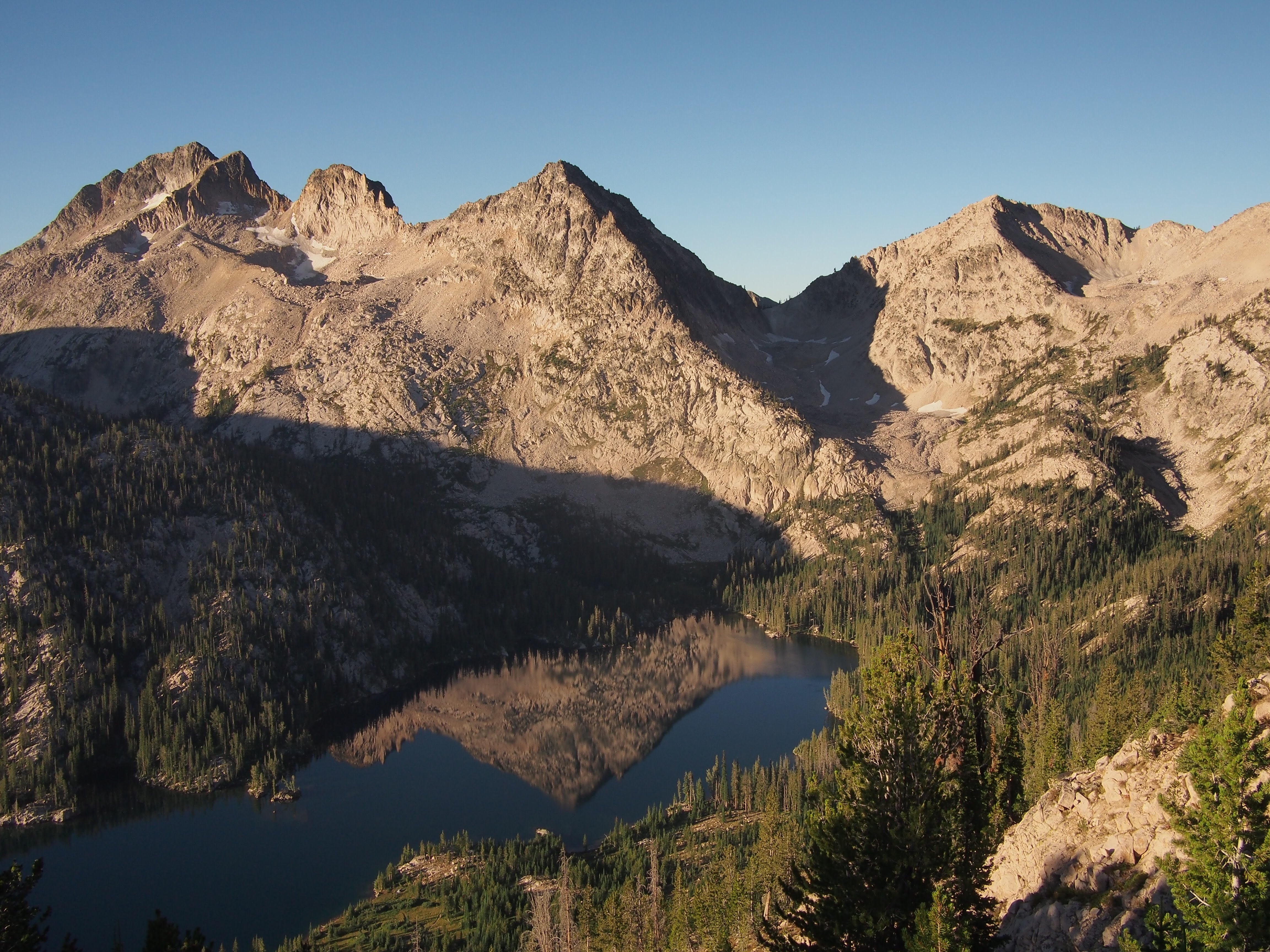
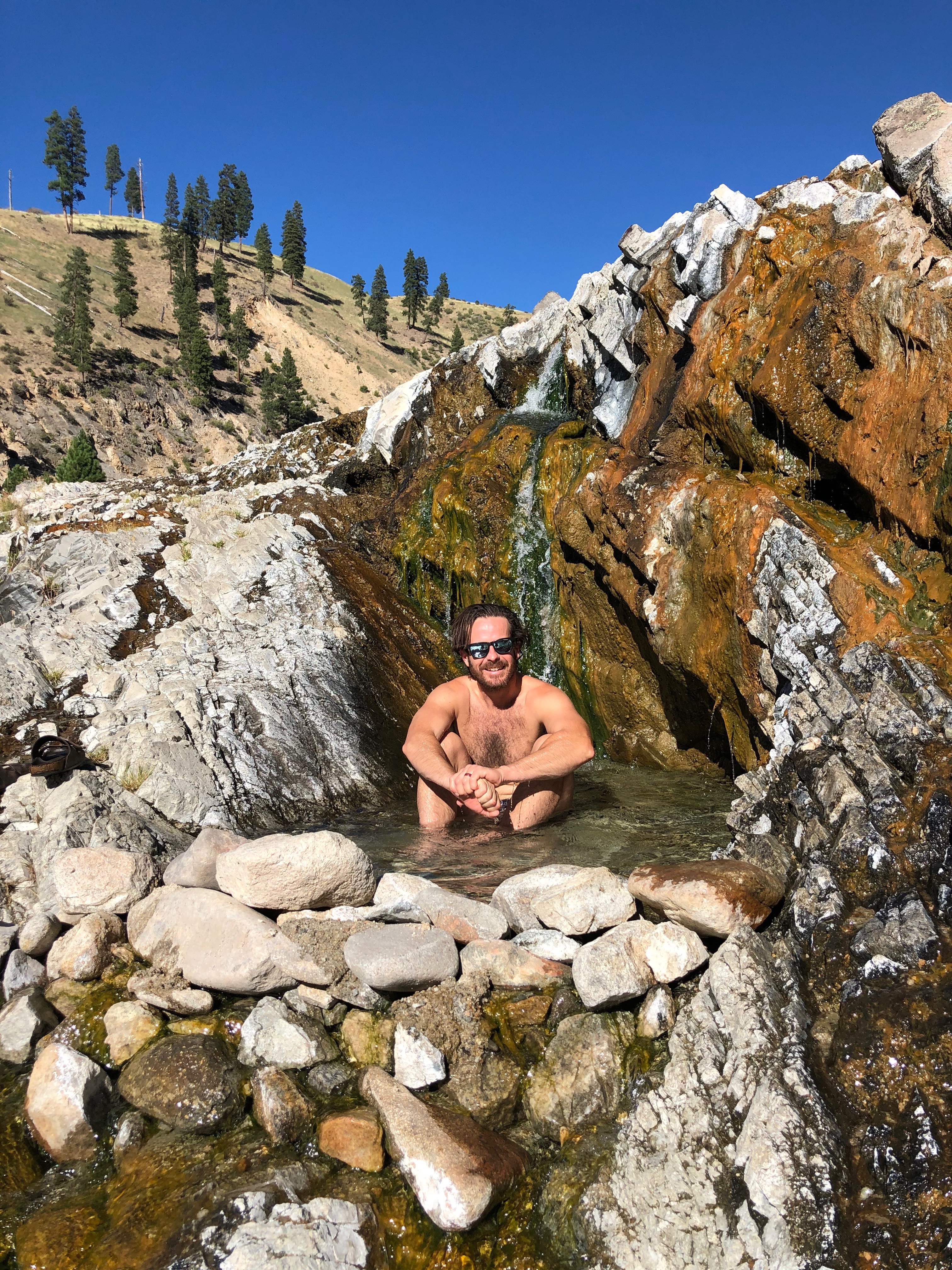
8/13/20…..20 miles…..Edna Lake, again

Last night it was overcast as we went to sleep but when my bladder woke me up at 3am the meteor shower was in full effect. I woke Sara up and we enjoyed a nice middle of the night stargazing session. This morning we slept in and didn’t get moving until after 8am. Walking clockwise around the second loop we passed alpine lake after alpine lake, it was rad. Halfway around the second loop we took a spur trail up a short but steep pass to Everly Lake, a pristine mountain lake and a perfect spot for lunch and a cold swim. From Everly lake we returned down the pass to the loop and walked all the way around and back to Edna Lake. The second half of the day the trail was more forested so it didn’t have quite as many views as this morning, still cool though. When we passed Benedict Creek it provided a short little natural water slide in the rocks, so I slid down that half a dozen times. We liked our campsite from last night so much that when we reached the junction to return to the other loop we kept walking the short distance back to Edna Lake. Our site was already taken but we found another one nearby and I went for my third swim of the day. Sara only had 1.5 swims today because I guess we have different standards for what counts as ‘swimming.’

8/14/20…..15 miles…..Oregon Rest Stop

First thing this morning we backtracked just a little bit from our campsite to the junction that would lead us back to the first loop or other side of the barbell. We climbed up to Sand Mountain Pass then down to the other loop that we followed counter clockwise. After passing Toxaway Lake we climbed another pass(it’s either unnamed or I can’t remember it) then dropped down to Twin Lakes and Alice Lake.  

At some point after Alice Lake a pair of hikers stopped us and recognized us from our adventure last year. Mold had picked us up hitchhiking a year ago about 30 minutes outside Hanksville, Utah while we were hiking the Hayduke. He and his wife Mildew(trail names) were up in the Sawtooths from Salt Lake and were on their way to climb a peak. Both thruhikers, they didn’t seem super surprised at this strange coincidence.

We walked another handful of miles and went for a nice swim in Pettit Lake just before reaching our car. From the Tin Cup trailhead we drove through the town of Stanley then stopped for a few hours at Kirkham Hot Springs. Both thumbs all the way up for these springs, lots of pools and some rocks you could jump off and then float down a rapid in the South Fork of the Payette. In a couple days we’re planning to run around Mount St Helen’s in Washington so after leaving the hot springs we drove west out of the mountains and eventually crossed into Oregon. Tonight we’re sleeping in the car at the Weatherby Rest Area on I-84. So far so good for a rest area. I think the Sawtooths are incredible. This small sampling of these mountains provided lots of impressive views, big jagged mountains, cold clear waters, and well maintained trail. I’ll definitely be back. If you’re planning on coming out here keep in mind that the first loop, known as the Alice Lakes Loop, is quite popular and for good reason. The second loop was also incredible but had far less people out there and felt much more secluded, and if you’re out this way don’t skip Everly Lake, it’s well worth a little extra walking. Kirkham Hot Springs

Feel free to follow this blog or find me on Instagram for more pictures @endlesspsummer

Day 1…..28 miles…..Cherry Mountain Trailhead

The Cohos(pronounced co-os like the way you would say co-op) Trail is a 165 mile footpath through northern New Hampshire. The southern terminus is at the Davis Path trailhead in Crawford Notch and it stretches to the Canadian Border in the North. We’ll be hiking from south to north. 
Yesterday Sara and I finished Vermont’s Long Trail, drove my car back to Smuggler’s Notch to pick up her car, then drove both cars to the tippity top of NH and dropped her car off by Third Connecticut Lake. From there we drove south to Crawford Notch and spent the night sleeping in my car before setting off in the morning. Along the drive we cached food about halfway in Stark, NH off rt 110 where we hid bear canisters in the woods stuffed with 3 days worth of ramen and Mike and Ike’s. Living in Massachusetts I have always felt that New Hampshire pretty much ends at the White Mountains. Boy was I mistaken. There’s so much more up here in The Great North Woods, as they call it and I’m about to find that out.
This morning we rolled out of the Subaru, crossed Bemis Bridge and climbed up Davis Path towards Stairs Mountain. The Cohos Trail goes up and over Mt. Isolation then drops way down to the Dry River. Actually not dry, we crossed it in knee deep water. From there we climbed up over the Presidential Ridge near Eisenhower, took a left on the AT and followed that for a quarter mile then dropped steeply down Edmonds Trail. We finally had some easier walking on snowmobile trails once we got to the bottom. After passing the Mt. Washington Hotel monstrosity we went west on 302 for a bit. 
For dinner we grabbed gas station sandwiches and walked another mile before looking for a place to camp. The Cohos Trail runs along Old Cherry Mountain Road which has ‘primitive’ camping but everything was taken. These are sites carved into the woods with no toilets or electrical hookup. There were cars in every single one of them. Besides the primitive spots, the woods are so thick with brush it’s next to impossible to find a spot for the tent. We walked a bit longer than we would have liked to but finally found a spot in the woods right across from the trailhead up Old Cherry Mountain. A pleasant and productive first day on the Cohos Trail. 
Day 2…..25 Miles…..Mt Weeks Summit
Yesterday I forgot to dry out my sleeping bag. We got rained on at some point, my bag got wet and I forgot all about it until we set up camp. Sara and I made due with 1 sleeping bag for the night. Fortunately it wasn’t that cold out and we were both exhausted and able to sleep. From our spot next to the trailhead we walked up and over Mounts Martha and Owls Head(the other NH Owls Head). Finally seeing some Cohos Trail signs and yellow blazes we followed these down through a series of snowmobile and rail trails around Pondicherry wildlife sanctuary before doing a decent road walk on 115A. Before starting the road walk I think I saw a bear. I can’t confirm it, it was either a bear or bigfoot, but I think it was a bear.
At the junction of 115A and Rt 2 there’s a country store attached to an Irving gas station. This place has massive subs, both thumbs up, and good pizza. We took our time eating lunch, went back in to pick up a few things for a 1 day resupply then sat on the porch doing some housekeeping; organizing food and cleaning our feet and stuff. We had been there for about an hour and as I looked over towards the gas station I thought I saw my cousin’s husband pumping gas. As I walked over to get a better look, my cousin Kate walked out of the store! Kate, John, and their daughter Mila were up here on vacation and were coming from Santa’s Village. And it was Kate’s birthday! What a treat. I know we’re only 3 hours from the North Shore of Boston and to see someone from home isn’t outside the realm of possibility but at one of the only places we’ll stop this whole trail, and a first cousin, that was quite a coincidence. 
After an unexpected visit with family Sara and I walked up the Starr King Trail towards Kilkenny Ridge. A few miles later my back started burning like a son of a gun. It felt like somebody was simultaneously pulling out every single one of my back hairs. I took my shirt off and Sara wiped my back off, gave me an examination, and a diagnosis: heat rash. Neither one of us knew the cure. For the rest of the day I adjusted my pack so it wasn’t directly on my back and it seemed to help a little. We rolled along Kilkenny Ridge summitting Waumbek and a few smaller peaks before setting up on top of Mt. Weeks. My back seemed to get better for now which is a big relief. 
Day 3…..27 miles…..Percy tent site
This morning we continued on the Kilkenny Ridge Trail slowly for another 15 miles. We went up and down a few smaller peaks and topped out for the day at Mt. Cabot, the northernmost 4000 footer in New Hampshire. On the way up Cabot we met a pair of southbound Cohos Trail thru hikers, Goliath and Handsome Dan. Long distance hikers, if we didn’t know the same people we knew the same trails and traded info with them on stuff coming up.
Eventually, after what seemed like forever, we got off the Kilkenny Ridge trail and found ourselves at South Pond. This pond is at the northernmost part of the White Mountain National Forest. There’s a beach here and a swimming area. While the other beach goers did their thing Sara and I took baths washing off a few days worth of bug spray and B.O. It was extremely refreshing. 
Leaving the pond we had a few miles of road walking, crossing rt 110 then the Upper Ammonoosuc River and entered Nash Stream Forest. We located our hidden bear canisters with our untouched 3 day resupply in them and took a few minutes to organize our food. I think we have now entered the Great North Woods and virtually everything up here is uncharted terrain for me. I’m very familiar with WMNF but I’ve only been hiking north of Cabot once, it’s all brand new to me. Sara and I walked another 6 miles with the last 2 being extra grueling and got to camp at the Percy tent site. 
Amazingly today my heat rash on my back all but vanished. I did my best to keep my pack off my back and the weight of it more on my hips but other than that I didn’t do much to cure it. Had it been as bad as yesterday I would have considered getting off trail at rt 110 and figuring out how to get back to my car. 
Day 4…..29 miles…..Panorama Shelter
Today started off innocently enough. A nice 4 mile downhill to a waterfall with an excellent swimming hole. A cool dip was a perfect way to start the day. 
For the rest of the day we just walked. Here and there we find ourselves on decent trail for a few miles but I’ve noticed much of this trail is a conglomeration of snowmobile trails, road walks, atv or jeep roads, rail trails, and old logging roads. I don’t hate it, I’m enjoying myself, but it hasn’t been super scenic and the trail at times is just ok.
This afternoon we walked through the Balsams Ski Resort. I thought someone was supposed to build a big resort up here but this place looks like a thing of the past. There sure was a huge hotel in the distance though. We dropped way down to Dixville Notch, crossed rt 26, then climbed way up on the north side. Dixville Notch is a highlight of the trail (also the place where the first presidential ballots are cast every 4 years). There’s cascading waterfalls and great views from steep jagged cliffs on both sides. Sara and I had planned to camp once we got up the north side but there was nothing even close to suitable. Another thing about this trail, camping options are very limited. We had to crank out another 3 miles at sunset to Panorama shelter and got in just before the rain started. 
Day 5…..30 miles…..Pittsburg, NH 
All night it rained absolute buckets. Sleeping in the shelter the sound of the rain was amplified by the tin roof making it even scarier or more soothing. We were very lucky to push on last night. Had we set up it most likely would have been in an uneven campsite probably right in middle of the trail somehow and we would have got soaked. 
Although the rain had stopped this morning we still got soaked through splashing in puddles, mud, and walking through wet ferns. The trail turned to road after half a dozen miles and the skies opened up on us. We walked through an empty Colebrook State Park and then had a series of road walks for most of the day. Our goal today was Young’s Store in Pittsburg, 30 miles from Panorama Shelter. It was ambitious especially since it closed at 7pm but with about 20 of those miles on road or ATV road(this area is a hotbed for ATV and snowmobile enthusiasts) I felt pretty confident we’d get there. Since we were a bit ahead of schedule we both had enough food to only be a little bit hungry before finishing the trail tomorrow. By the afternoon we had moved fast enough that we had time for a nice lunch and quick swim in Lake Francis. 
We got to Young’s Store by quarter to 6, got subs, macaroni salad, ice cream and a little bit of food to supplement our bags for tomorrow. There’s cabins for rent across the street so we decided to rent one for two nights. This way we can slack pack the last 25 miles to the border then drive Sara’s car back here and totally relax for a night. 
Day 6…..25 miles…..Canada
Today’s hiking wasn’t great. Sara and I were both glad to be finishing up the trail but the miles today just didn’t have much going for them. It poured again overnight which didn’t help and when we got going at 6am it was already warm. The cloud we were walking through felt like a steam room and the overgrown snowmobile trails were muddier than usual. 
We spent all day within the town of Pittsburg, the largest town by area in New England. The trail parallels rt 3 and took us by 1st, 2nd, 3rd, and 4th Connecticut Lakes. These lakes are the headwaters of the Connecticut River that becomes the NH/VT border and flows all the way to Long Island Sound. Once we reached the Canadian Border the Cohos Trail takes a left for nearly a mile up through the clear cut which is the actual border. Don’t write off this last mile as easy clear cut walking. It’s anything but. After climbing about 500 feet the trail comes to 4th Connecticut Lake and does a small loop before returning to the clear cut then the dastardly mile back to the road. When we got back to the road we walked past the border patrol office then a mile south into the USA where we left Sara’s car by 3rd Connecticut Lake. We jumped in the water and washed off all our sins. Tonight we’re staying again at the Mountain View Cabins in Pittsburg. So rewarding and comfortable! 
Overall Sara and I had a good time out there. We beat the bag out of the trail and had fun. It was difficult but we kind of did that to ourselves. Had we slowed down and taken another day or two it probably would have seemed significantly easier. The weather however, didn’t make me want to stick around too long. I probably wouldn’t hike this trail again but like I said it may have been more enjoyable if we took a bit longer. Also just like the Long Trail, the time of year to hike probably isn’t the dead of summer. One other thing, it might be better to hike this trail south as it gets more mountainous in the south.

For more pictures feel free to follow my insta @endlesspsummer

7/19/20…..10.5 miles…..Bear Hollow

This will be my last installment of Vermont’s Long Trail. From Smuggler’s Notch(rt 108) to the Canadian border is my fourth and final section. 

If you’re confused reading these posts, note that I haven’t done the Long Trail in order. In 2015 I hiked the southern most section from Massachusetts to Sherburne Gap, then again while thru hiking the AT in ‘16 I repeated that section. In ‘18 Sara and I hiked from Lincoln Gap to Smuggler’s Notch and in ‘19 we hiked from Sherburne Gap to Lincoln Gap. 

Due to Covid-19 Sara and I figured hitching would be potentially unsafe and more of a pain in the ass than usual so we drove two cars, dropping one at Journey’s End road in Jay, VT then drove the other south to start our hike from rt 108. After about 5 hours altogether and shuffling cars around we started our hike steeply up through the Smugglers Notch Ski Resort. 
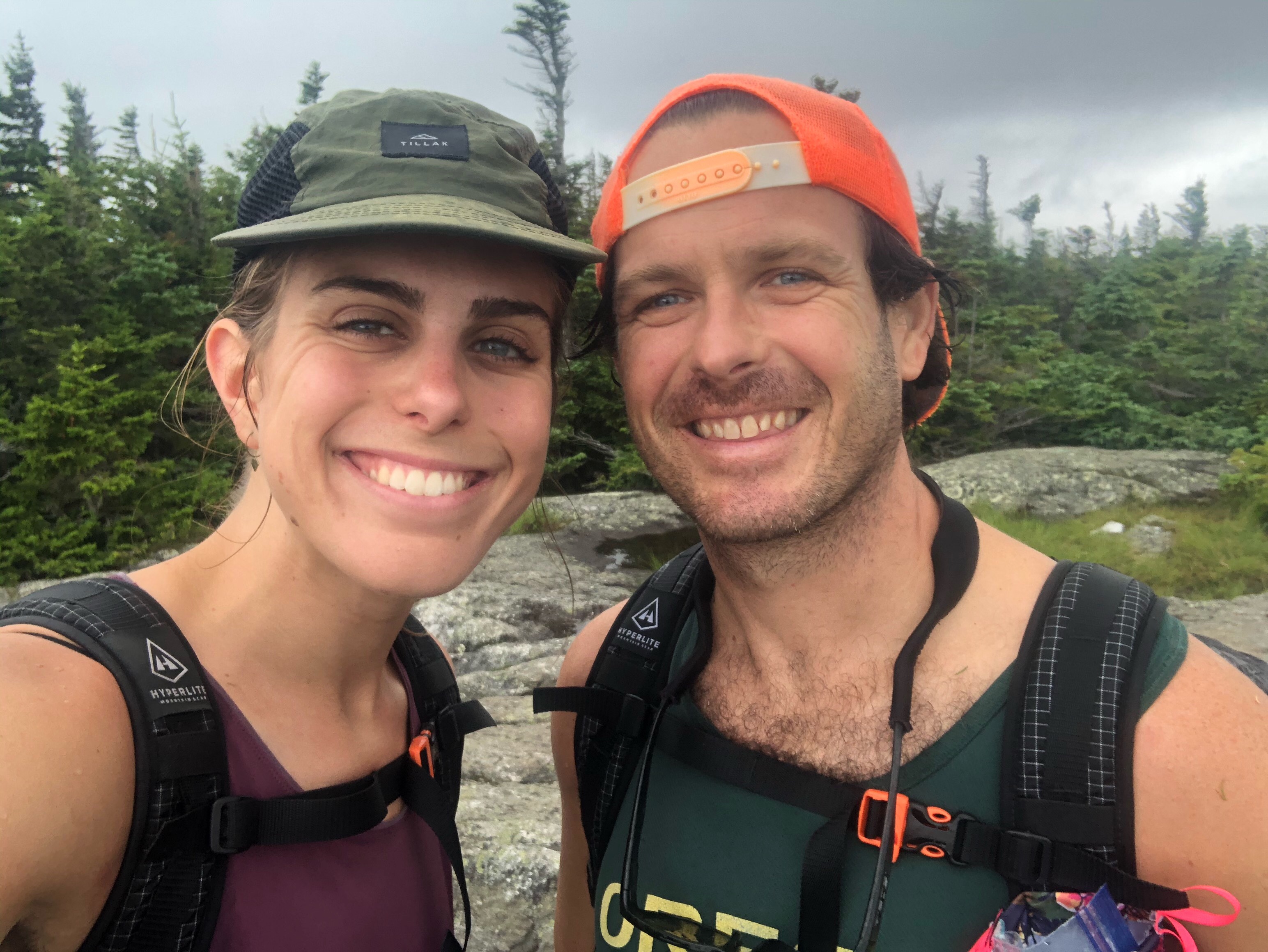
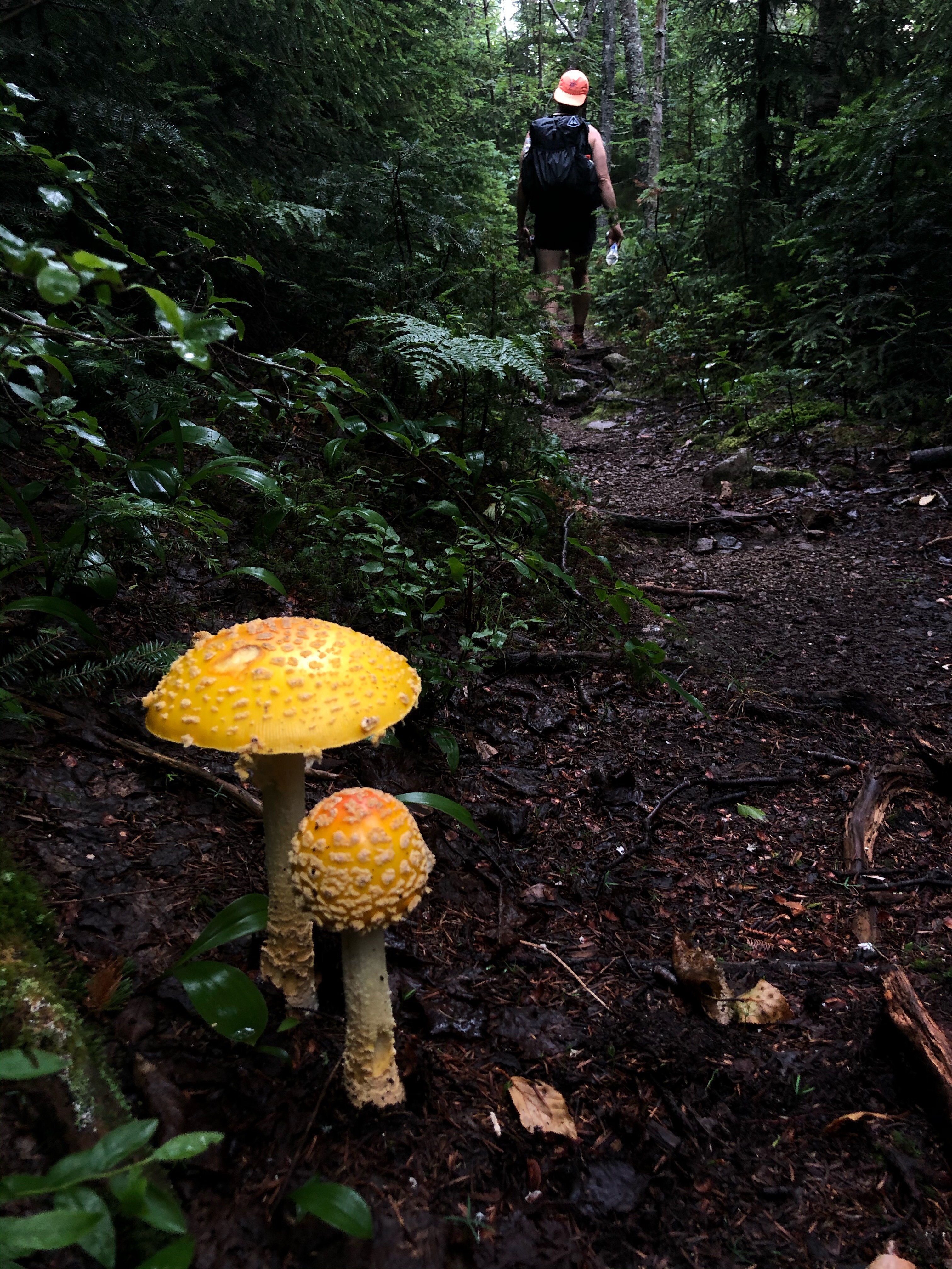
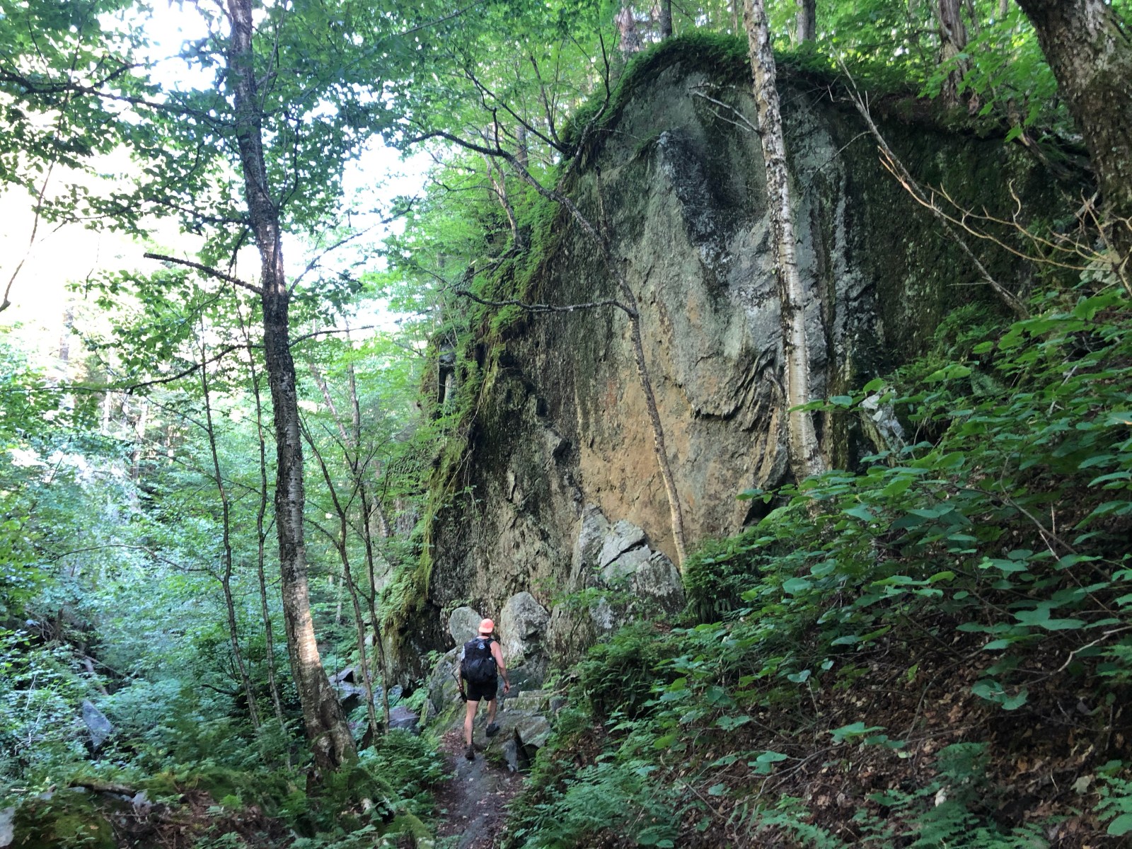
This trail is rugged! I’m reminded of that every time I come out and start on this trail. It feels like it’s always either straight up or straight down and packed with rocks, roots, and mud. Always mud. Unless we come across it in the next 55 or so miles there is very little cruiser trail out here. And it always seems hot and muggy and buggy. Section hiking is definitely tougher than thru hiking. There’s so much more logistics getting to and from trail and you’re always starting fresh. When you’re thru hiking you only have to start once and after a few days your body is conditioned for the next two thousand or whatever miles. But today my body felt good and we had a great day out here, just not my favorite trail. We topped out on Madonna Peak, the summit of Smugglers Notch ski resort and had an excellent refreshing swim in Sterling Pond. This evening we even got a nice mansplanation of every nook and cranny of the next 4 miles of trail trail from an adult wearing a gun on his hip in a camouflage holster. I spent those 4 miles wondering what that guy was so afraid of that he needed to carry a gun out here for.

We made it to a flat spot out front of the Bear Hollow shelter and had our dinner in the tent as it started to rain. 

7/20/20…..28 miles…..Belvedere Peak

Today was a banger of a day out here. Nothing like easing into the hiking season with 8000 feet of vertical over 28 miles on the Long Trail. Since shelters are gross even when there isn’t a pandemic going on we slept in our tent last night and got poured on. It wasn’t the best night sleep, it was wicked hot, then it poured. Luckily we had about 7-8 pretty chill miles right away. It was a very gradual way to wake up. Once the sun came out we stopped and dried out all our stuff from last night. The trail then went up and down all day in muddy, rocky, rooty conditions typical of the Long Trail. It was hot and humid, not quite as bad as yesterday but still, and it was buggy. Sara either wasn’t getting bit or was keeping it a secret because even with deet on and wearing a bug net I was still the object of the deer flies desire. Today also had some of the highlights of the whole Long Trail, especially the showers we took at a waterfall pouring over a cliff. 
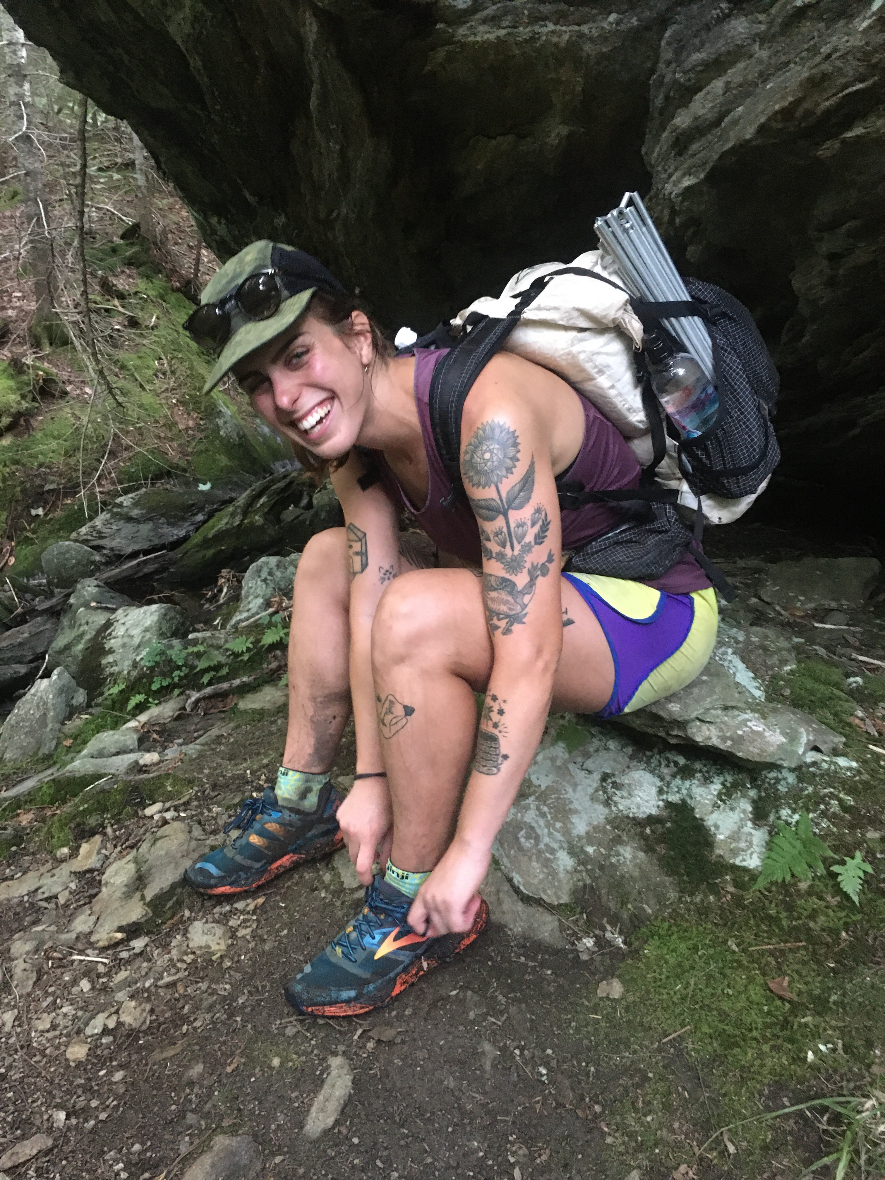
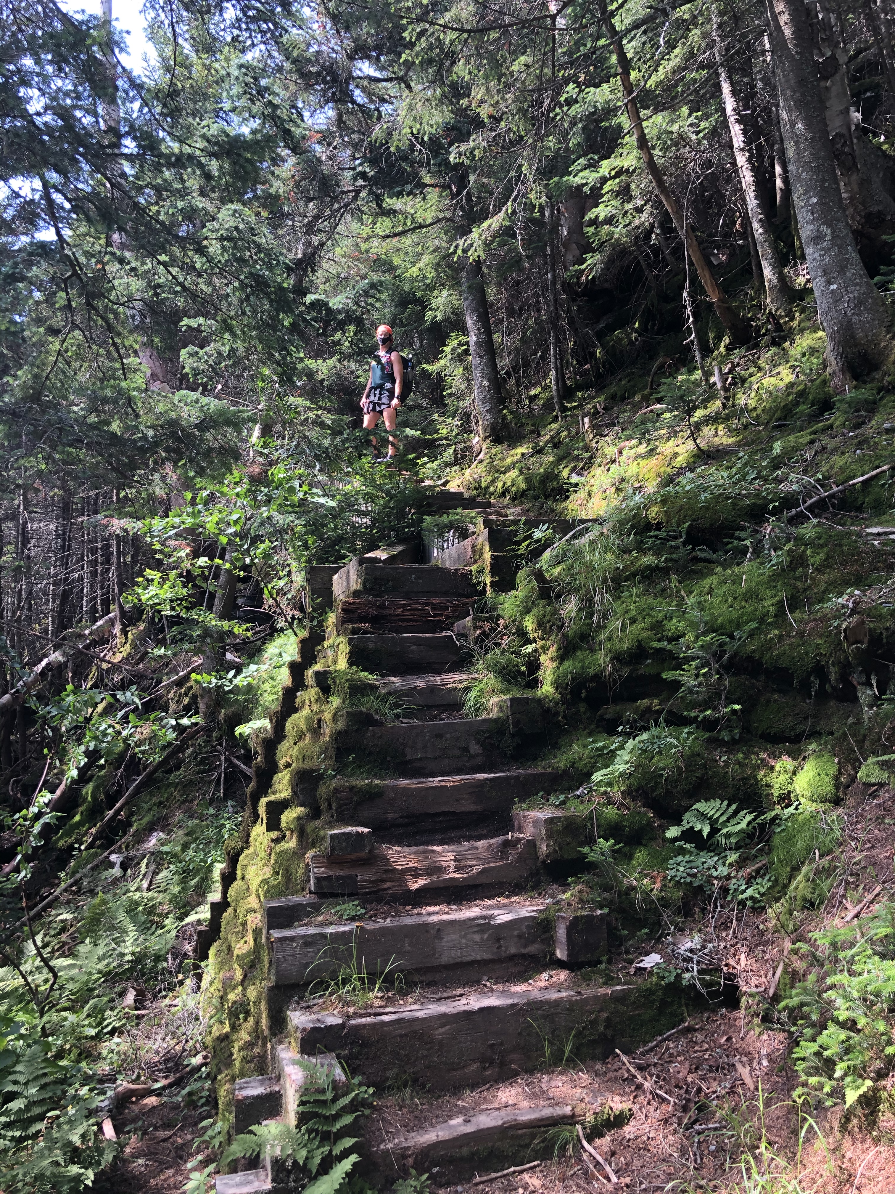
Shortly after that I busted my ass in a mud puddle, but I guess that’s why they call it ‘Vermud.’ We also went through Devil’s Gulch which is a short chasm through big boulders, something like a miniature Mahoosuc Notch if you’re familiar. Tonight we’re camped in some trees just off the summit of Belvedere Peak which has some awesome views in all directions, some of the finest I’ve seen on this whole trail.

7/21/20…..21 Miles…..Shooting Star Shelter

Never have I spent more time walking and covered less ground than I did today. I smell like I’ve been out here for a month. The trail was extra slow today. Super steep climbs followed by steeper descents on slippery rocks were interrupted only with muddy flat sections that we had to tiptoe around instead of ending up knee deep in mud. There were no easy miles today and we were traveling at a warp speed of 1.5 mph. That being said, it was much cooler out and there were no bugs which was a big relief. The highlight of today was a climb up to the top of Jay Peak. I had planned on skiing Jay in March but the mountain(and the world) closed early due to Covid. At the top we had great views in every direction. 
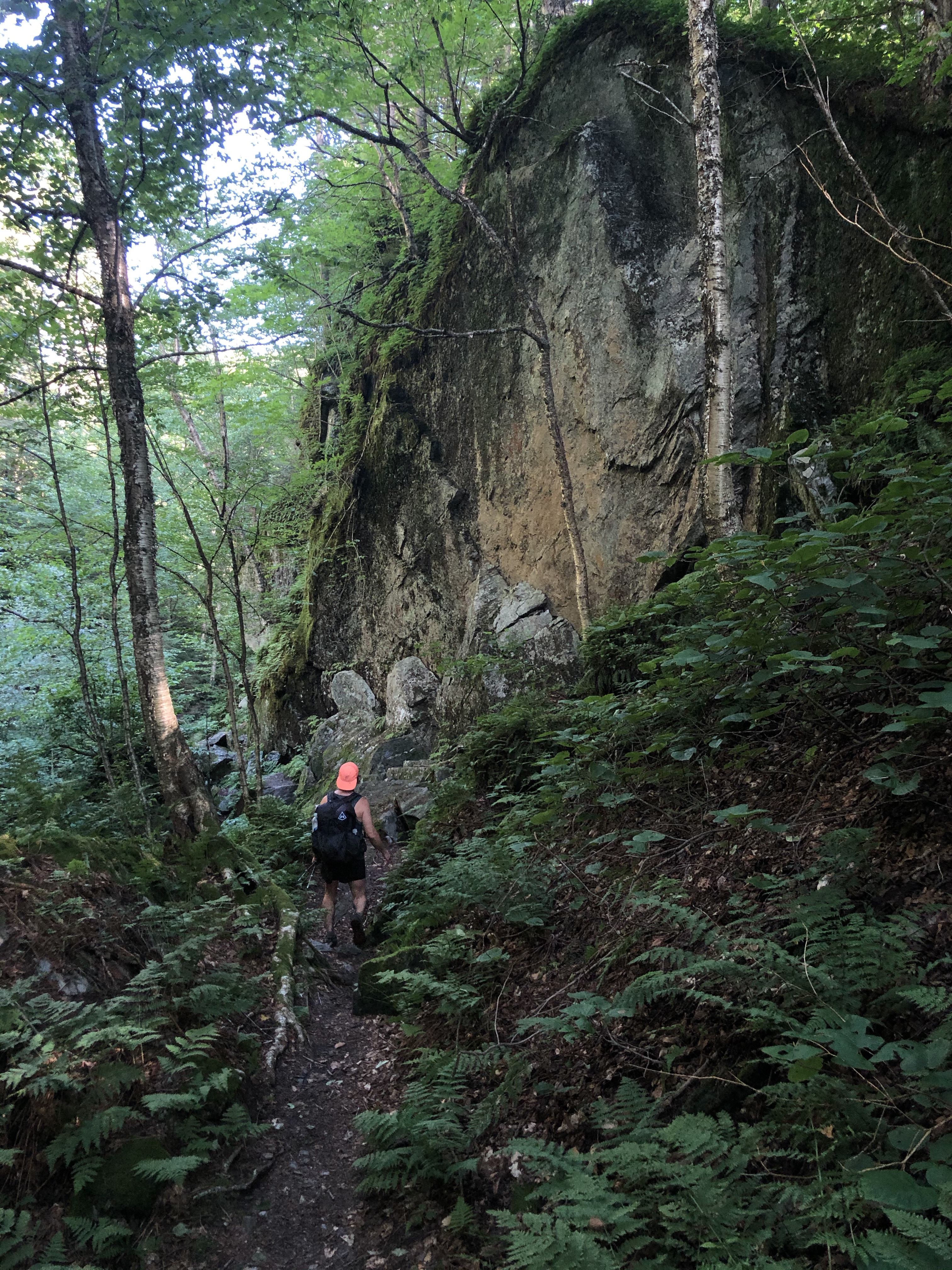
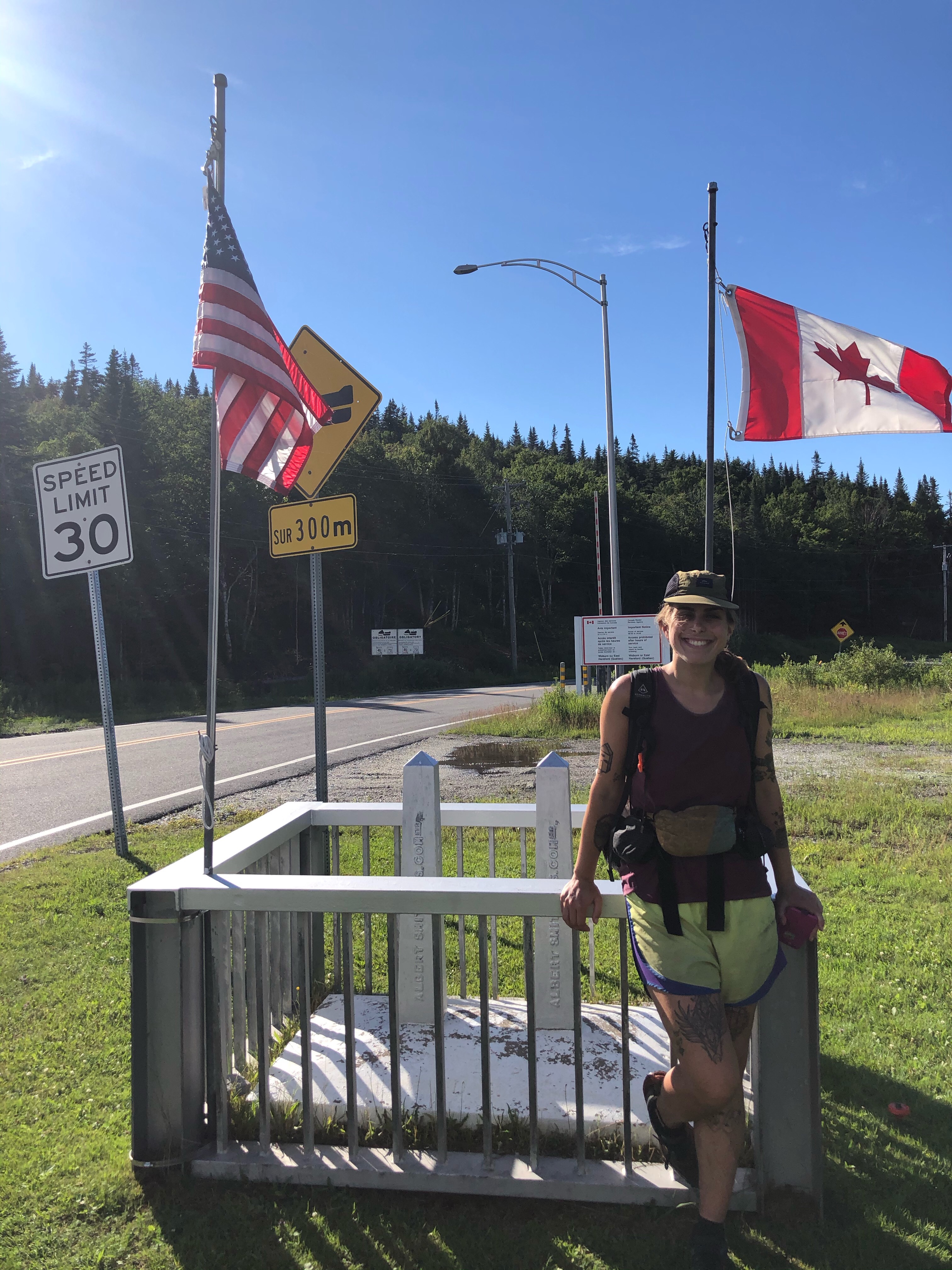
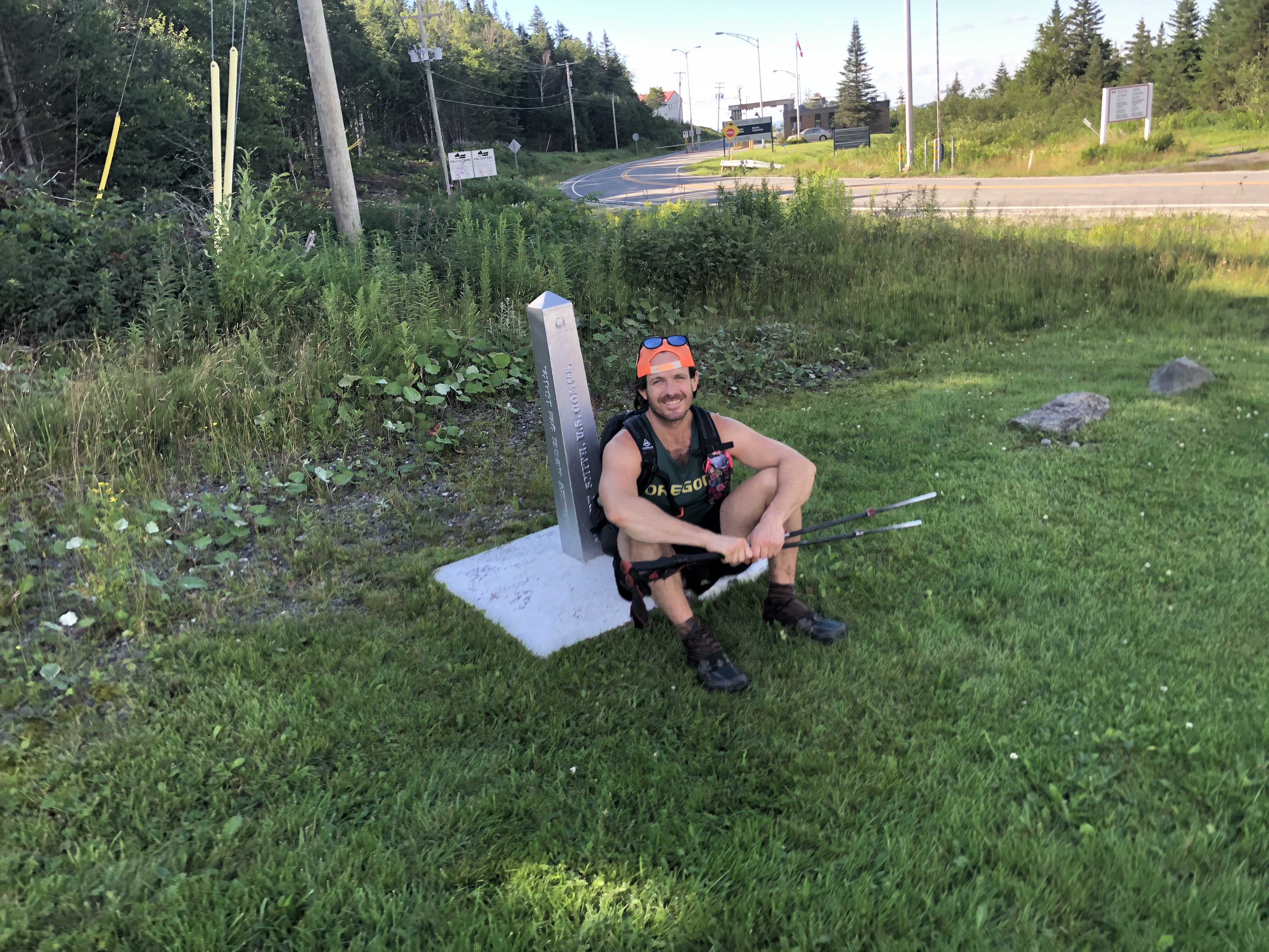
We could see Lake Champlain and into NY to the West, North into Quebec, East to Mt Washington in NH and to the South back to Mt. Mansfield and beyond on the Long Trail. This evening instead of making it back to the car like we had hoped, we finished our day tenting outside of Shooting Star Shelter. 21 miles with 7000 feet of gain in almost 14 hours with very little dilly dallying.

7/22/20…..5.7 miles…..Canada

Done with the Long Trail! This morning’s miles were rather smooth and in a few hours we reached the clear cut through the forest with the monument symbolizing the end of the trail and the Canadian border. It’s actually quite a nice terminus as long trails go. There’s a view north into Canada and a boulder perched up above the obelisk looking down towards the clear cut border. Sara and I high fived, took a few pictures, and vowed never to step foot on this trail again(just kidding, but seriously). We enjoyed ourselves but the trail itself isn’t my favorite. I’m not sure how much I would recommend this trail to prospective hikers. Well let’s say this; maybe don’t hike the Long Trail in the dead of summer. Hiking the LT in the fall is probably much more enjoyable, not that I’ll ever know. And I think I’d rather hike it in one shot, I prefer thru hiking but since I live relatively close to the Vermont I figured I’d hike this trail in sections whenever I could fit it in.

Once we reached the border we took the 1.5 mile side trail to the parking lot where my car was waiting. Our plans were to shuffle the cars around and begin hiking NH’s Cohos Trail tonight but zigzagging up and down Northern Vermont and New Hampshire took a fair amount longer than we expected. We settled on a bath in a lake and a full night sleep in the car at the Davis Path Trailhead and starting the Cohos Trail the next day.

For more pictures of this adventure and others feel free to follow me on Instagram @endlesspsummer

11/8/19…..Hayduke Day 43…..20 miles

We woke up to a delicious home cooked breakfast of potatoes, black beans, corn, cheese, eggs, toast, yogurt, fruit and coffee. Then, after we packed up, Lynn drove us 40 miles out of Kanab to where we got off trail yesterday at the corner of AZ 389 and Yellowstone Rd. I’ve said it before and I’ll say it again Lynn and her husband Richard are the ultimate trail angels and have done so much for not just me and QB but so many hikers on the Arizona Trail and the Hayduke.

We walked dirt roads through the tiny town of Cane Beds, AZ and then a paved highway for awhile. It was boring. The walking all day today and yesterday was a road walk across the ‘Arizona Strip’ and the best way I can describe it is just boring. I have to just go elsewhere in my mind for monotonous boring road walks like this. For awhile we were on a paved road with a fair amount of traffic, and I found a cell phone in good condition on the side of the road. We charged it up and turned it on but the thing’s locked and we don’t know how to find the owner. Did anybody lose an android near the Arizona/Utah border? I didn’t think so. When we did cross back into Utah after lunch we turned onto a very sandy 4wd road. It was like walking on the beach for 10 miles with no waves. Tomorrow we’ll be in Zion and all this road walking/connector trail will be worth it.

11/9/19…..Hayduke Day 44…..15 miles

We woke to frost on the tent, which wouldn’t be a big deal if we didn’t have to walk through an ice cold river this morning. It warmed up a little as we walked 5 more miles of very sandy jeep road. The road dead ended and we followed a steep trail down to the bottom Parunuweap Canyon aka ‘The Barracks.’ This canyon contained the East Fork of the Virgin River which we would walk along and through for the next 6 miles.

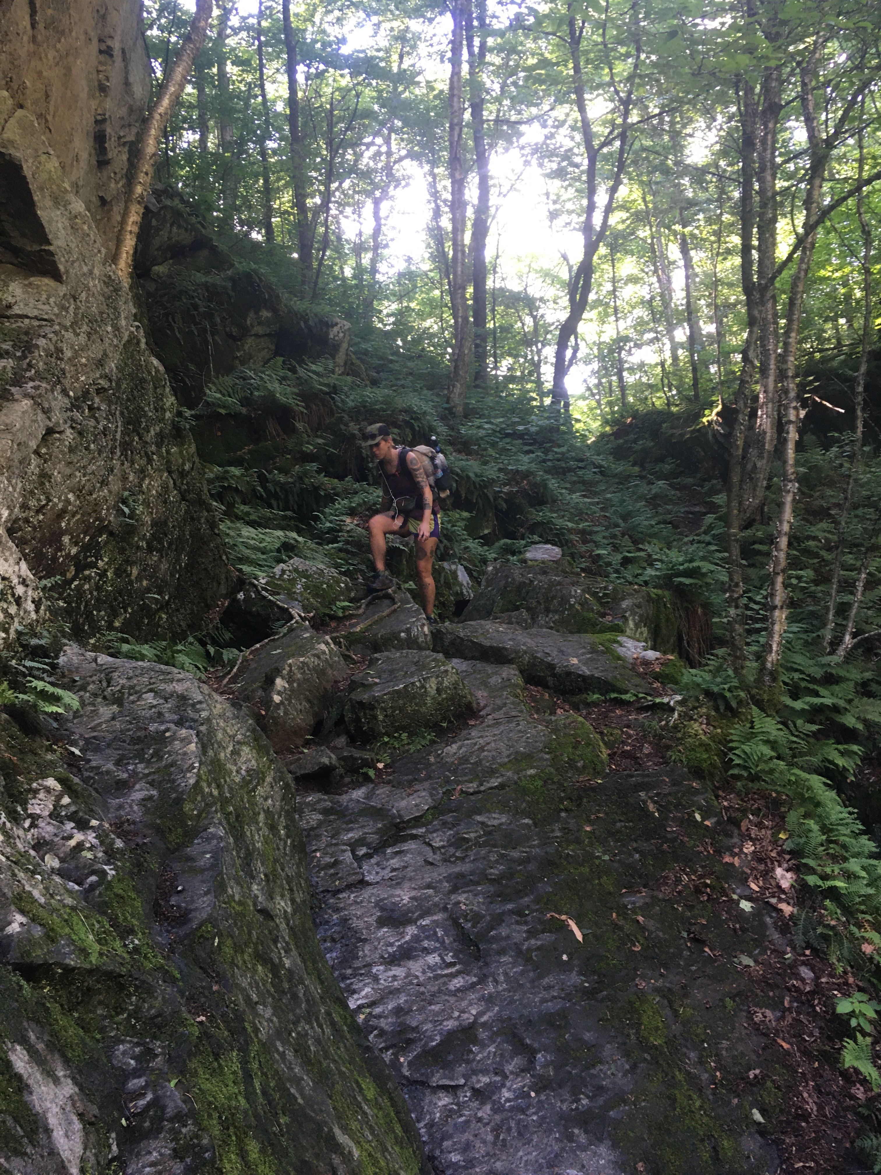
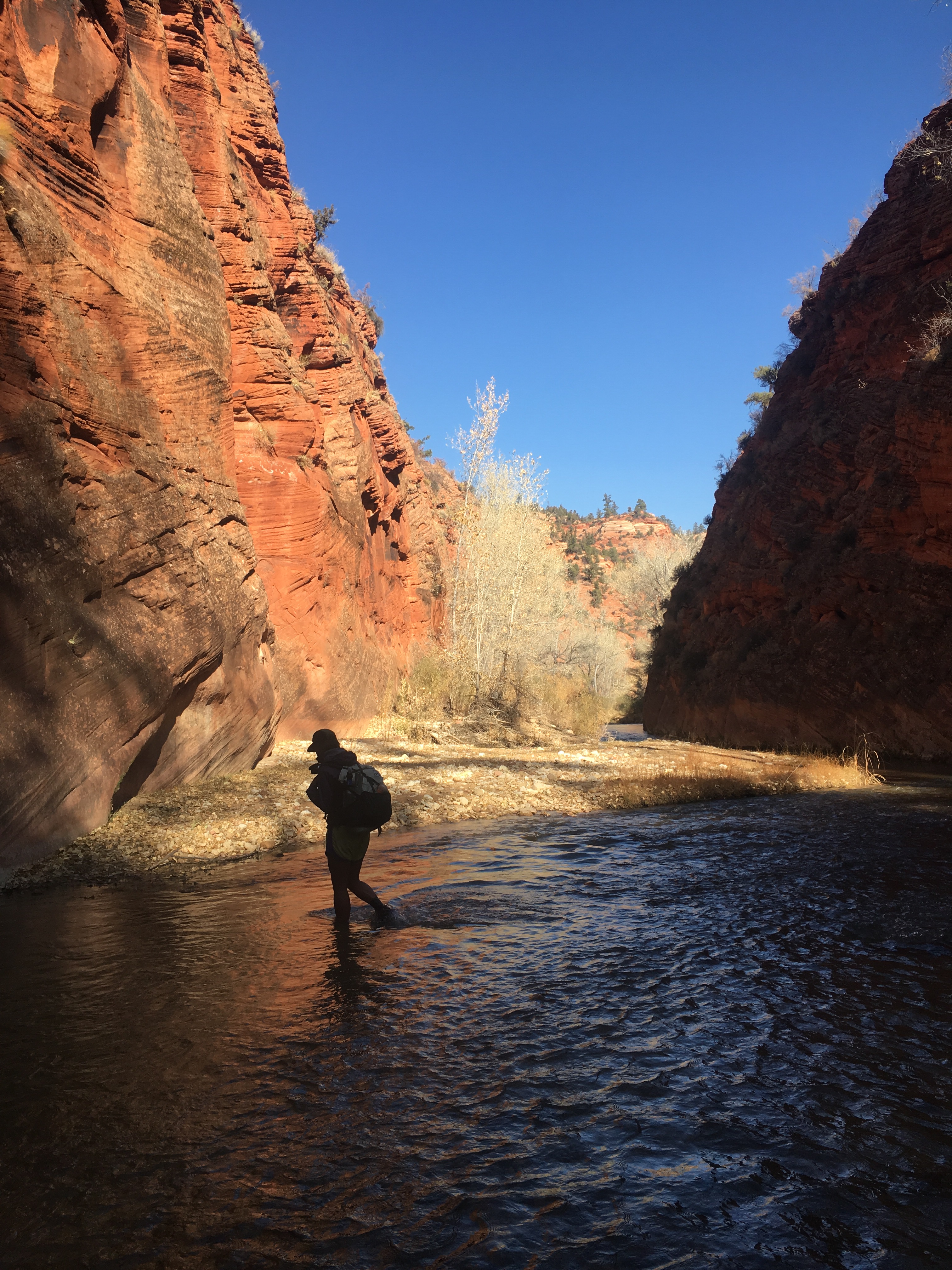
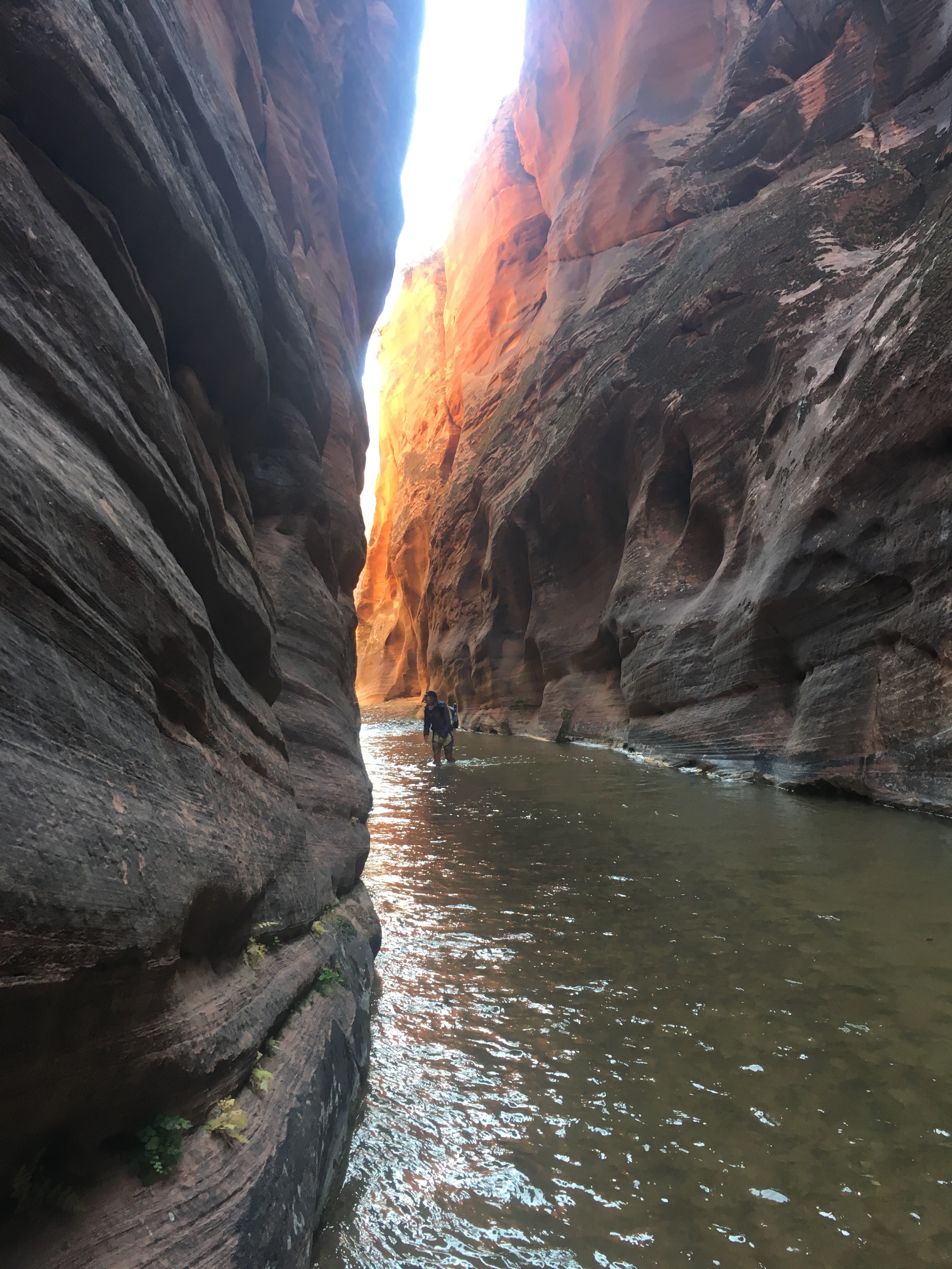
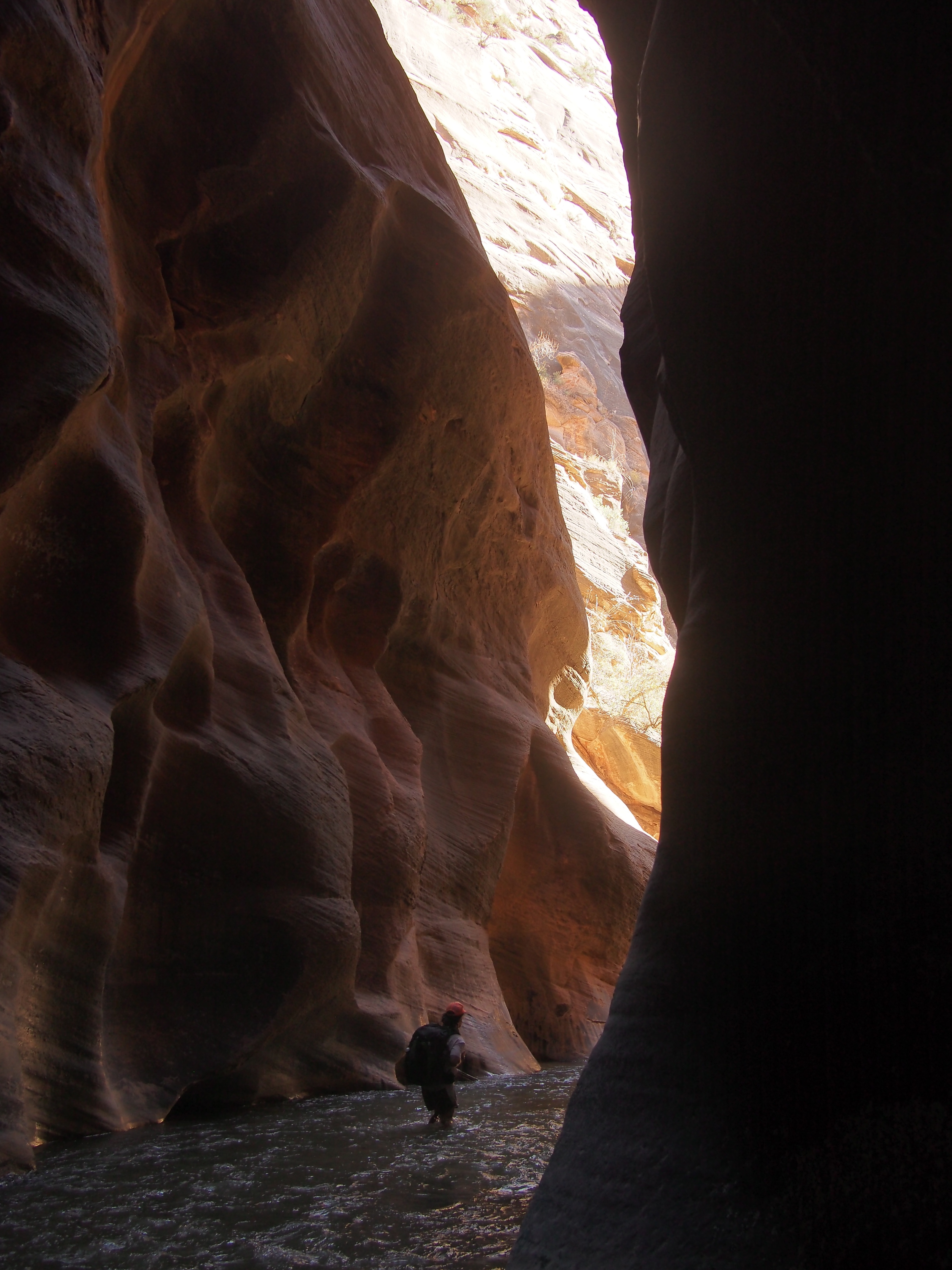
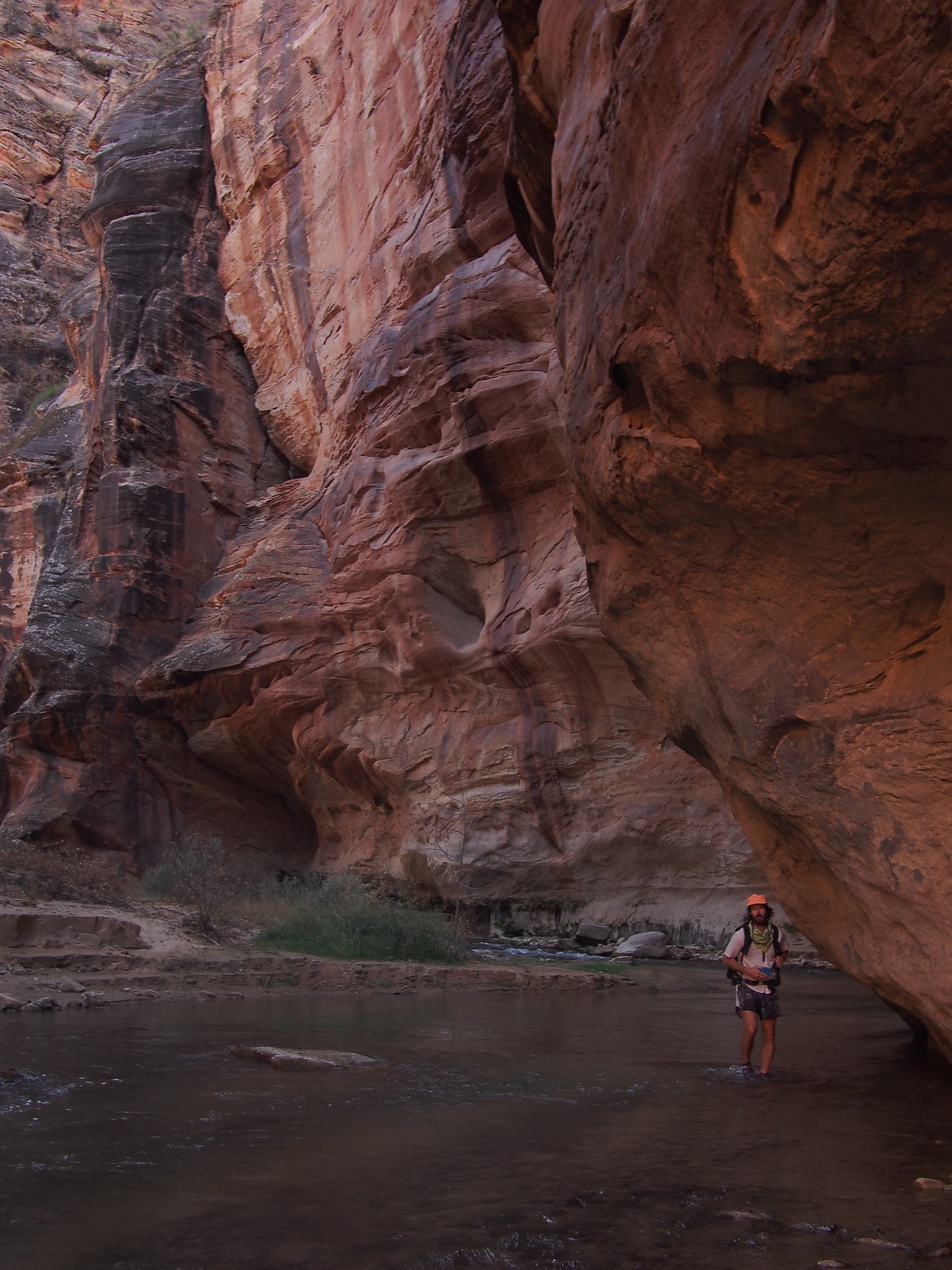
The water was ice cold! Bone chilling. At least for the first hour. We had to keep crossing over and over and only had these small sections of dry land for our feet to warm up a bit. Luckily it didn’t get more than knee deep and it must have been in the low 30’s or colder. I don’t think my feet have ever been more uncomfortable. For some reason the cold water didn’t seem to bother QB or at least she didn’t complain, I had trouble doing anything else.

There was a bald eagle down in the canyon keeping us company for awhile. Or maybe it was 4 bald eagles. Most likely it was 1 eagle that I saw 4 times. Finally after one of the coldest hours my feet have ever endured the water definitely warmed up and became bearable and the canyon was really very cool. It just seemed like the Hayduke’s final boss that we had to defeat. After 15 miles of super sandy jeep road and a half dozen miles of a viciously cold river and 1 quick class 3 scramble you can finish the route. The scramble was through a lemon squeeze beneath a giant boulder and down a natural tunnel all to avoid an impassable waterfall. Shortly after this we climbed out of the river by way of a route called ‘Fat Man’s Misery’ and walked 4-5 more miles crossing into Zion NP and reaching Mt. Carmel Highway.peeing

The official end of the Hayduke is the Weeping Wall within the park but because of a rockslide the Weeping Wall as well as the East Rim Trail are closed. We’ve done both of these before so I’m not losing much sleep about it. Going into Zion our plan has been to hitch around into the park and walk the Zion Traverse starting on the West Rim Trail and finishing at Kolob Canyon. Since Mt. Carmel Highway goes through a huge tunnel that is illegal to walk, we had to hitch and quickly got a ride from Hugo and Manuel. These guys dropped us off at the ranger station where we got our permit for tomorrow.

We’re camping in the park tonight and got into Springdale for a meal. If you come to Zion, Oscar’s just outside the park is where it’s at for food. Very good and they’ve got thru hiker portions.

11/10/19…..Hayduke Day 45…..23 miles

From our campsite at the Watchman CG we took the Zion free park shuttle to the Grotto stop and started up towards the West Rim Trail. The beginning of this trail is the same one that goes to Angel’s Landing. It’s paved, moderately steep, and crowded. After a mile or so we fell in step with an older couple and the woman started asking increasingly personal questions. It was getting weird, and I couldn’t out hike her. Good thing they were stopping at Angel’s Landing because I could only lie to her for so long.

Quickly we got away from the crowds and walked through a very cool part of the park. I feel like so many people in Zion stick to the main attractions within Zion Canyon but there’s a lot to see if you get just a little beyond them, for example the West Rim Trail.

In 2017, roughly the same time of year, QB and I hiked the Zion Traverse or Trans Zion Trail in the opposite direction. The next section the trail splits for 4 or 5 miles, you can continue to take the West Rim Trail or get on the Telephone Canyon Trail. I would recommend staying on the West Rim Trail, we did that last time and it was definitely more scenic. No big deal though. We carried on up near Lava Point, took a left through Wildcat Canyon and by the end of the day got to the Hop Valley Trail and the beginning of Hop Valley. For about a mile the Hop Valley Trail dips out of the Park into Zion Wilderness and that’s where we camped for the night. As we closed in on our campsite we were treated to possibly the most magnificent sunset of the entire Hayduke.

11/11/19…..Hayduke Day 46…..13 miles

Hayduke Lives!!! Finished the trail today.

We got going from our campsite and proceeded to walk through Hop Valley. This is a very underrated part of Zion. If you’re in the area I definitely recommend exploring the east side of the park and especially getting yourself to Hop Valley. If we had been here just a few days early the cottonwoods would still have been flying their bright yellow leaves. We crossed a bunch of partially frozen streams in Hop Valley then descended to La Verckin Creek. After following the creek for half a dozen miles we came to Lee Pass and for us the Western Terminus of the Hayduke. We high fived a few times, took a couple pictures and got busy hitching.

Deanna picked us up and ended up driving us almost 3 hours to Vegas. She even brought us to a thrift store in St. George, UT so we could buy clean new clothes for the next couple days. We’re staying 2 nights in Vegas, flying to NY for a few days then driving home to Massachusetts. Tonight we’re gorging ourselves at a buffet on the strip. We’re both trying to eat our weight in crab legs.

Thanks for reading! The Hayduke was a truly incredible endeavor, it was very difficult but the payoff was well worth it. I hope you enjoyed following along, I enjoyed having you. Feel free to follow us on insta for more pictures @endlesspsummer and QB @sarahikes.