
Day 1…..28 miles…..Cherry Mountain Trailhead
The Cohos(pronounced co-os like the way you would say co-op) Trail is a 165 mile footpath through northern New Hampshire. The southern terminus is at the Davis Path trailhead in Crawford Notch and it stretches to the Canadian Border in the North. We’ll be hiking from south to north.
Yesterday Sara and I finished Vermont’s Long Trail, drove my car back to Smuggler’s Notch to pick up her car, then drove both cars to the tippity top of NH and dropped her car off by Third Connecticut Lake. From there we drove south to Crawford Notch and spent the night sleeping in my car before setting off in the morning. Along the drive we cached food about halfway in Stark, NH off rt 110 where we hid bear canisters in the woods stuffed with 3 days worth of ramen and Mike and Ike’s. Living in Massachusetts I have always felt that New Hampshire pretty much ends at the White Mountains. Boy was I mistaken. There’s so much more up here in The Great North Woods, as they call it and I’m about to find that out. 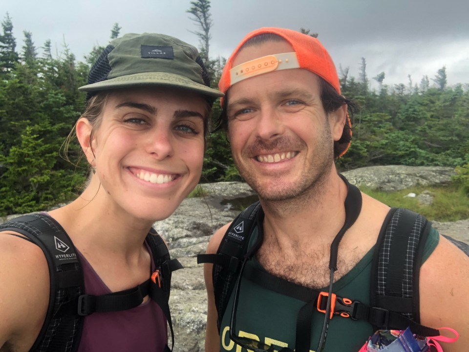
This morning we rolled out of the Subaru, crossed Bemis Bridge and climbed up Davis Path towards Stairs Mountain. The Cohos Trail goes up and over Mt. Isolation then drops way down to the Dry River. Actually not dry, we crossed it in knee deep water. From there we climbed up over the Presidential Ridge near Eisenhower, took a left on the AT and followed that for a quarter mile then dropped steeply down Edmonds Trail. We finally had some easier walking on snowmobile trails once we got to the bottom. After passing the Mt. Washington Hotel monstrosity we went west on 302 for a bit. 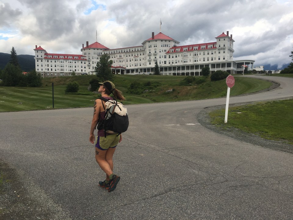
For dinner we grabbed gas station sandwiches and walked another mile before looking for a place to camp. The Cohos Trail runs along Old Cherry Mountain Road which has ‘primitive’ camping but everything was taken. These are sites carved into the woods with no toilets or electrical hookup. There were cars in every single one of them. Besides the primitive spots, the woods are so thick with brush it’s next to impossible to find a spot for the tent. We walked a bit longer than we would have liked to but finally found a spot in the woods right across from the trailhead up Old Cherry Mountain. A pleasant and productive first day on the Cohos Trail. 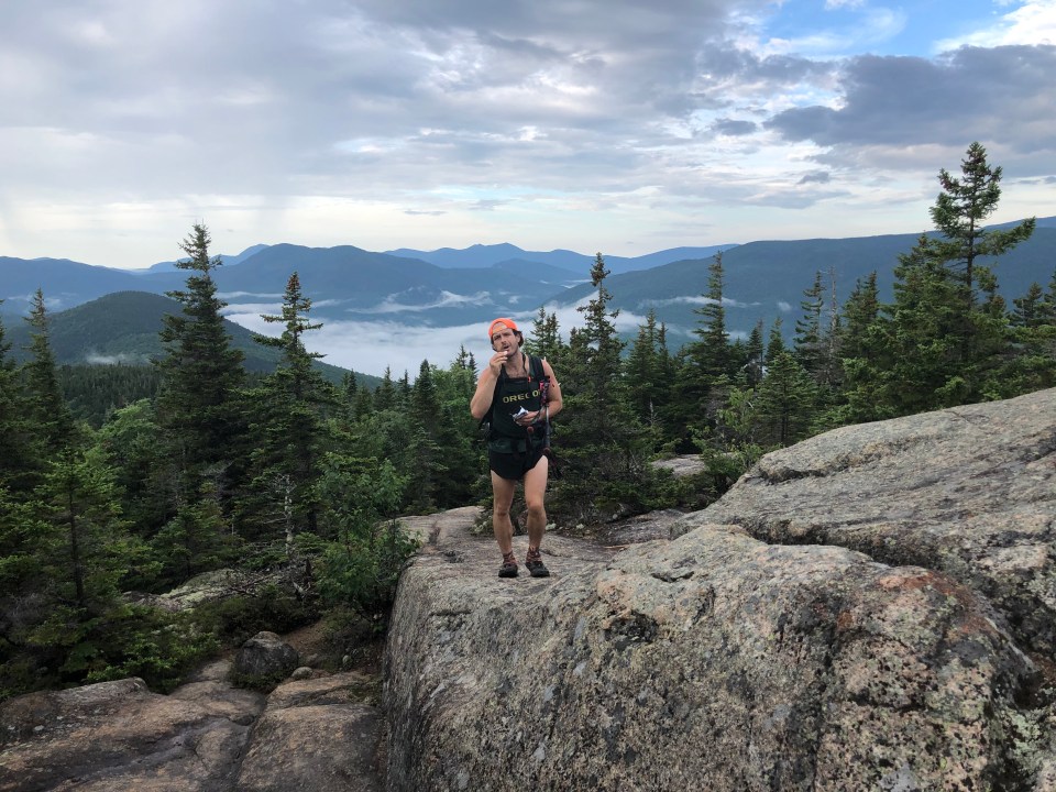
Day 2…..25 Miles…..Mt Weeks Summit
Yesterday I forgot to dry out my sleeping bag. We got rained on at some point, my bag got wet and I forgot all about it until we set up camp. Sara and I made due with 1 sleeping bag for the night. Fortunately it wasn’t that cold out and we were both exhausted and able to sleep. From our spot next to the trailhead we walked up and over Mounts Martha and Owls Head(the other NH Owls Head). Finally seeing some Cohos Trail signs and yellow blazes we followed these down through a series of snowmobile and rail trails around Pondicherry wildlife sanctuary before doing a decent road walk on 115A. Before starting the road walk I think I saw a bear. I can’t confirm it, it was either a bear or bigfoot, but I think it was a bear.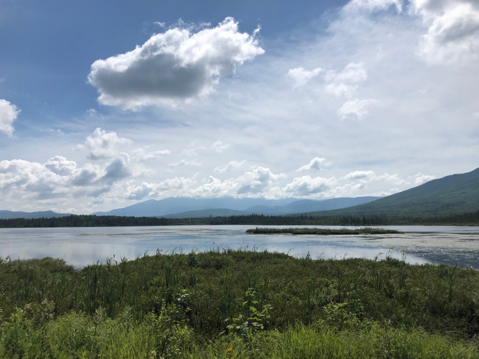
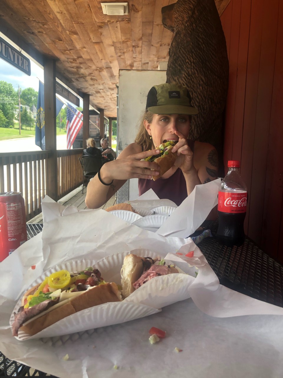
At the junction of 115A and Rt 2 there’s a country store attached to an Irving gas station. This place has massive subs, both thumbs up, and good pizza. We took our time eating lunch, went back in to pick up a few things for a 1 day resupply then sat on the porch doing some housekeeping; organizing food and cleaning our feet and stuff. We had been there for about an hour and as I looked over towards the gas station I thought I saw my cousin’s husband pumping gas. As I walked over to get a better look, my cousin Kate walked out of the store! Kate, John, and their daughter Mila were up here on vacation and were coming from Santa’s Village. And it was Kate’s birthday! What a treat. I know we’re only 3 hours from the North Shore of Boston and to see someone from home isn’t outside the realm of possibility but at one of the only places we’ll stop this whole trail, and a first cousin, that was quite a coincidence. 
After an unexpected visit with family Sara and I walked up the Starr King Trail towards Kilkenny Ridge. A few miles later my back started burning like a son of a gun. It felt like somebody was simultaneously pulling out every single one of my back hairs. I took my shirt off and Sara wiped my back off, gave me an examination, and a diagnosis: heat rash. Neither one of us knew the cure. For the rest of the day I adjusted my pack so it wasn’t directly on my back and it seemed to help a little. We rolled along Kilkenny Ridge summitting Waumbek and a few smaller peaks before setting up on top of Mt. Weeks. My back seemed to get better for now which is a big relief. 
Day 3…..27 miles…..Percy tent site
This morning we continued on the Kilkenny Ridge Trail slowly for another 15 miles. We went up and down a few smaller peaks and topped out for the day at Mt. Cabot, the northernmost 4000 footer in New Hampshire. On the way up Cabot we met a pair of southbound Cohos Trail thru hikers, Goliath and Handsome Dan. Long distance hikers, if we didn’t know the same people we knew the same trails and traded info with them on stuff coming up.
Eventually, after what seemed like forever, we got off the Kilkenny Ridge trail and found ourselves at South Pond. This pond is at the northernmost part of the White Mountain National Forest. There’s a beach here and a swimming area. While the other beach goers did their thing Sara and I took baths washing off a few days worth of bug spray and B.O. It was extremely refreshing.
Leaving the pond we had a few miles of road walking, crossing rt 110 then the Upper Ammonoosuc River and entered Nash Stream Forest. We located our hidden bear canisters with our untouched 3 day resupply in them and took a few minutes to organize our food. I think we have now entered the Great North Woods and virtually everything up here is uncharted terrain for me. I’m very familiar with WMNF but I’ve only been hiking north of Cabot once, it’s all brand new to me. Sara and I walked another 6 miles with the last 2 being extra grueling and got to camp at the Percy tent site.
Amazingly today my heat rash on my back all but vanished. I did my best to keep my pack off my back and the weight of it more on my hips but other than that I didn’t do much to cure it. Had it been as bad as yesterday I would have considered getting off trail at rt 110 and figuring out how to get back to my car. 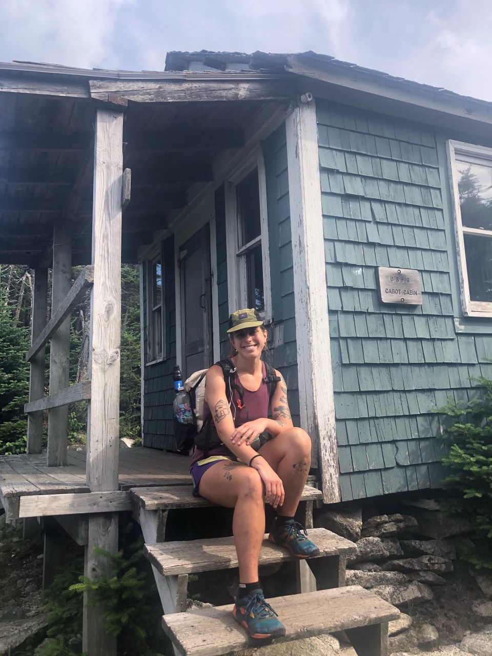
Day 4…..29 miles…..Panorama Shelter
Today started off innocently enough. A nice 4 mile downhill to a waterfall with an excellent swimming hole. A cool dip was a perfect way to start the day. 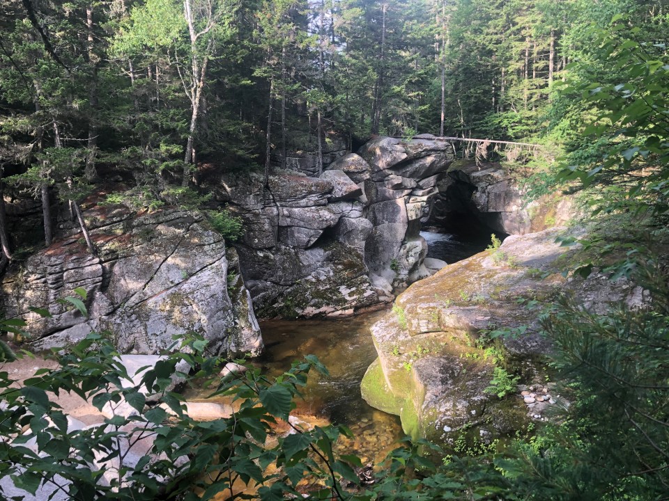
For the rest of the day we just walked. Here and there we find ourselves on decent trail for a few miles but I’ve noticed much of this trail is a conglomeration of snowmobile trails, road walks, atv or jeep roads, rail trails, and old logging roads. I don’t hate it, I’m enjoying myself, but it hasn’t been super scenic and the trail at times is just ok. 
This afternoon we walked through the Balsams Ski Resort. I thought someone was supposed to build a big resort up here but this place looks like a thing of the past. There sure was a huge hotel in the distance though. We dropped way down to Dixville Notch, crossed rt 26, then climbed way up on the north side. Dixville Notch is a highlight of the trail (also the place where the first presidential ballots are cast every 4 years). There’s cascading waterfalls and great views from steep jagged cliffs on both sides. Sara and I had planned to camp once we got up the north side but there was nothing even close to suitable. Another thing about this trail, camping options are very limited. We had to crank out another 3 miles at sunset to Panorama shelter and got in just before the rain started. 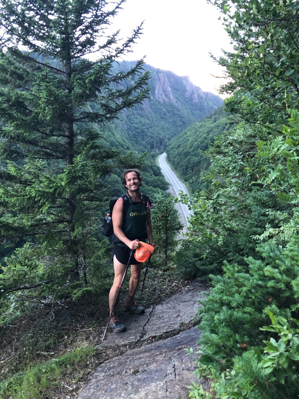
Day 5…..30 miles…..Pittsburg, NH
All night it rained absolute buckets. Sleeping in the shelter the sound of the rain was amplified by the tin roof making it even scarier or more soothing. We were very lucky to push on last night. Had we set up it most likely would have been in an uneven campsite probably right in middle of the trail somehow and we would have got soaked.
Although the rain had stopped this morning we still got soaked through splashing in puddles, mud, and walking through wet ferns. The trail turned to road after half a dozen miles and the skies opened up on us. We walked through an empty Colebrook State Park and then had a series of road walks for most of the day. Our goal today was Young’s Store in Pittsburg, 30 miles from Panorama Shelter. It was ambitious especially since it closed at 7pm but with about 20 of those miles on road or ATV road(this area is a hotbed for ATV and snowmobile enthusiasts) I felt pretty confident we’d get there. Since we were a bit ahead of schedule we both had enough food to only be a little bit hungry before finishing the trail tomorrow. By the afternoon we had moved fast enough that we had time for a nice lunch and quick swim in Lake Francis. 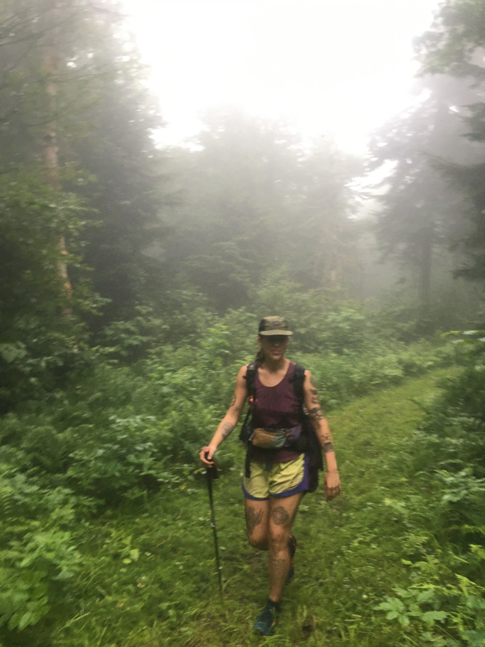
We got to Young’s Store by quarter to 6, got subs, macaroni salad, ice cream and a little bit of food to supplement our bags for tomorrow. There’s cabins for rent across the street so we decided to rent one for two nights. This way we can slack pack the last 25 miles to the border then drive Sara’s car back here and totally relax for a night. 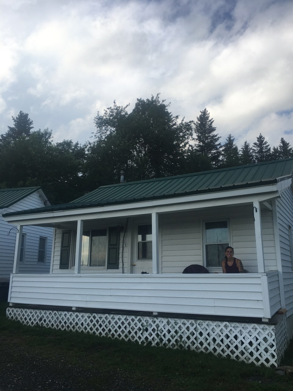
Day 6…..25 miles…..Canada
Today’s hiking wasn’t great. Sara and I were both glad to be finishing up the trail but the miles today just didn’t have much going for them. It poured again overnight which didn’t help and when we got going at 6am it was already warm. The cloud we were walking through felt like a steam room and the overgrown snowmobile trails were muddier than usual. 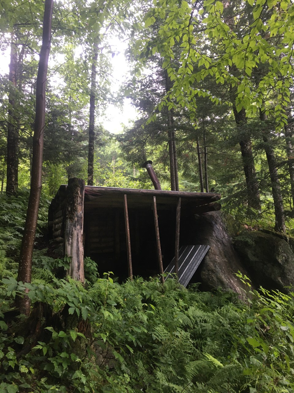
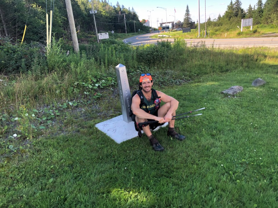
We spent all day within the town of Pittsburg, the largest town by area in New England. The trail parallels rt 3 and took us by 1st, 2nd, 3rd, and 4th Connecticut Lakes. These lakes are the headwaters of the Connecticut River that becomes the NH/VT border and flows all the way to Long Island Sound. Once we reached the Canadian Border the Cohos Trail takes a left for nearly a mile up through the clear cut which is the actual border. Don’t write off this last mile as easy clear cut walking. It’s anything but. After climbing about 500 feet the trail comes to 4th Connecticut Lake and does a small loop before returning to the clear cut then the dastardly mile back to the road. When we got back to the road we walked past the border patrol office then a mile south into the USA where we left Sara’s car by 3rd Connecticut Lake. We jumped in the water and washed off all our sins. Tonight we’re staying again at the Mountain View Cabins in Pittsburg. So rewarding and comfortable! 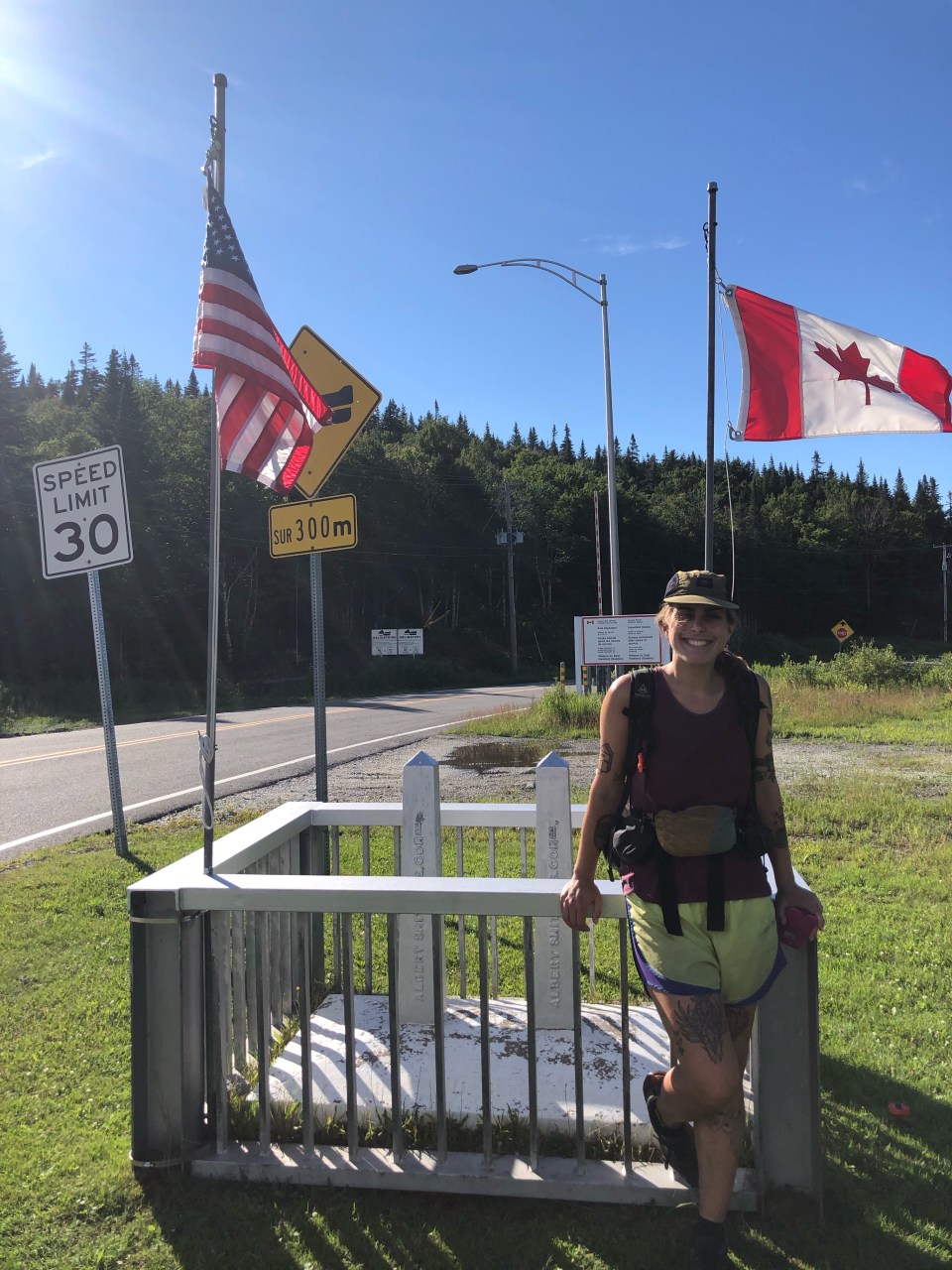
Overall Sara and I had a good time out there. We beat the bag out of the trail and had fun. It was difficult but we kind of did that to ourselves. Had we slowed down and taken another day or two it probably would have seemed significantly easier. The weather however, didn’t make me want to stick around too long. I probably wouldn’t hike this trail again but like I said it may have been more enjoyable if we took a bit longer. Also just like the Long Trail, the time of year to hike probably isn’t the dead of summer. One other thing, it might be better to hike this trail south as it gets more mountainous in the south.
For more pictures feel free to follow my insta @endlesspsummer

Fun to read about your adventures!!! Cool you ran into your cousin, too!
LikeLiked by 1 person
Thanks!
LikeLike
Day 2 heat rash is classic Chris Carmody. I bet you didn’t stop complaining the entire day. Poor Sara.
LikeLiked by 1 person
Hahaha…you know me so well
LikeLike