
8/29/20…..6 miles…..Aneroid Lake

Yesterday, after bathing in the Deschutes river, we drove west from Bend and last night we slept in the car in the Sheep Creek dispersed camping area outside LaGrande, OR. This was our second(and much better) choice after unsuccessfully trying to sleep at a busy rest area on I-84 near Pendleton. Today, from Sheep Creek, we drove through Hell’s Canyon, resupplied and did laundry in the towns of Enterprise and Joseph, OR. ***Joseph, Oregon named after Chief Joseph of the Nez Perce. The Wallowa Valley was originally their Ancestral homeland.*** In Joseph there was a car show going on right on the main drag through town. As our laundry washed we walked around and looked at shiny antique cars while their owners sat in lawn chairs listening to cowboy music and not wearing masks. Maybe ten percent of the people in Joseph wore masks. Other than that, Joseph was cool. I felt like the car show people didn’t accurately represent the town, I could be wrong though. And another thing, antique cars don’t really do it for me, unless you can sleep in them. RV’s, Vans, or cars and trucks converted to something of an RV are the only vehicles that turn me on.
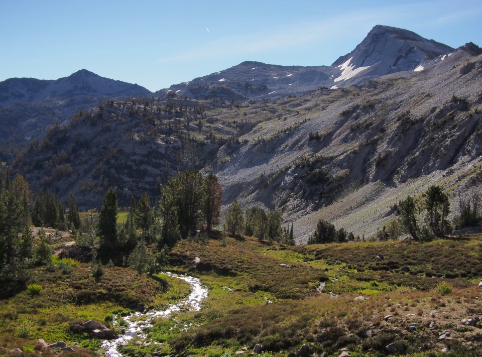

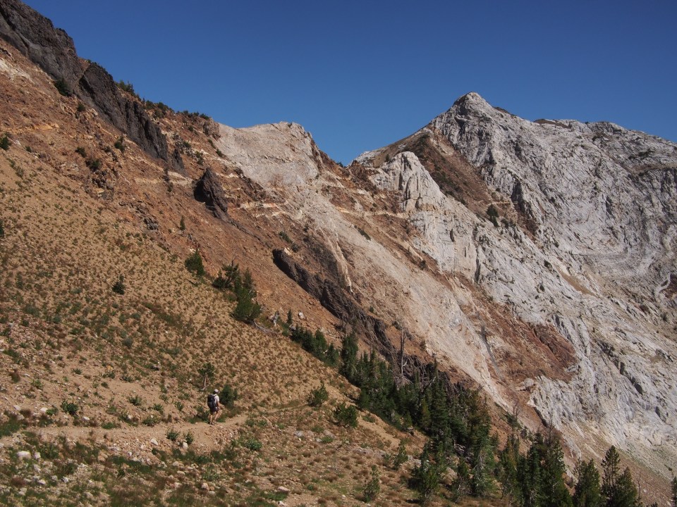
After lunch we climbed switchbacks to the top of Hawkins Pass and then dropped into a valley following the South Fork of the Imnaha River. Looking out from both sides of Hawkins Pass was impressive scenery. We followed the Imnaha for about 5 miles then turned up a trail alongside Cliff Creek for another 5. We came across a few floating heads on the trail making animal calls and carrying crossbows. Shortly afterwards a big beautiful bull elk crossed the trail about a hundred feet ahead of me. Hopefully he goes undetected by the hunters. 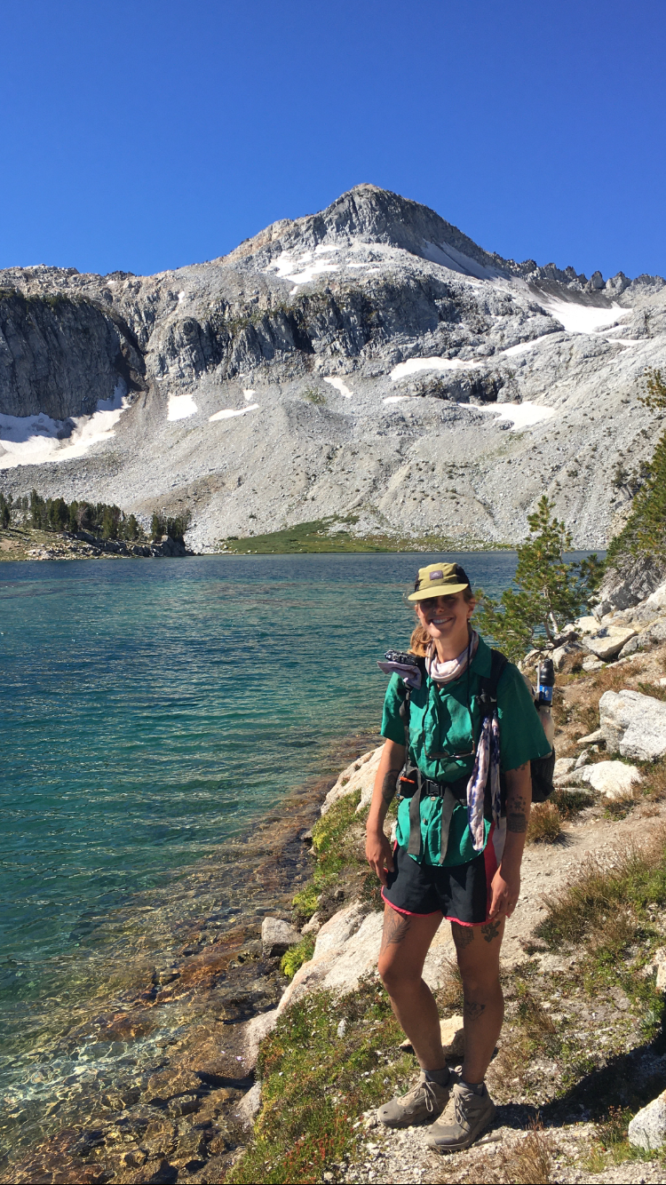
Tonight we camped at Crater Lake, not to be confused with Crater Lake National Park. There seems to be no inflow or outflow to the lake and it must have been caused by a meteor. Lots of fish though, there was a bunch of ripples in the water and just as I was about to go in for a swim we watched an osprey pluck a fish from the surface and bring it to a nearby tree for dinner, majestically.

We ate lunch at the creek after about 7 miles then took a side trail up to a couple of alpine lakes; Moon and Hidden. The trail ended at Hidden Lake and it was in something of a cirque(wall of mountains). After exploring for a bit we backtracked back to East Eagle Trail followed it for another mile then took a left up and over Frazier Pass. If you’re feeling froggy I think you could climb up and over a pass behind Hidden Lake and drop down onto the far side of Frazier Pass. There’s no trail but both sides look manageable to the naked eye.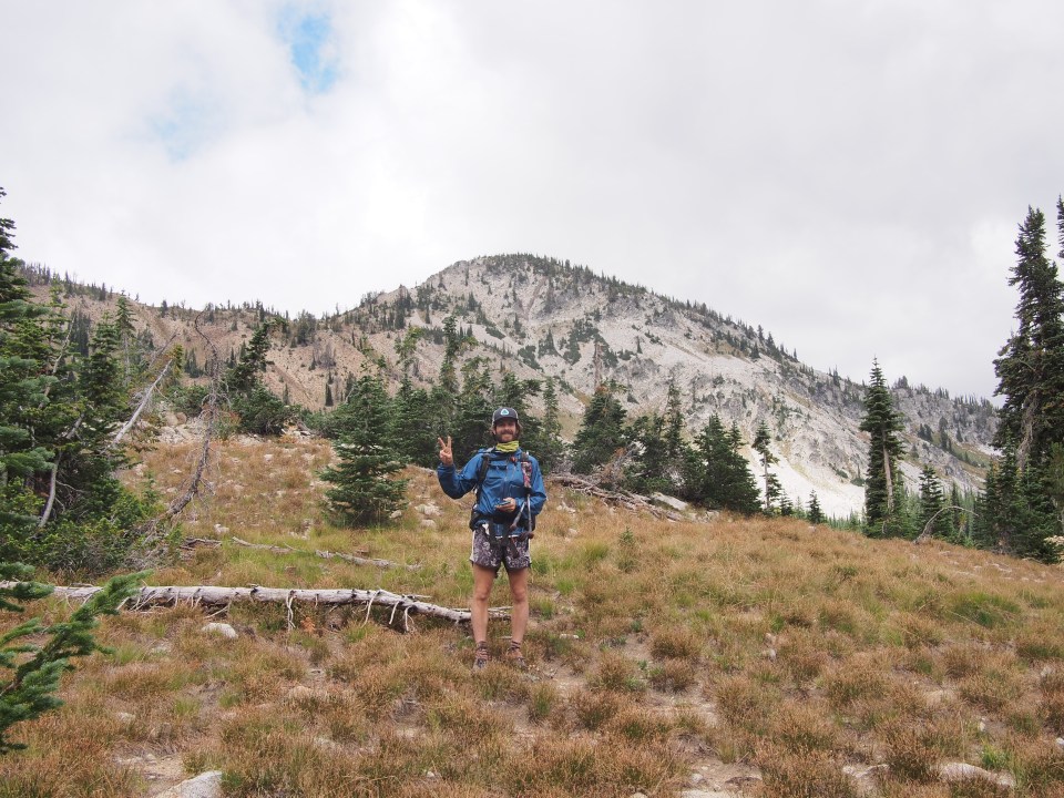
Down the other side of Frazier Pass we took a right and followed the Minam River trail to Minam lake. There was a 1 mile dead end trail up to Blue Lake from here so we took that and have a beautiful campsite next to Blue Lake within another cirque of mountains. Amazingly there’s nobody else camped up here. We actually hardly saw anybody all day, besides a few cowboys and their horses camped down by Minam River. 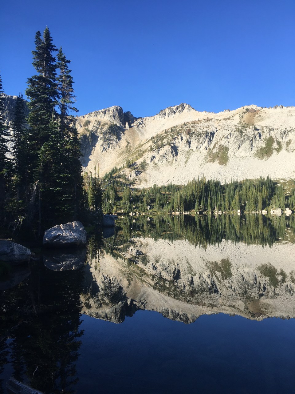
We walked downhill from our campsite at Blue to Minam Lake then up and over Ivan Carper Pass back into the Alpine Lakes Basin. From here we walked past Mirror Lake and Eagle Cap Peak, which the wilderness is named for, to Moccasin Lake. We then took a little detour to do some exploring. We followed an out and back trail that went up Glacier Pass and then down just a little bit on the other side to Glacier Lake. This lake was absolutely gorgeous, my favorite lake in the Wallowas so far and worth the extra effort to seek it out. After swimming we retreated the same way we came, climbing back up Glacier Pass, then back down to Moccasin Lake. We walked a few miles through the Lakes Basin to Lee Lake where we ate lunch and swam again. This lake has a 15 foot cliff that I’m sure people jump off but I wouldn’t recommend, I actually talked to some kids who were just leaving there that said they did it. In order to safely do it you’d have to clear a 6 foot granite shelf at the bottom, definitely not worth the risk to me. I’m just not confident enough in my leaping abilities.
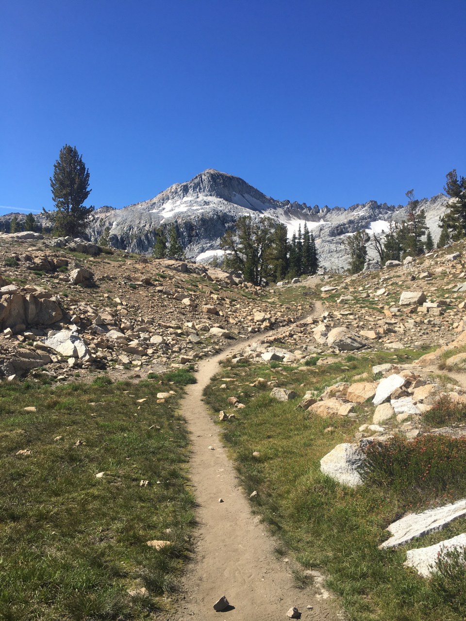
After lunch we took the Lakes Basin Trail down and out of the Basin to the West fork of the Wallowa River. This trail leads all the way back to Wallowa Lake and the car but after a few miles we took another detour up to Ice Lake. The Ice Lake Trail climbed 2300 feet over almost 5 miles but it was well graded and an enjoyable climb. It went past some awesome cascading waterfalls and from the trail we saw a mountain goat in the distance(I’m always pointing out wild animals to Sara or rocks that I think are wild animals). When we got to the lake it was still warm enough to go for a quick dip, so before we set up camp we quickly jumped in and out just as the sun was setting. Just like the name implies, it was icy cold. Beautiful though and a worthy side trip as it sits at the base of some of the highest mountains of the Wallowas. 
9/2/20…..7 miles…..Antelope Resevoir CG, Southeastern Oregon
Soon Sara and I were out of the woods and back at our car. We took a bath in Wallowa lake, did laundry in the town of Joseph and filled up on burritos and Chimichangas. From here we’re heading south. We drove a few hours to the Snively Hot Springs on the Owyhee River and then a couple more to a campsite on Antelope Reservoir. 
Check out our instas for more pictures and stuff: @endlesspsummer @sarahikes

LOL…..my guess is you have quite a readership!
Looks like a fantastic trip. I’ve lived in Oregon for over 40 years and am ashamed to say I’ve never been to this corner of the state. Will try to resolve that sometime soon! Great photos and a very interesting and entertaining read! Thank you!!
LikeLiked by 1 person
Thanks! Yeah get out there when you can! It’s a beautiful area
LikeLike
Pingback: Oregon’s Sea Snake Route: late 2025 state-of-the-snake | Hike Invention