8/16/20…..33.7 miles…..6800 ft gain
We planned on running the perimeter of MSH, but it ended up being less of a run and more of a long day hike. The Loowit Trail is roughly 30 miles around and can be accessed by a handful of different trails. The shortest of which and the one we chose is the June Lake Trail at about 1.7 miles each way. The Loowit Trail itself is a big loop circumnavigating the (still active?) volcano. 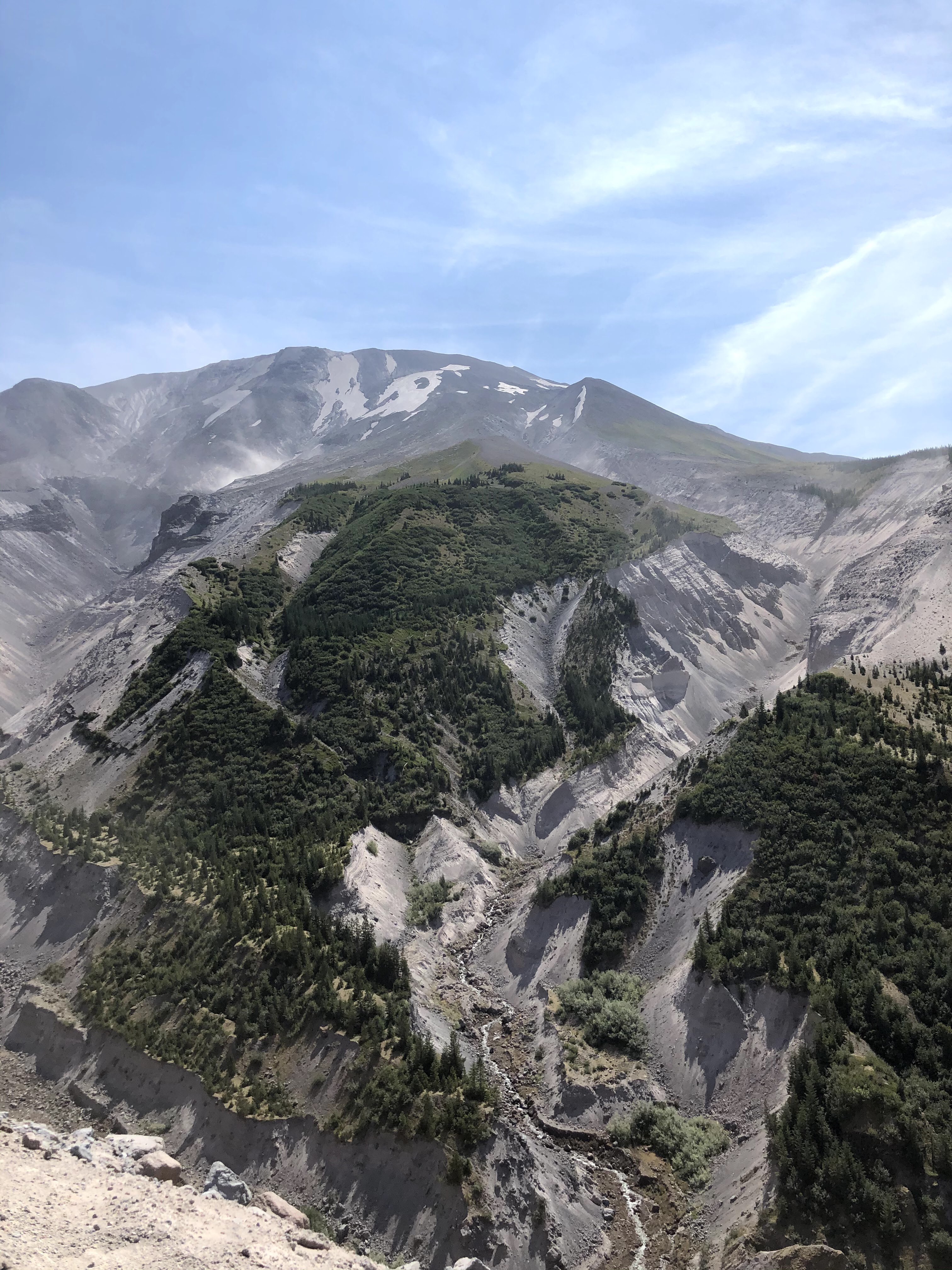
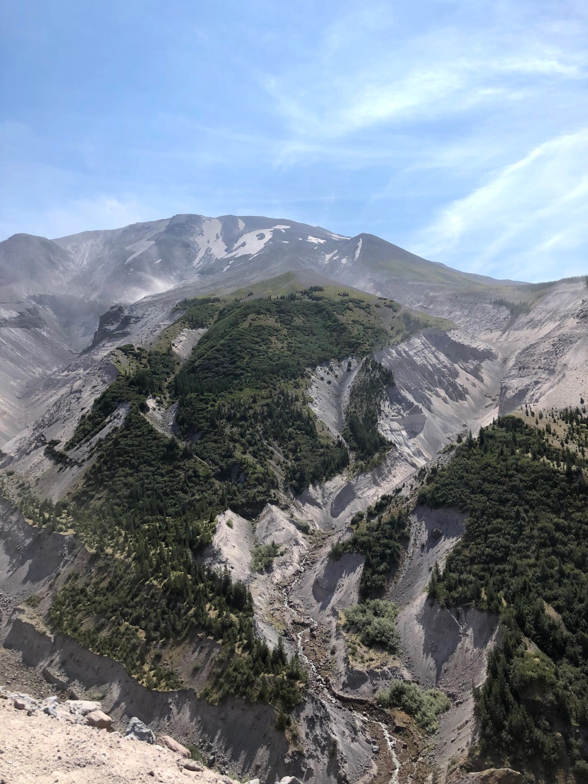
We spent the day before the hike, driving across Oregon into Washington and preparing while putting ourselves in position for an early start. Getting to June Lake from the Columbia River Gorge there’s a super windy road that took upwards of an hour from Hood River, OR. In Hood River we loaded up on burritos, ice cream and a few necessities for the hike. Throughout Gifford Pinchot National Forest is a fair amount of dispersed free camping right off the road. I think there’s a million little unnamed logging roads up this way so probably pretty easy to get lost. We didn’t though. We found a great secluded campsite about a half mile from the trailhead and perfect for car camping. Before any big day I always have trouble sleeping, always, and this was no exception. A massive effort with minimal sleep is doable but frustrating. The weather in the gorge was supposed to be up near a hundred and although a bit cooler on the mountain, we’d be in direct sun for much of the day so we planned on getting up at 4:30. Like a kid on Christmas morning, I tossed and turned most of the night and pushed the wake up time back to 5:30. When we did get up, Sara and I both hemmed and hawed for awhile whether or not this was a good idea to hike on what was probably the hottest day of the year out here. We figured we had a few bailout options if it was horrible and decided to give it a go. This cost us a little more time and we didn’t start walking until 6:15. We survived though.  Going up the June Lake Trail we passed through a bunch of massive old growth trees and a sweet waterfall that flows into a murky June Lake. At the intersection with the Loowit Trail we took a left going clockwise to avoid having the sun directly in our faces all morning and it would also give us more water sources later in the day. It was a good choice, I think clockwise is the way to go. For the first 10-12 miles we alternated between lush old growth forests with massive trees(they don’t call it the Evergreen State for nothing) with soft trail underfoot and then rock hopping through volcanic boulder fields. Every once in a while we’d have to cross a gully created by runoff from snowmelt at the top of the volcano. Some were deeper and steeper than others and if so the trail would follow along them downhill until it was safe enough to cross. A couple times there were fixed ropes in place in order to get down into or up out of them. It was a manageable challenge. Some but not all of these had streams running through adding another level to the challenge. Around 12 miles in we grabbed water out of one of these streams and then climbed way up on sandy switch backs into the direct sun. Our next 6-8 miles were probably the crux of the day. We were in direct sunlight going around the north side of MSH where it had erupted 40 years ago. A huge chunk of the peak was missing and we walked through the debris field following poorly defined trail marked by cairns. Our next water source was an extremely silty stream in one or these runoff gullys. I carried some water from it for the next 2 miles but only planned to put it through the filter if our next source was a bust. In 2 miles the water source was far from a bust, only the greatest oasis I’ve ever seen. A beautiful spring with crystal clear, ice cold water coming up from the side of the mountain. This spring created a little ecosystem in the middle of an otherworldly landscape providing shade and a perfect spot for a nice long lunch.
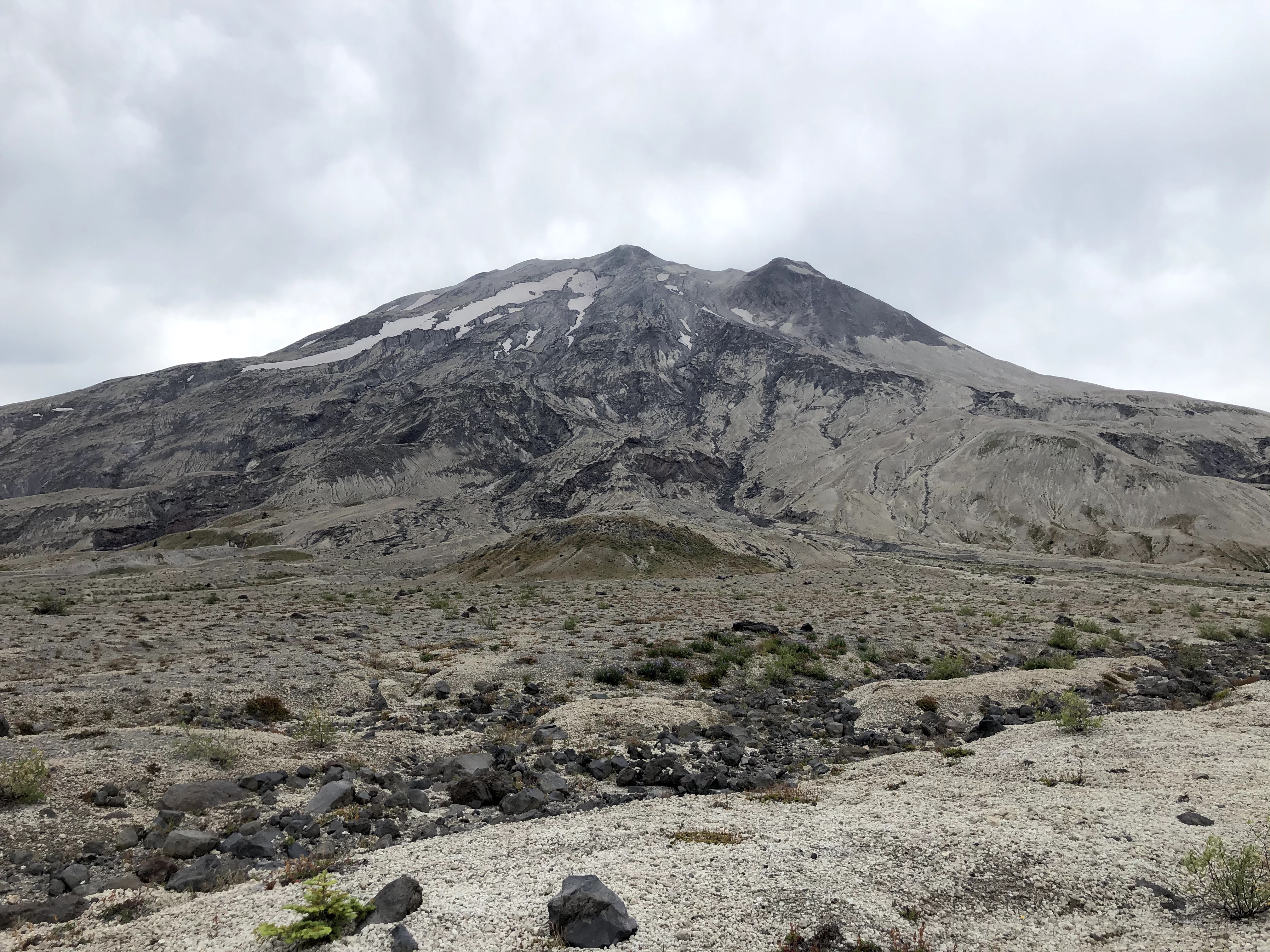

We still had another 12 miles to go but Sara and I felt like we made it. We were rejuvenated after our late lunch, there was a bit of overcast and it felt much cooler. We walked through a section called the Plains of Abraham which was enjoyable. In the distance we could see some waterfalls and a couple of mountain goats, or polar bears, but probably mountain goats. The last 5 miles of the Loowit Trail were tough, this section included a lot of steep gullys we had to drop into and climb out of. At this point though we could smell the barn and knew we’d soon be back within the deep forest and walking down to the car and our cozy bed. Overall we had a great day out there. It was hard but not too bad and I think on a cooler day it would be much more runnable and easier. It took us about 12.5 hours and for us that seemed reasonable. I’d recommend it and I’d do it again. 
For more pictures and maybe some videos find us on insta @endlesspsummer and @sarahikes

Awesome!! I was here in Oregon when the mountain blew up and a year later ventured into the area on the south flank where you could still find abandoned vehicles and lots of ash. Pretty sobering.
LikeLiked by 1 person
Must have been crazy, I can’t imagine
LikeLike