
The Uinta Highline Trail is a 104 mile trail that goes east to west in Northeast Utah from McKee Draw trailhead to Hayden Pass trailhead(or vice versa). One of the few mountain ranges in the lower 48 that run horizontal. QB and I will be attempting to do it in 5 days, but first we have to get there. From Pinedale, WY it took us a full day of hitching as we hopscotched from Pinedale to Boulder, WY to Rock Springs, WY to Green River, WY then finally to Manila, UT where we spent the night.
9/5/19…..UHT Day 1…..23 miles
From the hotel in Manila I walked across the street and got a coffee at the Sinclair then QB and I started walking south on Utah Rt 44 with our thumbs out. There wasn’t too much traffic and it took us a couple miles before Kevin and his son Liam stopped to pick us up. These guys drove us about 45 minutes around the Flaming Gorge to the McKee Draw trailhead, the Eastern Terminus of the Uinta Highline Trail.
I knew this coming into it but the easternmost 20 miles of trail are supposed to be a bit bland. And they were. A fair amount of people either begin or end their hikes 20 miles west of McKee Draw at Leidy Peak Trailhead, but not us. We walked the relatively boring terrain all day and it wasn’t unenjoyable. It was mostly pine forest with some rocky trail criss crossing with a few service roads here and there. It was desolate as we didn’t see another person out here all day and we were under the constant threat of thunderstorms. Luckily we barely got any rain just walked into some super dark clouds.
If you’re planning to do this hike note that there is a significant dry stretch from around mile 4 near the East Park Reservoir to mile 21 where we found a small creek in Summit Park. 
11/6/19…..UHT Day 2…..19 miles
Overnight we got a fair amount of rain. At one point QB and I both woke up to the flash of lightning and tenths of a second later heard the crack of thunder. That was scary, but we were in a secure spot so didn’t expect to get struck.
The skies were clear in the morning though, at least for a little while. We walked gradually uphill through forest for about 3 miles to the Leidy Peak Trailhead and then had an option of going left or right around the peak. From the trailhead we were now right at treeline closing in on 11,000 feet. The trail to the left of the peak became a bit difficult to follow. If you’re doing this trail note that the trail itself takes a sharp left turn downhill but the GPS track sticks closer to the treeline. QB and I stayed high and followed some elk trails until we got to a steady stream of cairns. For the next 5-6 miles there really wasn’t much trail but there were lots of highly visible cairns since we were above treeline and easy enough to follow. 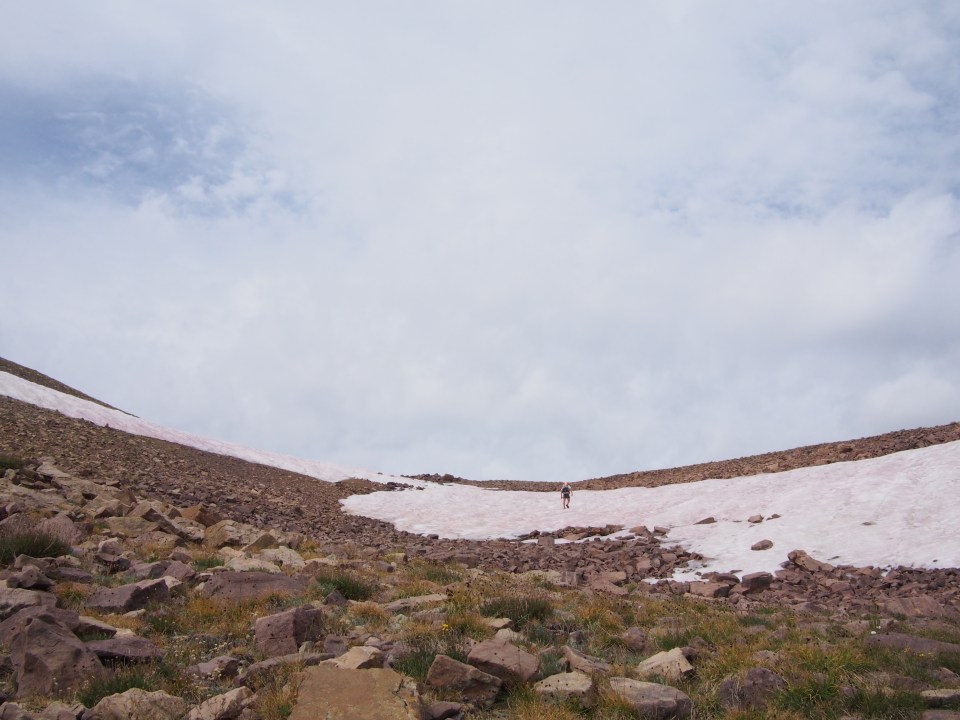
We made it up and over Gabbro Pass and then walked another mile or so to Deadman’s Lake. The skies were starting to look very ominous now and thunder was rumbling so instead of bolting right up the pass by the lake we decided to take an early lunch and see if we could wait for clearer skies. Our first attempt ended when we heard a loud crack of thunder and retreated back down to the lake. After waiting 15 minutes the skies cleared up and we had no problem getting up and over the pass.
This afternoon we more or less cruising through the forest without getting rained on. We’re not trying to beat the bag out of this trail and strategically camped early next to Lower Reeder Lake after 19 miles. I tied a fly to a stick and tried fishing the lake but there must not be any fish in there, hopefully better luck tomorrow.
9/7/19…..UHT Day 3…..25 miles
From our spot by the lake we got up and going by sunrise and steadily climbed for a few miles to the top of North Pole Pass at 12,200 feet. This was a nice beefy pass with comfortable graded rocky trail switchbacking nicely to the top. Once we crested the pass we crossed into High Uintas Wilderness (not sure what wilderness we had been in before this). We could now see some beefier peaks in the distance.
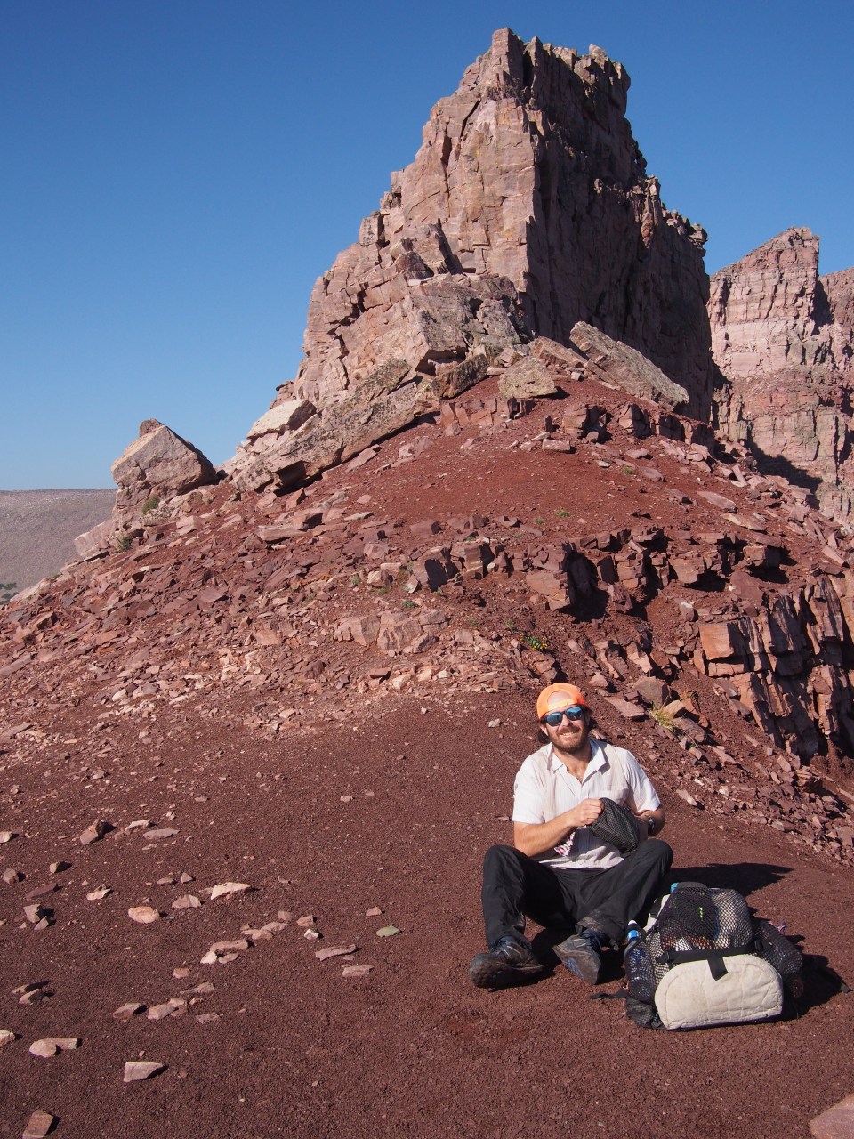
 From North Pole Pass we dropped into a pretty forested valley that we were able to cruise through for most of the day. After lunch we noticed the air was starting to get hazy and I got a whiff of smoke. Dang wildfires! It would have been a beautiful day had it not been for the smoke, and now it was hard to tell if we had blue skies or clouds rolling in. We got to the base of Anderson Pass and the air quality hadn’t improved but we climbed up anyway. This was about a 3 mile climb that gained roughly 1500 feet bringing us to the highest point of the trail, 12,700 feet. At the top of the pass we had the option of climbing up steep talus to our left for another 500 vertical feet to the summit of King’s Peak, the highest point in the state of Utah. This would have been nice but the smoke really hampered visibility and it looked as if the summit was about to be socked in with clouds. Plus it was around 4:30 and bad form to summit so late in the day, right? We’ll have to come back and climb this one, the state high points aren’t all that important to me.
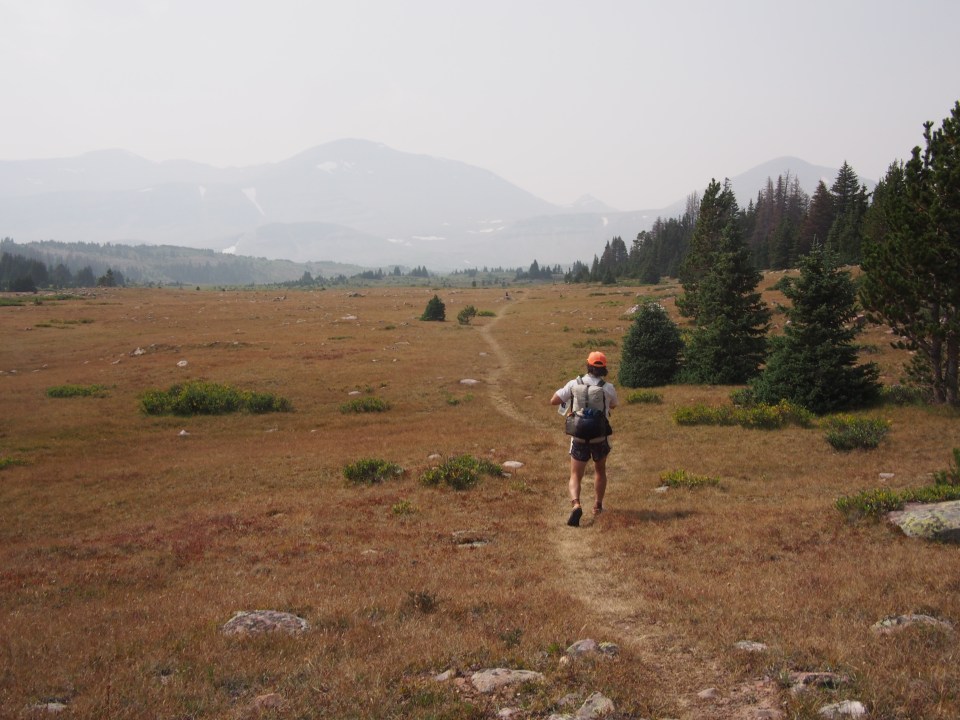
Instead we descended down some steep switchbacks and ended up in another valley. We walked a few more miles to get water and found a place to camp among some pines and pink boulders. 
9/8/19…..UHT Day 4…..16 miles
It was cold this morning and had rained overnight. I noticed some water had even got into the tent. So I basically woke up cold, wet, and without a goodnight’s sleep. Not a good start. 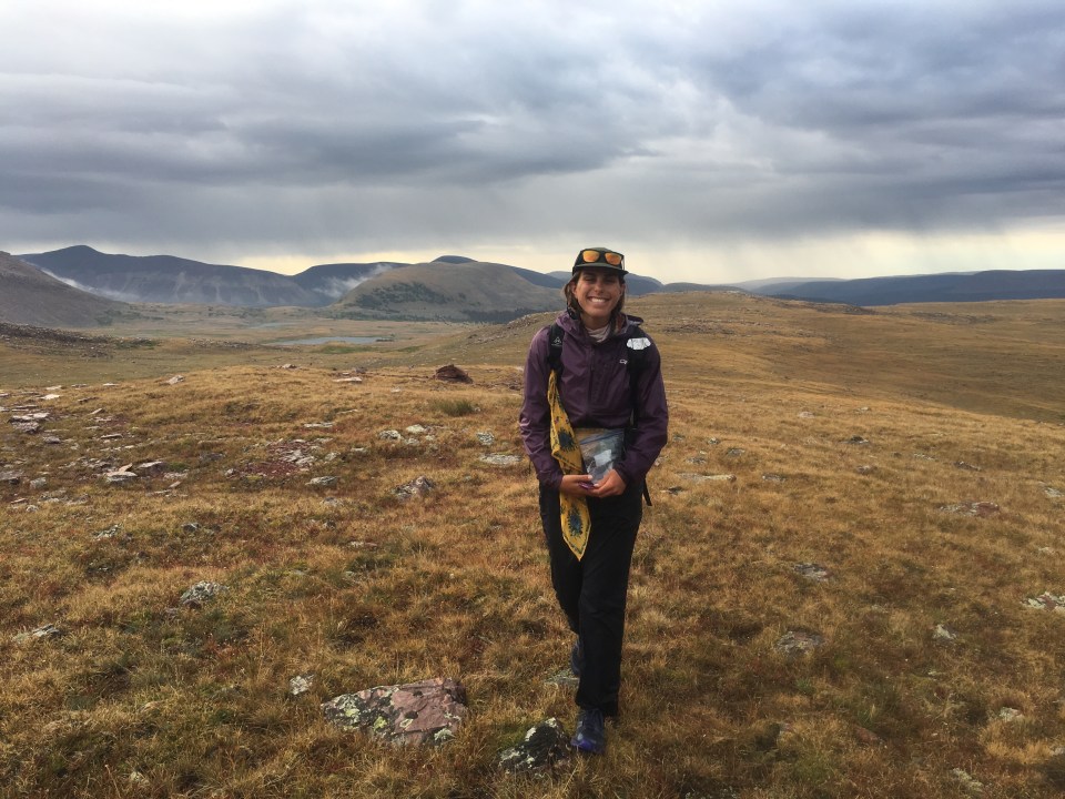
At first it was dry out but there were clouds threatening in every direction and as we started up Tungsten Pass(a poor excuse for a pass) it started to rain. A cold driving rain that fortunately didn’t last all that long. We were quickly up and down Tungsten and as we made our way across a valley and started up Porcupine Pass some hints of halfway decent weather started to show up. On the way up we saw a dead horse down in a gully, awfully sad and strange because this isn’t a steep pass. Ironically, tomorrow we’re due to go over Dead Horse Pass.
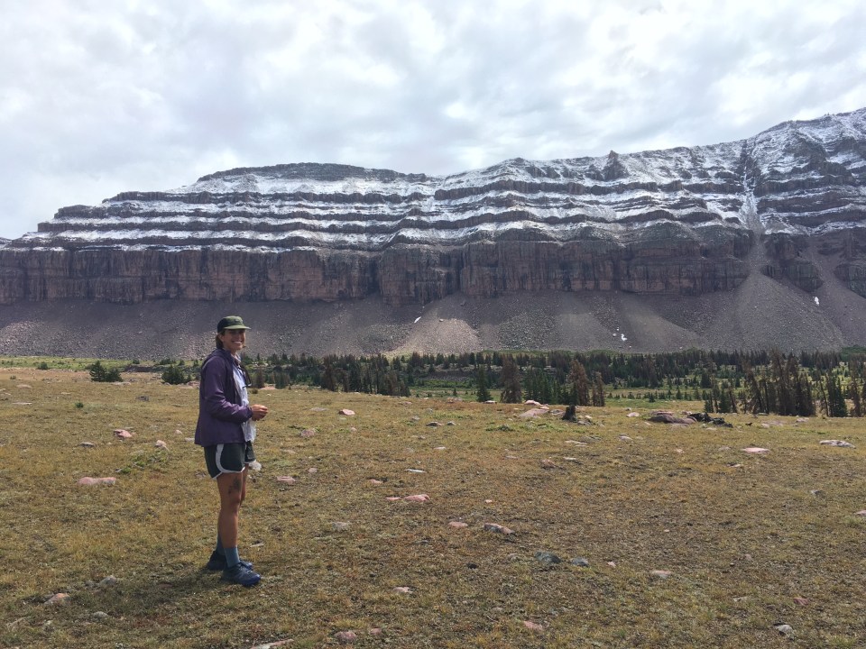
From on top of Porcupine Pass at 12,200 feet we could see far into a spectacular valley with treeline about 3 miles ahead and 1000 feet down. Beyond that were some formidable looking clouds. This was a situation where the only thing we could do was walk directly into the weather and hope we reached the treeline before the storm clouds reached us. As we got closer to the trees the weather really turned on us and soon we had a combination of freezing rain and sleet driving into us while getting whipped with a relentless cold wind. QB and I rushed towards the safety of some pines and we quickly realized this storm front wasn’t going anywhere anytime soon. We set the tent up as fast as possible and did what we had to do to get warm and dry. 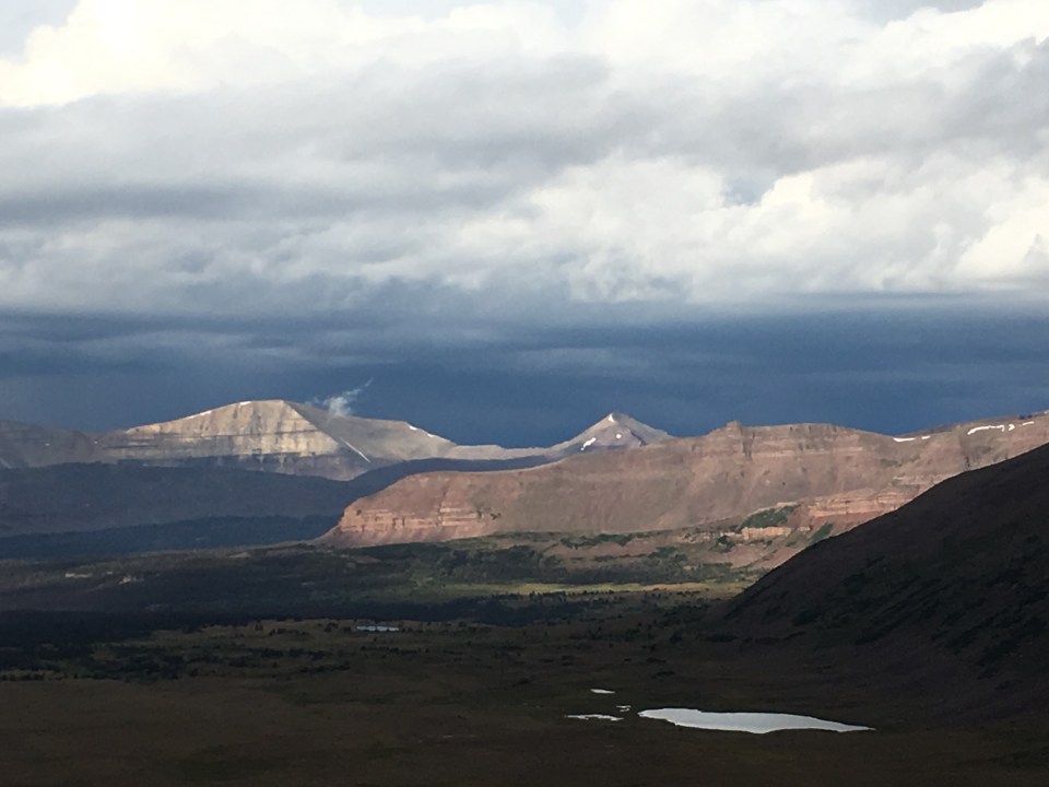
While in the tent we eventually warmed up as the rain outside turned to snow. After a couple hours it seemed to let up and of all things the sun came out. We changed back into our wet clothes, packed up, and got on with our day. Not before admiring the landscape with a brand new paint job though: a fresh layer of snow was on Porcupine Pass, the mountains, the valley walls, and part of the valley that we had just walked through. Oh yeah, and if you’re wondering not a hint of smoke from those phantom wildfires yesterday. 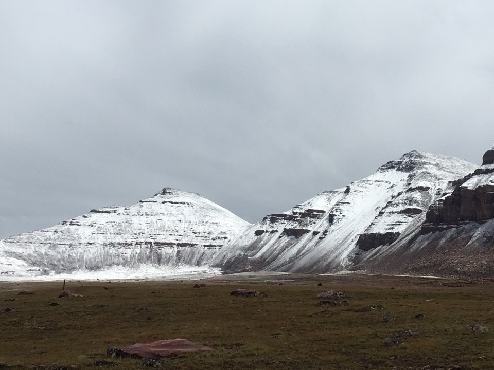
Round 2: the sun was now in and out of the clouds and the wind and precipitation had stopped but we still weren’t completely in the clear. Our objective was to make it 8 more miles to the bottom of Red Knob Pass to set ourselves up for a 22 mile 3 pass final day tomorrow. Ideally we’d have liked to get over Red Knob this afternoon and give ourselves a better chance of getting to a hotel room tomorrow night. Odds weren’t in our favor though. We got almost 2 hours of hiking in when the clouds started to close in on us and we began looking for a spot to set up again. As soon as we took off our packs we suddenly were getting pelted with pea sized hail, better than rain I guess or at least dryer. Soon we were back in the safety of the tent reading Harry Potter and listening to the hail ping off the little poles that are keeping our shelter in place. 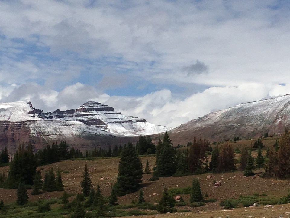
After an hour of hail, rain, and b-hole puckering thunder and lightning, the sun came out again. We packed up as quickly as possible and were soon back on trail. There was only about 4 miles the bottom of Red Knob Pass and we made it here without incident. From the base of the pass the clouds were moving very quickly and were too difficult to read. We decided to camp and leave the climb for the morning. Shortly after we set up for the night the rain started again, so I guess we made the right call. What a day!
9/9/19…..UHT Day 5…..22 miles
Brrrr!!! It was a gd cold one this morning! I wore almost all my clothes I’ve been carrying as we packed up the tent and started up towards Red Knob Pass, our first climb of the day. It didn’t take long before we crested this pass and were looking down at an amazing valley and across to our next obstacle, Dead Horse Pass. 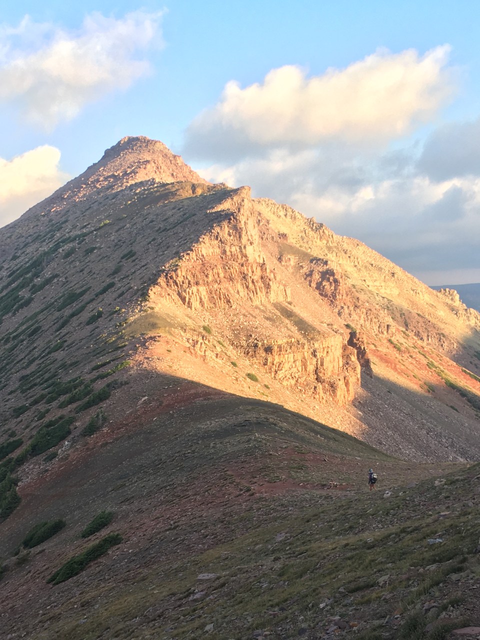
As we dropped down into the valley full of domestic sheep, the sun finally started to warm us up. We crossed this forested valley and started up Dead Horse which was said to be the crux of the whole trail. It was definitely steep and at times maybe a little sketchy but it really wasn’t all that bad just wicked steep switchbacks up the side of a mountain. It was all walkable, actually at no point during this whole Uinta Highline Trail has anything been more than class 1 walking. 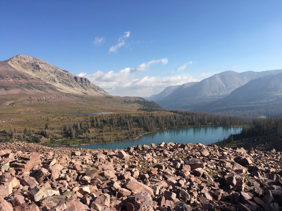
From the top of Dead Horse we looked down into another incredible valley and spotted a pair of mountain goats. Finally some wildlife! I heard this place was loaded with animals but besides these 2 goats we’ve only seen a handful of deer out here. We must be scaring them.
For the next few hours we cruised through forest until we came to Rocky Sea Pass, our final challenge. This was another steep pass with nice switchbacks all the way up. From there we made quick work of the 8 miles of forest to Hayden Pass, the Western Terminus of the trail. With a few miles to go we met Chris and his dog Frankie, one of the very few hikers we came across our here. Chris’ girlfriend Ally was picking him up at Hayden Pass and the two of them gave us a ride to Kimball Junction(part of Park City I think?) where we will spend the night.
The Uinta Highline Trail was pretty rad. I didn’t know too much about it going in but I would say in some cases it didn’t live up to expectations and in others it exceeded them. If I was to do it over again I think I would do either an out and back of the westernmost 50-60 miles or some kind of loop involving the western half. I thought the western half of the train was amazing while the first half was a bit underwhelming. Especially the easternmost 20 miles, if you’re planning to do this trail just start or end at Leidy Peak Trailhead, the first 20 miles are definitely skippable. 
If you liked what you read feel free to follow this blog and follow or follow me on insta @endlesspsummer.com
