8/21/20…..31 miles…..White River CG
The Wonderland Trail is the premier volcano perimeter trail of the Pacific Northwest, or at least it’s the longest, that I know of. It’s a footpath that stretches 90 miles around Mt. Rainier, the tallest mountain in Washington and the beefcake you can see from Seattle and the Puget Sound among many other places. I first hiked this trail in September of ‘16 on three of the nicest days of that summer and have been telling people how great it is ever since. Sara had yet to see it for herself and I was definitely down to do it again, so here we are.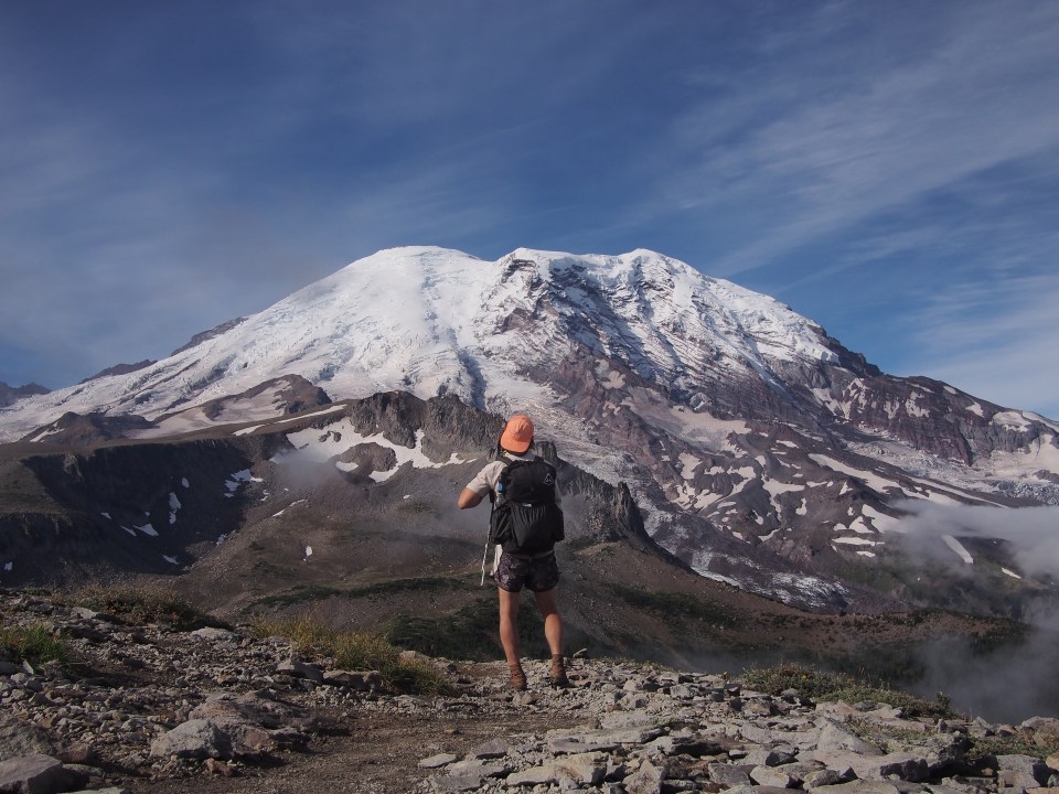
When I did this hike in ‘16 I showed up at the ranger station in the morning, waited around for it to open, then was told all the backcountry sites were taken. According to that ranger I could camp in the hiker/biker sites at the 2 front country campgrounds as long as I could get to them each in a days walk. This requires 3 days of 31, 25, and 34 miles each or the other way around. In ’16 all I did by waiting around for the ranger was waste daylight. This year I figured we could just do the same thing. That is, don’t get backcountry permits, just hike big days and camp in the front country hiker/biker walk in sites. 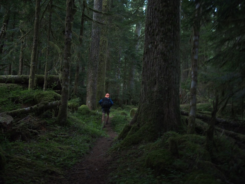
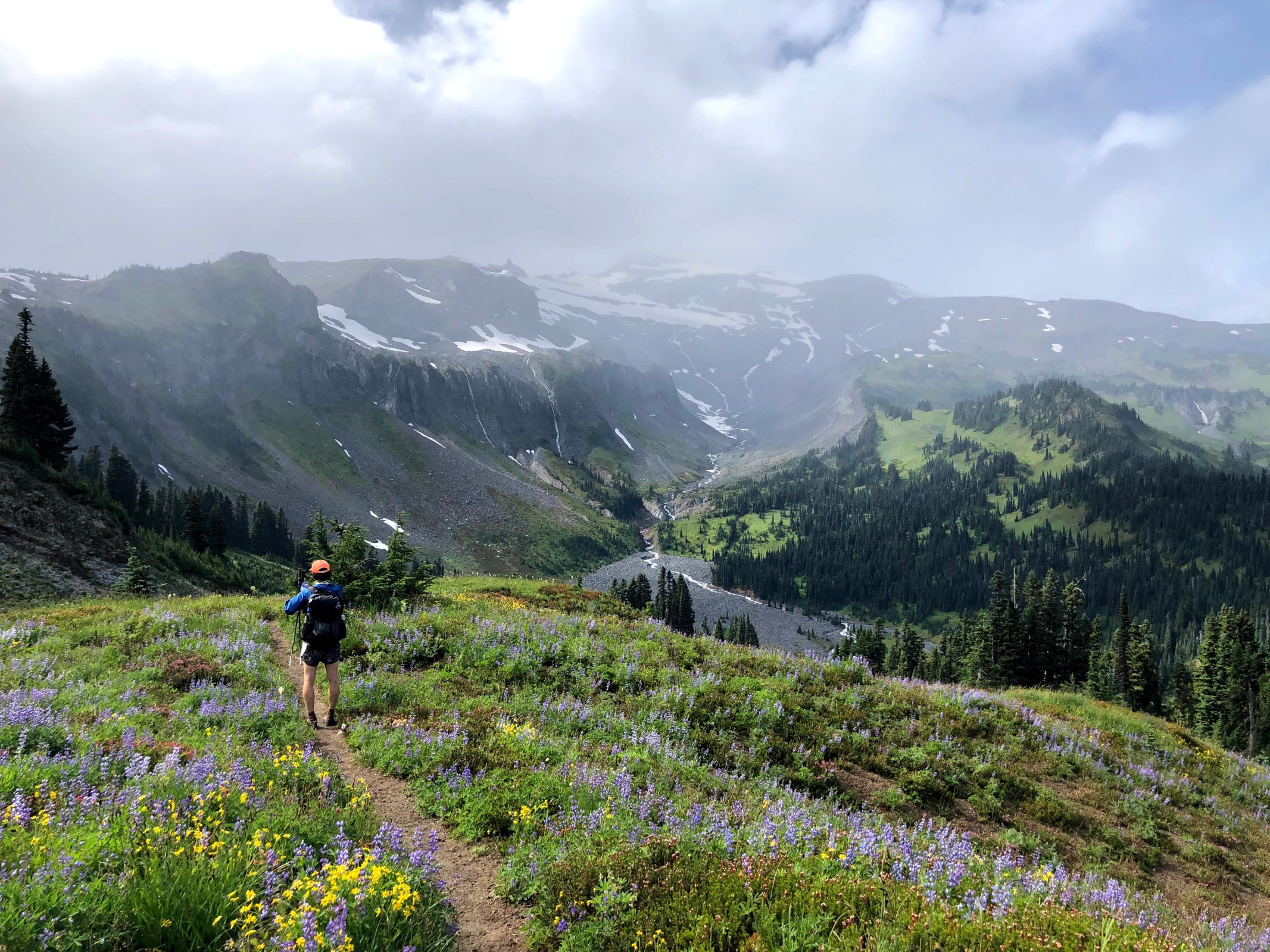
Last night we slept in the car in a little campsite off the side of the road on National Forest land nearby. We got to Longmire which is more or less the headquarters for Mt Rainier National Park this morning and began hiking counterclockwise. There were chances of rain so a 31 mile day in the rain was preferable to a 34 mile day in the rain. All day the trail was great. We walked through deep dark old growth forest then had long steady climbs to alpine passes and long descents back into the forest. Halfway through the day we ran into a ranger who started asking us questions and feeling us out. Now we didn’t have a permit but according to the guy in ‘16 didn’t need one. I guess things change. This guy we just ran into wasn’t being a dick or anything but he did tell us we need a permit to camp at the hiker/biker site at White River. He told us we might be able to get a car camping spot if we got there in time but if not should plan accordingly. Sara wasn’t worried and figured maybe the guy had his facts wrong. I went along with her assumption that everything would work out just fine. After that it started raining and then pretty much drizzled all afternoon. The rain produced a few glorious rainbows and we even had a nice black bear sighting this afternoon. When we got to White River all the hiker/biker sites were taken and the campground was full. We hiked 30+ miles, it was raining, and getting dark. There weren’t many options but fortunately we met a new friend Charlie and his daughter who were on a road trip touring national parks. Since it was raining they planned to sleep in their truck so we could certainly camp in their unused tent space. They were so nice! And Sara was right, everything worked out just fine. I don’t recommend this though, just get a permit.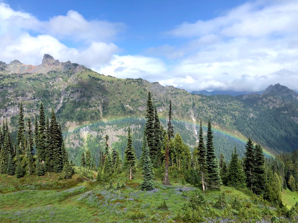
8/22/20…..25 miles…..Mowich Lake CG
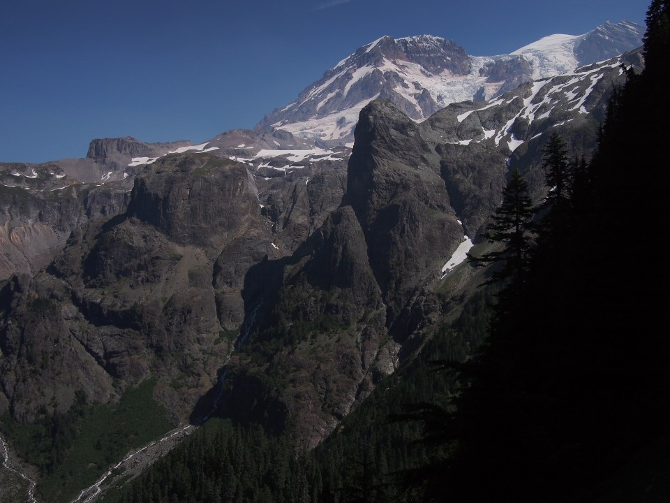
I woke up in a fog today. Not like I wasn’t thinking clearly, I woke up inside of an actual cloud. We had a stiff uphill for a few miles to start the day and as we got to the top the fog lifted, the sun came out and we had some incredible views of Rainier. On the way up we had an owl swoop down in front of us and then perch him or herself up on a stump beside the trail. It was quite a sighting if you’re into birds of prey, which I am.
For most of the morning we had clear skies and excellent views of the impressive volcano we’re walking around. We stopped at Mystic Lake for lunch and sadly I didn’t swim. The lake looked good for swimming once you got out in the middle, but until then there looked to be just too much mud walking to justify it. From Mystic lake we walked downhill along a massive glacier with an angry river running beneath it. We did this twice actually, descend on trail beside huge glaciers with big mean rivers then cross the rivers on bridges and climb up on the other side. I remember in ‘16 seeing a huge chunk fall from one of these glaciers and scaring the bejesus’s out of me. It’s visibly noticeable to the naked eye how much they’ve melted and receded in only 4 years. No massive chunks falling off them this time but looking across the river we did see a mountain goat, or possibly a polar bear but most likely a mountain goat.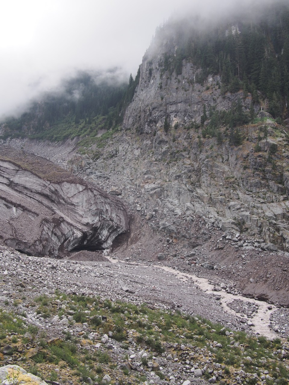
After crossing Carbon River on a suspension we took the Spray Park Alternate. This had the same mileage as the regular route and just a bit more elevation. I think it was cool but mostly it was just cloudy. Lots and lots of waterfalls and babbling brooks and stuff and a few times the clouds cleared and we got a view of the mountain. Tonight we made it to Mowich Lake Campground which is pretty crowded but seems to have a bunch of sites reserved for walk-ins. I don’t know for sure but the ranger we talked to yesterday said we should be fine to stay here.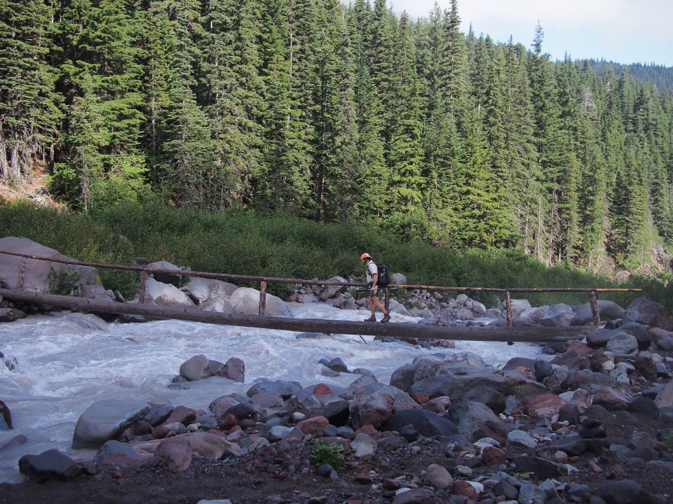
8/23/20…..34 miles…..Ashford, WA National Forest land
Due to a massive day ahead of us, 34 miles and just under 9000 feet of elevation gain, we got up a little earlier than normal and were walking by 5:20 am. The first 3-4 miles were a steady downhill in the dark followed by a steady 3-4 mile uphill. This continued all day. Either we were going down or going up, nothing extreme but also no flat cruiser trail at all. Oddly each of the climbs and descents got a little bit shorter as the day went on. Today’s elevation profile looked like a saw blade, that could probably be said for just about all of the Wonderland Trail.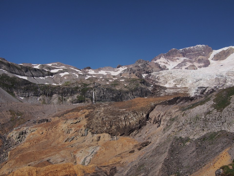
It wasn’t the fastest day but we finished before needing to put our headlamps back on(just barely) which was my ultimate goal. The weather was the best of the 3 days and views of Rainier were just the tops. Our only major obstacle today and really of the whole trip was crossing Kautz Creek with about 3 miles left. This is a rather angry river gushing down a gully and had washed out the previous log bridge. Maybe early in the day there’s less water and I’m sure there’s probably an easier place to cross had we walked further downstream but we got a bit misled by a confusingly placed rock cairn. I built myself a shaky bridge with a piece of driftwood while Sara opted for getting her feet wet and carefully walking across. I’d recommend walking further downstream to cross. An hour later we got back to our car parked at Longmire, high fived, and drove 15 mins into Gifford Pinchot National Forest to the same campsite we were at 3 nights ago.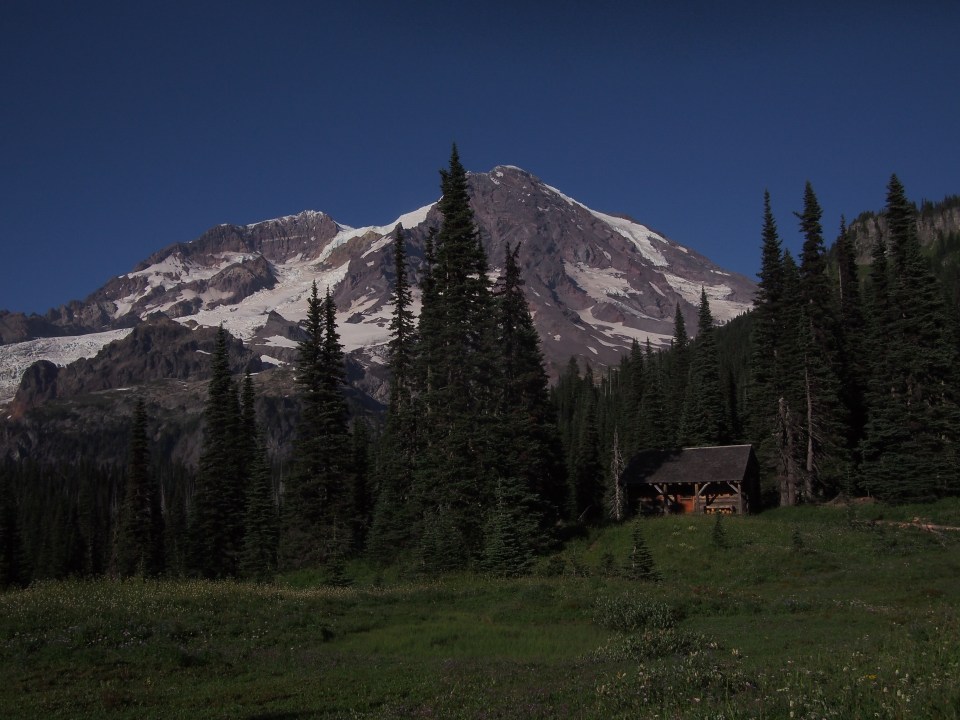
The Wonderland Trail did not disappoint. I didn’t remember it having so much elevation gain and loss but that certainly isn’t new. The views were spectacular, the weather was decent and the trail was challenging but not difficult. I recommend hiking this trail. Mt. Rainier is a natural beauty and a true gem of the Northwest. Do yourself a favor and maybe get the permits ahead of time and take an extra day or two. 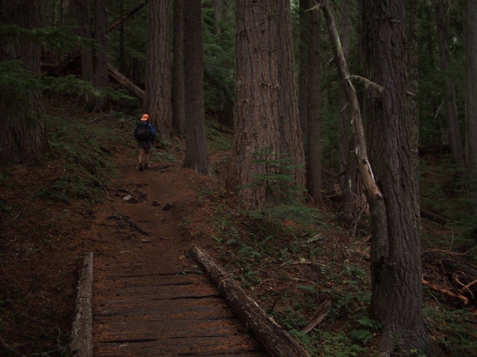
Feel free to follow this blog or find me and QB on Insta @endlesspsummer and @sarahikes. She took all these pictures since I dropped my phone in the ocean.

Sara + Chris
Always nice to hear from you.
Two months into retirement & enjoying a new side hustle “job” shopping for & delivering groceries. With plans to travel some this year. Need guidance .. tips on overnighting in an SUV, van or possibly an RV.
Have been watching a YouTube channel where a gal your age lives off grid in a small airstream base camp trailer w/ a dog panda cat. She remotely works from it too.
My idea of the overnighting in a vehicle is just to stretch the hotel/AirBNB budget a bit.
Smilin Mike
LikeLiked by 1 person
Awesome! Just put a mattress in the back of your car. We use a foam mattress topper in the back of our Outback and just cut it to size.
LikeLike
Great photos!!!
LikeLiked by 1 person
Thanks for reading!
LikeLike
Always enjoy reading these!!
LikeLiked by 1 person
Thanks Jay!
LikeLike