Aug 26th Lois Lake, Sunshine Coast
We woke up this morning in the car at the Kin Beach CG and enjoyed a view across the Salish Sea(which is part of the Straight of Georgia) to mainland British Columbia. We took a 10 am ferry from the town of Comax to Powell River on the other side. Powell River is a little town on the Sunshine Coast and although the SC is on mainland British Columbia, I guess a couple of deep fjords make it impossible to build road access and ends up making it a rather remote little area.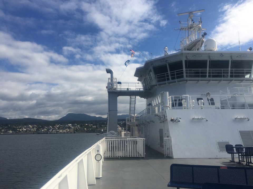

Our plan is to hike the Sunshine Coast Trail which is a hut to hut hiking trail that stretches 112 miles(and even more kilometers) from Sarah’s Point to Saltery Bay. In order to get to get to Sarah’s Point we have to take a water taxi from the tiny town of Lund at the northern end of the Sunshine Coast. So what we’re doing today is food shopping and organizing our food for about 5 days of hiking, doing laundry, hopefully finding a place to run and swim, then driving to Saltery Bay where we’ll end up camping and leaving the car. Tomorrow we’ll be hitching to Lund to catch the water taxi to Sarah’s point in the afternoon(I better see an orca). Logistics are a MFer but the trail looks cool so I bet it will all be worth it.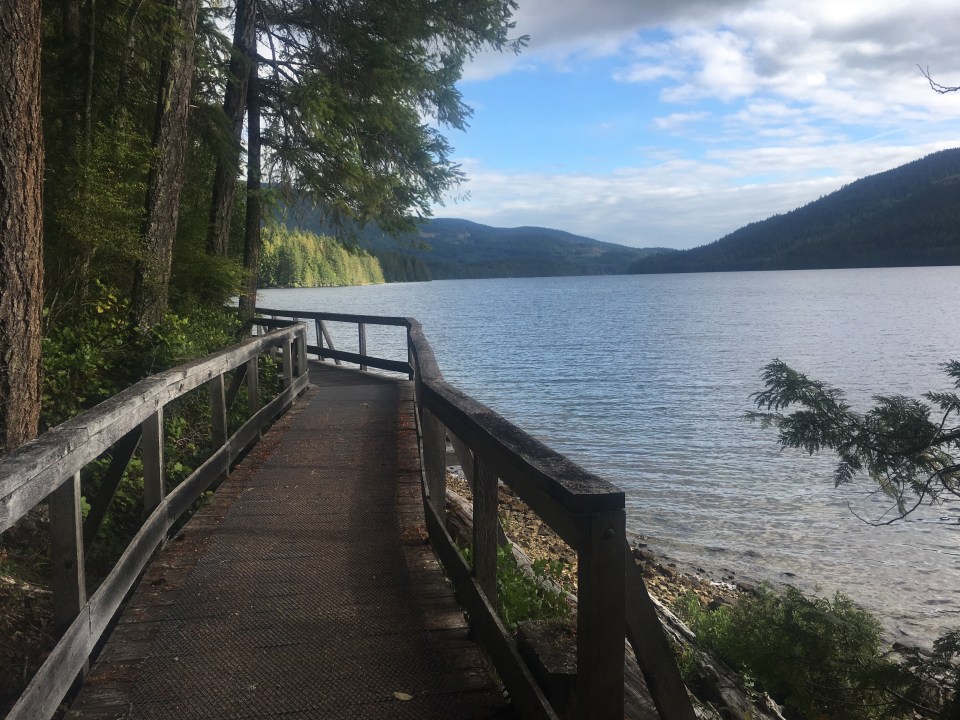
We did find a good place to run. Inland Lake Provincial Park is near Powell River and there’s a really nice trail around the lake and some nice clean water to jump into afterwards. And for camping tonight we heard about this mysterious free campground next to Lois Lake but to find it you had to follow a series of unmarked logging roads. Eventually we got there and it was worth a few wrong turns because it was an absolutely beautiful spot next to a pristine lake.
Aug 27th SCT 16K Manzanita Hut
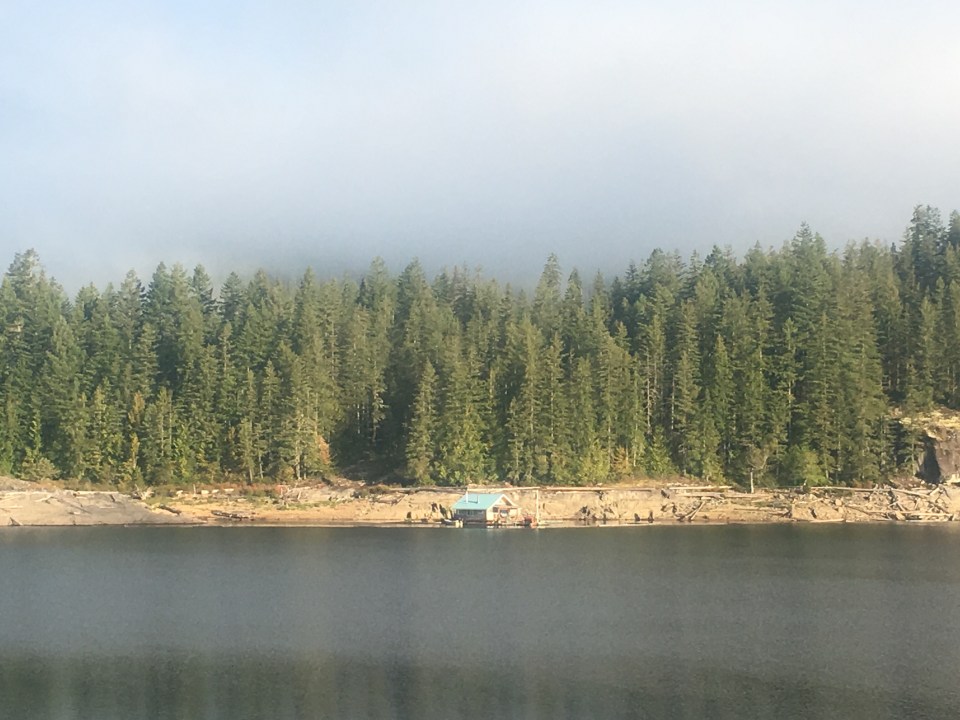
We woke up next to Lois Lake and it was better looking in the daylight. Because it’s forest land there’s a few cabins floating out on the water. I don’t really know how that works but they looked like cool places to live.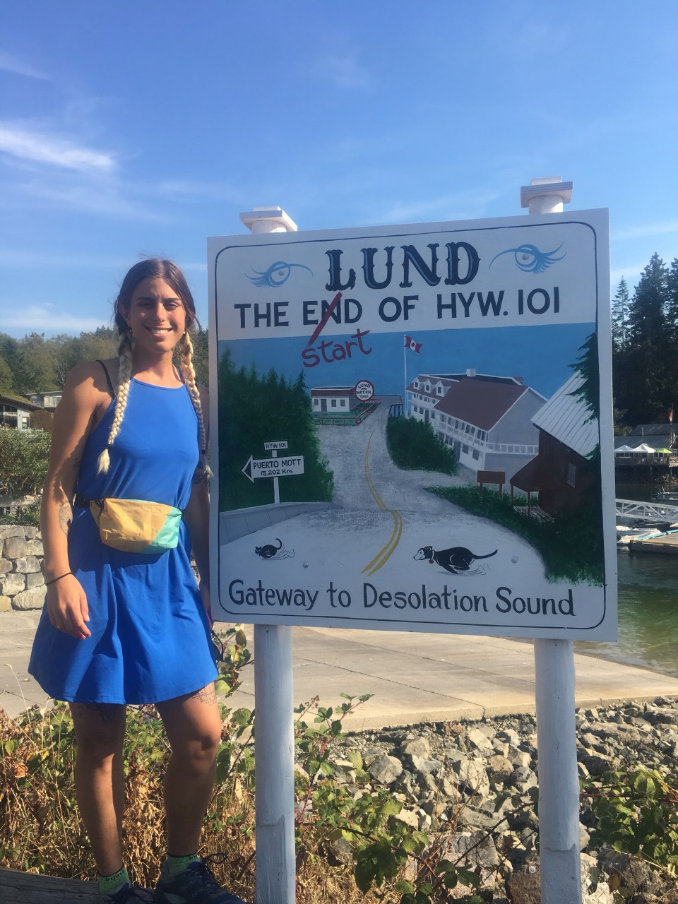

From Lois Lake we drove south towards Saltery Bay, found a spot to take a quick dip in the ocean then left the car in a parking lot near the ferry terminal. We had to hitch north about 60K to Lund where we catch a water taxi to Sarah’s Point and the beginning of the trail. Our first ride, Wendy, had 4 little daschunds with her and drove us about 10 minutes before we got another ride from Chris. This guy traveled the world and was a retired professional soccer player, sheriff, volunteer firefighter, carpenter, and I’m guessing a few other things. I’ll be reading his book when it comes out. He learned us about all kinds of stuff on the Sunshine Coast and gave us a lift to Powell River, waited for us to run an errand then drove us about 10 minutes further north. We put our thumbs out and quickly got picked up by Ian, Denise, and Nora. Ian dropped the two women off at their waterfront home then brought us the rest of the way into Lund giving us some more info about the area.
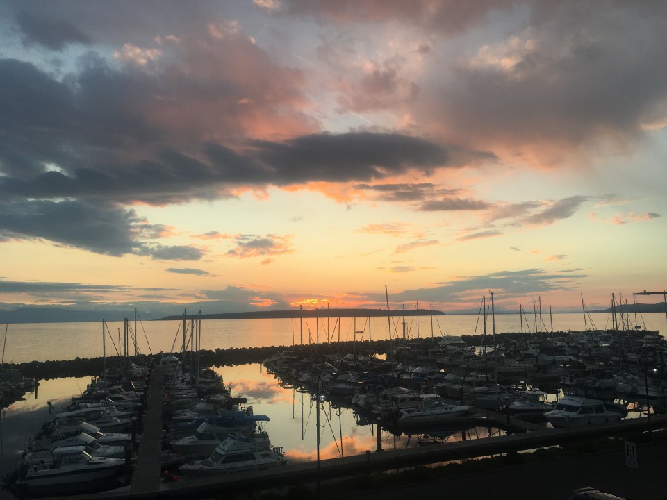
Lund is the very northern point of Route 101 that goes all the way south to the tip of Argentina, it’s the ‘end of the road’ if you will. It’s basically a marina, a hotel, some camps and a bakery.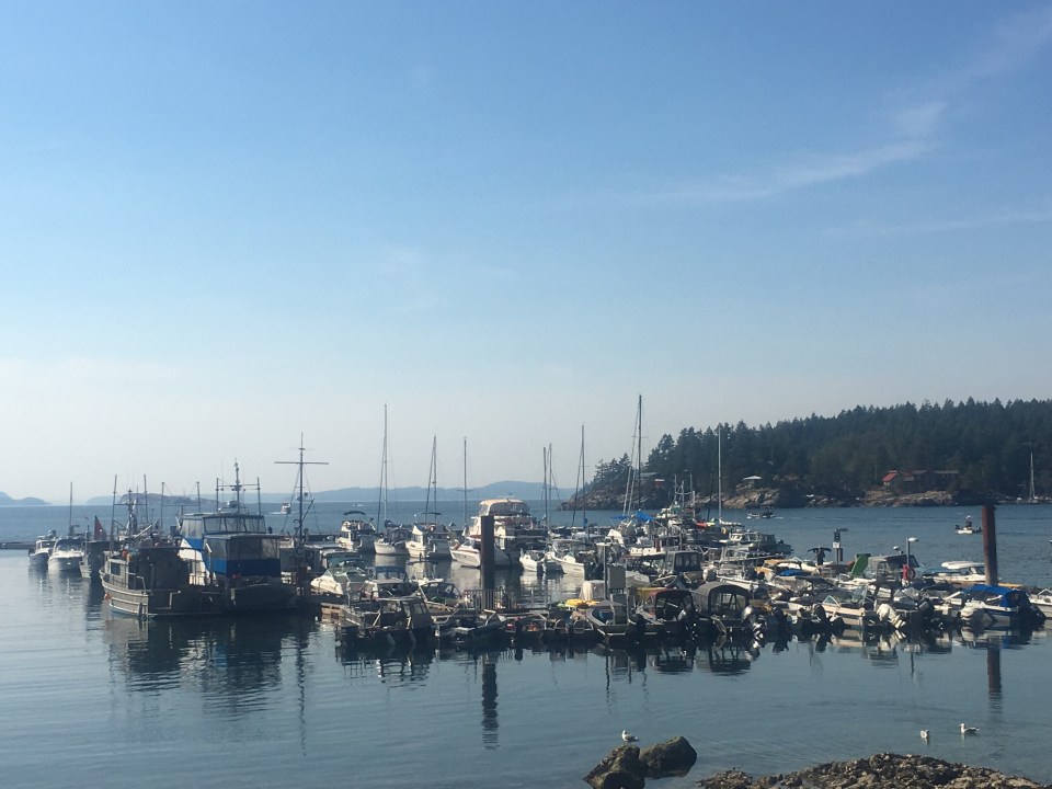
Our boat didn’t leave until 4:45 so we chilled out in the bakery until then. The water taxi was a short 20 minute ride up the rocky coast along a bunch of houses that are only accessible by boat or a 4×4 Jeep road. We opted for the boat ride. When we got to Sarah’s point there was no dock but just a rock we got close to and jumped onto. And that was the beginning of the trail. It’s 180 kilometers back to Saltery Bay so we brought maybe enough food for 5 days. People have been asking us how long we plan on hiking for and when we tell them 5 days they look at us like we’ve got lobsters crawling out of our ears. I don’t really think it’s all that fast but we’ll see. Anyway we didn’t have much sunlight left so we just kind of crushed it through some dense green forest for 16k to Manzanita Hut. There’s 2 other girls staying here who were already in bed so we quietly ate a quick meal of rehydrated beans and called it a night.
Aug 28th SCT 58K
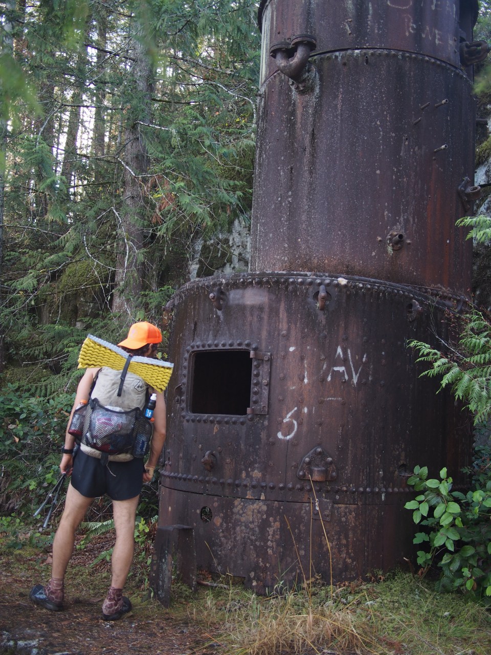
Today was great although uneventful, I just walked all day. We got moving from Manzanita Hut around 7:30 and were up and down through deep green forest for most of the morning. Once in a while we’d come to a pond or cross a river on a fallen down tree turned into a lot bridge. We ate lunch at Rieveley Hut and I saw a bunch of bull frogs. The huts on this trail are in really good condition, so far anyway, I’ve only seen 2. They both had a picnic table and kitchen area downstairs then the upstairs were just big lofts with space for about a dozen people.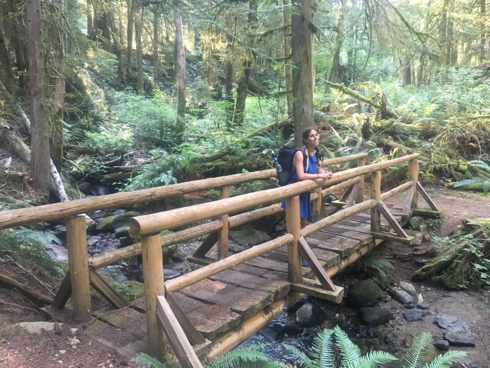

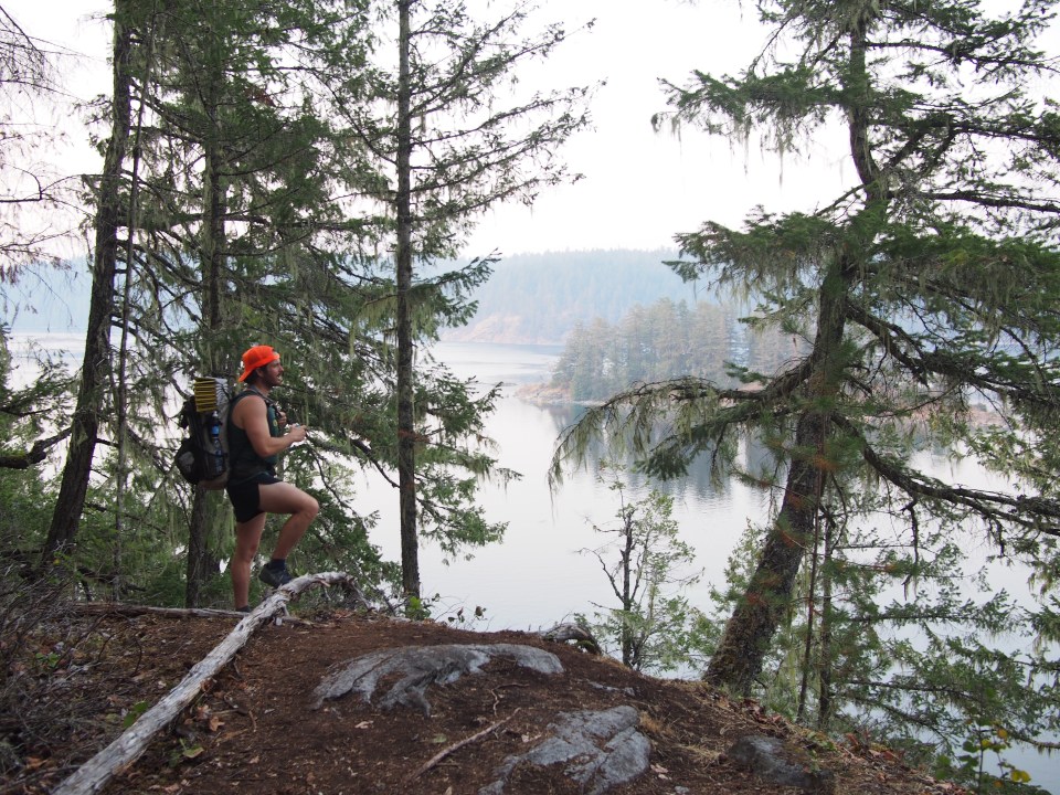
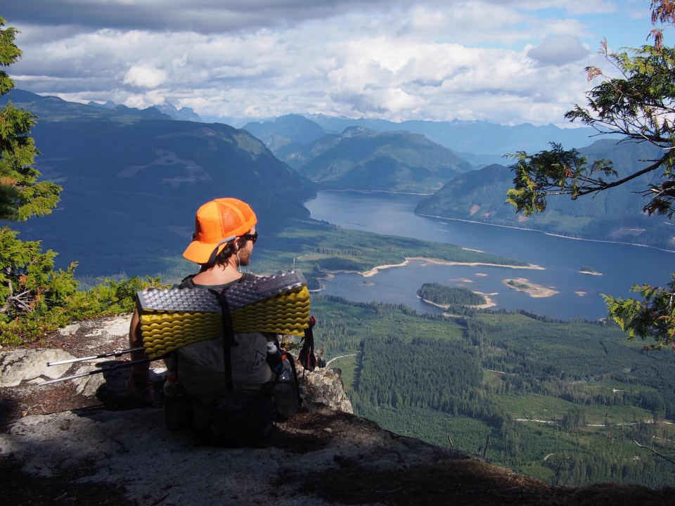
This afternoon we were walking through more old growth rain forest and then all of a sudden I found the ultimate swimming hole. Gorge Falls had a few big pools of icy cold water then a narrow pool that was about 12 feet deep, way over my head anyway. After we got cleaned up there we walked along Sliammon Lake and up onto a bluff where we could see out across Salish Sea to the mountains on Vancouver Island plus Hardwick and Texada Islands. It was quite an amazing view. We walked down from the bluff to Powell Lake and passed climbers top roping on a cliff right next to us. When we got to Powell Lake we were actually pretty close to the town of Powell River and it would be easy to just start here if you wanted to do a modified hike of the SCT. We had planned on camping at Haywire Bay, but after a couple hours of walking along the lake we realized it was a pay campground and at $23 a night neither one of us was having that. About 100 meters after the campground was a flat spot next to the trail and that’s where we set up our tent.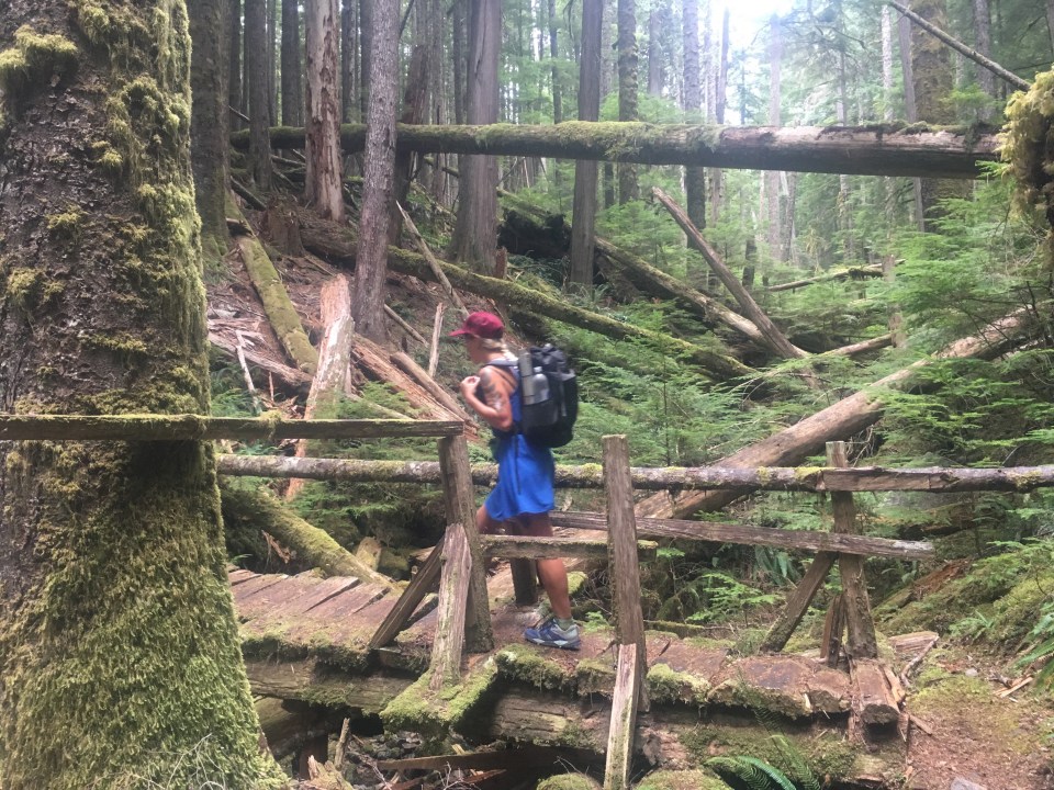

Aug 29th SCT 93K
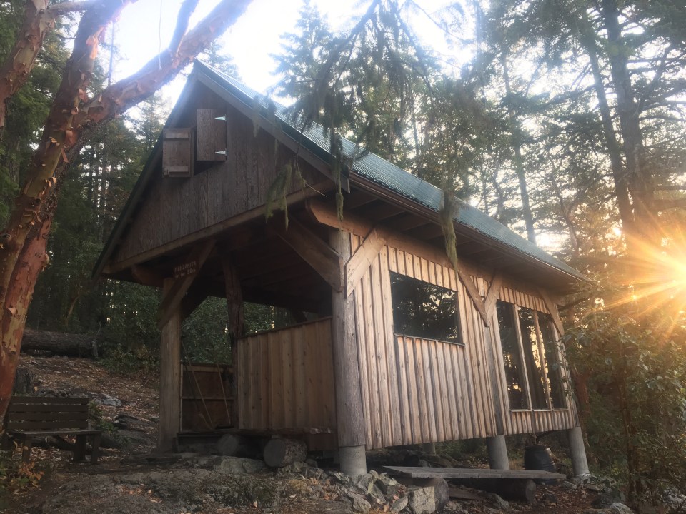
Today was a tough one. We started off walking down towards Inland Lake, the same lake we ran around a few days ago, and followed the trail around the southern half of the lake. Leaving Inland Lake the trail climbed very steeply up towards Confederation Lake, this went on for about an hour and it was the steepest the trail has been yet. We had a little lunch break at the Confederation Lake Hut and this place was sweet! There was a pellet stove and it was winterized, I’m guessing a perfect place to snowshoe up to for a night in the winter.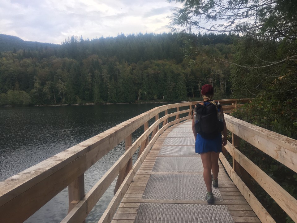
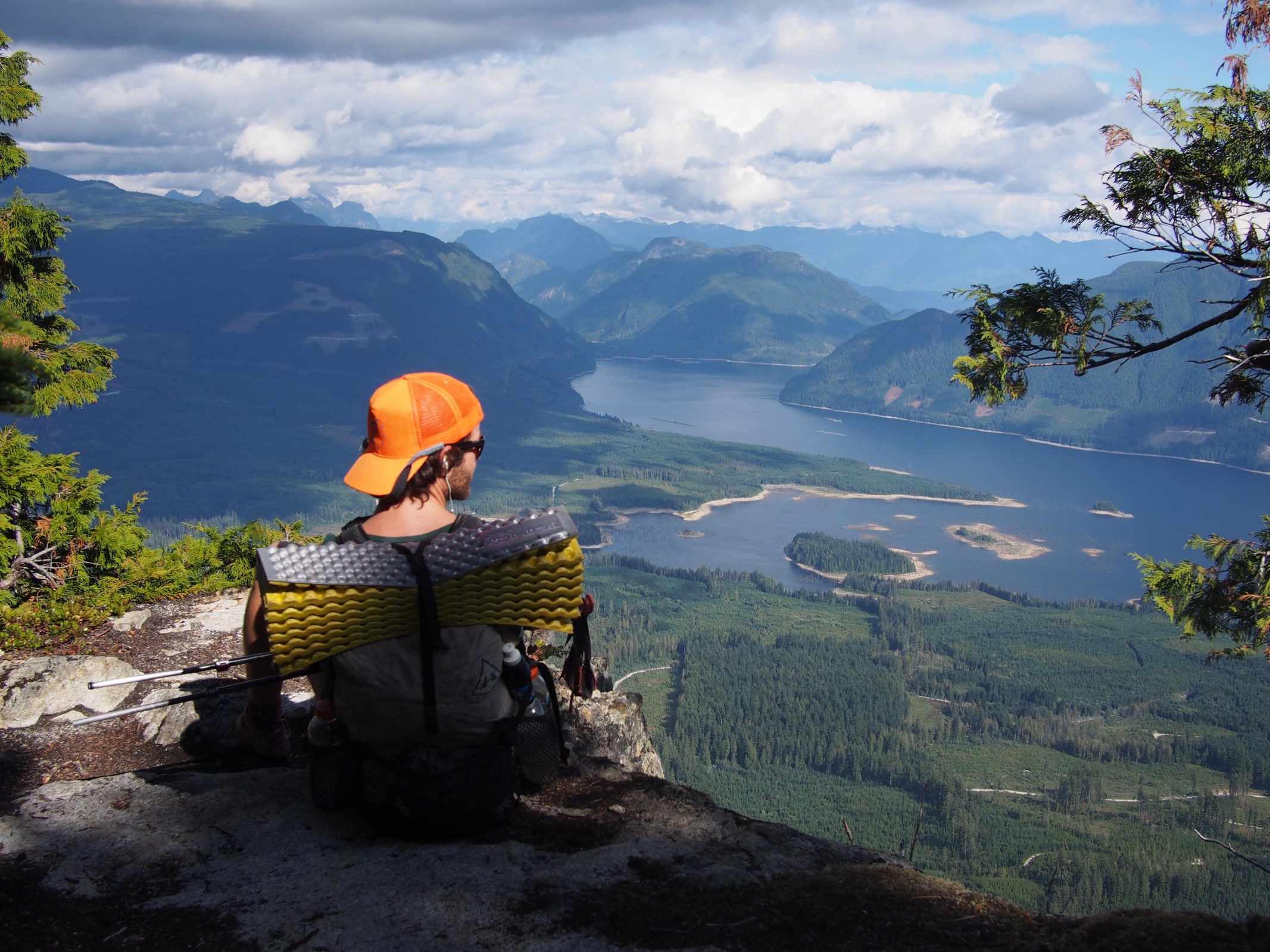
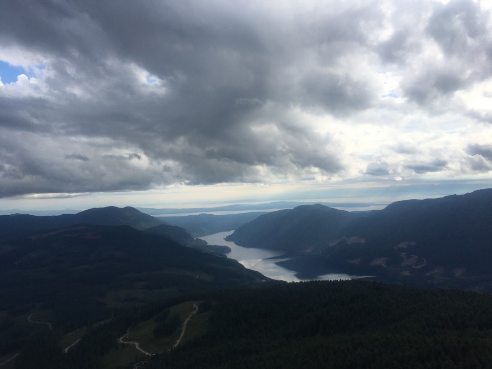
The rest of the day was big descents and big climbs with Tin Hat Mountain being the biggest. From the top of this peak there were panoramic views of all the mountains and lakes in the area. There was also another winterized hut and if there weren’t so many people already staying and if we had enough water we probably would have spent the night but decided to push on for awhile. The trail down from Tin Hat was super steep and kilometer markers were grossly inaccurate. This whole trail every kilometer has been marked and we usually pass a marker every 12-15 minutes but during this descent it took over an hour for one K. I didn’t think that was right and it ended up taking us longer than I wanted to get to Lewis Lake where we camped for the night. Plus I got stung by a wasp on the way down, Sara already got stung twice today but you wouldn’t have known it. I definitely did enough whining for the both of us.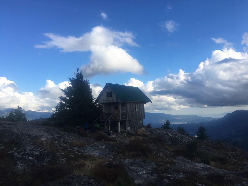

Aug 30 SCT 134K
First thing this morning Sara spotted a few beavers swimming around in Lewis Lake right next to the trail as we walked by. There were three of them just swimming slowly in a big circle looking for fish or sticks or whatever and every once in awhile smacking their tails against the water. I must have heard them doing this last night as I was trying to sleep but I just figured the noise I heard was bullfrogs doing belly flops off logs. It was an incredible wildlife sighting.
The rest of the day went pretty smoothly, the trail went up and down all day through forest and right up close to some recently clear cut forest that can be a bit ugly. We climbed up to Elk Lake where I took a quick bath then we ate lunch at the hut there. Later this afternoon we climbed up Walt Hill and some amazing views of the surrounding mountains, lakes, sea and islands. The Sunshine Coast is a really beautiful area. For much of this trail we’ve been walking through forest, which is cool, but when we get up high and the views open up you can see all the incredible surroundings.
As we were looking for a campsite tonight I heard a bunch of rustling in the bushes. I just figured it was a bear but as we turned a corner I saw about 15-20 elk running from a section of clear cut forest into the woods. 1 male and the rest female(his harem). I learned from a hitch one time that the end of August is mating season, and also hunting season. Shortly after we got all set up I heard half a dozen shots, hopefully none of those elk got hit.
Aug 31 SCT 171K Fairview Bay
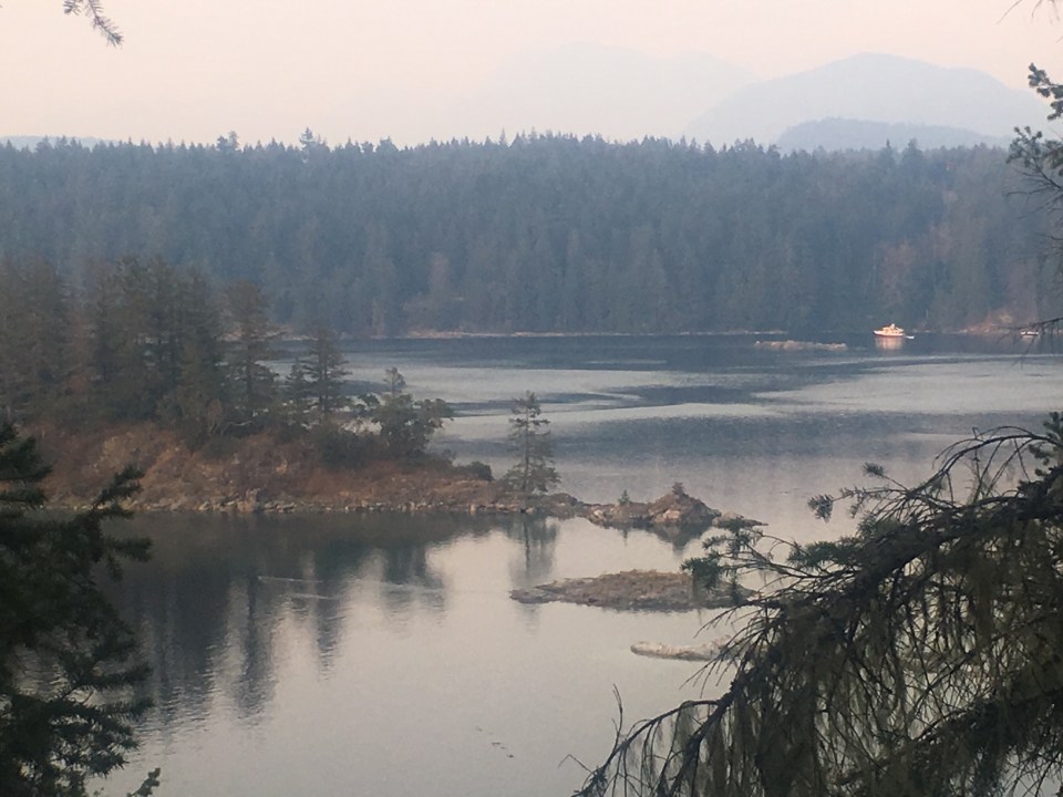
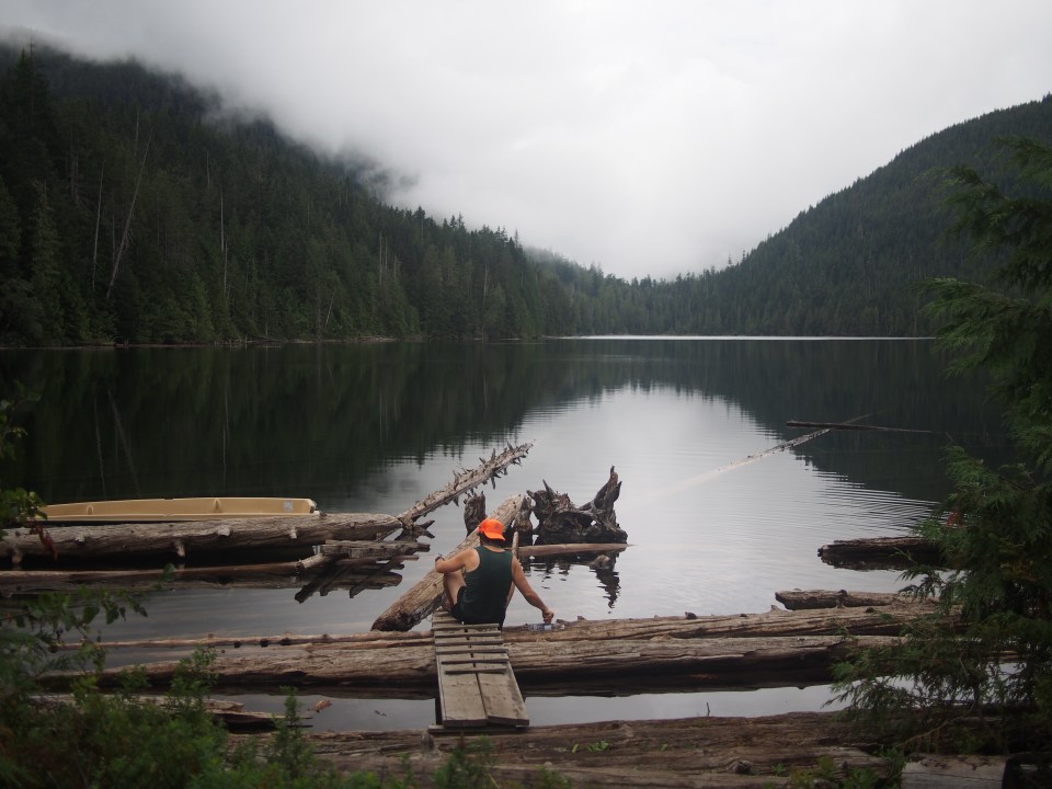
We pretty much camped right on trail last night, there wasn’t much we could do about it, so we got up quickly before anybody had to ask us to move and started walking. After a couple hours we came to Lois Lake where we had car camped the night before we started the trail. We watched a giant eagle that flew across the water and checked out these little cabins that are built on floats. I don’t get it but I think it has something to do with it being forest land and you can’t have cabins on land. I want one.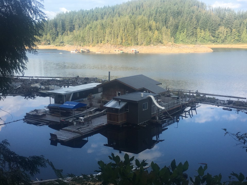
The trail climbed from there, eventually bringing us up to Elephant lake where we took a break and I went for a quick swim. Yesterday I swam in Elk Lake and ended up seeing about 20 elk, I better see a bunch of wild elephants today. Probably won’t happen though. From the lake we climbed up to the top of the Troubridge Massif, over 4000 feet and the highest point of the trail. It wasn’t too tough and there were some awesome views of Saltery Bay and the Salish Sea from the top. The descent sucked though. It was super steep! My legs were burning. I would much rather climb something steep then descend.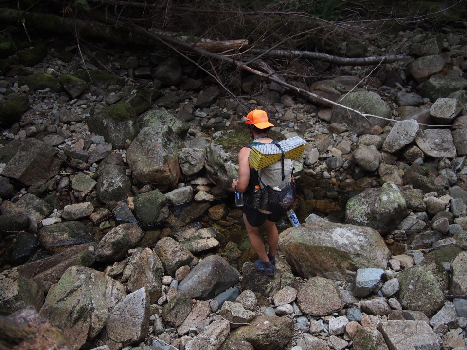
We could have walked another coupe hours tonight and got to the car but we stopped at Fairview Bay Shelter for the night. This is a really nice little shelter right on the ocean. We ate on a rock looking out at the bay and I went for a quick swim thinking that the salt water will neutralize my b.o. Maybe a little. 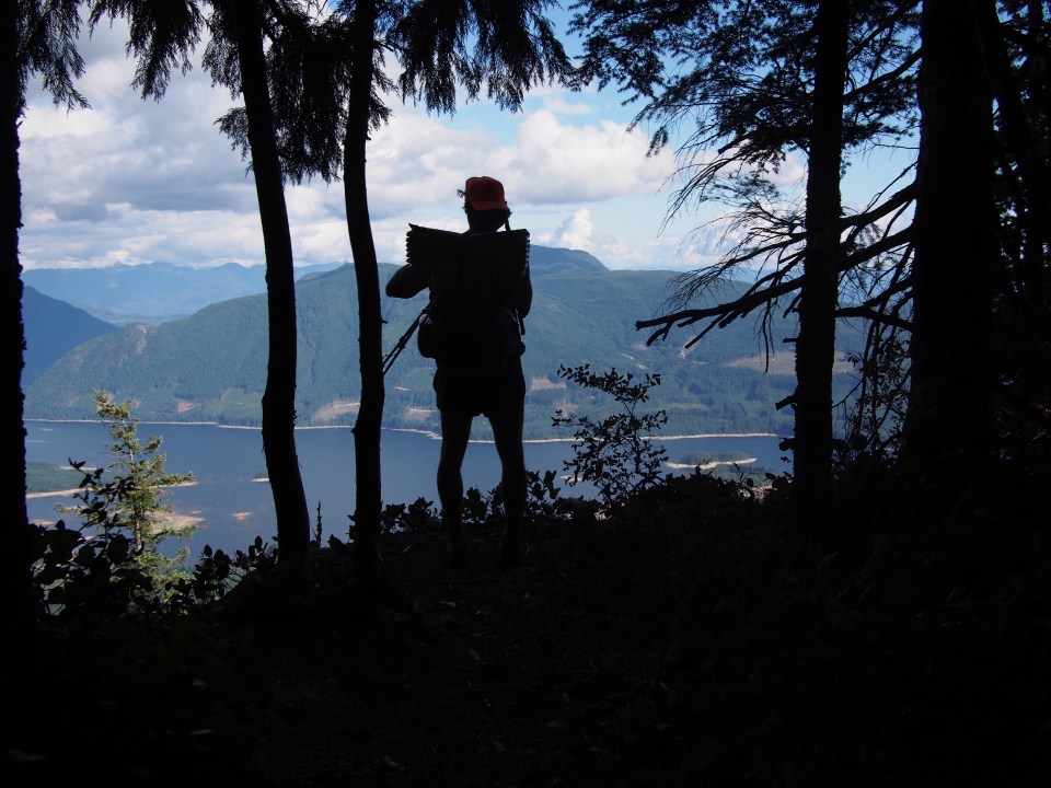


Sep 1 SCT 178K Saltery Bay
Sunshine Coast Trail complete! What a great trail! It’s obvious how much this trail is cared for by the locals in the area. The SCT was built completely by volunteers from the PR PAWS and the B.O.M.B. Squad and it’s very well done. The huts are in great shape, there’s lots of other handmade infrastructure and a ton of the trail has been cut through some thick forest. It couldn’t have been easy to build. And it’s well signed, almost too well signed, there’s little orange squares nailed onto what seems like every other tree. Super easy to navigate. It’s a great trail but it’s tough, definitely more difficult than I expected, so if you’re in the mood for a nice cruiser short trail to crush this probably isn’t the one for you. Still fun though.
This morning we walked for a couple hours, mostly along the coast, finishing what we had left and got back to the car. The trail ends right at the Saltery Bay ferry terminal and as we were getting to the car we watched as the 9:30 ferry took off. Oh well, we got the next one. We had to catch a ferry to Earl’s Cove, drive an hour and a half then catch another ferry to mainland BC and drive to Vancouver. It takes awhile to get anywhere from the Sunshine Coast but that’s kind of the beauty of it, so GD isolated. 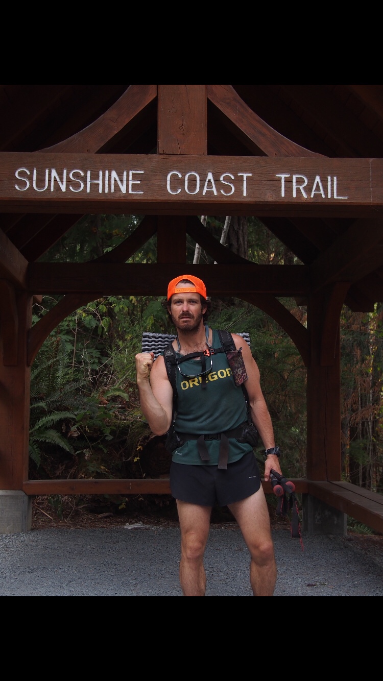

This evening we spent a few hours walking around and eating a bunch of food in Vancouver and then just decided to go back to the U.S. We parked at the first rest area over the Washington Border and called it a night. 
 Feel free to follow me on insta for more pictures @endlesspsummer and Sara or QB @sarahikes

Thanks for bringing back memories. It’s been about a dozen years since i hike the SCT. The crew in Powell River really do spend a lot of time maintaining the trail. A couple of the huts are quite new. Cheers!
LikeLike
Oh cool! It’s a great trail, definitely harder than I expected
LikeLike
Loving your blog and the pictures are awesome!
LikeLiked by 1 person
Thanks Nancy!
LikeLike
Thank you for writing this post, it is extremely helpful! I have had difficulty finding information about thru hiking the SCT, especially posts written by actual thru hikers. I really do not have 9-12 days to take off from work to hike this trail. Although I do not hike as fast as you do, this journal has given me a more realistic idea of how many kms I can aim to hike each day. I am planning a thru hike of the PCT for 2020, and was hoping the SCT would be a great introduction to longer trails as there are not many long hikes in western BC. Were there any swimming holes/places you passed through that you would suggest spending more time at?
Thank you!
LikeLiked by 1 person
My pleasure. There were a few places where I jumped in the water but I can’t remember exactly where. For huts I wish I had spent a night up on Tin Hat but it didn’t work out with my schedule.
Good luck and have fun! It’s a great trail. And I highly recommend the PCT also, if you have any questions about that one feel free to contact me.
LikeLike